East Atlanta in DeKalb County, Georgia — The American South (South Atlantic)
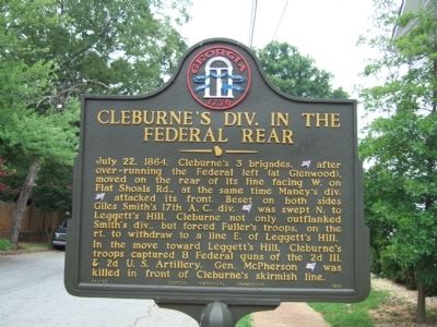
Cleburne's Div. in the Federal Rear
Erected 1956 by Georgia Historical Commission. (Marker Number 044-65.)
Topics and series. This historical marker is listed in this topic list: War, US Civil. In addition, it is included in the Georgia Historical Society series list. A significant historical date for this entry is July 22, 1808.
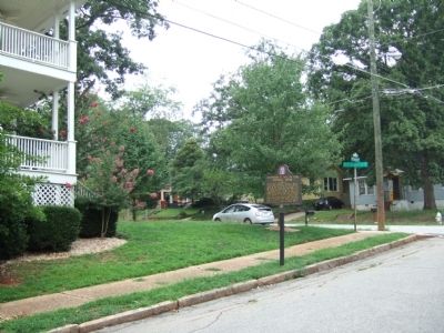
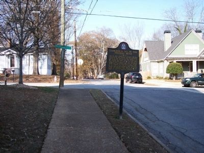
Location. 33° 44.535′ N, 84° 20.584′ W. Marker is in Atlanta, Georgia, in DeKalb County. It is in East Atlanta. Marker is at the intersection of Patterson Avenue and Metropolitan Avenue, on the left when traveling north on Patterson Avenue. Touch for map. Marker is in this post office area: Atlanta GA 30316, United States of America. Touch for directions.
Other nearby markers. At least 8 other markers are within walking distance of this marker. Cleburne Outflanked Left Wing, 17th A.C. (about 700 feet away, measured in a direct line); Historic Ground --1864 (approx. 0.2 miles away); Death of McPherson (approx. 0.2 miles away); Gresham's Division (approx. 0.4 miles away); McPherson's Last Ride (approx. 0.4 miles away); Wheeler's Cav. Intrenched (approx. 0.4 miles away); Leggett's Hill (approx. 0.4 miles away); Maney's Div. in the Battle of Atlanta (approx. 0.4 miles away). Touch for a list and map of all markers in Atlanta.
Credits. This page was last revised on February 8, 2023. It was originally submitted on July 25, 2008, by Felch Dumas of Decatur, Georgia. This page has been viewed 1,521 times since then and 29 times this year. Photos: 1, 2. submitted on July 25, 2008, by Felch Dumas of Decatur, Georgia. 3. submitted on January 1, 2011, by Michael Dover of Ellerslie, Georgia. • Craig Swain was the editor who published this page.


