Fredericksburg, Virginia — The American South (Mid-Atlantic)
The Rappahannock River Runs Free Once More
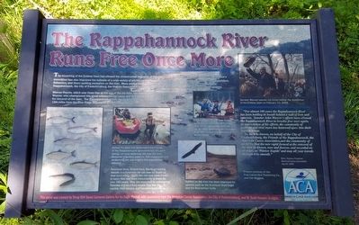
The breaching of the Embrey Dam has allowed the unobstructed migration of fish upstream to their natural spawning grounds. The dam’s demolition has also improved the habitats of a wide variety of wildlife on the Rappahannock River. It also provides a safer haven for paddlers, fishermen, and those seeking recreation on the river. Many parties helped with the removal of the dam, including the Friends of the Rappahannock, the City of Fredericksburg, the Virginia Department of Game and Inland Fisheries, and the U.S. Army Corps of Engineers.
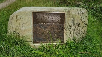
Warner Rapids, which now flows free at the site of the old dam, has been named in honor of Senator John Warner, who championed this great environmental cause and helped obtain federal funding for removal of the dam. The Rappahannock is now the longest free-flowing river on the East Coast, running 184 miles from the Blue Ridge Mountains to the Chesapeake Bay.
“For almost 100 years the Rappahannock River has been holding its breath behind a wall of iron and concrete. Senator John Warner’s efforts have allowed the Rappahannock River to breathe free once again. In appreciation of his efforts, the community of paddlers and river users has bestowed upon him their highest honor.
So, let it be known, on behalf of the City of Fredericksburg, the Friends of the Rappahannock, the the f & the American Canoe Association, and the community of paddlers, that the new rapid formed at the removal of the dam be known as ‘Warner Rapids’ and may all your travewls through it be smooth.”
Kirk Havens, President
American Canoe Association
July 30, 2005
(captions)
Before the dam was demolished the Friends of the Rappahannock sponsored fish lifts each spring, carrying spawning fish over the dam. Restored migratory patterns, fish maturation and re-stocking are now helping fish populations rebound.
American shad, Striped bass, Blueback herring, Alewife and American eel can now be found up river once more. These fish can now swim freely in water that had been inaccessible to them for over 150 years. They are important to commercial fisheries and as a food source they link the marine, tidal estuary and non-tidal food chains.
U.S. Senator Warner and State Senator Houck are escorted by Bill Micks in a canoe for a ribbon cutting ceremony July 30, 2005, celebrating the conclusion of the dam removal and dedication of Warner Rapids.
Habitat on the river has been improved for species such as the American Bald Eagle and the Red-bellied Turtle
Senator Warner salutes the crowd before the demolition of the Embrey Dam on February 23, 2004.
Photos courtesy of the Free Lance-Star Publishing Co., and Hal Wiggins.
This panel was created by Troop 994 Scout Cameron Gahres for his Eagle Project, with assistance from the American Canoe Association, the City of Fredericksburg, and W. Scott Howson Designs.
Erected by American Canoe Association.
Topics. This historical marker is listed in these topic lists: Environment • Man-Made Features • Waterways & Vessels. A significant historical date for this entry is July 30, 2005.
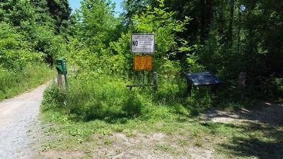
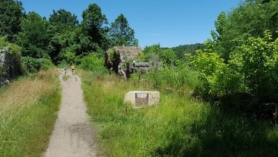
Location. 38° 19.259′ N, 77° 29.375′ W. Marker is in Fredericksburg, Virginia. Marker can be reached from the intersection of Fall Hill Avenue (Virginia Route 639) and Tyler Street, on the right when traveling north. Located 0.4 miles upriver on the old Embry Dam Trail. Touch for map. Marker is at or near this postal address: 3219 Fall Hill Ave, Fredericksburg VA 22401, United States of America. Touch for directions.
Other nearby markers. At least 8 other markers are within walking distance of this marker. Embrey Dam (a few steps from this marker); Falls of the Rappahannock River (a few steps from this marker); A Once Promising Canal Becomes a Raceway (approx. 0.3 miles away); Confederate Defenses in December 1862 (approx. 0.4 miles away); Fall Hill Road (approx. 0.4 miles away); Tactical Terrain (approx. 0.4 miles away); Confederate and Federal Defenses in May 1863 (approx. 0.4 miles away); Rappahannock River Heritage Trail (approx. 0.4 miles away). Touch for a list and map of all markers in Fredericksburg.
Credits. This page was last revised on February 2, 2023. It was originally submitted on June 20, 2016, by Bernard Fisher of Richmond, Virginia. This page has been viewed 384 times since then and 15 times this year. Photos: 1, 2, 3, 4, 5. submitted on June 20, 2016, by Bernard Fisher of Richmond, Virginia.
