Fredericksburg, Virginia — The American South (Mid-Atlantic)
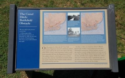
The Canal Ditch: Battlefield Obstacle
“We were subject to fire from the canal all day.”
—A Mississippi soldier describing his experience on December 14, 1862, the day after the battle of Fredericksburg. The Union army would withdraw that night.
On December 12, I862, the 82nd New York Infantry Regiment cleared Confederate pickets from a paper mill (in the area to the right of the dog park) where a lesser canal (sometimes called a canal ditch) branched off from the Rappahannock Canal. The soldiers closed at control gate to try to reduce the water flow, but the canal ditch remained a deep and muddy obstacle when Federal assault columns moved forward the next day.
On May 3, 1863, two batteries of the 1st Rhode Island Light Artillery took position neat the Mary Washington monument. Federal infantry crossed the canal at a nearby bridge (behind you) and moved west. One of the Rhode Island batteries pulled out of the line and followed in support. While the artillerymen were crossing the canal, Confederate guns on the hill now occupied by Mary Washington Hospital hit a caisson, knocking it off the bridge.
(captions)
On December 13, 1862, the Confederate line extended across the hills behind Fredericksburg (1). In town, the Federal attacks were funneled towards Marye’s Heights (2) by the Rappahannock Canal (3) and Hazel Run (4). No major combat occurred in this area, but sharp skirmish fire punctuated the day across this valley. These maps are oriented to the direction you are facing and also show the modern road network to help relate the battle action to the ground.
This 1910 photo reveals the width of the canalditch and its generally wet condition. It has since been contained within a covered concrete flume that roughly follows Kenmore Avenue.
The Mary Washington monument (100 yards to your left) was far from complete when the Civil War swirled around its once quiet setting.
On May 3, 1863, while the main armies fought at Chancellorsville, the Federal Sixth Corps confronted a Confederate division in the second battle of Fredericksburg. Union troops maneuvered to cross the Rappahannock Canal (1), but the Confederates responded by repositioning cannons from William Street (2) and from Fall Hill (3). A Federal assault punched through the weakened Confederate line at William Street (4), while additional columns overran Marye’s Heights (5), with the help of an enveloping assault (6).
Erected by Fredericksburg Economic Development and Tourism Office.
Topics. This historical marker is listed in this topic list: War, US Civil. A significant historical date for this entry is May 3, 1863.
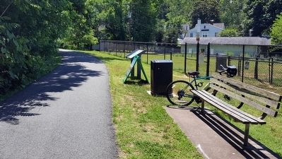
Location. 38° 18.443′ N, 77° 28.238′ W. Marker is in Fredericksburg, Virginia. Marker can be reached from the intersection of Washington Avenue and Maury Street, on the right when traveling south. Located along the Rappahannock Canal Path. Touch for map. Marker is in this post office area: Fredericksburg VA 22401, United States of America. Touch for directions.
Other nearby markers. At least 8 other markers are within walking distance of this marker. Fredericksburg Granite (about 400 feet away, measured in a direct line); Col. George Eskridge Memorial Tree (about 700 feet away); Meditation Rock (about 700 feet away); The Mary Washington Monument (about 700 feet away); Welcome (about 800 feet away); Mary Washington Burial Site (about 800 feet away); Religious Liberty (approx. 0.2 miles away); Shiloh Baptist Cemetery (approx. 0.2 miles away). Touch for a list and map of all markers in Fredericksburg.
Related marker. Click here for another marker that is related to this marker. Old Marker At This Location titled "The Canal Ditch".
Credits. This page was last revised on February 2, 2023. It was originally submitted on June 20, 2016, by Bernard Fisher of Richmond, Virginia. This page has been viewed 474 times since then and 19 times this year. Photos: 1, 2. submitted on June 20, 2016, by Bernard Fisher of Richmond, Virginia.

