Fredericksburg, Virginia — The American South (Mid-Atlantic)
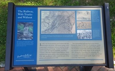
The Railway, With Tracks and Without
Fredericksburg: Timeless.
In 1877, the Fredericksburg and Gordonsville Rail Road began operations, with narrow gauge tracks connecting to established railways running through Fredericksburg and Orange. A series of companies tried to make this railroad profitable, including a company called the Virginia Central Railway, which upgraded the narrow tracks to the standard gauge in 1926. Still, insufficient traffic caused this part of the railway to be abandoned in 1938.
The surrounding landscape has its own history. During the winter of 1862-63, a Confederate winter encampment covered the hills north of Hazel Run. The Southern troops built small huts on the southern exposure of the nearby slopes. In the spring of 1863, during the Chancellorsville campaign, this cleared and level railway (without tracks) also proved an excellent covered way to rapidly deploy troops across the rough terrain.
(captions)
When the Virginia Central Railway upgraded its tracks from a narrow gauge to a standard gauge, it replaced stone abutments with poured concrete piers, to handle the wider tracks. Note that the end facing upstream is pointed, like the prow of a ship.
A rail link between Fredericksburg and the Town of Orange appeared to be a critical need within Virginia's network of railways, but never proved profitable. The cleared, but unfinished route is more readily remembered as part of a Civil War battlefield.
Hut holes in the woods on the opposite side of Hazel Run are all that remain of a large Civil War encampment. The winter huts were of rude construction and locating them on a southern exposure was an attempt to derive as much comfort as possible from the sun.
On the afternoon of May 4, 1863, Confederate troops moved through this area along the graded route, preparing for an assault against Federal forces along Plank Road (State Route 3).
Erected by Fredericksburg Economic Development and Tourism Office.
Topics and series. This historical marker is listed in these topic lists: Industry & Commerce • Railroads & Streetcars • War, US Civil. In addition, it is included in the Virginia, Fredericksburg: Timeless. series list.
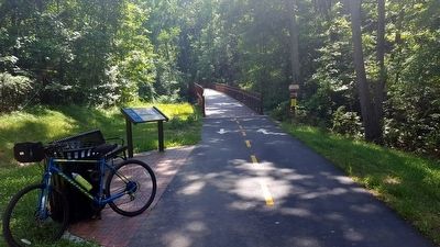
Location. 38° 16.883′ N, 77° 29.879′ W. Marker is in Fredericksburg, Virginia. Marker can be reached from the intersection of Jefferson Davis Highway (U.S. 1) and Kings Mill Drive, on the right when traveling south. Located along the Virginia Central Railway Trail. Touch for map. Marker is in this post office area: Fredericksburg VA 22401, United States of America. Touch for directions.
Other nearby markers. At least 8 other markers are within 2 miles of this marker, measured as the crow flies. Virginia Central Railway Trail (about 700 feet away, measured in a direct line); Reestablishing a Travel Way (approx. 0.2 miles away); The Walker Landram House (approx. 0.4 miles away); Fredericksburg (approx. 0.8 miles away); Building a Railroad Through a Stream Valley (approx. 0.9 miles away); The Virginia Central Railway (approx. one mile away); Lee’s Position (approx. one mile away); Lee’s Hill (approx. 1.2 miles away). Touch for a list and map of all markers in Fredericksburg.
Credits. This page was last revised on February 2, 2023. It was originally submitted on June 20, 2016, by Bernard Fisher of Richmond, Virginia. This page has been viewed 320 times since then and 15 times this year. Photos: 1, 2. submitted on June 20, 2016, by Bernard Fisher of Richmond, Virginia.

