Near Inez in Victoria County, Texas — The American South (West South Central)
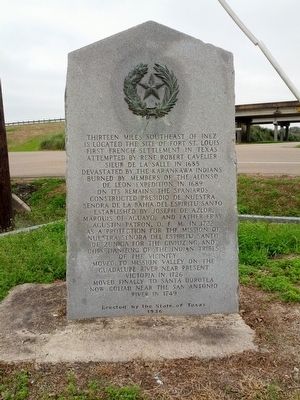
Fort St. Louis
Moved finally to Santa Dorotea now Goliad near the San Antonio River in 1749.
Erected 1936 by State of Texas. (Marker Number 2020.)
Topics and series. This historical marker is listed in these topic lists: Exploration • Forts and Castles • Settlements & Settlers. In addition, it is included in the Texas 1936 Centennial Markers and Monuments series list. A significant historical year for this entry is 1685.
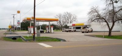
Location. 28° 54.285′ N, 96° 47.493′ W. Marker is near Inez, Texas, in Victoria County. Marker is at the intersection of U.S. 59 and Farm to Market Road 444, on the right when traveling east on U.S. 59. Located at NW corner of gas station parking area. Touch for map. Marker is at or near this postal address: 9 FM 444, Inez TX 77968, United States of America. Touch for directions.
Other nearby markers. At least 8 other markers are within 9 miles of this marker, measured as the crow flies. St. Joseph Catholic Church (approx. 0.2 miles away); St. Joseph Catholic Cemetery (approx. ¼ mile away); Victoria County (approx. 2.3 miles away); Site of Camp Independence (approx. 8½ miles away); Foster Field (approx. 8.8 miles away); Foster Army Air Field (approx. 9 miles away); Foster Field Memorial (approx. 9 miles away); 201st Fighter Squadron, Mexican Expeditionary Air Force (the Aztec Eagles) (approx. 9 miles away). Touch for a list and map of all markers in Inez.
Also see . . .
1. La Salle's Texas Settlement article at Handbook of Texas Online. (Submitted on June 21, 2016, by Gregory Walker of La Grange, Texas.)
2. La Salle Expedition article at Handbook of Texas Online. (Submitted on June 21, 2016, by Gregory Walker of La Grange, Texas.)
Credits. This page was last revised on October 20, 2016. It was originally submitted on June 21, 2016, by Gregory Walker of La Grange, Texas. This page has been viewed 899 times since then and 87 times this year. Photos: 1, 2. submitted on June 21, 2016, by Gregory Walker of La Grange, Texas. • Bernard Fisher was the editor who published this page.

