Alcova in Natrona County, Wyoming — The American West (Mountains)
Devil's Gate
Inscription.
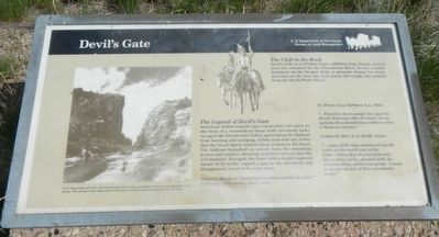
The Legend of Devilís Gate
American Indian legend says a powerful evil spirit in the form of a tremendous beast with enormous tusks ravaged the Sweetwater Valley, preventing the Indians from hunting and camping. A holy man told the tribes that the Great Spirit wanted them to destroy the beast. The Indians launched an attack from the mountain passes and ravines, shooting countless arrows into the evil monster. Enraged, the beast with a mighty upward thrust of its tusks, ripped a gap in the mountain and disappeared, never to be seen again.
Robert L. Munkees, “Independence Rock and Devilís Gate” in Annals of Wyoming, April 1968.
Fr. Pierre-Jean DeSmet, S.J., 1841
"...Travelers have named this spot the Devil's Entrance (Devil's Gate). In my opinion they should have rather called it Heaven's Avenue."
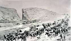
Goldfish 49'er, J.G. Bruff, wrote:
"...some of the boys clambered up the rock on the north side of the Gate...where they fired pistols and threw down rocks, pleased with the reverberation, which was great. I made a careful sketch of this remarkable gorge."
The Cleft in the Rock
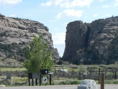
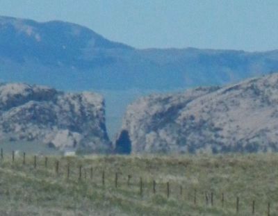
Devil's Gate is a 370-foot high, 1,500-foot long fissure carved over centuries by the Sweetwater River. It was a major landmark on the Oregon Trail...a pleasant change for weary travelers on the four day trek across the rough, dry country from the North Platte River.
Erected by U.S. Department of the Interior, Bureau of Land Management.
Topics and series. This historical marker is listed in these topic lists: Natural Features • Roads & Vehicles • Settlements & Settlers. In addition, it is included in the Oregon Trail series list. A significant historical month for this entry is April 1968.
Location. 42° 26.238′ N, 107° 13.05′ W. Marker is in Alcova, Wyoming, in Natrona County. Marker is on State Highway 220 near Martin Cove Road. Touch for map. Marker is in this post office area: Alcova WY 82620, United States of America. Touch for directions.
Other nearby markers. At least 8 other markers are within walking distance of this marker. Martin's Cove (within shouting distance of this marker); Sun Ranch (about 300 feet away, measured in a direct line); Following the River (about 500 feet away); A Tribute to Hardship (about 500 feet away); The Emigrant Road (about 700 feet away); Tom Sun Ranch (approx. 0.3 miles away); The Oregon Trail (approx. 0.3 miles away); The Pioneer Women (approx. 0.3 miles away). Touch for a list and map of all markers in Alcova.
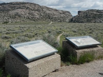
More about this marker. This marker is located at the Devil's Gate BLM Interpretive Site, approximately 7 miles southwest of Independence
Rock.
Also see . . . Devil's Gate - WyoHistory. Although the cleft was too narrow for wagons to pass through alongside the river, emigrants frequently stopped to hike around these rocks and carve their names. Often they noticed bighorn sheep climbing the hills. “The chasm is one of the wonders of the world,” emigrant Charles E. Boyle wrote in 1849. “The water rushes roaring and raving into the gorge, and the noise it makes as it comes in contact with the huge fragments of rock lying in its course is almost deafening.” (Submitted on June 28, 2016, by Barry Swackhamer of Brentwood, California.)
Credits. This page was last revised on July 1, 2016. It was originally submitted on June 28, 2016, by Barry Swackhamer of Brentwood, California. This page has been viewed 980 times since then and 89 times this year. Photos: 1, 2, 3. submitted on June 28, 2016, by Barry Swackhamer of Brentwood, California. 4. submitted on June 30, 2016, by Barry Swackhamer of Brentwood, California. 5. submitted on June 28, 2016, by Barry Swackhamer of Brentwood, California.
