Near Jeffrey City in Fremont County, Wyoming — The American West (Mountains)
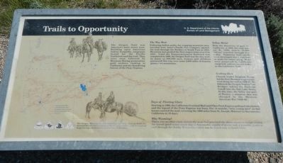
Trails to Opportunity
Inscription.
The Oregon Trail was Americanís main street west. Building upon American Indians footpaths, emigrants bound for the Pacific Northwest used the trail. They were soon followed by Mormons fleeing persecution, gold seekers rushing to California and the thundering hooves of the Pony Express.
The Way West
Following Indian paths, fur trapping mountain men traveled west. Astor's Pacific Fur Company opened the trail through the Rockies at South Pass in 1812. Mountain men guided the first wagon train over it in 1841. Until the Transcontinental Railroad was completed in 1869, the Oregon Trail was the way west. As many as 500,000 men, women and children journeyed this way over some 2,000 miles of deserts, plains and mountains.
Yellow Metal
With the discovery of gold in California in 1848, the rush was on! By 1850, nearly 75,000 "49'ers" traveled through this valley. Numerous Trail cutoffs were developed that saved time or made for easier going. Some were pioneered by California emigrants and are known today as the California Trail.
Seeking Zion
Church leader Brigham Young led the first Mormon wagon train west along the trail in 1846-47. He followed the Oregon Trail to Fort Bridger, taking the Hastings Cutoff into the Salt Lake Valley. At this time, the Valley was part of Mexico, a situation that was changed by the Mexican-American War (1846-48).
Day of Fleeting Glory
Starting in 1860, the California Overland Mail and Pikes Peak Express galloped into history and the legend of the Pony Express was born. For 18 months, "wiry young men" on fast horses carried the mail, covering the 1600 miles from St. Joseph, Missouri to Sacramento, California in 15 days.
Why Wyoming!
There was no other route across the west that provided the three essential things needed for travel good water every day; a dependable supply of grass; a passable grade to and through the Rocky Mountains which can be found only at South Pass.
The Oregon, Mormon Pioneer, California and Pony Express are National Historic Trails designated by Congress. BLM is actively involved in preserving and maintaining trail sites in Wyoming.
Erected by U.S. Department of the Interior, Bureau of Land Management.
Topics and series. This historical marker is listed in these topic lists: Roads & Vehicles • Settlements & Settlers. In addition, it is included in the Mormon Pioneer Trail, and the Oregon Trail series lists.
Location. 42° 27.224′ N, 107° 32.764′ W. Marker is near Jeffrey City, Wyoming, in Fremont County. Marker can be reached from Wyoming 789 near Wyoming Highway 220, on the right when traveling west. Touch for map. Marker is at or near this postal address: 2656 Wyoming 789, Jeffrey City WY 82310, United States of America. Touch for directions.
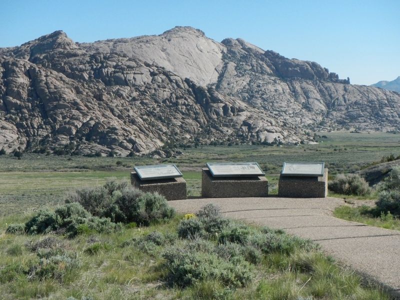
Other nearby markers. At least 7 other markers are within 9 miles of this marker, measured as the crow flies. Wild Horses (here, next to this marker); Split Rock (here, next to this marker); Split Rock Meadows (within shouting distance of this marker); a different marker also named Split Rock (within shouting distance of this marker); Pony Express (within shouting distance of this marker); a different marker also named Split Rock (approx. 3.2 miles away); Muddy Gap (approx. 8.2 miles away).
More about this marker. This marker is located at the BLM Split Rock Historic Site between Muddy Gap and Jeffrey City.
Credits. This page was last revised on July 12, 2016. It was originally submitted on July 12, 2016, by Barry Swackhamer of Brentwood, California. This page has been viewed 407 times since then and 14 times this year. Photos: 1, 2. submitted on July 12, 2016, by Barry Swackhamer of Brentwood, California.

