Fort Larned National Historic Site in Pawnee County, Kansas — The American Midwest (Upper Plains)
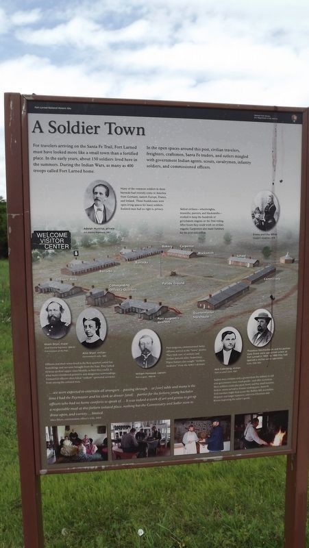
A Soldier Town
For travelers arriving on the Santa Fe Trail, Fort Larned must have looked more like a small town than a fortified place. In the early years, about 150 soldiers lived here in the summers. During the Indian Wars, as many as 400 troops called Fort Larned home.
In the open spaces around this post, civilian travelers, freighters, craftsmen, Santa Fe traders, and sutlers mingled with government Indian agents, scouts, cavalrymen, infantry soldiers, and commissioned officers.
Many of the common soldiers in these barracks had recently come to America from Germany, eastern Europe, France, and Ireland. These bunkhouses were open living spaces for many soldiers. Enlisted men had no right to privacy.
Skilled civilians - wheelwrights, tinsmiths, painters, and blacksmiths - worked to keep the hundreds of government wagons on the Trail rolling. After hours they could work on civilian wagons. Carpenters also made furniture for the post and coffins.
Officers and their wives lived in the best quarters amid fine furnishings and servants brought from the East. They aimed to keep up their upper-class lifestyle, as best they could, in what most considered primitive and dangerous surroundings. Unmarried officers often hired "strikers" (personal servants) from among the enlisted men.
...we were expected to entertain all strangers...passing through...at [our] table and many is the time I had the Paymaster and his clerk at dinner [and]...parties for the forlorn young bachelor officers who had no home comforts to speak of...It was indeed a work of art and genius to get up a respectable meal at this forlorn isolated place, nothing but the Commissary and Sutler store to draw upon, and variety...limited.
Alice Dryer, commandant officer's wife, 1865
Post surgeons, commissioned Army officers, served as the "town" doctor. They took care of military and civilian patients alike. Sometimes Plains Indians also sought "modern medicine" from the Army's doctors.
Sutlers were civilians with a permit from the military to sell non-government-issue retail goods - and offer recreation. Here soldiers could play pool, bowl, and buy small luxuries. Sutlers' stores served as frontier melting pots. Santa Fe Trail travelers might find scouts like Buffalo Bill, journalists, Hispanic and Anglo teamsters, and even Cheyenne and Kiowa inspecting the sutler's goods.
Erected by National Park Service.
Topics and series. This historical marker is listed in these topic lists: Entertainment • Forts and Castles • Industry & Commerce • Settlements & Settlers. In addition, it is included in the Santa Fe Trail series list. A significant historical year for this entry is 1865.
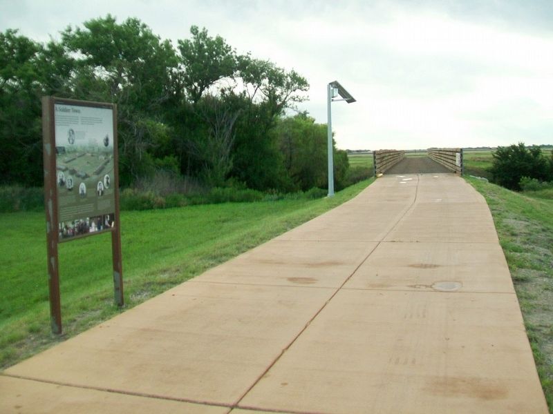
Location. 38° 10.948′ N, 99° 13.25′ W. Marker is in Fort Larned National Historic Site, Kansas, in Pawnee County. Marker is on the path from the parking lot to the bridge over the Pawnee River. Touch for map. Marker is at or near this postal address: 1767 KS Hwy 156, Larned KS 67550, United States of America. Touch for directions.
Other nearby markers. At least 8 other markers are within walking distance of this marker. Doesn't Every Fort Have a Wall? (a few steps from this marker); Well, Adobe Hospital and Hospital Steward's Quarters (about 700 feet away, measured in a direct line); The Great Wagon Road to the Southwest (approx. 0.2 miles away); Soldiers Who Died At Fort Larned (approx. ¼ mile away); Third Infantry Honored Dead (approx. ¼ mile away); Santa Fe Trail (approx. 0.4 miles away); Fort Larned (approx. 0.4 miles away); The Frontier Army and the U.S. Mail (approx. 0.4 miles away). Touch for a list and map of all markers in Fort Larned National Historic Site.
Related marker. Click here for another marker that is related to this marker. An identical marker within the park
Also see . . .
1. Fort Larned National Historic Site. (Submitted on July 14, 2016, by William Fischer, Jr. of Scranton, Pennsylvania.)
2. Santa Fe National Historic Trail. (Submitted on July 14, 2016, by William Fischer, Jr. of Scranton, Pennsylvania.)
Credits. This page was last revised on July 5, 2023. It was originally submitted on July 14, 2016, by William Fischer, Jr. of Scranton, Pennsylvania. This page has been viewed 324 times since then and 12 times this year. Photos: 1. submitted on July 4, 2023, by Jeff Leichsenring of Garland, Texas. 2. submitted on July 14, 2016, by William Fischer, Jr. of Scranton, Pennsylvania.

