Guatemala City in Guatemala Department, — Central America
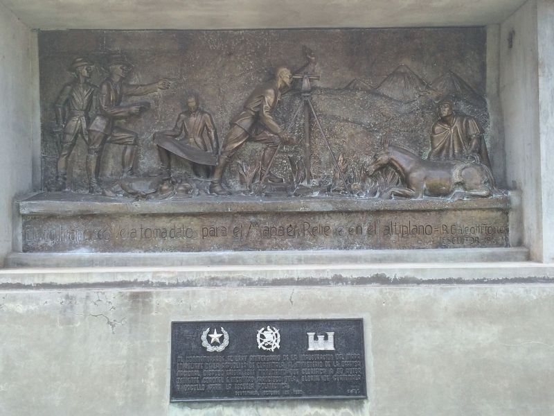
Engineer Francisco Vela
R. Galeotti Torres Escultor 1980
Marcador adicional
Al conmemorarse el LXXV aniversario de la inauguración del Mapa en Relieve de la Republica de Guatemala, el Ministerio de la Defensa Nacional dispuso erigir este monumento que glorifica a su autor Teniente Colonel e Ingeniero Francisco Vela, gloria de Guatemala y orgullo para la Escuela Politécnica.
Guatemala, Octubre de 1982
R. Galeotti Torres, Sculptor 1980
Additional marker:
In order to commemorate the 75th anniversary of the inauguration of the Relief Map of the Republic of Guatemala, the Ministry of National Defense erected this monument, which glorifies its author, Lieutenant Colonel and Engineer Francisco Vela, glory of Guatemala and pride of the Guatemalan Military College.
Guatemala, October 1982
Erected 1980.
Topics. This historical marker is listed in these topic lists: Arts, Letters, Music • Charity & Public Work • Education. A significant historical month for this entry is October 1982.
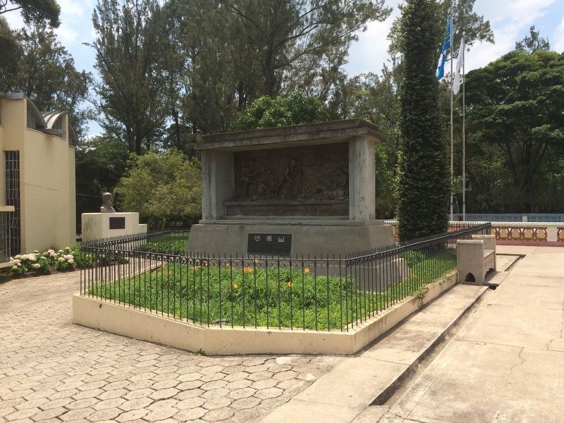
Location. 14° 39.642′ N, 90° 30.523′ W. Marker is in Guatemala City, Guatemala (Guatemala Department). Marker can be reached from Avenida Simeon Cañas. The marker is near the small museum at the Relief Map of Guatemala at the end of Avenida Simeon Cañas. Touch for map. Marker is in this post office area: Guatemala City, Guatemala 01002, Guatemala. Touch for directions.
Other nearby markers. At least 8 other markers are within walking distance of this marker. Engineer Claudio Urrutia M. (a few steps from this marker); Lieutenant Colonel and Engineer Francisco Vela (within shouting distance of this marker); General Francisco Morazán (approx. 1.1 kilometers away); First Autonomous University in Guatemala (approx. 1.2 kilometers away); Jocotenango Park (approx. 1.2 kilometers away); Yurrita House (approx. 1.4 kilometers away); The Mexican Fountain at El Cerrito del Carmen (approx. 1.5 kilometers away); First Council of the City of Guatemala (approx. 1.5 kilometers away). Touch for a list and map of all markers in Guatemala City.
Photographed By J. Makali Bruton, June 17, 2016
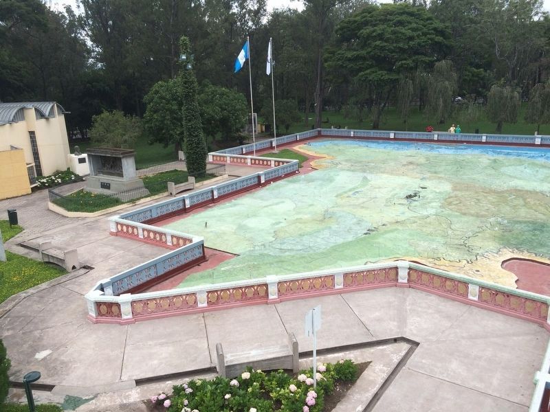
3. Engineer Francisco Vela Marker
The marker and monument can be seen to the left of the Relief Map, from the western observation tower. Here the northern part of the map showing mostly the department of Petén can be seen. Further to the left can be seen the marker and bust dedicated to Engineer Claudio Urrutia Mendoza.
Photographed By J. Makali Bruton, June 17, 2016
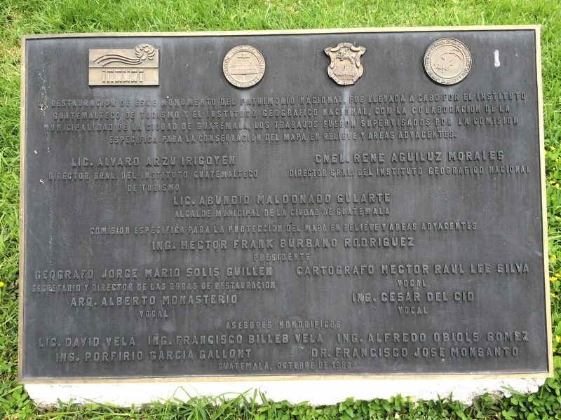
4. Additional marker on the 1980 restoration of the Relief map.
This marker is south of the featured marker and to the west of the map. It is interesting in that it features future President of Guatemala and Mayor of Guatemala City Álvaro Arzú as Director of the Guatemalan Institute of Tourism. It also features David Vela as an Honorary Consultant of the Restoration Committee, famous for composing the University of San Carlos of Guatemala's hymn, La Chalana, among other formidable accomplishments.
Credits. This page was last revised on May 17, 2021. It was originally submitted on July 14, 2016, by J. Makali Bruton of Accra, Ghana. This page has been viewed 587 times since then and 12 times this year. Photos: 1, 2, 3, 4, 5. submitted on July 14, 2016, by J. Makali Bruton of Accra, Ghana.
