Flintstone in Allegany County, Maryland — The American Northeast (Mid-Atlantic)
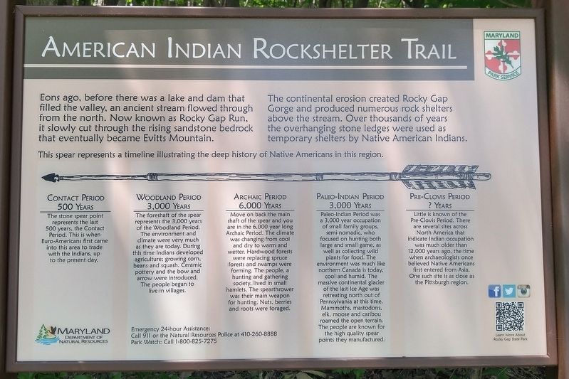
American Indian Rockshelter Trail
The continental erosion created Rocky Gap Gorge and produced numerous rock shelters above the stream. Over thousands of years the overhanging stone ledges were used as temporary shelters by Native American Indians.
[text with image of spear] This spear represents a timeline illustrating the deep history of Native Americans in this region.
Contact Period, 500 Years. The stone spear point represents the last 500 years, the Contact Period. That is when Euro-Americans first came into this area to trade with the Indians, up to the present day.
Woodland Period, 3,000 Years. The foreshaft of the spear represents the 3,000 years of the Woodland Period. The environment and climate were very much as they are today. During this time Indians developed agriculaure, growing corn, beans and squash. Ceramic pottery and the bow and arrow were introduced. The people began to live in villages.
Archaic Period, 6,000 Years. Move on back the main shaft of the spear and you are in the 6,000 year long Archaic Period. The climate was changing from cool and dry to warm and wetter. Hardwood forests were replacing spruce forests and swamps were forming. The people, a hunting and gathering society, lived in small hamlets. The spearthrower was their main weapon for hunting. Nuts, berries and roots were foraged.
Paleo-Indian Period, 3,000 Years. Paleo-Indian Period was a 3,000 year occupation of small family groups, semi-nomadic, who focused on hunting both large and small game, as well as collecting wild plants for food. The environment was much like northern Canada is today, cool and humid. The massive continental glacier of the last Ice Age was retreating north out of Pennsylvania at this time. Mammoths, mastodons, elk, moose and caribou roamed the open terrain. The people are known for the high quality spear points they manufactured.
Pre-Clovis Period, ? Years. Little is known of the Pre-Clovis Period. There are several sites across North America that indicate Indian occupation was much older than 12,000 years ago, the time when archaeologists once believed Native Americans first entered from Asia. One such site is as close as the Pittsburgh region.
Topics. This historical marker is listed in these topic lists: Anthropology & Archaeology • Native Americans.
Location. 39° 42.002′ N, 78° 39.766′ W. Marker
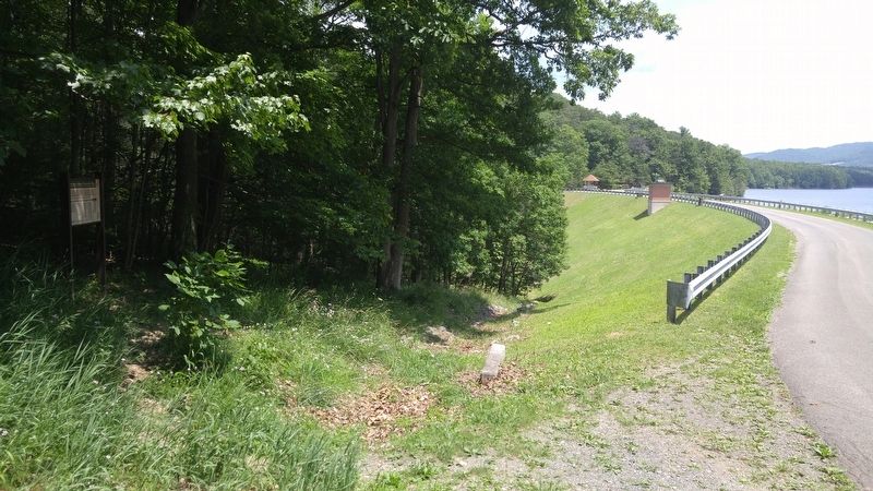
is in Flintstone, Maryland, in Allegany County. Marker can be reached from Old Hancock Road. Marker is within Rocky Gap State Park, near the Lake Habeeb dam, about 1/3 mile north of the end of Old Hancock Road. Touch for map. Marker is in this post office area: Flintstone MD 21530, United States of America. Touch for directions.
Other nearby markers. At least 8 other markers are within 4 miles of this marker, measured as the crow flies. The Naming of the Lake (about 300 feet away, measured in a direct line); Evart's Homesite (approx. 0.7 miles away); Life in Pleasant Valley (approx. 0.7 miles away); Martins Mountain (approx. ¾ mile away); Union Grove School (approx. 1.9 miles away); Washington’s Road (approx. 2.7 miles away); Pennsylvania (approx. 3.1 miles away in Pennsylvania); Camp Mason & Dixon (approx. 3.4 miles away in Pennsylvania). Touch for a list and map of all markers in Flintstone.
Credits. This page was last revised on July 17, 2016. It was originally submitted on July 17, 2016, by F. Robby of Baltimore, Maryland. This page has been viewed 843 times since then and 70 times this year. Photos: 1, 2, 3. submitted on July 17, 2016, by F. Robby of Baltimore, Maryland.


