Hancock in Washington County, Maryland — The American Northeast (Mid-Atlantic)
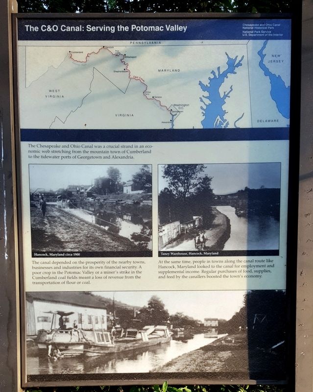
The C&O Canal: Serving the Potomac Valley
Chesapeake and Ohio Canal National Historical Park
The canal depended on the prosperity of the nearby towns, businesses and industries for its own financial security. A poor crop in the Potomac Valley or a miner's strike in the Cumberland coal fields meant a loss of revenue from the transportation of flour or coal.
At the same time, people in towns along the canal route like Hancock, Maryland looked to the canal for employment and supplemental income. Regular purchases of food, supplies, and feed by the canallers boosted the town's economy.
(captions)
Hancock, Maryland circa 1900
Taney Warehouse, Hancock, Maryland
Erected by National Park Service, U.S. Department of the Interior.
Topics and series. This historical marker is listed in these topic lists: Industry & Commerce • Waterways & Vessels. In addition, it is included in the Chesapeake and Ohio (C&O) Canal series list.
Location. 39° 41.878′ N, 78° 10.752′ W. Marker is in Hancock, Maryland, in Washington County. Marker can be reached from the intersection of Canal Street and North Church Street. Located on the C&O Canal Towpath. Touch for map. Marker is in this post office area: Hancock MD 21750, United States of America. Touch for directions.
Other nearby markers. At least 8 other markers are within walking distance of this marker. Hancock in the Canal Era (a few steps from this marker); Discover the Trail (within shouting distance of this marker); A New Beginning (within shouting distance of this marker); Major James Breathed (about 300 feet away, measured in a direct line); Hancock Station (about 300 feet away); a different marker also named Discover the Trail (about 300 feet away); Hancock (about 300 feet away); "Perkins House" / "Davis" Hotel (about 300 feet away). Touch for a list and map of all markers in Hancock.
Also see . . . Chesapeake & Ohio Canal National Historical Park. National Park Service (Submitted on July 25, 2016.)
Credits. This page was last revised on July 25, 2016. It was originally submitted on July 25, 2016, by Bernard Fisher of Richmond, Virginia. This page has been viewed 333 times since then and 10 times this year. Photos: 1, 2. submitted on July 25, 2016, by Bernard Fisher of Richmond, Virginia.

