Near Orchard in Antelope County, Nebraska — The American Midwest (Upper Plains)
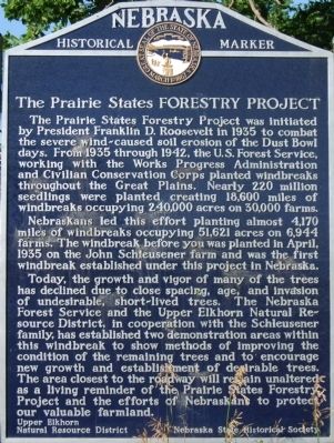
The Prairie States Forestry Project
Nebraskans led this effort planting almost 4,170 miles of windbreaks occupying 51,621 acres on 6,944 farms. The windbreak before you was planted in April, 1935 on the John Schleusener farm and was the first windbreak established under this project in Nebraska.
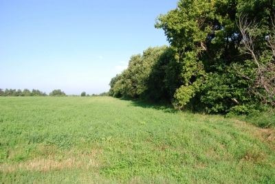
Today, the growth and vigor of many of the trees has declined due to close spacing, age, and invasion of undesirable, short-lived trees. The Nebraska Forest Service and the Upper Elkhorn Natural Resource District, in cooperation with the Schleusener family, has established two demonstration areas within this windbreak to show methods of improving the condition of the remaining trees and to encourage new growth and establishment of desirable trees. The area closest to the roadway will remain unaltered as a living reminder of the Prairie States Forestry Project and the efforts of Nebraskans to protect our valuable farmland.
Erected by Upper Elkhorn Natural Resource District; Nebraska State Historical Society. (Marker Number 296.)
Topics and series. This historical marker is listed in these topic lists: Agriculture • Horticulture & Forestry. In addition, it is included in the Civilian Conservation Corps (CCC), the Nebraska State Historical Society, and the Works Progress Administration (WPA) projects series lists. A significant historical month for this entry is April 1935.
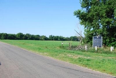
Location. Marker has been reported permanently removed. It was located near 42° 21.424′ N, 98° 14.57′ W. Marker was near Orchard, Nebraska, in Antelope County. Marker was on 513 Avenue, 1.4 miles north of Orchard, on the left when traveling north. Touch for map. Marker was in this post office area: Orchard NE 68764, United States of America.
We have been informed that this sign or monument is no longer there and will not be replaced. This page is an archival view of what was.
Other nearby markers. At least 4 other markers are within 10 miles of this location, measured as the crow flies. The Savidge Brothers, Aviation Pioneers (approx. 8.7 miles away); These Flags Fly (approx. 8.7 miles away); Page School (approx. 9.4 miles away); Page Base Line (approx. 9.4 miles away).
Additional commentary.
1. Marker removed in 2017?
The History Nebraska website list of Nebraska Historical markers notes the marker was removed in 2017 as the windbreak, mentioned on marker, was also removed.
— Submitted June 18, 2021, by Mark Hilton of Montgomery, Alabama.
Credits. This page was last revised on June 18, 2021. It was originally submitted on July 28, 2008, by Dawn Bowen of Fredericksburg, Virginia. This page has been viewed 2,743 times since then and 36 times this year. Photos: 1, 2, 3. submitted on July 28, 2008, by Dawn Bowen of Fredericksburg, Virginia. • Kevin W. was the editor who published this page.


