Mifflin in Ashland County, Ohio — The American Midwest (Great Lakes)
Historic Mifflin
Side A
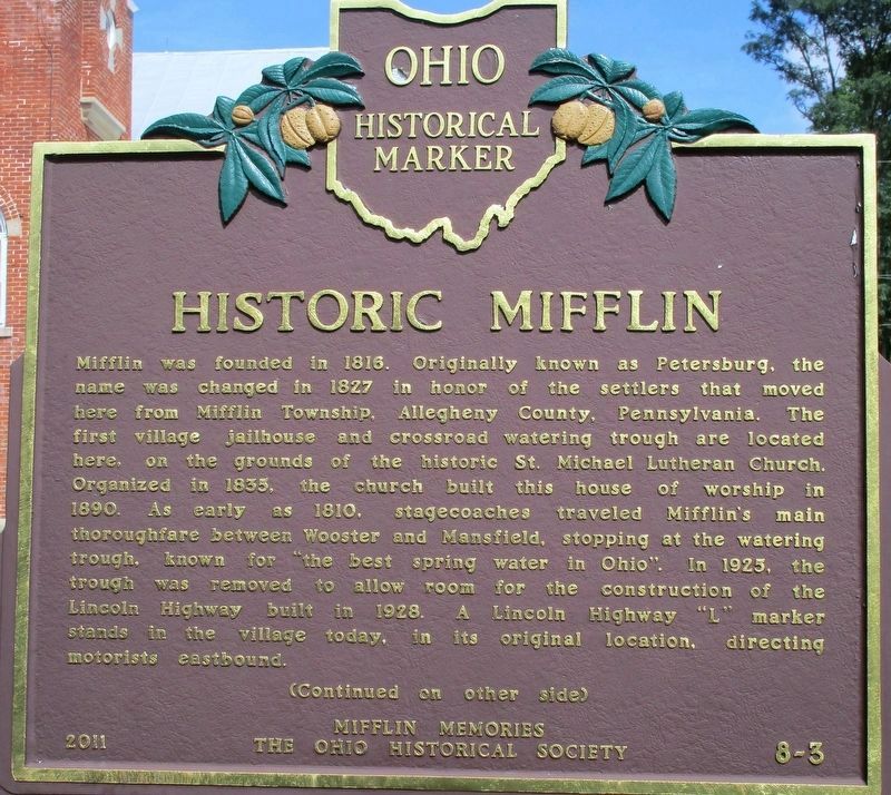
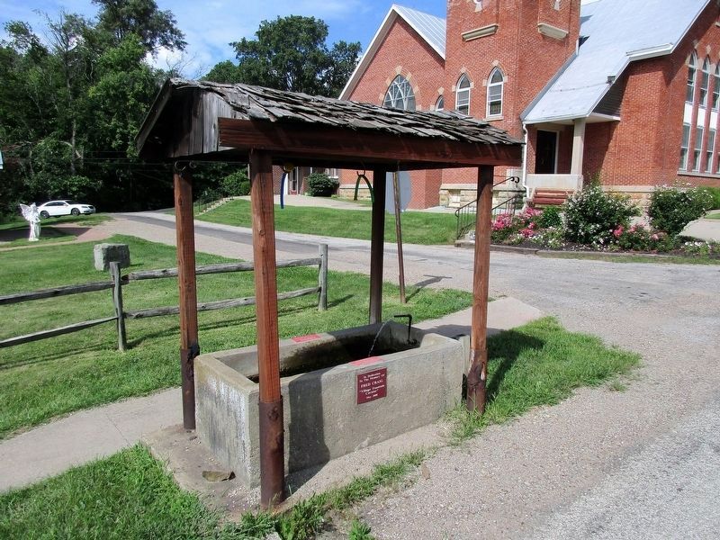
Mifflin was founded in 1816. Originally known as Petersburg, the name was changed in 1827 in honor of the settlers that moved here from Mifflin Township, Allegheny County, Pennsylvania. The first village jailhouse and crossroad watering trough are located here, on the grounds of the historic St. Michael Lutheran Church. Organized in 1835, the church built this house of worship in 1890. As early as 1810, stagecoaches traveled Mifflin's main thoroughfare between Wooster and Mansfield, stopping at the watering trough, known for "the best spring water in Ohio". In 1925, the trough was removed to allow room for the construction of the Lincoln Highway built in 1928. A Lincoln Highway "L" marker stands in the village today, in its original location, directing motorists eastbound.
Side B
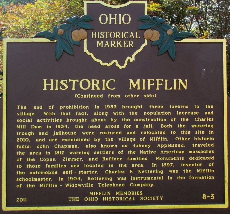
The end of prohibition in 1933 brought three taverns to the village. With that fact, along with the population increase and social activities brought about by the construction of the Charles Mill Dam in 1934, the need arose for a jail. Both the watering trough and jailhouse were restored and relocated to this site in 2010, and are maintained by the village of Mifflin. Other historic facts: John Chapman, also know as Johnny Appleseed, traveled the area in 1812 warning settlers of the Native American massacres of the Copus,
Erected 2011 by Mifflin Memories The Ohio Historical Society. (Marker Number 8-3.)
Topics and series. This historical marker is listed in these topic lists: Churches & Religion • Roads & Vehicles • Settlements & Settlers. In addition, it is included in the Ohio Historical Society / The Ohio History Connection series list.
Location. 40° 46.452′ N, 82° 21.742′ W. Marker is in Mifflin, Ohio, in Ashland County. Marker is at the intersection of Lincoln Highway (County Route 30A) and Iowa Street, on the right when traveling west on Lincoln Highway. Marker is next to St. Michael’s Lutheran Church. Touch for map. Marker is at or near this postal address: 26 E Maine St, Ashland OH 44805, United States of America. Touch for directions.
Other nearby markers. At least 8 other markers are within 7 miles of this marker, measured as the crow flies. Frontier Violence During the War of 1812 (approx. 2.4 miles away); PFC Terry L. Schaub (approx. 5.2 miles away); Hayesville (approx. 5.3 miles away); Hayesville Town Hall and Opera House (approx. 5.3 miles away); Greentown Delaware Village (approx. 5.6 miles away); Ashland County Veterans Memorial Bridge (approx. 6.1 miles away); Founding of Ashland College / Ashland Eagles Tradition (approx. 6.4 miles away); Jones Memorial Terrace (approx. 6˝ miles away).
Additional keywords. Lincoln Highway Johnny Appleseed
Photographed By Rev. Ronald Irick, August 20, 2016
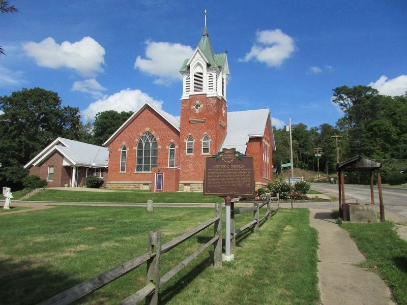
4. Historic Mifflin Marker
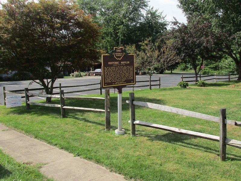
Marker can be seen at a distance; looking east towards St. Michael's Church, with the Lincoln Highway coming down the hill, around the Church. The spring is to the right. Street sign says "Minnesota", but plat map calls this "Iowa Street".
Credits. This page was last revised on March 17, 2021. It was originally submitted on August 21, 2016, by Rev. Ronald Irick of West Liberty, Ohio. This page has been viewed 837 times since then and 53 times this year. Photos: 1, 2, 3, 4, 5. submitted on August 21, 2016, by Rev. Ronald Irick of West Liberty, Ohio. • Bill Pfingsten was the editor who published this page.
