Root in Montgomery County, New York — The American Northeast (Mid-Atlantic)
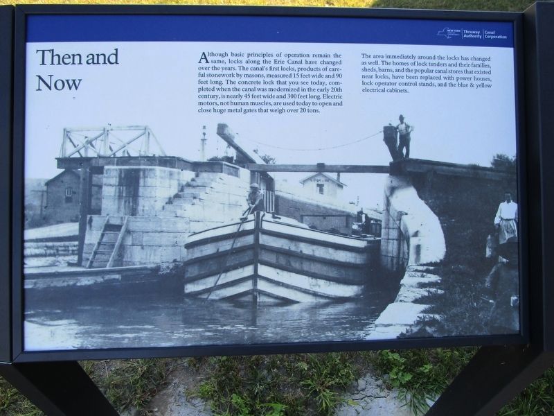
Then and Now
The area immediately around the locks has changed as well. The homes of lock tenders and their families, sheds, barns, and the popular canal stores that existed near the locks, have been replaced with power houses, lock operator control stands, and the blue & yellow electrical cabinets.
Erected 2016 by New York State Thruway Authority / Canal Corporation.
Topics and series. This historical marker is listed in this topic list: Waterways & Vessels. In addition, it is included in the Erie Canal series list.
Location. 42° 54.964′ N, 74° 26.782′ W. Marker is in Root, New York, in Montgomery County. Marker can be reached from the intersection of Interstate 90 at milepost 187 and Lock 13 Living History Rest Area. Marker is at a new rest area for I-90 westbound travelers between exit 28 (Fultonville) and exit 29 (Canajoharie). The rest area is at Lock 13 on the Erie Barge Canal. It officially opened on August 11, 2016 at 11:30 am. Touch for map. Marker is in this post office area: Fultonville NY 12072, United States of America. Touch for directions.
Other nearby markers. At least 8 other markers are within walking distance of this marker. History of the Buoy Boat (within shouting distance of this marker); Bollards (within shouting distance of this marker); The Mohawk Valley (within shouting distance of this marker); a different marker also named The Mohawk Valley (within shouting distance of this marker); Transportation is King / Modernization (within shouting distance of this marker); a different marker also named The Mohawk Valley (within shouting distance of this marker); The Erie Canal (within shouting distance of this marker); a different marker also named The Mohawk Valley (within shouting distance of this marker).
Credits. This page was last revised on March 20, 2019. It was originally submitted on September 9, 2016, by Anton Schwarzmueller of Wilson, New York. This page has been viewed 286 times since then and 21 times this year. Last updated on March 9, 2019, by Steve Stoessel of Niskayuna, New York. Photos: 1, 2. submitted on September 9, 2016, by Anton Schwarzmueller of Wilson, New York. • Bill Pfingsten was the editor who published this page.

