Elk Rapids in Antrim County, Michigan — The American Midwest (Great Lakes)
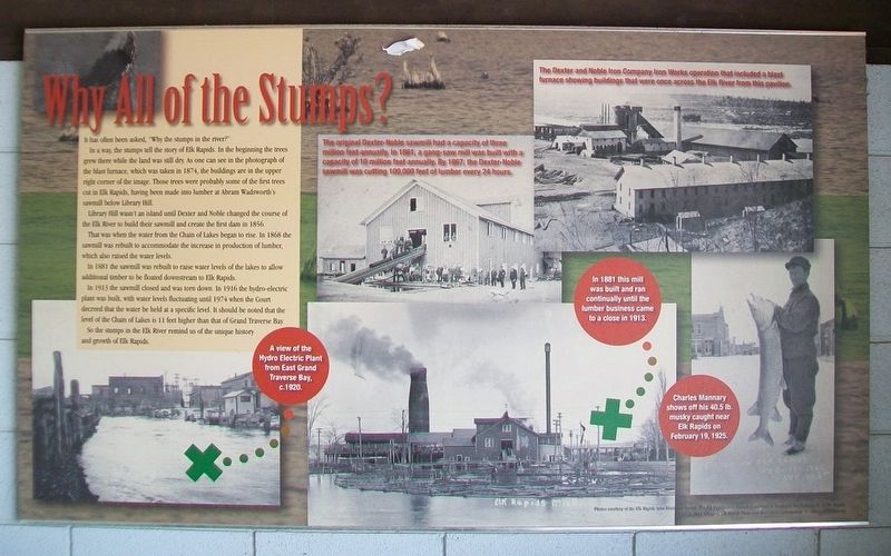
Why All of the Stumps?
It has often been asked, "Why the stumps in the river?"
In a way, the stumps tell the story of Elk Rapids. In the beginning the trees grew there while the land was still dry. As one can see in the photograph of the blast furnace, which was taken in 1874, the buidlings are in the upper right corner of the image. Those trees were probably some of the first trees cut in Elk Rapids, having been made into lumber at Abram Wadsworth's sawmill below Library Hill.
Library Hill wasn't an island until Dexter and Noble changed the course of the Elk River to build their sawmill and create the first dam in 1856.
That was when the water from the Chain of Lakes began to rise. In 1868 the sawmill was rebuilt to accommodate the increase in production of lumber, which also raised the water levels.
In 1881 the sawmill was rebuilt to raise water levels of the lakes to allow additional lumber to be floated downstream to Elk Rapids.
In 1913 the sawmill closed and was town down. In 1916 the hydro-electric plant was built, with water levels fluctuating until 1974 when the Court decreed that the water be held at a specific level. It should be noted that the level of the Chain of Lakes is 11 feet higher than that of Grand Traverse Bay.
So the stumps in the Elk River remind us of the unique history and growth of Elk Rapids.
[Photo captions read]
• A view of the Hydro Electric Plant from East Grand Traverse Bay, c.1920.
• The original Dexter-Noble sawmill had a capacity of three million feet annually. In 1861, a gang-saw mill was built with a capacity of 10 million feet annually. • By 1867, the Dexter-Noble sawmill was cutting 100,000 feet of lumber every 24 hours.
• The Dexter and Noble Iron Works operation that included a blast furnace showing buildings that were once across the Elk River from this pavilion.
• In 1881 this mill was built and ran continually until the lumber business came to a close in 1913.
• Charles Mannary shows off his 40.5 lb. musky caught near Elk Rapids on February 19, 1925.
Photos courtesy of the Elk Rapids Area Historical Society. The Elk Rapids Area Historical Museum is located at 301 Traverse St. in Elk Rapids. Map Courtesy of Michigan Maps, Inc., Elk Rapids.
©2012 Village of Elk Rapids Parks and Recreation Commission.
Erected 2012 by Village of Elk Rapids Parks and Recreation Commission.
Topics. This historical marker is listed in these topic lists: Environment • Horticulture & Forestry • Industry & Commerce • Waterways & Vessels. A significant historical year for this entry is 1874.
Location. 44° 53.807′ N, 85° 24.563′ W. Marker is in Elk Rapids, Michigan, in Antrim County. Marker is inside the Rotary Park Pavilion, on the right while traveling north on U.S. 31. Touch for map. Marker is at or near this postal address: Rotary Park, 305 US 31, Elk Rapids MI 49629, United States of America. Touch for directions.
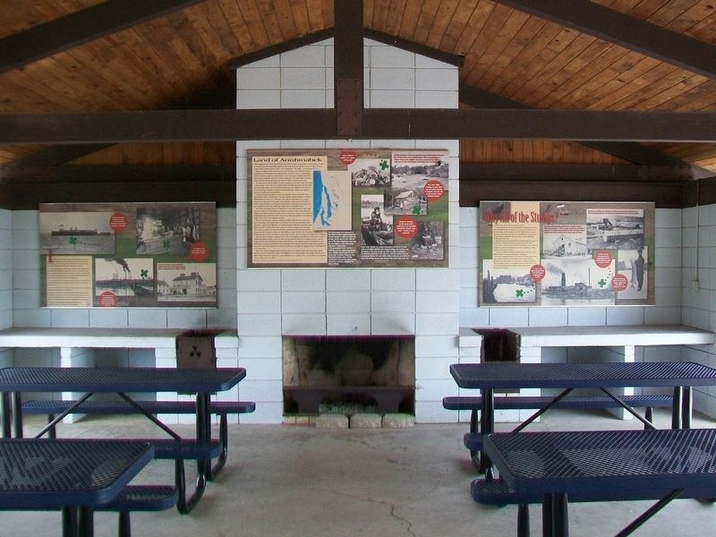
Other nearby markers. At least 8 other markers are within walking distance of this marker. Elk Rapids (here, next to this marker); Land of Anishinabek (here, next to this marker); Elk River, Entry to the Chain of Lakes of Antrim County (here, next to this marker); Because of the Water... (here, next to this marker); Rotary Park "Centennial Project" (here, next to this marker); Early Elk Rapids and the Elk River (here, next to this marker); First Methodist Episcopal Church (approx. 0.3 miles away); The Island House (approx. 0.3 miles away). Touch for a list and map of all markers in Elk Rapids.
Also see . . .
1. Elk Rapids Early History. Elk River Township website entry (Submitted on January 17, 2022, by Larry Gertner of New York, New York.)
2. Historical Notes on Alden and Helena Township, Michigan. Antrim County MIGenWeb website entry (Submitted on September 25, 2016, by William Fischer, Jr. of Scranton, Pennsylvania.)
3. Edward S. Noble. Elk River Township website entry (Submitted on January 17, 2022, by Larry Gertner of New York, New York.)
4. Elk Rapids Waterfront Cultural Landscape Report. (Submitted on September 25, 2016, by William Fischer, Jr. of Scranton, Pennsylvania.)
Credits. This page was last revised on January 17, 2022. It was originally submitted on September 24, 2016, by William Fischer, Jr. of Scranton, Pennsylvania. This page has been viewed 619 times since then and 46 times this year. Photos: 1. submitted on September 25, 2016, by William Fischer, Jr. of Scranton, Pennsylvania. 2. submitted on September 24, 2016, by William Fischer, Jr. of Scranton, Pennsylvania.

