Near Guernsey in Platte County, Wyoming — The American West (Mountains)
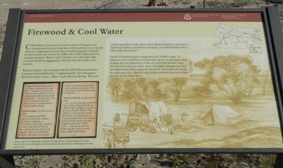
Firewood & Cool Water
William Clayton, who traveled with the 1847 Mormon Pioneer Company and published an “emigrant guide” for subsequent Mormon trains, write, “Bitter Creek and Cold Spring; This was [a] dry September 13 )the return trip to Winter Quarters). Here there is plenty of timber, and if there is no water, you will find plenty three and a half miles further.”
On the Nebraska prairie, emigrants used “buffalo chips,” or whatever else would burn, to heat their dinner or noontime meal. Despite the eery loneliness of this site, it is likely all who came this way felt a sense of relief – here was a great campground that provided water, timber, grass for livestock, and shade and shelter for weary travelers. About a mile to the northeast the creek drains into the North Platte River.
Many explorers, emigrants, and pioneers kept diaries and journals of their five month trek across the prairies and mountains that provide us with insight into their experiences.
Captain Fremont says this of the Bitter Cottonwood Creek area- “We halted at noon on the Fourche Amere [Poplar Fork], so called being timbered principally with poplar… The bed of the creek is sand and gravel, the water dispersed over the broad bed in several shallow stream.”
Howard Egan, Saturday, June 5, 1847 “…encamped about half a mile west of the little company of Oregon emigrants, on Cottonwood creek. Day’s journey, 17 miles. From the left back of the creek, by the side of the road, issued a clear and cold spring of water. The grass is very good; timber much more plentiful than below Laramie. It consists of ash, cottonwood, willows and box elder in low places…”
Thomas Bullock, Sunday June 6, 1847 “…at 2:35 our camp again pursued their journey, along the banks of “Bitter Creek” going thro’ a grove of Cotton Wood & Willow Trees, which is a rarity on this journey. Passed thro’ a small quantity of very good grass, then took a sudden bend to the left, round a Ravine, & again crossed over “Bitter Creek” … Traveled by the most timber this day than any where since we left Grand Island…”
Erected by Mormon Trail Heritage Foundation, National Park Service.
Topics and series. This historical marker is listed in these topic lists: Exploration • Roads & Vehicles • Settlements & Settlers. In addition, it is included in the Mormon Pioneer Trail, and the Oregon Trail series lists. A significant historical date for this entry is June 5, 1847.
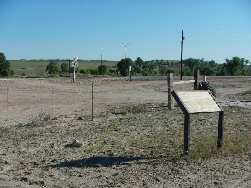
Location. 42° 18.816′ N, 104° 53.364′ W. Marker is near Guernsey, Wyoming, in Platte County. Marker is at the intersection of Wendover Road and Cottonwood Road, on the left when traveling north on Wendover Road. Touch for map. Marker is at or near this postal address: 635 Wendover Road, Guernsey WY 82214, United States of America. Touch for directions.
Other nearby markers. At least 8 other markers are within 6 miles of this marker, measured as the crow flies. Oregon Trail (within shouting distance of this marker); a different marker also named Oregon Trail (approx. 2˝ miles away); The Guernsey-Wendover Cutoff (approx. 5.2 miles away); Guernsey Tunnel No. 2 (approx. 5.2 miles away); Civilian Conservation Corps (approx. 5.2 miles away); "Million Dollar Biffy" (approx. 5.4 miles away); The Castle (approx. 5˝ miles away); a different marker also named The Oregon Trail (approx. 6 miles away). Touch for a list and map of all markers in Guernsey.
Credits. This page was last revised on April 13, 2020. It was originally submitted on October 3, 2016, by Barry Swackhamer of Brentwood, California. This page has been viewed 631 times since then and 34 times this year. Last updated on April 8, 2020, by Mary Werner of Lincoln, Nebraska. Photos: 1, 2. submitted on October 3, 2016, by Barry Swackhamer of Brentwood, California. • Bill Pfingsten was the editor who published this page.

