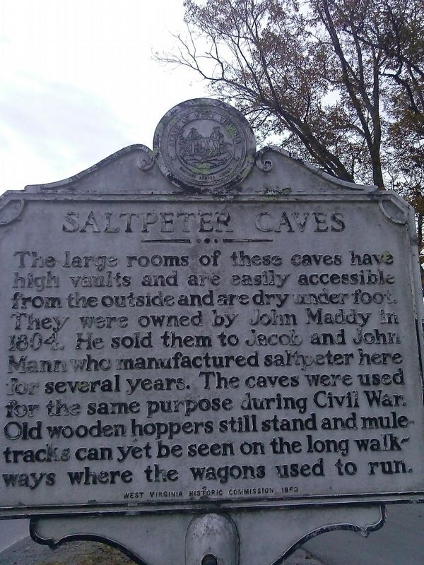
Greenville in Monroe County, West Virginia — The American South (Appalachia)
Saltpeter Caves
Erected 1963 by West Virginia Historic commission.
Topics and series. This historical marker is listed in these topic lists: Industry & Commerce • War, US Civil. In addition, it is included in the West Virginia Archives and History series list. A significant historical year for this entry is 1804.
Location. 37° 32.743′ N, 80° 40.529′ W. Marker is in Greenville, West Virginia, in Monroe County. Marker is at the intersection of Laurel Creek Rd (West Virginia Route 122) and Greenville Road on Laurel Creek Rd. Touch for map. Marker is at or near this postal address: 46 Laurel CreekRd, Greenville WV 24945, United States of America. Touch for directions.
Other nearby markers. At least 8 other markers are within 7 miles of this marker, measured as the crow flies. Cook's Fort (approx. 0.8 miles away); Mann-Miller / Springfield (approx. 1.4 miles away); Home of Isaac Estill / Block House on Indian Creek (approx. 2.9 miles away); Grave of Elizabeth Graham Stodghill (approx. 4.8 miles away); Red Sulphur Springs (approx. 5.4 miles away); Summers County / Monroe County (approx. 6 miles away); Salt Sulphur (approx. 6 miles away); Dr. Henry Lake Dickason (approx. 6.4 miles away). Touch for a list and map of all markers in Greenville.
Credits. This page was last revised on October 18, 2016. It was originally submitted on October 18, 2016, by Roger Miller of Pulaski, Virginia. This page has been viewed 720 times since then and 41 times this year. Photos: 1, 2. submitted on October 18, 2016, by Roger Miller of Pulaski, Virginia. • Bill Pfingsten was the editor who published this page.

