Hatton Grange near Scottsville in Albemarle County, Virginia — The American South (Mid-Atlantic)
Hatton Ferry
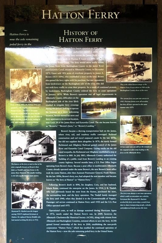
History of Hatton Ferry.
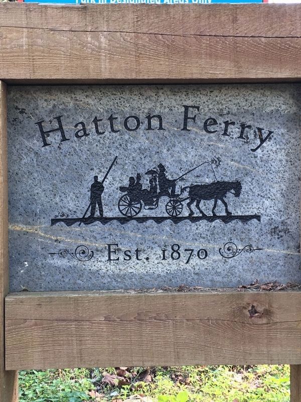
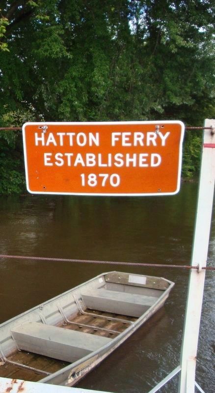
The Hatton Ferry began operation in 1870, when Buckingham County authorities issued a court order to construct a public ferry across the James River to the Albemarle County lands of Thomas P. Gantt (ca. 1846-1896), a distiller near Totier Creek. The ferry would move traffic across the James River from Buckingham County to the James River and Kanawha Canal, situated in Albemarle County. In December 1873, Gantt sold 18¾ acres of riverfront property to James A. Brown (1835-1896), who established a store on the land. Brown also gained the ferry rights with his purchase, but met opposition from landowners on the Buckingham side of the river, who did not wish ferry traffic to cross their property. As a result of continued protests by landowners, Buckingham County ordered the ferry to cease operations in January 1874. While Brown's operation met all legal requirements in Albemarle County, difficulties on the Buckingham side of the river likely resulted in irregular ferry crossings during this period. Seeking to operate his business at a more welcoming location, Brown moved his store and ferry upstream to its current location, near lock 24 of the James River and Kanawha Canal. The site became known as "Brown's," "Brown's Store," or "Brown's Landing."
Brown's became a thriving transportation hub on the James, where river, rail, and roadway traffic converged. Railroad construction and rail travel outpaced canals by the late 1870's, but did not supplant them altogether. In 1878, the newly formed Richmond and Allegheny Railroad gained control of the James River and Kanawha Canal Company. Laying tracks on the old canal towpaths, the Richmond and Allegheny established a stop at Brown's in 1881. In July 1883, Albemarle County authorized the building of a public road from Brown's Landing to an existing county highway. Several months later, a U.S. Post Office began operating from Brown's Store. Because a post office in northwestern Albemarle County already operated under the name Brown's, the new Brown's Store office took the name Hatton, after then Assistant Postmaster General, Frank Hatton. By the late 1890's, Brown's ferry, too, had adopted the new moniker and became known as "the ferry at Hatton" or "Hatton Ferry."
Following Brown's death in 1896, his daughter, Cora, and her husband, Edwin Raine, continued the enterprise on the James. In 1914, J.B. Tindall, who had previously leased the store from the Raines, purchased the store, the surrounding land, and the ferry operation. The Tindall family managed the ferry until 1940, when they deeded it to the Commonwealth of Virginia. Passenger rail service continued at Hatton Ferry until 1950 and the U.S. Post Office operated until 1973.
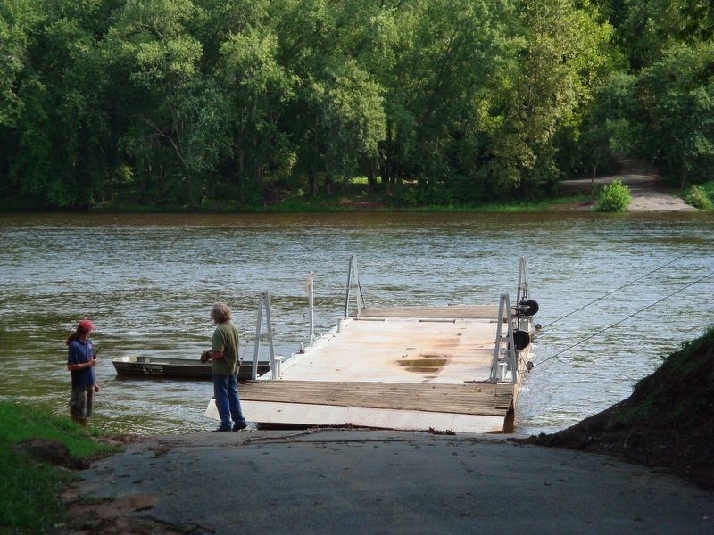
Operational costs, as well as damage sustained during Hurricane Agnes in 1972, nearly ended the Hatton Ferry's run. In 2009, however, the Albemarle Charlottesville Historical Society (ACHS), along with citizens from Albemarle and Buckingham Counties, initiated efforts to save the ferry. ACHS gained formal ownership of the ferry in 2010, establishing the non-profit corporation "Hatton Ferry," which has enabled the continued operation of the Hatton Ferry—now the sole remaining poled ferry in the United States.
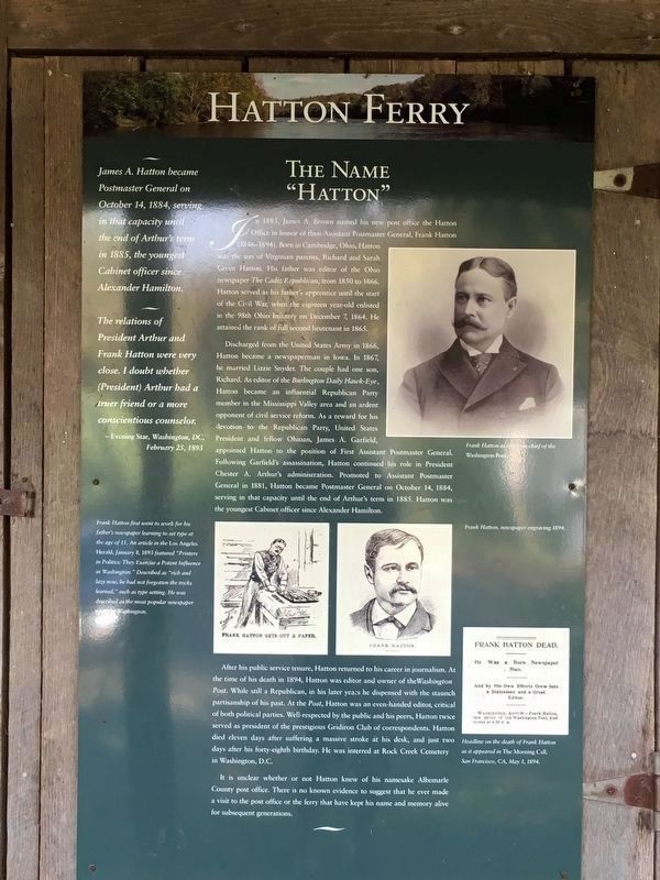
The Name “Hatton”.
In 1883, James A. Brown named his new post office the Hatton Office in honor of then-Assistant Postmaster General, Frank Hatton (1846-1894). Born in Cambridge, Ohio, Hatton was the son of Virginian parents, Richard and Sarah Green Hatton. His father was editor of the Ohio newspaper The Cadiz Republican, from 1850 to 1866. Hatton served as his father’s apprentice until the start of the Civil War, when the eighteen year-old enlisted in the 98th Ohio Infantry on December 7, 1864. He attained the rank of full second lieutenant in 1865.
Discharged from the United States Army in 1866, Hatton became a newspaperman in Iowa. In 1867, he married Lizzie Snyder. The couple had one son, Richard. As editor of the Burlington Daily Hawk-Eye, Hatton became an influential Republican Party member in the Mississippi Valley area and an ardent opponent of civil service reform. As a reward for his devotion to the Republican Party, United States President and fellow Ohioan, James A. Garfield, appointed Hatton to the position of First Assistant Postmaster General. Following Garfield's assassination, Hatton continued his role in President Chester A. Arthur’s administration. Promoted to Assistant Postmaster General in 1881, Hatton became Postmaster General on October 14, 1884, serving in that capacity until the end of Arthur’s term in 1885. Hatton was the youngest Cabinet officer since Alexander Hamilton.
After his public service tenure, Hatton returned to his career in journalism. the time of his death in 1894, Hatton was editor and owner of the Washington Post. While still a Republican, in his later years he dispensed with the staunch partisanship of his past. At the Post, Hatton was an even-handed editor, critical of both political parties. Well-respected by the public and his peers, Hatton twice served as president of the prestigious Gridiron Club of correspondents. Hatton died eleven days after suffering a massive stroke at his desk, and just two days after his forty-eighth birthday. He was interred at Rock Creek Cemete in Washington, D.C.
It is unclear whether or not Hatton knew of his namesake Albemarle County post office. There is no known evidence to suggest that he ever made a visit to the post office or the ferry that have kept his name and memory alive for subsequent generations.
(sidebar)
James A. Hatton became Postmaster General on October 14, 1884, serving in that capacity the end of Arthur's term in 1885, the youngest Cabinet officer since Alexander Hamilton.
The relations of President Arthur and Frank Hatton were very close. I doubt whether (President) Arthur had a truer friend or a more conscientious counselor: —Evening Star, Washington, DC, February 25, 1693
(sidebar)
Frank Hatton first went to work for his father’s newspaper learning to set type at the age of 11. An article in the Los Angeles Herald, January 11, 1893 featured “Printers in Politics: They Exercise a Potent Often Washington.” Described as “rich and lazy now, he had not forgotten the tricks learned.” such as type setting. He was described as the most popular newspaper editor in Washington.
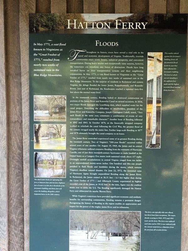
Floods. In May 1771, a vast flood known to Virginians as the "Great Freshet of 1771," resulted from nearly two weeks of sustained rain in the Blue Ridge Mountains.
Throughout its history, rivers have served a vital role in the social and economic development of Virginia. Traditionally, riverside communities enjoy scenic beauty, industrial prosperity, and convenient transportation. During heavy storms and exceptionally rainy seasons, however, the waterways can transform into forces of destruction. Floods have long wreaked havoc on river transportation systems and their neighboring communities. In May 1771, a vast flood known to Virginians as the "Great Freshet of 1771," resulted from nearly two weeks of sustained rain in the Blue Ridge Mountains. To the surprise of residents in Richmond and eastern Virginia, the deluge flooded the lower James, Rappahannock, and Roanoke Rivers. Just east of Richmond, the floodwaters reached a reported forty-five feet above the normal water level.
In the nineteenth century, flooding halted or destroyed construction on portions of the James River and Kanawha Canal on several occasions. In 1836, two major floods damaged the Lynchburg dam, which supplied water for the canal project. Describing the difficulties to stockholders, president of the James River and Kanawha Company, Joseph Carrington Cabell, noted, "Two such floods in the same year, constitutes a combination of events of very extraordinary and remarkable character." Another bout of flooding followed in 1842 and 1843. In October 1870, as the financially strapped company worked to refurbish the canal following the Civil War, the greatest flood of the century ravaged nearly the entire line. Further large-scale flooding in 1877 and 1878 ultimately brought the canal company to its knees.
The James River watershed experienced some of its greatest flooding during the twentieth century. Two of Virginia's "100-year floods" occurred within several years of one another. On August 19, 1969, the James and its central Virginia tributaries suffered extensive flooding from the remnants of Hurricane Camille, one of just three twentieth-century hurricanes to make landfall in the United States as a Category Five storm (with sustained winds above 157 mph). Overnight rainfall accumulations in central Virginia ranged from ten inches to an unprecedented twenty-seven inches. One hundred and fifty-one people perished in flash floods and landslides during the storm, which remains Virginia's deadliest natural disaster. On June 22, 1972, the torrential rains of Hurricane Agnes brought unparalleled flooding along the James River. In Richmond, the James crested at 36.51 feet — 6.5 feet higher than during the Great Freshet of 1771 — and Albemarle County experienced its highest recorded crest of the James, at 34.02 feet. At the time, Agnes was the costliest storm ever to strike the U.S. The flooding significantly damaged the Hatton Ferry and obliterated the nearby Warren Ferry.
While Virginia's waterways have provided significant economic and aesthetic benefits for surrounding communities, flooding remains a persistent danger. Recognizing the history of flooding in the region enables an appreciation and respect for the power of the mighty James River and its tributaries.
(sidebar)
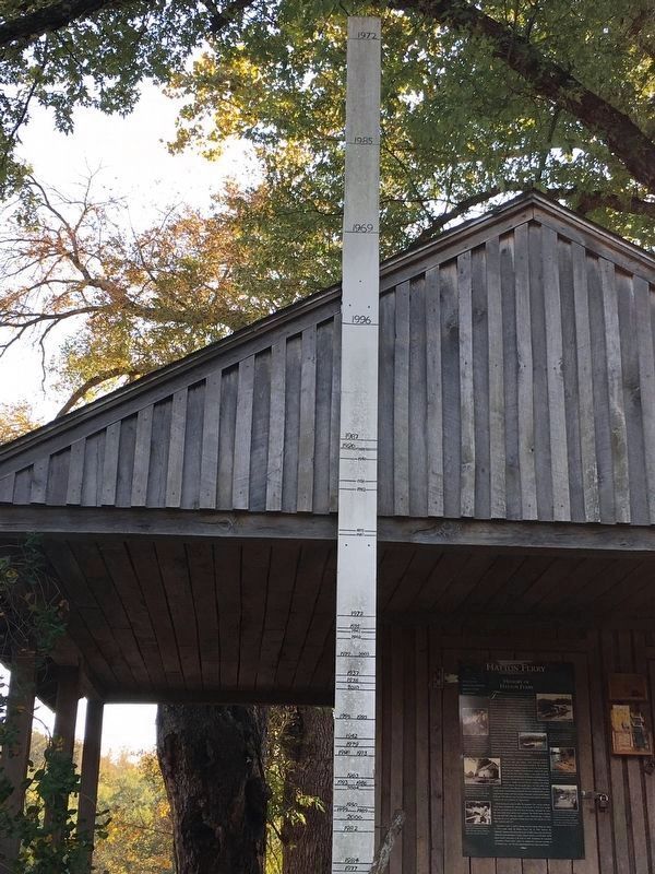
The ideal water levels for operating the ferry is between four and ten feet. Eighteen feet of water is at the door threshold of the ferryman's building and thirty feet will cover the building altogether. which happened twice in the 20th century.
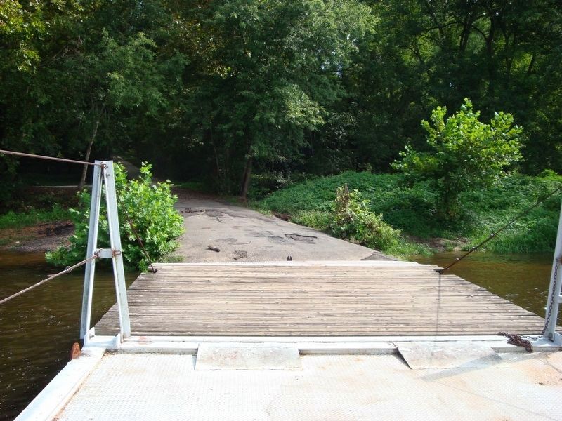
The ferry can typically ride out a flood, but there have been exceptions. The mayor floods occuring in 1969, 1972 and 1985 took out the ferry. The ferry was replaced each time and in 1985 it was replaced with the current metal ferry, a departure from the previous all wooden ferries.
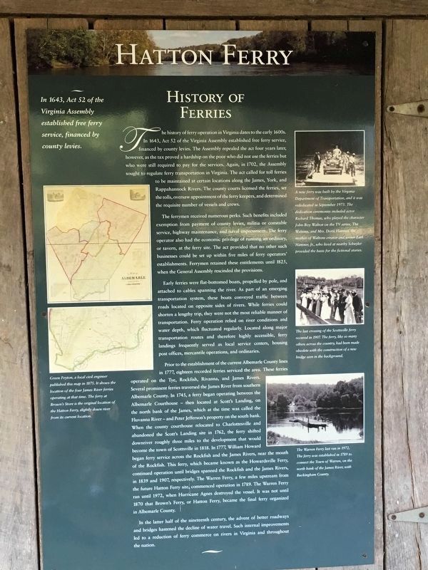
History of Ferries.
In 1643, Act 52 of the Virginia Assembly established free ferry service, financed by county levies.
The history of ferry operation in Virginia dates to the early 1600s. In 1643, Act 52 of the Virginia Assembly established free ferry service, financed by county levies. The Assembly repealed the act four years later, however, as the tax proved a hardship on the poor who did not use the ferries but who were still required to pay for the services. Again, in 1702, the Assembly sought to regulate ferry transportation in Virginia. The act called for toll ferries to be maintained
at certain locations along the James, York, and Rappahannock Rivers. The county courts licensed the ferries, set the tolls, oversaw appointment of the ferry keepers, and determined the requisite number of vessels and crews.
The ferrymen received numerous perks. Such benefits included exemption from payment of county levies, militia or constable service, highway maintenance, and naval impressment. The ferry operator also had the economic privilege of running an ordinary, or tavern, at the ferry site. The act provided that no other such businesses could be set up within five miles of ferry operators' establishments. Ferrymen retained these entitlements until 1825, when the General Assembly rescinded the provisions.
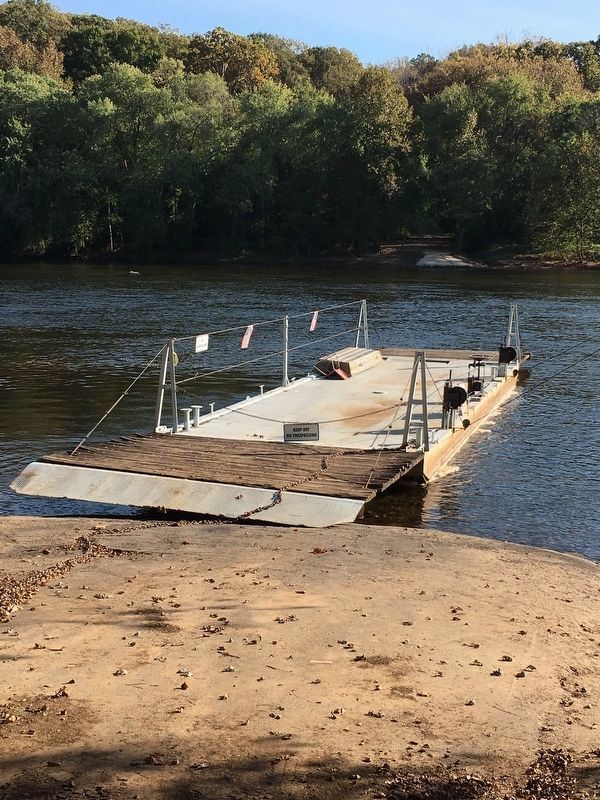
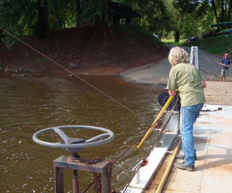
Early ferries were flat-bottomed boats, propelled by pole, and attached to cables spanning the river. As part of an emerging transportation system, these boats conveyed traffic between roads located on opposite sides of rivers. While ferries could shorten a lengthy trip, they were not the most reliable manner of transportation. Ferry operation relied on river conditions and water depth, which fluctuated regularly. Located along major transportation routes and therefore highly accessible, ferry landings frequently served as local service centers, housing post offices, mercantile operations, and ordinaries.
Prior to the establishment of the current Albemarle County lines in 1777, eighteen recorded ferries serviced the area. These ferries operated on the Tye, Rockfish, Rivanna, and James Rivers. Several prominent ferries traversed
the James River from southern Albemarle County. In 1745, a ferry began operating between the Albemarle Courthouse—then located at Scott's Landing, on the north bank of the James, which at the time was called the Fluvanna River—and Peter Jefferson's property on the south bank. When the county courthouse relocated to Charlottesville and abandoned the Scott's Landing site in 1762, the ferry shifted downriver roughly three miles to the development that would become the town of Scottsville in 1818. In 1777, William Howard began ferry service across the Rockfish and the James Rivers, near the mouth of the Rockfish. This ferry, which became known as the Howardsville Ferry, continued operation until bridges spanned the Rockfish and the James Rivers, in 1839 and 1907, respectively. The Warren Ferry, a few miles upstream from the future Hatton Ferry site; commenced operation in 1789. The Warren Ferry ran until 1972, when Hurricane Agnes destroyed the vessel. It was not until 1870 that Brown's Ferry, or Hatton Ferry, became the final ferry organized in Albemarle County.
In the latter half of the nineteenth century, the advent of better roadways and bridges hastened the decline of water travel. Such internal improvements led to a reduction of ferry commerce on rivers in Virginia and throughout the nation.
(sidebars)
Green Peyton. a local civil engineer published this map in 1807. It shows the location of the four James River ferries operating at that time. The ferry at Brown's Store is the original location of the Hatton Ferry, slightly down
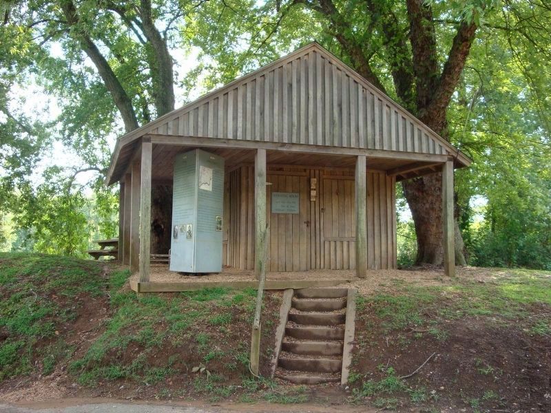
Photographed By Roger Dean Meyer, August 29, 2008
9. Replica of the Ferry Operator's House
This photograph shows the previous marker from before 2008. The marker panels pictured on this page replaced the grey triangular marker.
Click for more information.
Click for more information.
A new ferry was built by the Virginia Department of Transportation, and it was rededicated in September 1973. The dedication ceremonies included actor Richard Thomas, who played the character John-Boy Walton on the TV series The Waltons and Mrs. Doris Hammer, the mother of Walton creator and writer Earl Hammer, Jr., who lived at nearby Schuyler, provided the basis for the fictional stories.
The last crossing of the Scottsville Ferry occurred in 1907. The ferry, like so many others across the country, had been made obsolete with the construction of a new bridge seen in the background.
Green Peyton, a local civil engineer published this map in 1807. it shows the location of the four James River ferries operating at that time. The ferry at Brown's Store is the original location of the Hatton Ferry, slightly down river from its current location.
The Warren Ferry last ran in 1972. The ferry was established in 1789 to connect the Town of Warren, on the north bank of the James River with Buckingham County.
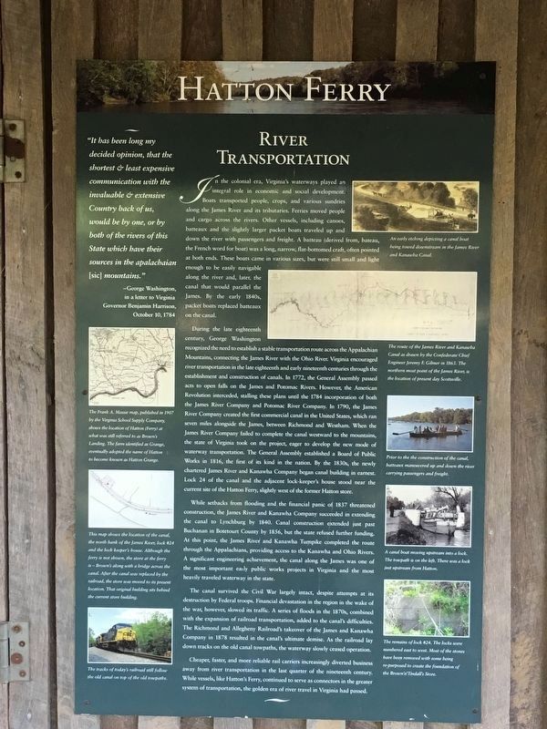
River Transportation.
“It has been long my decided opinion, that the shortest & least expensive communication with the invaluable & extensive Country back of us, would be by one, or by both of the rivers of this State which have their sources in the apalachaian [sic] mountains.”>
—George Washington, in a letter to Virginia Governor Benjamin Harrison, October 10,1784
In the colonial era, Virginia's waterways played an integral role in economic and social development. Boats transported people, crops, and various sundries along the James River and its tributaries. Ferries moved people and cargo across the rivers. Other vessels, including canoes, batteaux and the slightly larger packet boats traveled up and down the river with passengers and freight. A batteaux (derived from bateau, the French word for boat) was a long, narrow, flat-bottomed craft, often pointed at both ends. These boats came in various sizes, but were still small and light enough to be easily navigable along the river and, later, the canal that would parallel the James. By the early 1840s, packet boats replaced batteaux on the canal.
During the late eighteenth century, George Washington recognized the need to establish a stable transportation route across the Appalachian Mountains, connecting the James River with the Ohio River. Virginia encouraged river transportation in the late eighteenth and early nineteenth centuries through the establishment and construction of canals. In 1772, the General Assembly passed acts to open falls on the James and Potomac Rivers. However; the American Revolution interceded, stalling these plans until the 1784 incorporation of both the James River Company and Potomac River Company. In 1790, the James River Company created the first commercial canal in the United States, which ran seven miles alongside the James, between Richmond and Westham. When the James River Company failed to complete the canal westward to the mountains, the state of Virginia took on the project, eager
to develop the new mode of waterway transportation. The General Assembly established a Board of Public Works in 1816, the first of its kind in the nation. By the 1830s, the newly chartered James River and Kanawha Company began canal building in earnest. Lock 24 of the canal and the adjacent lock-keeper's house stood near the current site of the Hatton Ferry, slightly west of the former Hatton store.
While setbacks from flooding and the financial panic of 1837 threatened construction, the Jaynes River and Kanawha Company succeeded in extending the canal to Lynchburg by 1840. Canal construction extended just past Buchanan in Botetourt County by 1856, but the state refused further funding. At this point, the James River and Kanawha Turnpike completed the route through the Appalachians, providing access to the Kanawha and Ohio Rivers. A significant engineering achievement, the canal along the James was one of the most important early public works projects in Virginia and the most heavily traveled waterway in the state.
The canal survived the Civil War largely intact, despite attempts at its destruction by Federal troops. Financial devastation in the region in the wake of the war, however, slowed its traffic. A series of floods in the 1870s, combined with the expansion of railroad transportation, added to the canal's difficulties. The Richmond and Allegheny Railroad's takeover of the James and Kanawha Company in 1878 resulted in the canal's ultimate demise. As the railroad lay down tracks on the old canal towpaths, the waterway slowly ceased operation.
Cheaper,
faster, and more reliable rail carriers increasingly diverted business away from river transportation in the last quarter of the nineteenth century. While vessels, like Hatton's Ferry, continued to serve as connectors in the greater system of transportation, the golden era of river travel in Virginia had passed.
(captions)
The Frank A. Massie map, published in 1907 by the Virginia School Supply Company, shows the location of Hatton (Ferry) at what was still referred to as Brown's Landing. The farm identified as Grange eventually adopted the name of Hatton to become known as Hatton Grange.
This map shows the location of the canal, the north bank of the James River, lock #24 and the lock keeper's house. Although the ferry is not shown, the store at the ferry is—Brown's, along with a bridge across the canal. After the canal was replaced by the railroad, the store was moved to its present location. That original building sits behind the current store building.
The tracks of today's railroad still follow the old canal on top of the old towpaths.
An early etching depicting a canal boat being towed downstream in the James River and Kanawha Canal.
The route of the James River and Kanawha Canal as drawn by the Confederate Chief Engineer Jeremy F. Gilmer in 1863. The northern most point of the James River is the location of present day Scottsville.
Prior to the the construction of the canal, batteaux maneuvered up and down the river carrying passengers and freight.
A canal boat moving upstream into a lock. The towpath is on the left. There was a lock just upstream from Hatton.
The remains of lock #24. The locks were numbered east to west. Most of the stones have been removed with some being re-purposed to create the foundation of the Brown’s Tindall’s Store.
Erected 2013 by Albemarle County Historical Society.
Topics and series. This historical marker is listed in these topic lists: Bridges & Viaducts • Industry & Commerce • Roads & Vehicles • Waterways & Vessels. In addition, it is included in the Former U.S. Presidents: #21 Chester A. Arthur, and the Postal Mail and Philately series lists. A significant historical month for this entry is January 1874.
Location. 37° 45.511′ N, 78° 30.747′ W. Marker is near Scottsville, Virginia, in Albemarle County. It is in Hatton Grange. Marker is on Hatton Ferry Road, half a mile south of Hatton Ferry Lane. Same as markers that have been updated. Touch for map. Marker is at or near this postal address: 10120 Hatton Ferry Rd, Scottsville VA 24590, United States of America. Touch for directions.
Other nearby markers. At least 8 other markers are within 4 miles of this marker, measured as the crow flies. A different marker also named Hatton Ferry (about 400 feet away, measured in a direct line); Wilson Cary Nicholas (approx. 2.6 miles away); Hurricane Camille (approx. 2.9 miles away); Historic Scottsville (approx. 3 miles away); Scottsville (approx. 3 miles away); Barclay House and Scottsville Museum (approx. 3 miles away); Scottsville Confederate Cemetery (approx. 3.2 miles away); a different marker also named Hatton Ferry (approx. 3½ miles away). Touch for a list and map of all markers in Scottsville.
More about this marker. Markers currently presented replaced previous markers on site in April, 2013.
Regarding Hatton Ferry. The Hatton Ferry is the only surviving “Poled” ferry in the United States.
The ferry operates normally from April through October, on Saturdays from 9am until 5pm, and Sundays from noon until 5pm. Current fees are 5.00 per person or $10.00 per vehicle.
Credits. This page was last revised on January 3, 2024. It was originally submitted on November 5, 2016, by Brandon D Cross of Flagler Beach, Florida. This page has been viewed 836 times since then and 54 times this year. Photos: 1, 2, 3, 4, 5, 6. submitted on November 5, 2016, by Brandon D Cross of Flagler Beach, Florida. 7, 8. submitted on November 16, 2016, by Brandon D Cross of Flagler Beach, Florida. 9, 10, 11, 12, 13. submitted on October 23, 2008, by Roger Dean Meyer of Yankton, South Dakota. • J. J. Prats was the editor who published this page.
