Downtown Seattle in King County, Washington — The American West (Northwest)
Why Are the Piers Angled?
Waterfront History
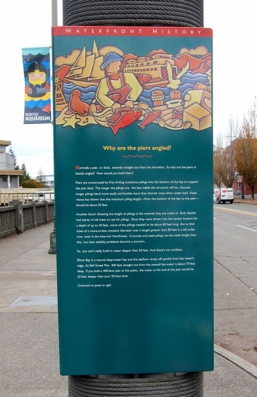
Piers are constructed by first driving numerous pilings into the bottom of the bay to support the pier deck. The longer the pilings are, the less stable the structure will be, because longer pilings bend more easily and buckle more than shorter ones when under load. Experience has shown that the maximum piling length from the bottom of the bay to the pier should be about 50 feet.
Another factor dictating the length of pilings is the material they are made of. Early Seattle had plenty of tall trees to use for pilings. Since they were driven into the harbor bottom for a depth of up to 30 feet, some of the pilings needed to be about 80 feet long. But to find trees of a more-or-less constant diameter over a length greater than 80 feet is a tall order now, even in the tree-rich Northwest. Concrete and steel pilings can be made longer than this, but then stability problems become a concern.
So, you can't really build in water deeper than 50 feet. And there's our problem.
Elliott Bay is a natural deep-water bay and the seafloor drops off quickly from the water's edge. At Bell Street Pier, 400 feet straight out from the seawall the water is about 70 feet deep. If you built a 400-foot pier at this point, the water at the end of the pier would be 20 feet deeper than your 50-foot limit.
Continued on panel to right
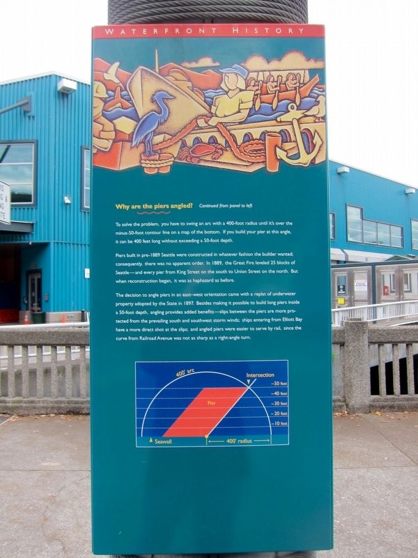
To solve the problem, you have to swing an arc with a 400-foot radius until its over the minus-50-foot contour line on a map of the bottom. If you build your pier at this angle, it can be 400 feet long without exceeding a 50-foot depth.
Piers built in pre-1889 Seattle were constructed in whatever fashion the builder wanted; consequently, there was no apparent order. In 1889, the Great Fire leveled 25 blocks of Seattle—and every pier from King Street on the south to Union Street on the north. But when reconstruction began, it was as haphazard as before.
The decision to angle piers in an east–west orientation came with a replat of underwater property adopted by the State in 1897. Besides making it possible to build long piers inside a 50-foot depth, angling provides added benefits—slips between the piers are more protected from the prevailing south and southwest storm winds; ships entering from Elliott Bay have a more direct shot at the slips; and angled piers were easier to serve by rail, since the curve from Railroad Avenue was not as sharp as a right-angle turn.
Topics. This historical marker is listed in this topic list: Waterways & Vessels.
Location.
47° 36.724′ N, 122° 20.998′ W. Marker is in Seattle, Washington, in King County. It is in Downtown Seattle. Marker is on Alaskan Way south of Wall Street, on the right when traveling south. Touch for map. Marker is at or near this postal address: 2411 Alaskan Way, Seattle WA 98121, United States of America. Touch for directions.
Other nearby markers. At least 8 other markers are within walking distance of this marker. Bell Street Bridge (about 400 feet away, measured in a direct line); Seattle-Galway Stone (about 400 feet away); Bell Street Terminal, Pier 66 (about 500 feet away); Belltown Pan (approx. 0.2 miles away); Austin A. Bell Building (approx. 0.2 miles away); Where did this bridge used to go? / Where does this bridge go now? (approx. ¼ mile away); Speakeasy Café (approx. ¼ mile away); Guiry/Schillestad Buildings (approx. ¼ mile away). Touch for a list and map of all markers in Seattle.

Photographed By Andrew Ruppenstein, October 24, 2016
3. Why Are the Piers Angled? Marker - Wide View
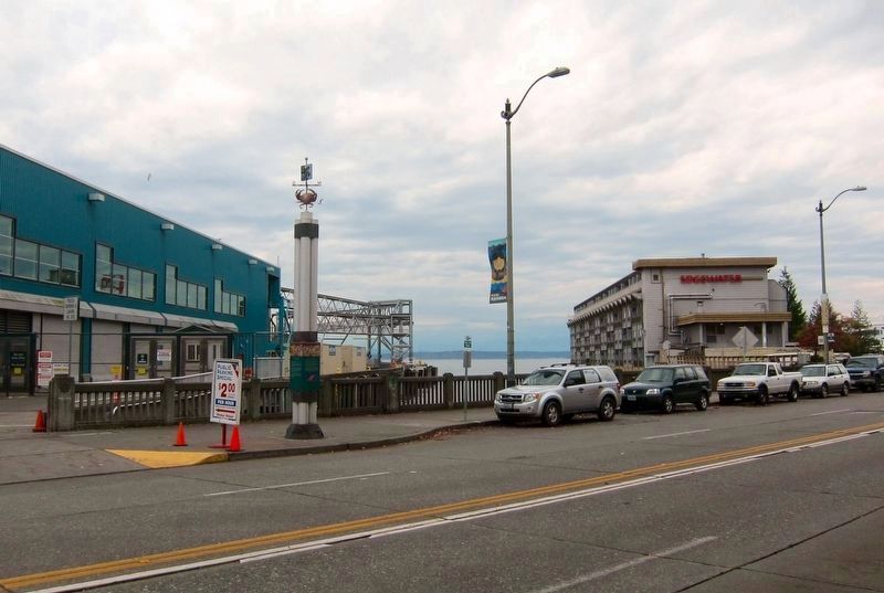
This picture, taken perpendicular to the seawall, shows the angling of the piers.
The marker is visible here, attached to the pole. (The astute observer will also note that this is clearly a deluxe model historical marker, as it has been optioned with both a crustacean and a weather vane on top.)
The marker is visible here, attached to the pole. (The astute observer will also note that this is clearly a deluxe model historical marker, as it has been optioned with both a crustacean and a weather vane on top.)
Credits. This page was last revised on February 7, 2023. It was originally submitted on November 15, 2016, by Andrew Ruppenstein of Lamorinda, California. This page has been viewed 809 times since then and 61 times this year. Photos: 1, 2. submitted on November 15, 2016, by Andrew Ruppenstein of Lamorinda, California. 3, 4. submitted on November 16, 2016, by Andrew Ruppenstein of Lamorinda, California.


