Forest in Bedford County, Virginia — The American South (Mid-Atlantic)
Commemorating Lewis and Clark
"The Juno of our groves"
— "Trees of use and ornament" —
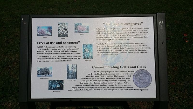
In 2003, surveyors placed a monument on the lawn northwest of the house to commemorate the bicentennial of the Lewis and Clark expedition. The brass survey disk bears the design of Jefferson's Indian Peace Medal. Lewis and Clark gave the medal, symbolizing "Peace and Friendship," to tribal leaders that they met on their journey. It depicts a Native American hand (left) clasping a hand representing the U.S. government (right). The central triangle contains a point for determining the monument's exact location. Nationally, disks like this one have been placed at sites associated with the expedition.
(upper) "The Juno of our groves"
Likening the "Tulip Poplar to the queen or the Roman gods, Thomas Jefferson described this species of tree as "the Juno of our groves." Native to Virginia, Tulip Poplars are the tallest trees of the eastern forest, reaching 50-150 feet in height. Jefferson used them in his grounds at Poplar Forest and Monticello and recommended them to other gardeners in America and Europe.
The Tulip Poplars on the north lawn are the last survivors of a larger grove that grew here before Jefferson designed his retreat. Tree ring counts of two felled Tulip Poplars that were, until recently, part of the grove date them to the second half of the 18th century. Jefferson later incorporated these trees into his design, where they formed a naturalistic grove.
(middle) "Trees of use and ornament"
In 1813, Jefferson reported that he was improving the property by "planting trees of use and ornament." These improvements included both native trees and more exotic imports from the South Pacific and Europe.
In the winter of 1812-1813, gardeners planted more than 300 trees individually, in rows and in clumps within the 61-acre enclosure that surrounded the house.
Topics. This historical marker is listed in these topic lists: Architecture • Exploration • Horticulture & Forestry • Patriots & Patriotism. A significant historical year for this entry is 1812.
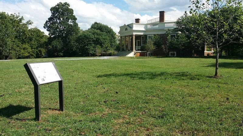
Location. This marker has been replaced by another marker nearby. It was located near 37° 20.897′ N, 79° 15.9′ W. Marker was in Forest, Virginia, in Bedford County. Marker could be reached from Bateman Bridge Road. Located on the grounds of Thomas Jefferson's Poplar Forest. Touch for map. Marker was in this post office area: Forest VA 24551, United States of America. Touch for directions.
Other nearby markers. At least 8 other markers are within 3 miles of this location, measured as the crow flies. Transforming a Plantation into a Private Retreat, 1806—1826 (here, next to this marker); Poplar Forest Planting Memorandum 1812 (within shouting distance of this marker); Mounds Made of Ideas and Sweat (within shouting distance of this marker); "A Culture Productive of Infinite Wretchedness” (about 300 feet away, measured in a direct line); Crafting a Masterpiece, Longing for Home (about 300 feet away); Plantation Worker Housing (about 400 feet away); “I have this summer built a wing of offices...” (about 400 feet away); St. Stephen's Church (approx. 2.4 miles away). Touch for a list and map of all markers in Forest.
Related marker. Click here for another marker that is related to this marker. New Marker At This Location titled "Transforming a Plantation into a Private Retreat, 1806—1826".
Credits. This page was last revised on May 19, 2022. It was originally submitted on November 19, 2016, by Michael C. Wilcox of Winston-Salem, North Carolina. This page has been viewed 401 times since then and 18 times this year. Photos: 1, 2. submitted on November 19, 2016, by Michael C. Wilcox of Winston-Salem, North Carolina.

