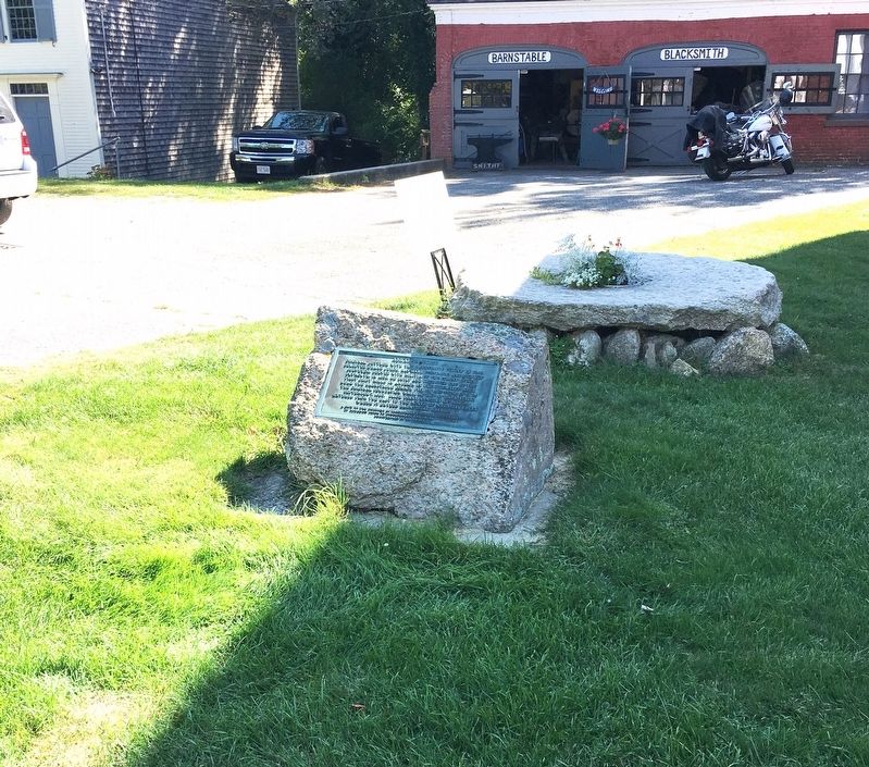
Original Settler with the Barnstable Colony in 1640.
Selected Grand Juror, Hayward, Constable, and Highway
Surveyor. Served with Militia of the Colony of New
Plymouth. In 1658, he built and operated one of the
First Grist Mills in . . . — — Map (db m140492) HM
Sandwich Monthly Meeting of Friends, established in 1657, is the
oldest continuous Quaker meeting in North America. It consists
of congregations here, in West Falmouth and in Yarmouth.
This meetinghouse, the third on this site, was built . . . — — Map (db m140503) HM
You are standing in the center of the Old Nye Estate. Before construction of the canal, this was the finest home in Bournedale, a sleepy Cape Cod village complete with post office, village hall, general store, and its own industry - the Tahanto Iron . . . — — Map (db m217361) HM
Long before the first European settlements in the Herring River Valley, a band of Wampanoag Indians lived in this area. The seasonal village called Comassakumakanit, stood beside Megansett Waye, an important trading path linking Cape and the . . . — — Map (db m225678) HM
The Old Village, encompassing the land between Chatham Harbor on the east and Mill/Little Mill Pond on the west, became the town center in the 1800’s probably due to the Old Harbor area becoming less navigable. A concentration of small stores on . . . — — Map (db m159151) HM
We Have Always Been Here
For thousands of years Wampanoag have lived in this area inhabiting the shore during the warmer months and moving to less exposed areas in winter. Time has eradicated most of the remains of their earliest . . . — — Map (db m160412) HM
(Front)
Here lies buried
Dr. Samuel Lord
who died of smallpox
after devoted service
to the citizens of
Chatham in the
epidemic of
1765 – 1766
(Back)
This monument was erected by
the Town of Chatham in . . . — — Map (db m160407) HM
The first European to land on the shores of Chatham was Samuel de Champlain, who took refuge in Stage Harbor in October, 1606. Although relations with the Natives were initially friendly, after about ten days tensions increased and a battle . . . — — Map (db m158345) HM
He came from Norwich England in 1637. He acquired from the Indians by a series of purchases prior to the year 1683 the greater part of the present Township then known as Monomoyick. He and his sons and sons-in-laws Robert Nickerson • Samuel . . . — — Map (db m68997) HM
The house of William Nickerson built about 1664, stood south 51 degrees west at a distance of 19 1/5 rods (about 105 yards) from this marker. He was the first settler in Monomoit where he purchased from the Indians most of what is now Chatham. . . . — — Map (db m157368) HM
Somewhere within gunshot of this stone lies the remains of Squanto, Indian guide, friend and counselor of the Plymouth Colony, who died in 1622 on the sloop “Swan” in Stage Harbor. — — Map (db m159026) HM
The Josiah Mayo House sits along Main Street across from the Town Hall, as it has since it was built nearly 200 years ago by Josiah himself, a blacksmith who came to town from Brewster. Although it’s been moved on the site – it originally . . . — — Map (db m166801) HM
A group of Separatist from the Church of England, later named Pilgrims, left England for Holland in 1608 in settled in Leiden in 1609. After staying there for 11 years, the group sailed back to England on the ship Speedwell, where they joined by . . . — — Map (db m78321)
Tisquantum (also known as Squanto), the most famous Native American to encounter the Pilgrims, died near here in 1622, roughly 40 years before William and Anne (Busby) Nickerson established their homestead on this site.
Born at Patuxet, a . . . — — Map (db m159031) HM
One mile west of this site
hostile Indians had their
First Encounter
6 December 1620
(Old Style)
With Myles Standish, John Carver,
William Bradford, Edward Winslow.
John Tilley, Edward Tilley, John
Howland, . . . — — Map (db m141405) HM
On this spot hostile Indians had their first encounter December 8, 1620, old style, with Myles Standish, John Carver, William Bradford, John Tilley, Edward Winslow, John Howland, Edward Tilley, Richard Warren, Stephen Hopkins, Edward Dotey, John . . . — — Map (db m51139) HM
Near this site the Nauset tribe of the Wampanoag nation, seeking to protect themselves and their culture, had their first encounter, 8 december 1620, with Myles Standish, John Carver, William Bradford, Edward Winslow, John Tilley, Edward Tilley, . . . — — Map (db m51142) HM
For thousands of years before the Europeans landed, the Nauset Indians lived beside the marshes of Cape Cod. Among the evidence of their occupation is this community grinding rock, one of four such boulders found in the Nauset Bay area. . . . — — Map (db m111595) HM
After 66 days spent in the cramped confines of a small ship pitching and rolling its way from England across the stormy North Atlantic, the Mayflower’s passengers gave thanks. It was the morning of November 9,1620 and they had spotted land - the . . . — — Map (db m141189) HM
One of a pair of grinding stones found on property once owned by the Brooks family in Harwich Center. By the 18th century the town boasted as many as eight grist mills where local farmers could take their grain to be ground. — — Map (db m157856) HM
Hyannis Harbor, Then …
The sandy peninsula of Cape Cod, a distinctive “arm and elbow” reaching into the Atlantic Ocean, was created by glacial deposits during the ice age more than 23,000 years ago. The Cape offered a . . . — — Map (db m166627) HM
Main Street, Hyannis in the 1960s was filled with activity. Shops were bustling, and supporters of John F. Kennedy, running for president, lined the streets. Since JFK based much of his campaigning out of the Kennedy Compound in Hyannis Port, . . . — — Map (db m144001) HM
The history of the town of Orleans is closely linked to the town of Eastham, and has deep roots in the original Plymouth Colony established in 1620. For some time, the colonists there had considered moving the colony to a better location due to . . . — — Map (db m158924) HM
In memory of the five Mayflower passengers who died at sea and while the ship lay in Cape Cod Harbour
William Butten Nov 16th, 1620
Edward Thomson Dec 14th, 1620
Jasper More Dec 16th, 1620
Dorothy Bradford Dec 17th, 1620
James Chilton . . . — — Map (db m234955) HM
This memorial stone is erected by the Commonwealth of Massachusetts to commemorate the Compact, or Constitution of Government, signed by the Pilgrims, on board the Mayflower in Provincetown Harbor, November 11, 1620, old style.
On the reverse . . . — — Map (db m234505) HM
On November 20, 1620 the Pilgrims dropped the Mayflower’s anchor for the first time in the new world- not at Plymouth where they later settled, but in the harbor ahead. Just off the shores of today’s Provincetown they drafted and signed a pioneering . . . — — Map (db m111673) HM
Thomas Dexter began building gristmills on this site in 1637.
The mill you see here today started operating in about 1654.
The early settlers of Sandwich brought their corn to “The Grist Mill”
to be ground into meal, . . . — — Map (db m140436) HM
Edmond Freeman Born in England 1590 Died in Sandwich 1682 A Founder of the Town of Sandwich in 1637 Assistant to Governor Bradford 1640 - 1647 — — Map (db m120748) HM
Sixteen Pilgrims led by Myles Standish, William Bradford, Stephen Hopkins and Edward Tilley found the precious Indian corn on this spot which they called Corn Hill, November 16, 1620.
Old style.
And sure it was God’s good . . . — — Map (db m156633) HM
Ancient Cemetery
Seventeenth Century Burial Ground
For the First English Settlers of
The South Side of This Town, Near
The Site of a Pre-Historic
Native American Burial Ground — — Map (db m158348) HM
On this site, in the log house of Peter Wilcox, was held
the first town meeting – Dec. 26, 1777.
The following men were elected to office.
“Moderator – William Ingersoll
Clerk – Prince West. These two, and Oliver . . . — — Map (db m86710) HM
On July 11, 1774, the people of New Marlborough Township assembled in their first Meeting-House here to record their opposition to certain acts of the British Parliament. On that day – nearly a year before the Battle of Bunker Hill – . . . — — Map (db m136846) HM
has been designated a
Registered National
Historic Landmark
under the provisions of the
Historic Sites Act of August 21, 1935
This site possesses exceptional value
in commemorating or illustrating
the history of the United . . . — — Map (db m118819) HM
Hancock Shaker Village installed this solar photovoltaic (pv) array in December 2009. Here is one sample pv panel for you to examine and touch (it is not connected to the array and will not harm you).
Throughout the Village there are many . . . — — Map (db m118828) HM
The Shakers, perhaps more than any other religious movement, embraced purity of design and consummate craftsmanship in everything they created. These banners represent a sample of the typical and joyful Shaker palette. As you tour this National . . . — — Map (db m118818) HM
New Boston
Settled 1751
Founded along the Farmington River by the Dantel Brown family of Boston. Smiths, Demings, Hawley and sears were also early farming settlers. The Browns established the New Boston Inn a store and mills.
The village was . . . — — Map (db m97508) HM
Site of first cabin built by Isaac Stratton in 1762; first tavern, built by Samuel Sloan in 1767; town meetings in second story hall built by John Jordan in early 1830's. — — Map (db m118574) HM
The northerly part of this house is one of the earliest extant structures in town. Built about 1767 in "regulation" size, it was enlarged to become a salt box. In the mid-1970's it was completely rebuilt and enlarged to its present form. — — Map (db m118658) HM
Built in 1756 on this house-lot Number Six under decree of the Great and General Court of the Province of the Massachusetts Bay in compliance with urgent appeal from the homesteaders it served as sole refuge from their allied foes the French and . . . — — Map (db m118713) HM
Built in 1768 and removed in 1797 to make way for the second Meeting House, completed 1798 and destroyed by fire January 21, 1866. — — Map (db m118715) HM
For thirty six years (1647-1683) prominent in the affairs of the town of Rehoboth: representing the town in the house of deputies in the Plymouth Colony: when these lands were bought from Wamsutta Chief Sachem of the Wampanoags (1661) he was active . . . — — Map (db m57929) HM
Was erected near here in 1828
the geographic center of the town at that time
Committee Selectmen
Noah Claflin Elkanah Briggs
Abijah M. Ide Samual Cushman
Ellis Blackington . . . — — Map (db m52405) HM
London
Cuffe sought support in London from the African Institution - a group that was committed "to stimulating trade with Africa, without itself trading, to promote African education and improved farming methods, and to be a . . . — — Map (db m86901) HM
The view down Centre Street has changed little over the years, and no street in New Bedford served the whaling industry longer. Little finery can be seen in the facades of these buildings, for this was a working waterfront, where utility overrode . . . — — Map (db m58182) HM
Has been designated a registered National Historic Landmark
Under the provisions of the historic sites act of August 21, 1935 this site possesses exceptional value in commemorating or illustrating the history of the United States — — Map (db m58196) HM
Circa 4000BC
Natives of this area made tools from red felsite rock.
1669-1771
The Allen, Capron and Mann families owned this property. The Mann family burial ground still remains close by.
1772
Stephan Draper built a homestead . . . — — Map (db m57747) HM
Top PlaqueThis marker
is given by Massachusetts Society
Daughters of the American Colonists
in recognition of
The role this historic building played
in the area's early growth
presented: September 13 1969 Bottom Plaque . . . — — Map (db m55680) HM
This historic area along Stony Brook was named Chartley before 1700. The name is thought to be related to the iron business, which thrived in this area.
In 1695, the Taunton North Purchase granted to Thomas and James Leonard land along the . . . — — Map (db m55989) HM
Winneccunnett Pond is the only sizable, natural body of water in Norton, Massachusetts. Winneccunnett is a Native American word meaning "the place of the black geese." A Native American village was established on the north end of the pond long . . . — — Map (db m56459) HM
Former site of the Anawan House, once called the Lewis Tavern built ca. 1835 as a rest stop for travelers between Taunton and Providence Plantations.
The Anawan House and inn served the public until July 1970. In February 1971 the building was . . . — — Map (db m55683) HM
In 1720, Jonathan Bliss moved here from South Rehoboth and established a sawmill on the East Branch of the Palmer River with a homestead nearby. This homestead was one of the first in the area, and Bliss called it " my farm in the woods" the mill . . . — — Map (db m56247) HM
The ruins of the old dam are all that remain of the once busy Perry Turning Mill. This mill originally operated as a saw mill in a joint venture by Aaron Cole and Ezra Perry. Perry bought out Cole's share in he early 1800's, and raised the dam, and . . . — — Map (db m56249) HM
Plain St. now crosses what was once sawmill pond.
On a cold New Years day in 1830, 14 new converts to the nearby Oak Swamp Baptist Church were baptized by being immersed in the pond through a hole cut in 14" of ice — — Map (db m55905) HM
When the British occupied Newport, RI. during the Revolution they often threatened the surrounding towns with raids or "alarums" as they were called. When a raid began a system of beacon fires were lit to warn the militia in neighboring towns to . . . — — Map (db m55911) HM
About 200 feet south of this spot is a natural oven shaped hole in a rock. According to local tradition, Indians used this as a bake oven and to parch their corn. — — Map (db m55684) HM
Nearby runs Mine Brook named after an iron mine established here in 1696 by the Leonards, a famous iron monger family from Norton and Taunton.
The ore dug at this site called bog iron, was found in the swamp and brook. The Leonards hauled the ore . . . — — Map (db m55679) HM
During the American Revolution, a large white oak called "the Liberty Tree" stood near this place, which was then near the edge of a field. Beacons warning of trouble in Rhode Island could be seen by watchers at nearby Horton's Signal. After . . . — — Map (db m55918) HM
Rehoboth's second Meeting House,built in 1773,was located in the present cemetery. It replaced the Lake St Meeting House, and was used for town meetings and church services. The site included a stable, a cemetery west of the meeting house, a militia . . . — — Map (db m55656) HM
This town pound maintained by Col. Frederick Drown for many years. Stray cattle were kept here until retrieved by their owners.
The Wheeler family ran a pot ash business nearby. — — Map (db m55912) HM
It was known as Butterworth Falls in the colonial days. Deacon Thomas Carpenter and later the Perry family maintained the saw-gristmill-turning shop here for almost 200 years — — Map (db m55686) HM
Redway Plain is named after James Redway, who settled here in the early 1700's. Originally the plain included this field, The Faxon Farm Field,and the Village Cemetery. Neither Winthrop Street or Pond Street existed before 1828.
From colonial . . . — — Map (db m56243) HM
Founded by Josiah Millerd in 1731. For over 140 years neighborhood farmers had their corn ground into meal and their logs sawn into lumber at this mill. — — Map (db m55917) HM
Framing for this church had begun at Peckham Street, when disgruntled Oak Swamp people took away the timbers in the night and raised the church here. — — Map (db m55913) HM
Site of "The Palmer's River Meeting House" The first meeting house in the second precinct of Rehoboth. Construction started in 1717 and completed November 29th 1721, with Reverend David Turner as pastor. Fifty pounds was donated towards the cost of . . . — — Map (db m55662) HM
King’s Rock, spanning 200 ft. along today’s Warren/Swansea border, was a significant location along the route and an important place for tribal gatherings under Metacom’s older brother, Wamsutta. Tribes from all over New England were known to have . . . — — Map (db m235790) HM
Near this spot stood the John Myles Garrison House. The place of meeting of the troops of Massachusetts Bay and Plymouth colonies.
Commanded by
Majors Thomas Savage and James Cudworth, who marched to the relief of Swansea at the opening of . . . — — Map (db m56215) HM
Built in 1638 by John Balch, who came over in 1623 with Captain Robert Gorges. The "Old Planters" received this land in exchange for their settlement at Salem. — — Map (db m47949) HM
Roger Conant was a prudent and religious man who led the old planters from Gloucester
to Salem in 1626, and held them together until the Bay Colony was founded. This house was
built on land given by him to his son Exercise Conant in 1666. — — Map (db m47357) HM
This house was built in 1694 by the Rev. John Hale, first minister of the first church in Beverly. A charge of witchcraft made against his wife convinced the minister of the folly and wickedness of the crusade and ended all witch-hunting in . . . — — Map (db m48760) HM
The old planters, Roger
Conant, John Woodbery and
John Balch used this path
from their homesteads to the
cove at the head of Bass river. — — Map (db m47401) HM
Roger Conant
Leader of the Old Planters
And Founder in 1626
Of Naumkeag (Salem)
Built His House Here in 1636
In the Southern Angle Of
A Two Hundred Acre Grant
He Lived Here Until His Death
November 19, 1679
Erected by the Roger . . . — — Map (db m36444) HM
From 1632-1754 a few farms and native American habitations dotted the woodlands among this land originally granted to pioneer settlers Gov. John Endecott and Rev. Samuel Skelton. On the road to Salem lay the farm of George Jacobs, Sr., a victim . . . — — Map (db m43938) HM
In 1681 the Salem village inhabitants built a home for their minister at this site. Ministers residing here were George Burroughs (1681-83), Accused in 1692 of being a witch and hanged; Deodat Lawson (1684-88), Author of the first volume about . . . — — Map (db m48720) HM
Site of Israel Hutchinson's Home
—
Here were brought Danvers
Soldiers slain at the
battle of Lexington —
This memorial is a tribute to his
memory, from lineal decendants,
and the town of Danvers. —
1896
. . . — — Map (db m47197) HM
{Not all of the text on this marker can be transcribed.}
In February, 1681, the Salem village inhabitants voted, "We will build a house for the Ministry and provid convenient Land for that end. The Dementions of the House are as . . . — — Map (db m48721) HM
{Not all text on marker is transcribed here.}
In 1717 Rev. Peter Clark became minister at Salem Village. The 1681 parsonage was in poor condition, so that by the early 1730's Clark asked the inhabitants to come to a decision either to . . . — — Map (db m48722) HM
One-eighth of a mile distant.
On a part of the 300 acres
granted to Governor John
Endecott, is the pear tree
planted by the Governor in
1632. This tree still bears
fruit. — — Map (db m46192) HM
Called "Porter's Plain" after 17th century settler
John Porter, this level expanse of about one square
mile was sparsely inhabited into the mid-18th century.By the time of the American Revolution, patriot
Captain Jeremiah Page had settled here, . . . — — Map (db m38341) HM
A free school for Chebacco
parish was opened in an
upper room of this house in
1695 by the appointed master,
Nathaniel Rust, Junior. The town
gave "Six acres of pasture land
for the benefit of the school
and one-quarter acre for
Mr. Rust's . . . — — Map (db m47496) HM
Erected in 1701 by John Wise, pastor of the Chebacco parish of Ipswich, now Essex. Son of a laborer, Harvard graduate, army chaplain, protestant against taxation without representation and against the witchcraft delusion, defender of democracy in . . . — — Map (db m47955) HM
In 1668 the town granted the
adjacent acre of land "To the
inhabitants of Ipswich for a yard
to build vessels and to employ
workmen for that end."
The shipbuilding industry has
continued uninterruptedly in
Essex since that date. — — Map (db m47495) HM
Ten rods east stood the
house of Benjamin Goodrich
who, with his wife and two
children, was slain by the
Indians on October 23, 1692 — — Map (db m47864) HM
On this site in 1623
A company of fishermen and farmers from Dorchester England under the direction of Rev. John White founded the Massachusetts Bay Colony From that time the fisheries the oldest industry in the commonwealth has been . . . — — Map (db m85296) HM
James Babson
Farm
Granted by Special Town Act December 23, 1658
James and his mother Isabel were the first Babsons to reach America, arriving in 1632.
James' father died on shipboard while crossong.
-----------------
Town records show . . . — — Map (db m36302) HM
On December 3, 1787, the first covered wagon to leave
Massachusetts for the west
set forth from this spot
arriving the next spring in
the northwest territory and
founding Marietta, Ohio. — — Map (db m47272) HM
On this spot the Indians signed a deed granting Pentucket, now Haverhill, to the white settlers for three pounds ten shillings. The original deed dated November 15, 1642, is now in possession of the Haverhill Historical Society. — — Map (db m47862) HM
Among the founders and early
residents of Ipswich - 1630 -
were John Winthrop, Junior,
scientist and industrial pioneer; Nathaniel Ward, lawmaker
and wit; Richard Bellingham
and Richard Saltonstall, magistrates who defended popular
rights; . . . — — Map (db m47556) HM
Side 1 A few rods east of this spot were the dwelling and school house of Ezekiel Cheever first master of the Grammar School 1650-1661. In the east side of the common was the home of Rev. Nathaniel Ward 1634 Minister of Ipswich 1637 . . . — — Map (db m97170) HM WM
From the date of its settlement by John Winthrop and twelve associates, 1630, Agawam (Ipswich) was the seat of pillow lace making, by 1790 the annual production was 41,979 yards. This craft continued until the introduction of lace machinery. — — Map (db m47920) HM
Here on August 23, 1687,
the citizens of Ipswich, led by
the Reverend John Wise, denounced the levey of taxes by
the arbirary government of
Sir Edmund Andros, and from
their protest sprang the
American revolution of 1689 — — Map (db m47594) HM
Established in 1638, one of the oldest graveyards in New England. Site of first meetinghouse. Six hundred Revolutionary heroes and several early pastors were interred at the top of the hill. — — Map (db m48005) HM
363 entries matched your criteria. The first 100 are listed above. Next 100 ⊳