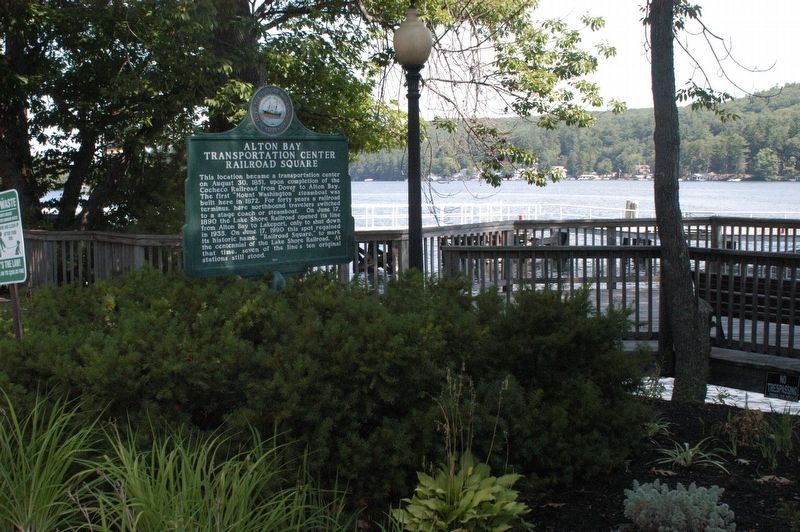
This location became a transportation center on August 30, 1851, upon completion of the Cocheco Railroad from Dover to Alton Bay. The first "Mount Washington" steamboat was built here in 1872. For forty years a railroad terminus, here northbound . . . — — Map (db m96751) HM
National Society
Women Descendants
Ancient and Honorable
Artillery Company
Massachusetts
1637 — 1774
Honors Two Charter Members
John Endicott and Edward Johnson
Captain Johnson surveyed
this area in 1652
for the . . . — — Map (db m173402) HM
Endicott Rock
the name of
John Endicvt Gov.
and the initials of
Edward Johnson and Simon Willard, Commissioners
of the Massachusetts Bay Colony,
John Sherman and Jonathan Ince, Surveyors,
were inscribed upon this rock
August . . . — — Map (db m172639) HM
In 1850, approximately 100 years after the town of Sanbornton was settled, a group of citizens petitioned to form a new town. Voted on at a special town meeting in 1869, and approved by the voters and the governor of N.H., the town of Tilton was . . . — — Map (db m97229) HM
Today a trip to town takes minutes.
For homesteaders, traveling the bumpy 15 miles to Conway by wagon took 3 hours, on a good day.
Trips to the store would not have been casual affairs, but a chance to stock up on supplies.
50 lb. sacks . . . — — Map (db m116172) HM
This piece of Sawyer's Rock represents the traditional landmark for the town line between Harts Location and the town of Bartlett. In 1870, Benjamin Sawyer and his partner Timothy Nash set out to prove to governor Wentworth that men and horses . . . — — Map (db m160826) HM
In honor and memory of Brigadier General James Reed Born at Woburn, Mass. Jan. 8, 1723 Died at Fitchburg, Mass. Feb 13, 1807 One of the proprietors of Monadnock No. 4, and a founder of this town. A leader in its civil and religious life. . . . — — Map (db m152116) HM WM
This veteran Captain of the French and Indian War, born in Woburn, Mass., settled here about 1765 as an original proprietor of Monadnock No. 4, now Fitzwilliam. After the Battle of Lexington, he recruited several companies to form the Third New . . . — — Map (db m136527) HM WM
The Village of Hinsdale From Agriculture to Manufacturing First settled as a farming community, Hinsdale received its New Hampshire charter in 1753. It was named for Col. Ebenezer Hinsdale, a respected early resident who had built a fort . . . — — Map (db m152179) HM
The Troy Common was established in 1815. The north side of the Common is on land obtained from Marlborough while the south side is on the land obtained from Fitzwilliam — — Map (db m151886) HM
The small man-made 'islands' in the river were used to secure a chain of boom logs which divided the Androscoggin River during the colorful and dramatic annual log drives, when the Brown Paper Company and the International Paper Company shared the . . . — — Map (db m74564) HM
On the knoll north of this site, William Sessions and his nephew, Cyrus Wheeler erected "the first building that could be honored with the name of house" in what is now Berlin, NH. Sessions helped clear many other farms in the area. In the 20th . . . — — Map (db m87972) HM
The village of Zealand grew up in 1875 to serve the logging industry. Henry owned 10,000 acres in the heart of the White Mtns., with a 10-mile railroad to move logs from forest to sawmill. The village had a post office, school, store, housing, and . . . — — Map (db m74556) HM
For whom the Notch is named, included Abel and his sons, Thomas J. and Ethan Allen. They established the first regional hotels and pioneered in opening the White Mountain area to the public. Ethan and his wife, Lucy Howe Crawford, author of an 1846 . . . — — Map (db m44299) HM
Here lies buried the first and only settlers of Dixville until 1865, John Whittemore and his wife Betsey.
Dixville had been granted to Colonel Timothy Dix in 1805 on the condition that thirty settlers be established here within five years. . . . — — Map (db m115640) HM
The waters of the Great North Woods have long been used for travel and transportation. Local bands of Wabanaki, "People of the Dawnland," traveled the Connecticut and Upper Ammonoosuc rivers in dugout, animal skin, and bark canoes. The rivers . . . — — Map (db m151931) HM
Known as Granny Stalbird, Deborah Vicker came through Crawford Notch c.1796 as cook for Col. Joseph Whipple. It is said she brought the first bible to the north country. She married Richard Stalbird and settled on land deeded to her by Whipple in . . . — — Map (db m77632) HM
The house was built by Jonas Wilder in 1780 and served
as a place for town and
religious meetings as well as an inn for travelers. The Holton family later acquired
it and owned it for over a century. In 1964 the Holton family sold the house to . . . — — Map (db m140029) HM
Top Left Panel:These waters abounded in fish, as did the forests in game
As the English were pushing their settlements up the valleys of the Connecticut and the Merrimack, trappers penetrated the wilderness far above the . . . — — Map (db m158923) HM
The Village of North Stratford occupies the farm of William Fuller, son of Luther Fuller who was killed at Fort Ticonderoga, New York, during the War of 1812. The house of William Fuller was raided by Indians, five hundred of whom camped on the . . . — — Map (db m151897) HM
Darby Field, a New Hampshire settler, accomplished this difficult feat in 1642 from a southerly approach. Partly guided by Indians and with only primitive equipment at his disposal, he is thus alleged to be the originator of all Mount Washington . . . — — Map (db m77638) HM
This corner marks the location where the Constitution establishing the Indian Stream Republic was adopted on July 9, 1832. The Center School built here in 1828 and known as Independence Hall served as school, town hall and courthouse. The Center . . . — — Map (db m156544) HM
In 1832 the settlers of the area between Indian Stream and Hall's Stream, claimed by both Canada and the United States, set up the independent republic of Indian Stream. Yielding to New Hampshire in 1836, Indian Stream became part of Pittsburg and . . . — — Map (db m75611) HM
THE INDIAN STREAM REPUBLIC
Borders have always aroused intrigue and fascination. Behind closed doors are whispered well-kept secrets, and forgotten stories as well. The Indian Stream Republic is one of those stories.
The signing of the . . . — — Map (db m156549) HM
Hunter, trapper, fisherman and guide, well and favorably known by the region's early settlers, "The Lone Indian of the Magalloway" was the last survivor of a band of Abnaki inhabiting the Upper Androscoggin. Blinded by accidents, Metallak died a . . . — — Map (db m75602) HM
Settled in 1766 by Jaasiel Harriman whose cabin was near the Great Rock. His nine year old daughter Mercy carried dirt in her apron to the top of this unique rock formation. Here she planted corn, pumpkins and cucumbers, making the first garden . . . — — Map (db m74569) HM
In this area of Easton (formerly part of Landaff and before that, Lincoln), the settlement of Wildwood once stood. At the turn of the 20th century Wildwood was a center for the "slash and run" logging of Mt. Moosilauke. The Village included a . . . — — Map (db m75773) HM
Downtown Enfield Village
This village, formerly called North Enfield, grew around mills powered by the Mascoma River. In the 1840s, railroad service and economic investment by the Enfield Shakers laid the foundation for its growth as a mill village . . . — — Map (db m98152) HM
Office of the Enfield Advocat
In this 1900 wood-frame building, the village’s first weekly newspaper, the Enfield Advocate,was published until 1946, and postcards and souvenir books of Mascoma Lake were printed and sold to a growing . . . — — Map (db m98154) HM
The Enfield Shakers
Founded in 1793, Shaker Village was the 9th of the original Shaker communities established in the U.S. At its peak c.1850 some 300 Shakers lived, worked and worshipped here, practicing equality of the sexes, celibacy, pacifism, . . . — — Map (db m98107) HM
This quiet site once buzzed with activity as the center of Franconia's economy during the time of the Industrial Revolution.
A dam about 200 feet upstream provided water power for an iron smelter across the river and for grist, saw and . . . — — Map (db m116363) HM
"The Corner" was part of a mile-wide strip of land claimed by both Haverhill and Piermont, and finally divided between them. Haverhill Corner's architecture reflects its history as Grafton County seat (1793–1891), home of Haverhill Academy . . . — — Map (db m88003) HM
This was about the center of the first settlement of the village called Concord under its first charter 1763.
The second charter made in 1768 called it Gunthwaite.
At the close of the Revolutionary War, in the entire township. comfortably . . . — — Map (db m155837) HM
Generations of visitors have followed this trail
According to local historians, Native Americans once traveled a path through the area to hunt and fish.
During the nineteenth century, writers and artists, moved by the splendor of the . . . — — Map (db m125094) HM
This is considered to be the site of Colonel John Goffe's log dwelling. In 1744 Goffe build a gristmill on Bowman's Brook, later run by his son, Major John Goffe (1727–1813), and his grandson, Theodore Atkinson Goffe (1769–1860). The . . . — — Map (db m88052) HM
This building was the second Congregational Church to stand on this spot. The first (pictured) had been constructed in 1816 but was sold and moved to Nashua in 1845. Later that same year, this second church was built to accommodate the growing . . . — — Map (db m230496) HM
Built in 1804 by Benjamin Pierce
Officer in the Revolutionary War
and Governor of New Hampshire in 1827-1829
Birthplace of his son Franklin Pierce
Fourteenth President of the United States
Restored and given to the
State of New . . . — — Map (db m230451) HM
The Currier Museum of Art originally opened in 1929, in a building designed by Edward Tilton of the New York architectural firm Tilton and Githens. Major expansions to the 1929 building were added to the north of the original building in 1982 . . . — — Map (db m125009) HM
Was the original town, chartered by Massachusetts Bay Colony in 1673, which embraced parts of New Hampshire and Massachusetts. The New Hampshire portion of this area, following determination of the province boundary in 1741, was subsequently . . . — — Map (db m88053) HM
The 452 Amherst Street (Route 101A) property housed a 40-acre farm containing two of the last early nineteenth and late eighteenth century homes remaining in northwest Nashua. The area was always bustling with commerce as various connecting roads . . . — — Map (db m230588) HM
As the center on the north side of the river, Railroad Square includes several railroad buildings such as the 1849 passenger depot (burned down), freight depot, and car house. It is home to Deschenes Oval, named in memory of Amedee Deschenes after . . . — — Map (db m244204) HM
Here were buried most of first settlers in Temple including Rev Samuel Webster, Patriot-Preacher. Francis Blood-Moses Child whom Gen. Washington sent on spy mission to Nova Scotia - Ebenezer Edwards who fought at Concord Bridge - First Burial in . . . — — Map (db m235451) HM
In 1960 their beautiful community was
sacrificed for the Everett Flood Control
Project. Their village was the home for over
60 families and was a self supporting thriving
community. Farming and lumbering was the way
of life for the . . . — — Map (db m132346) HM
Downtown Emerges
Ever since Concord was first settled in 1726, Main Street has been its principal thoroughfare.
The town's first plan shows an unnamed street that follows the same path as today's Main Street.
The 1-1/2 mile route was . . . — — Map (db m115859) HM
On the interval below this spot a committee of the General Court of Massachusetts Bay, their surveyors and attendants there present to locate and survey the Plantation of Penny Cook, conducted the first religious service ever held in the central . . . — — Map (db m129757) HM
Around this house was erected in 1746 the first stated garrison in Concord to protect from the French and Indian enemy the families of Rev. Timothy Walker, Capt. John Chandler, Abraham Bradley, Samuel Bradley, John Webster, Nathaniel Rolf, Joseph . . . — — Map (db m115939) HM
This
monument
is in memory of
Samuel Bradley
Jonathan Bradley
Obadiah Peters
John Bean &
John Lufkin
Who were massacred
August 11TH, 1746
By the Indians near
This spot
~
Erected 1837
By Richard Bradley
Son of the Hon. John Bradley,
& . . . — — Map (db m129598) HM
Near the site of this boulder stood the log cabin built by Philip Call first White settler of Franklin, N.H.
Sarah Trussel his wife was killed here by the Indians on August 15, 1754
Tablet placed by Abigail Webster Chapter D.A.R. 1928 — — Map (db m148364) HM
In February 1937, Hill residents learned that
their village, near the Pemigewasset River,
was to become a flood control reservoir for
the Franklin Falls dam project. By January of
1940, the citizens of Hill formed an association,
purchased . . . — — Map (db m139315) HM
Take opposite road 2.6 miles to the attractive buildings of this Utopian community organized in 1792 in the township of Canterbury. The Shakers established high standards of agricultural efficiency, craftsmanship and domestic skill for their sect . . . — — Map (db m117623) HM
The "Summer Business" flourished around Kezar Lake and North Sutton Village from the late 1800's to about 1950. People from the cities came to the rural lands and lakes of Sutton where farmers accepted boarders into their homes. Some of the . . . — — Map (db m161497) HM
Pembroke Street. Pembroke Street is one of several parallel roads laid out when the town was planned between 1730-36. The original large lots along this wide thoroughfare were subdivided into smaller lots for dwellings, meeting houses for . . . — — Map (db m115824) HM
The waters of Suncook River were harnessed in the 1730’s, eventually powering saw and grist mills, forge shops, and paper mills. The first cotton factory, owned by Major Caleb Stark, was built here in 1811. By 1900, Pembroke Mill, Webster Mill, . . . — — Map (db m115837) HM
In honor of John Folsom and his wife Mary Gilman, progenitors of the American Folsoms, natives of Hingham, England emigrated 1638, settled Exeter 1655. This stone erected by their descendants on land granted to Lieutenant Peter Folsom, was once the . . . — — Map (db m96467) HM
Founded by Rev. John Wheelwright in 1638, Exeter was one of the four original towns in the colony. Following New Hampshire’s provisional declaration of independence on January 5, 1776, it served as the capital of the new state during the period of . . . — — Map (db m75244) HM
(side 1)
Historic Black Rocks Village
Settled in the 1720's this section of Poplin, (now Fremont) between Scribner Road & Rowe's Gas Station at 225 Main Street, gradually grew into a thriving settlement called "Black Rocks . . . — — Map (db m115780) HM
In the year 1675, John Johnson was granted a tavern keeper's license. He resided and operated the tavern where the roads meet from Portsmouth, Exeter, and Hampton, at today's 480 Portsmouth Avenue. This is the house immediately in front of you. . . . — — Map (db m186250) HM
A Little Band of Pioneers
Under the Leadership of
Rev. Stephen Bachiler
of Southampton, England
Seeking a Larger Liberty
In October 1638
Settled in the Wilderness
Near This Spot to Plant a Free Church
In a Free Town
They . . . — — Map (db m162682) HM
This was the roadway. from the ancient landing on Hampton River taken on October 14, 1638 by Rev. Stephen Bachiler and his small band of followers, when they made the first settlement of Hampton, originally named Winnacunnet Plantation. For the . . . — — Map (db m162681) HM
The Frost Cemetery was a private family burying ground passed down through the Frost and Bell families for many generations. The families lived near the Piscataqua River and the cemetery was located at the end of their properties near the . . . — — Map (db m135323) HM
Boundary disputes among the early river
settlements caused this area to be called
Bloody Point. By 1640 Trickey's Ferry
operated between Bloody Point and Hilton's
Point in Dover. In 1712 the meeting house was erected and the parish set off, . . . — — Map (db m224489) HM
The Town of Nottingham was created by a Royal Charter in 1722. A plan of the town was completed in 1724; at that time the design of the Nottingham Square was laid out with house lots and the intersecting streets Bow, Fish, King and North. The . . . — — Map (db m235102) HM
About six miles offshore, these nine rocky islands served Europeans as a fishing station before the first mainland settlements were made in 1623. Capt. John Smith (1580-1631) named the group "Smiths Isles" in 1614. The codfish that "shoaled" or . . . — — Map (db m165413) HM
Origins of New England
John Smith’s map and widely read book “A Description of New England” detailed the region’s teeming fishing banks, abundant game, clean rivers, vast forests and native people. The book had a major influence . . . — — Map (db m165414) HM
The Wigwam
[Unreadable]
The Fire Pit
The fire pit was built [unreadable] sere as heat and cooking area meant to serve two families. The ondel would fit through the hole at the top of the wigwam.
The Bedding
Beds were . . . — — Map (db m160686) HM
A cordwainer (shoemaker) by trade, Jonathan Pattee used
this portion of the site as the foundation for his house. The
wooden structure burned in 1855. Pattee's techniques for
stonework were cruder and more utilitarian then those of
the original . . . — — Map (db m160689) HM
Based on the 1640 southern boundary of Bachiler's farm, it was surveyed by Capt. Nicholas Shapley in 1657, dividing the Province of New Hampshire from the Massachusetts Bay Colony 1689-1741.
In 1662 three Quaker women, being banished from the . . . — — Map (db m115419) HM
Granted in 1719 to encourage industrial development in the province and called New Portsmouth, this two-mile wide strip of land was set aside to provide homesites for imported workers at the Lamprey Ironworks. Wood from this strip was converted to . . . — — Map (db m152149) HM
Dover’s early settlers lived in relative peace with the local Pennacook tribe, learning hunting, fishing, and farming skills from the natives in the early 17th century. Passaconaway, highly respected leader of the Pennacook Confederacy, forged . . . — — Map (db m152213) HM
The New Durham Meetinghouse was built by settlers from Durham and nearby towns in 1770 as their house of worship and seat of government until 1819 when the town's first church was built. This area was the town center until the 1850's when the . . . — — Map (db m96748) HM
Near this place lived David Hamilton of Westburn: born in the parish of Cambuslang, Scotland, in October, 1620; captured by Oliver Cromwell at the Battle of Worcester, England, September 3, 1651; Brought to America as a prisoner in chains on the . . . — — Map (db m243067) HM
This tablet commemorates the successful defense of the fort on this site by Captain Phineas Stevens and his company of rangers against a large war-party of French and Indians April 7-10 1747 — — Map (db m66278) HM
In 1744 the settlers at No. 4 (now Charlestown) built a great log fort enclosing many of the town's dwelling. The fort, northernmost in the Connecticut Valley, was besieged in 1747 by a large force of French and Indians, who were beaten off by the . . . — — Map (db m74584) HM WM
Southerly on Old Church Road is located the first Roman Catholic edifice in New Hampshire. It was erected in 1823 under the direction of the Reverend Virgil Horace Barber, S.J. The building serves St. Mary's parish and contained the first Roman . . . — — Map (db m109414) HM
Located easterly on Old Church Road, this wood-frame structure, built 1771–1773, is the oldest standing Episcopal church in the State, serving the second oldest parish. The parish began in 1768 as a mission of the Society for the Propagation . . . — — Map (db m109370) HM
In April 1842, a group of citizens in this town banded together to form "the first Christian Society." In the Adventist movement of 1842-43, they espoused the Advent hope. In January 1842, these Washington Sabbathkeepers, after meeting for many . . . — — Map (db m73224) HM
N.H.
Washington The first town incorporated under the name of George Washington Our first president December 13, 1776
Erected Nov. 1932 — — Map (db m104566) HM
The Washington Common
has been placed on the
National Register
of Historic Places
by the
United States Department of the Interior — — Map (db m104562) HM
In 1776 Washington, New Hampshire, became the first town in the nation to be incorporated under the name of General Washington.
In the early 19th century two major turnpikes joined near the site of this wayside park: Second New Hampshire . . . — — Map (db m230400) HM