This old stone marked the grave of John Abbott, son of town’s founder. Since 1763, in a fence row at upper end of town at a site 128 ft east of Abbott Street 35 feet south of Water Street. Moved to this place in 1976 to make way for a parking lot — — Map (db m118927) HM
Surveyed in 1766. Named for an estate in England. The Manor was about 6 miles wide and 12 miles long with the southern boundary at present Mason-Dixon Line. It was the second largest reserved estate of the Penns in Pennsylvania. The western boundary . . . — — Map (db m11623) HM
Built ca. 1790 by David Studebaker, carpenter, farmer, and minister. He was related to the family that later built wagons and automobiles. The house is privately maintained as a museum. — — Map (db m11638) HM
Indian trader and interpreter of Maryland and Pennsylvania. First settler in this valley. Born of Swedish parents along the Delaware. This tablet erected by Liberty Twp. and Fairfield Area Bicentennial Cmte. First Marker Placed in 1924 by . . . — — Map (db m29543) HM
This was the site of the GLOBE INN, one of Gettysburg's oldest hotel-taverns, originally owned and operated in 1798 by townfounder James Gettys, and traditionally the unofficial headquarters for the local Democratic party. Such political . . . — — Map (db m32474) HM
The future President of the U.S., General of the Army, and Supreme Commander in Europe in WW II lived in this house with his wife Mamie and infant son Icky in the spring and summer of 1918. An Army captain, he was then commanding Camp Colt at . . . — — Map (db m6179) HM
"Three more acres or less on which are erected a one and a half story stone dwelling house and frame stable … directed and sold and struck off the same unto Thaddeus Stevens, trustee of Mary Thompson, for the sum of sixteen . . . — — Map (db m99848) HM
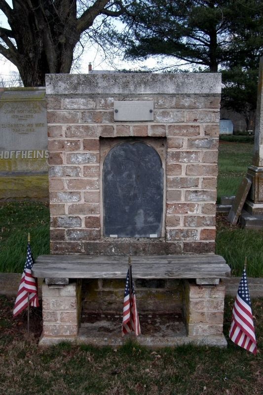
This site was part of the Manor of Maske warranted by John, Richard, and Thomas Penn Proprietors of Pennsylvania June 18, 1741 Surveyed January 17-30, 1766 Containing 43,500 acres (Around the edges are the survey annotations): North 3842 . . . — — Map (db m15305) HM
Buried in this historic cemetery
are some of the pioneer organizers
of Methodism in Adams County.
To these and others known only to God,
the Congregation of the Gettysburg
United Methodist Church
dedicate this monument
October 1990 . . . — — Map (db m96250) HM
After leaving office in 1961, President Dwight D. Eisenhower retired to his Gettysburg farm and became a Gettysburg College trustee. He wrote his memoirs in an office in the house that stands before you. Gettysburg College founded 1832 (Lower . . . — — Map (db m32422) HM
Hidden by a capstone, this hand dug stone lined well was discovered during renovations in 2011. Mentioned in an 1837 sheriff sale as "the well of water near the door". It is spring fed and 19 feet deep. Bricks from an interior wall were used to . . . — — Map (db m143718) HM
Beginning in the late 17th century, large waves of European settlers flooded into William Penn's colony in pursuit of opportunity and religious freedom. By the early 19th century, American Lutheran leaders realized that an institution dedicated . . . — — Map (db m66662) HM
Historic Gettysburg
A.L. Horner
Homestead
1819
Adams County,
Honored 1987
This property
is listed in the
National Register
of Historic Places
by the United States
Department of the Interior
Erected by . . . — — Map (db m192380) HM
Dwight D. Eisenhower Farmstead has been designated a Registered National Historic Landmark under the provisions of the Historic Sites Act of August 21, 1935 - This site possesses exceptional value in commemorating or illustrating the history of the . . . — — Map (db m37443) HM
The stone house across the field to your front was the home of the Warfields, an African American family that had moved here from Maryland less than a year before the battle. James Warfield, a blacksmith and farmer, had worked hard to purchase . . . — — Map (db m217056) HM
Initial Confederate Assault on the Second Day "Encouraged by the successful issue of the engagement of the first day, and in view of the valuable results that would ensure from the defeat of the army of General Meade, it was thought advisable . . . — — Map (db m10023) HM
This site was part of the Manor of Maske warranted by John, Richard, and Thomas Penn Proprietors of Pennsylvania June 18, 1741 Surveyed January 17-30, 1766 Containing 43,500 acres (Around the edges are the survey annotations): North 3842 . . . — — Map (db m192379) HM
This site was part of the Manor of Maske warranted by John, Richard, and Thomas Penn Proprietors of Pennsylvania June 18, 1741 Surveyed January 17-30, 1766 Containing 43,500 acres (Around the edges are the survey annotations): North 3842 . . . — — Map (db m203087) HM
From Home to Hospital About the George Spangler Farm The George Spangler Farm Civil War Hospital Site is one of the most intact Civil War field hospitals used during the battle of Gettysburg. When George Spangler bought the farm in 1848, he had . . . — — Map (db m75508) HM
This site
was part of the
Manor of Maske
Warranted by
Joh, Richard, and
Thomas Penn
Proprietors of Pennsylvania
June 18, 1741
Surveyed
January 17-30, 1766
containing 43,500 acres
North 3842 . . . — — Map (db m241691) HM
Surveyed in 1766. Named for an estate in England. The Manor was about 6 miles wide and 12 miles long with the southern boundary at present Mason-Dixon Line. It was the second largest reserved estate of the Penns in Pennsylvania. The eastern boundary . . . — — Map (db m13939) HM
The turn of the century brought the continuation of growth and change to Littlestown. The photos depict businesses and properties which may be familiar to many despite some changes in appearance. The Littlestown to Hanover trolley line, installed . . . — — Map (db m10859) HM
Littlestown is situated at the intersection of the Old Monocacy Road (opened in 1736) and the Baltimore to Pittsburgh Road, (1770) later known as the Gettysburg and Petersburg Turnpike. The Old Monocacy Road was the road between Wrightsville, PA and . . . — — Map (db m231100) HM
Littlestown's Sestercentennial
July 15, 2015
250 Years Proud
Littlestown was founded on July 15th of 1765 when Peter Little sold his first six lots. Peter was born Johann Peter Klein. — — Map (db m128574) HM
In honor of
Peter (Klein) Little
1724-1773
Founder of Littlestown
Founded in 1765
Originally named
"Kleina-Stedtle",
renamed in 1795 — — Map (db m147273) HM
Founded 1681 by William Penn as a Quaker Commonwealth.
Birthplace of
The Declaration of Independence
and
The Constitution of the United States — — Map (db m95201) HM
A man of strong intellect and sturdy independence of character with a sincere interest in the welfare of the colonists he was chosen a colonial justice and also served as Chairman of the Committee on Safety for York County in 1774. Together with . . . — — Map (db m130318) HM
This was a tavern site along the Marsh Creek Road as early as 1763. Operated by the Frederick Kuhn family from 1769 until 1791. In the next year son Henry Kuhn laid out, the town of Oxford here on part of his 256 acre property. Well located at . . . — — Map (db m130293) HM
The Dickson Log House is a well-preserved example of a late 18th-century log dwelling. It represents a common structure on the frontier of Pennsylvania in the 1790s, and is one of only a few such buildings preserved in the area north of the Ohio . . . — — Map (db m60570) HM
A militia captain during the American Revolution and civic leader in the early republic, Meeks was a petitioner to create Allegheny County in 1787. While making his living as a farmer, he took up arms to defend western Pa. during conflict and war. . . . — — Map (db m40221) HM
Near this site stood Fort Vance, a settlers fort built during the French and Indian War era by Revolutionary War Captain Robert Vance. Robert Vance was a member of the Virginia Regiment of the Colonial Army, under the command of George Washington, . . . — — Map (db m93567) HM
Near the corner of Second Avenue and Chestnut Street there was erected, about 1776, by Captain Robert Vance of Virginia.
Pioneer settler on this site, a stockade known as Montour Bottoms or Vance Fort
This stockade was manned by Washington . . . — — Map (db m60831) HM
top left
The Crossroads
By 1819 a tiny village had taken root at the intersection of Beaver Indian Trail and Sharon road. It consisted of a few log cabins. Traces of old military road between Fort Pitt and Fort McIntosh (Beaver) could . . . — — Map (db m216247) HM
Elizabeth's first burying ground dates back to the laying out of the town in 1787. Though few markers remain, the people of Elizabeth wish to pay tribute to the past and to those who helped make their home what it is today — — Map (db m205552) HM
This pioneer settler of Rostraver Township, Westmoreland County, arrived in Philadelphia from Rotterdam aboard the ship Mortonhouse in 1729. He and his wife Mary lived for a time near Hagerstown, Maryland and after the Braddock and Forbes . . . — — Map (db m63078) HM
Gateway to the West and steel center of the world. Named for William Pitt by General Forbes after the fall of French Fort Duquesne in 1758. Laid out as a town by John Campbell in 1764. Incorporated as a city, 1816. — — Map (db m75099) HM
Hunters, traders, warriors, militia, war captives, and diplomats all used this early Native American path, which passed this location, for most of the 1700s as part of a regional network of trails. It provided a direct route between Fort . . . — — Map (db m40355) HM
Oldest Episcopal Church in southwestern Pennsylvania, founded after the French and Indian War by veteran Major William Lea on his land grant. Francis Reno was the first vicar. Church members included General John Neville, the unpopular tax collector . . . — — Map (db m40978) HM
From whom McKeesport derives its name, first permanent white settler at the forks of the Monongahela and Youghiogheny Rivers in 1755. The Colonial Government granted to him exclusive right of ferrage over these rivers April 3, 1769, called . . . — — Map (db m29962) HM
John McKee and other members of the family were buried in the "Old Graveyard" on Ninth Avenue, just outside the limits of the original townsite.
On account of the abandonment of that primitive burial-ground in 1871 their remains . . . — — Map (db m224870) HM
Brighton Heights wishes to thank Jack Brennan For His Dedication To Community, Family and Friends.
He Was Instrumental In Helping Put Brighton Heights On The Map. He Had A Special Way Of Caring For Those Who Needed Help. His Caring Helped Bridge . . . — — Map (db m137908)
In 1751, the legislators of the Province of Pennsylvania ordered from an English foundry "A Good Bell" for the new bell tower of the state house (now know as Independence Hall) in Philadelphia. It was to be the jubilee symbol of the Pennsylvania . . . — — Map (db m66452) HM
Point of Confluence
Nature itself has conspired to render the Ohio hereabouts a place of consequence and importance, and the rendezvous of all the people of North America that are within reach of it.
John Mitchell 1756 . . . — — Map (db m156277) HM
Formed September 24, 1788 out of Westmoreland and Washington counties. Named for the Allegheny River. County seat of Pittsburgh was laid out in 1764 and became a city in 1816. A center of the iron, steel and other industries and “Workshop of . . . — — Map (db m40937) HM
The day after the fall of Fort Duquesne, General Forbes wrote in a letter to William Pitt:–
"I have used the freedom of giving your name to Fort Duquesne, as I hope it was in some measure the being actuated by your spirits . . . — — Map (db m156215) HM
Gateway to the West and steel center of the world. Named for William Pitt by General Forbes after the fall of French Fort Duquesne in 1758. Laid out as a town by John Campbell in 1764. Incorporated as a city, 1816. — — Map (db m40396) HM
Born near Harrisburg, Girty crossed cultural boundaries between native and white societies. He was captured and adopted by Seneca Indians in 1756. Upon his release, he settled here with his family. He worked as an interpreter for the British and . . . — — Map (db m108791) HM
In 1788, Alexander Negley became one of the earliest settlers of the East Liberty Valley, bringing his family west from Philadelphia to a 300-acre farm in Pittsburgh. Part of the original Negley family farmland is now Highland Park.
Negley . . . — — Map (db m182059) HM
Name of a Delaware Indian village that covered this site from about 1731 to the French occupation, 1754. It was the Allegheny River terminus of the Raystown Indian and Traders Path from Carlisle to the west. — — Map (db m40908) HM
This two-part sculpture recognizes the significant contributions of Pittsburgh and to American labor history by a symbolic representation of labor's role in our nation's development. The human figures populating the facades are engaged in this . . . — — Map (db m156087) HM
Conceived as a "Sculpture Park" within a "Sculpture Park", the varied elements that have contributed to Pittsburgh's growth are represented by forms which symbolize a paddlewheel (the rivers), a crucible (primary metals), the Golden Triangle . . . — — Map (db m156086) HM
A celebration of the three rivers and the molten metals that have been major forces in shaping Pittsburgh's industrial history.
Collection of Museum of Art, Carnegie Institute
[Additional plaque on the base of the sculpture:] . . . — — Map (db m156088) HM
In the early 1700s, the Allegheny River formed a boundary: lands claimed by European nations were to the east, and lands claimed by Native Americans were to the west.
Near this site in 1783, James Robinson, the first permanent European settler . . . — — Map (db m191484) HM
The Gilded Age mansion you see today is quite different from the home the Fricks purchased in 1882. After some alterations by architect Andrew Peebles, Henry Clay Frick and his bride Adelaide Howard Childs moved into the 11-room home in 1883. . . . — — Map (db m156193) HM
Before Henry Clay Frick gave the City of Pittsburgh 150 acres to create Frick Park, the land — formerly called the Gunn Hill Tract — was owned by the Wilkins family. The Honorable William Wilkins (1779 - 1865) was a prominent . . . — — Map (db m156131) HM
Frick Park is a place of wonder and enjoyment, thanks to its many strong partnerships and dedicated supporters. Chief among them are the City of Pittsburgh, the Pittsburgh Parks Conservancy, Nine Mile Run Watershed Association, and scores of . . . — — Map (db m156186) HM
Named for the hazelnut trees that once grew on the banks of the Monongahela River, Hazelwood possessed a natural beauty that George Washington noted in his early journals. Originally Native American territory, Hazelwood was purchased through the . . . — — Map (db m94065) HM
Between 1890 and 1910, the highway corridor where you are now standing developed into a Croatian community known as "Mala Jaska" (or Little Jastrebarsko), after the town from which many of the immigrants came. The area was initially settled by . . . — — Map (db m84561) HM
In the late nineteenth century, Croatian immigrants fled economic hardship and settled in Allegheny City (now Pittsburgh's North Side). The Croatian immigrants were predominantly peasants living in a region comprised of one faith, one . . . — — Map (db m84560) HM
Homestead Farms, owned by Major John Ormsby, was a huge tract of nearly 3,000 acres that included Pittsburgh's South Side and Mt. Washington neighborhoods. Major Ormsby acquired part of this land from England as payment for military service during . . . — — Map (db m174420) HM
This log cabin, typical of the log cabins built by the first white settlers, is one of the very few original log cabins in Allegheny County. It was in cabins such as this that our forefathers established their hold on the soil and raised the first . . . — — Map (db m78438) HM
Guyasuta ("Crosses Standing in a Row), a leader of the Seneca Tribe whose hunting ground included the Sharpsburg area, served as George Washington's guide during a 1753 survey of the point. He later represented his people in negotiations with the . . . — — Map (db m72852) HM
Patriot, Indian Fighter,
Soldier of Revolutionary War.
————————————————
First white man to settle in
what became East Liberty
and later the East End
of Pittsburgh, Pa. — — Map (db m225459) HM
An early Shawnee Indian village located at the site of present Tarentum. It was named for Pierre (Peter) Chartier, who had a trading post here from 1734 to 1743. He was the son of Martin Chartier, a French explorer. Several heavily traveled Indian . . . — — Map (db m113320) HM
...is dedicated to Thomas J. Kenny, who in 1818 crossed the Alleghenies and purchased this property for five pounds, ten shillings, six pence, and a barrel of whiskey. The farm he established later was called Kenny's Grove, a retreat where the . . . — — Map (db m76675) HM
In 1800, not too far from here along Cherry Run, George Painter built the first gristmill in Burrell Township. By 1804 he had relocated the mill to this site on Crooked Creek and added a sawmill. The mills changed hands several times and by 1822 a . . . — — Map (db m74142) HM
Prior to settlement, a native american presence evident in this vicinity. What is now Freeport and west of the Allegheny River, did not belong to Pennsylvania until the purchase of 1784. The "Depreciation Lands", surveyed out of this purchase were . . . — — Map (db m114803) HM
The most notable Delaware Indian village west of the Alleghenies, was situated here from about 1730 until destroyed by Armstrong's expedition in 1756. Its name means "great river", applying to the Ohio-Allegheny. — — Map (db m47564) HM
The most notable Delaware Indian village west of the Alleghenies, was situated here from about 1730 until destroyed by Armstrong's expedition in 1756. Its name means "great river", applying to the Ohio-Allegheny. — — Map (db m47565) HM
Kittanning or Attiqué Indian Town was located on this river flat. The chief settlement as early as 1727, of the Lenni-Lenape or Delaware Indians in their early westward movement from the Susquehanna River, became the most important Indian center . . . — — Map (db m49191) HM
This cemetery was established by George Baker on his land for his family and heirs. His was one of the first permanent families to settle in Beaver County. Cemetery is presently maintained by the trustees of The Blockhouse Baker Association. — — Map (db m47788) HM
The first colonial residents of Beaver County lived nearby. Alexander McKee operated a trading post 1769 or earlier. Colonel John Gibson farmed land near his trading post in 1771 then went on to a great military and legal career. McKee became a . . . — — Map (db m47789) HM
Maintained by the
Pennsylvania Historical
and Museum Commission
as a State memorial to the
Harmony Society
Organized February 15, 1805
Dissolved December 15, 1905
These buildings erected 1824-1831, . . . — — Map (db m40721) HM
One of the large Indian towns on the upper Ohio was located nearby in 1727-58. Important conferences were held here between the British, French, and Indians in the struggle for the Ohio country. — — Map (db m40240) HM
An historic Indian village, was located a short distance northwest of this spot. It was founded by Shawnees and later occupied also by Delawares, Senecas, Mohawks and Wyandots. Here in 1748 Conrad Weiser, agent of Pennsylvania, negotiated a treaty . . . — — Map (db m40298) HM
Located near here was the large Indian village of Logstown 1727-1758 important conferences were held and disputes settled between British, French and Indians in the struggle for the Upper Ohio Valley Territory — — Map (db m44494) HM
A short distance southeast of this spot, along the banks of the river, was situated the village of Logstown one of the largest Indian settlements on the upper Ohio. It was the scene of many important conferences between the French, the British and . . . — — Map (db m56580) HM
1558 entries matched your criteria. The first 100 are listed above. Next 100 ⊳