Near Meadow Road Northeast, 0.1 miles west of Ellipse Road Northeast, on the left when traveling west.
During the U.S. Civil War, Confederate soldiers used roasted, ground chicory root as a substitute for coffee, which was scarce during the conflict. Still popular in the southern states, chicory is either mixed with true coffee or prepared by itself. . . . — — Map (db m144436) HM
Near Meadow Road Northeast east of Eagle Nest Road Northeast, on the right when traveling east.
Among the world's oldest medicines, its pain relieving and sedative properties have been recognized for thousands of years. Its constituents include the well known alkaloids morphine and codeine. It was used to treat dysentery during the U.S. Civil . . . — — Map (db m235698) HM
On Washington Place Northeast, 0.3 miles south of Rhode Island Avenue Northeast (U.S. 1), on the right when traveling south.
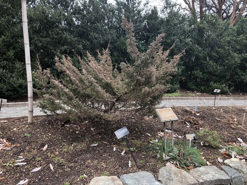
This area, including that of the adjacent shopping center, was once the site of Columbian Harmony Cemetery. The cemetery, established in 1828 "for free persons of color," was originally located near 6th and S Streets, NW, Washington, D.C. . . . — — Map (db m146576) HM
Near Washington Place Northeast at Rhode Island Avenue Northeast (U.S. 1), on the right when traveling south.
Many distinguished Black citizens including Civil War veterans were buried in this cemetery.
These bodies now rest in the new National Harmony Memorial Park Cemetery in Maryland. — — Map (db m16069) HM
On 14th Street Northeast at Perry Street Northeast, on the left when traveling north on 14th Street Northeast.
[Captions:]
Fort Bunker Hill from U.S. Army Corps of Engineers drawing.
Built by the 11th Massachusetts Volunteer Infantry Regiment who named the fort after the Revolutionary War battle in their home state.
Other Civil War fort . . . — — Map (db m111794) HM
Near Otis Street Northeast near 14th Street Northwest, on the right when traveling west.
One of the Civil War Defenses of Washington erected in the fall of 1861, Fort Bunker Hill occupied an important position between Fort Totten and Fort Lincoln in the defense of the National Capital. Thirteen guns and mortars were mounted in the fort. — — Map (db m111795) HM
On East Capitol Street Northeast at 12th Street Northeast, in the median on East Capitol Street Northeast.
In grateful memory of Abraham Lincoln. This monument was erected by the Western Sanitary Commission of Saint Louis, Mo., with funds contributed solely by emancipated Citizens of the United States declared free by his Proclamation, January 1st . . . — — Map (db m41617) HM
On Fort Totten Drive Northeast north of Crittenden Street Northeast, on the right when traveling north.
Earthworks of Fort Totten are visible within the wooded area 50 yards at the top of this hill. Cannon mounted at Fort Totten helped repulse a Confederate attack on Fort Stevens, July 11-12, 1864. — — Map (db m2993) HM
On Fort Totten Drive Northeast north of Allison Street Northeast, on the right when traveling north.
One of the Civil War defenses of Washington construction of Fort Totten was begun in August 1861, named after Gen. Joseph G. Totten the fort contained 20 guns and mortars including eight 32-pounders. — — Map (db m2999) HM
Near Fort Totten Drive Northeast north of Crittenden Street Northeast, on the right when traveling north.
Built in 1861 and named after Brigadier General Joseph Gilbert Totten, Chief of the Army Corps of Engineers, Fort Totten commanded the northeastern countryside of Washington, DC during the Civil War. Heavily armed with massive cannon that could hurl . . . — — Map (db m92906) HM
On Minnesota Avenue Northeast at Grant Street Northeast, on the left when traveling south on Minnesota Avenue Northeast.
Formerly known as the Bladensburg Piscataway Road, Minnesota Avenue has long served as an eastern gateway into Washington. Since the original wooden Benning Road Bridge across the Anacostia River was erected nearby in 1800, countless people . . . — — Map (db m136184) HM
On Benning Road Northeast at 41st Street Northeast, on the right when traveling west on Benning Road Northeast.
Fort Mahan
Civil War Defenses of Washington
1861-1865
Earthworks of Fort Mahan are visible; follow path at the top of the hill.
[Illustration:]
Fort Mahan from U.S. Army Corps of Engineers drawing.
- Fort . . . — — Map (db m46083) HM
On Taylor Street Northeast at Harewood Road Northeast, on the right when traveling west on Taylor Street Northeast.
The ridge that extends along the edge of the parking lot to the right where you are standing is the remains of a rifle trench built during the Civil War. This ridge, part of the Defenses of Washington, connected Ft. Totten to the north and Ft. . . . — — Map (db m115355) HM
On South Dakota Avenue Northeast north of New Hampshire Avenue Northeast, on the right when traveling north.
In 1860, the Union capital, Washington, D.C., was a sleepy city of approximately 62,000 residents. The city sat almost completely unprotected, with Fort Washington, the lone fortification, being 12 miles south. Virginia, a Confederate state, lay on . . . — — Map (db m115357) HM
On Georgia Avenue Northwest (U.S. 29) north of Madison Street Northwest, on the right when traveling south. Reported missing.
The City Park across the street was once Emery Place, the summer estate of Matthew Gault Emery.
A prominent builder, Emery was Washington City's last elected mayor during the period of home rule. He was succeeded in 1874 by a . . . — — Map (db m72816) HM
On Calvert Street Northwest at Biltmore Street Northwest, on the left when traveling east on Calvert Street Northwest. Reported permanently removed.
In 2013, Howard University archaeologists, working with concerned citizens, completed a seven-year survey of Walter C. Pierce Community Park. Their goal: to identify and protect two 19th Century cemeteries--the Colored Union Benevolent . . . — — Map (db m112588) HM
On 16th Street Northwest south of Euclid Street Northwest, on the right when traveling south.
During the Civil War (1861-1865), the Union Army Carver Hospital and barracks occupied Meridian Hill. The facilities attracted African American freedom seekers looking for protection and employment. By war’s end, a Black community had put down . . . — — Map (db m130705) HM
On Calvert Street Northwest at Biltmore Street Northwest, on the left when traveling east on Calvert Street Northwest. Reported permanently removed.
"I knew him when he was drafted for the war, and I knew him when he came back ... He had a soldier's clothes on when he came back, with a gun, canteen, knap sack and blanket."-- Lloyd Mudd, testifying to U.S. Pension officials about . . . — — Map (db m112866) HM
On Calvert Street Northwest at 20th Street Northwest, on the right when traveling west on Calvert Street Northwest.
The Civil War changed Washington, as Union troops poured into the city to secure it, and thousands of refugees from slavery arrived here seeking freedom. More than 40 African American soldiers and sailors were later buried at Mt. . . . — — Map (db m236779) HM
On Ward Circle Northwest east of Nebraska Avenue Northwest, on the right when traveling north.
Beyond Ward Circle to your left is the campus of American University, chartered by Congress in 1893. Methodist Bishop John Fletcher Hurst guided the university’s development as a center for training future public servants. With its schools in . . . — — Map (db m130932) HM
On River Road Northwest just west of Murdock Mill Road, on the right when traveling west.
Eldbrooke United Methodist Church's roots reach to about 1835, when Methodists gathered at the Loughborough Road home of Philip L. Brooke. Soon they built the simple, wooden Mount Zion Methodist Episcopal Church on land purchased from the . . . — — Map (db m184983) HM
On River Road Northwest at Western Avenue Northwest, on the right when traveling south on River Road Northwest.
Civil War Defenses of Washington 1861-1865. No visible evidence remains of Fort Bayard, which stood at the top of this hill. Named for Brig. Gen. George Bayard, mortally wounded at the Battle of Fredericksburg on December 13, 1862. — — Map (db m124) HM
On Quackenbos Street Northwest east of 13th Street Northwest, on the left when traveling west.
Hearing those words, President Abraham Lincoln ducked down from the Fort Stevens parapet during the Civil War battle that stopped the Confederates from taking Washington. On July 9, 1864, some 15,000 Rebels led by General Jubal A. Early . . . — — Map (db m72829) HM
On 14th Street Northwest at Rock Creek Ford Road Northwest on 14th Street Northwest.
Even before emancipation freed Washington's enslaved people in April 1862, a free African American community had developed here amid the European American farmers. The District of Columbia, unlike its neighbors, permitted the formerly enslaved . . . — — Map (db m143796) HM
On 13th Street Northwest at Quakenbos Street Northwest, on the right when traveling north on 13th Street Northwest.
Elizabeth Proctor Thomas (1821-1917), a free Black woman whose image appears on each Brightwood Heritage Trail sign, once owned 11 acres in this area. Known, respectfully in her old age as "Aunt Betty," Thomas and her husband James farmed and . . . — — Map (db m72830) HM
On Missouri Avenue Northwest at Georgia Avenue Northwest (U.S. 29), on the right when traveling west on Missouri Avenue Northwest.
In 1818 the Private Rockville and Washington Turnpike Co. began building a road to link Washington City to Rockville, Maryland. This road helped create a village. A toll gate on what today is Georgia Avenue between Quackenbos and Rittenhouse . . . — — Map (db m72819) HM
On 13th Street Northwest at Quakenbos Street Northwest, on the right when traveling north on 13th Street Northwest.
Civil War Defenses of Washington 1861-1865 The partial reconstruction of Fort Stevens that you see today was done by the Civilian Conservation Corps in 1937. No visible evidence of the original fort remains. Battle of Fort Stevens July . . . — — Map (db m3028) HM
On Missouri Avenue Northwest east of 14th Street Northwest, on the right when traveling west.
The Military Road School opened in 1864 here along what then was Military Road, an artery linking Civil War forts. The School was one of the first to open after Congress authorized public education for Washington's African Americans in 1862. . . . — — Map (db m115232) HM
On Quackenbos Street Northwest near 13th Street Northwest, on the left when traveling east.
Dedicated September 1936 in memory of The Grand Army of the Republic by the Daughters of Union Veterans of the Civil War 1861-1865 — — Map (db m49526) HM
On Georgia Avenue Northwest (U.S. 29) at Quackenbos Street Northwest, on the right when traveling south on Georgia Avenue Northwest. Reported permanently removed.
Across Quackenbos Street Emory United Methodist Church. Named to honor Bishop John Emory of Maryland (1789-1835), the congregation dates from 1832.
From the beginning, Emory welcomed all races but, like most Washington churches then, . . . — — Map (db m118907) HM
On Georgia Avenue Northwest (U.S. 29) at Quackenbos Street Northwest, on the right when traveling south on Georgia Avenue Northwest.
Across Quackenbos Street is Emory United Methodist Church. Named to honor Bishop John Emory of Maryland (1789-1835), the congregation dates from 1832.
From the beginning, Emory welcomed all races but, like most Washington churches then, . . . — — Map (db m147739) HM
On Piney Branch Road Northwest at Georgia Avenue Northwest (U.S. 29), on the right when traveling west on Piney Branch Road Northwest.
On July 11 and 12, 1864, this intersection was the center of the only Civil War battle fought in the District of Columbia. Here, Union sharpshooters at Fort Stevens, supported by forces across the
northernmost of Washington's ring of . . . — — Map (db m123226) HM
On 1st Street Northwest at Northwest Drive Northwest, on the right when traveling north on 1st Street Northwest.
The Peace Monument
By Franklin Simmons, 1878
The Peace Monument, also called the Naval Monument, was erected to commemorate the naval deaths at sea during the Civil War. at the top of the 44-foot monument, Grief, sometimes called . . . — — Map (db m186860) HM
On East Capitol Circle Northwest at Pennsylvania Avenue Northest, in the median on East Capitol Circle Northwest.
In memory of the officers seamen and marines of the United States Navy who fell in defence of the union and liberty of their country 1861-1865 — — Map (db m18594) HM
Near 15th Street Northwest south of Euclid Street Northwest, on the left when traveling north.
President Monroe singed a charter in 1821 that established Columbian College on a site north of Florida Avenue between 14th and 15th Streets, Columbian College moved to Foggy Bottom in 1912 and became George Washington University, but the original . . . — — Map (db m63771) HM
On 15th Street Northwest at Chapin Street Northwest, on the right when traveling north on 15th Street Northwest.
Wayland Seminary opened in Foggy Bottom just after the Civil War to train formerly enslaved people and others as “preachers and teachers for the South” and as missionaries to evangelize Africa. In 1875 it moved here, later merging . . . — — Map (db m130745) HM
On Connecticut Avenue Northwest at I Street Northwest, on the right when traveling south on Connecticut Avenue Northwest. Reported damaged.
With these legendary words, naval officer David G. Farragut led the Union fleet past Confederate mines (then called torpedoes) and to victory at the Battle of Mobile Bay on August 5, 1864. From the rigging of his flagship, USS Hartford, . . . — — Map (db m4104) HM
On 13th Street Northwest at K Street Northwest, on the right when traveling north on 13th Street Northwest. Reported permanently removed.
"going into the country"
This urban oasis exists because President Andrew Jackson needed water. The site of excellent springs (a rare commodity in the early city when everyone was dependent on private wells), . . . — — Map (db m29594) HM
On I Street Northwest at 15th Street Northwest, on the right when traveling west on I Street Northwest.
(Right):Maj. Gen. James B. McPherson. Atlanta. July 22, 1864. (Left):Erected by his comrades of The Society of The Army of the Tennessee — — Map (db m17534) HM
On Pennsylvania Avenue Northwest east of 17th Street Northwest, on the left when traveling east.
1836 home of Francis Preston Blair Editor of Globe, also of Montgomery Blair Attorney for Dred Scott, Postmaster General in the Cabinet of Abraham Lincoln. Occupied by George Bancroft, Historian. General Robert E. Lee was here offered command . . . — — Map (db m113099) HM
On Pennsylvania Avenue Northwest at Jackson Place, on the right when traveling west on Pennsylvania Avenue Northwest.
Home of Rear Admiral Samuel Phillips Lee, U.S. Navy and Elizabeth Blair Lee, to whom it was given by her father, Francis Preston Blair. Admiral Lee commanded the North Atlantic Blockading Squadron during the Civil War. Home also of their son Blair . . . — — Map (db m4050) HM
On 15th Street Northwest at Pennsylvania Avenue Northwest, on the left when traveling north on 15th Street Northwest. Reported permanently removed.
Billions for the war,
and a bunker
for the president
The grand, pillared United States Treasury building that stands before you, its first section designed by Robert Mills in 1836, was the financial command center for the Union. It . . . — — Map (db m130407) HM
On 15th Street Northwest north of Pennsylvania Avenue Northwest, on the right when traveling south.
Billions for the war
and a bunker
for the president
The grand, pillared United States Treasury building that stands before you was the financial command center for the Union during the Civil War. It was here between 1861 and 1865 . . . — — Map (db m130491) HM
On 15th Street Northwest at E Street Northwest, on the right when traveling south on 15th Street Northwest.
"On no earthly account will I do any act or think any thought hostile to or in defiance of the old government of the United States." Alexandria, Louisiana, January 18, 1861 "War's legitimate object is more perfect peace." Washington, D.C., . . . — — Map (db m8350) HM
On I Street Northwest just east of 14th Street Northwest, on the right when traveling west.
Origins
Franklin Park was never supposed to exist. Unlike many other parks in Washington, DC, this land was not set aside for any special purpose. However, the natural springs that emerged from the ground here created a gathering place for . . . — — Map (db m240159) HM
On N Street Northwest west of Connecticut Avenue Northwest.
One of this country’s most distinguished river, harbor and shoreline engineers, he was led by civic concerns to become the noted original author of the familiar parliamentary manual, Robert's Rules of Order.
Robert served in the . . . — — Map (db m31140) HM
On Rhode Island Avenue Northwest at M Street Northwest, on the right when traveling east on Rhode Island Avenue Northwest.
(Upper Inscription): They comforted the dying, Nursed the wounded, carried hope to the imprisoned, gave in His name a drink of water to the thirsty. (Lower Inscription):To the memory and in honor of The Various Orders of Sisters who . . . — — Map (db m10176) HM
On Dupont Circle Northwest at Connecticut Avenue Northwest on Dupont Circle Northwest.
Samuel Francis Du Pont, United States Navy, 1803 - 1865
This memorial fountain replaces a statue erected by the Congress of the United States in recognition of his distinguished services. — — Map (db m32426) HM
On Dupont Circle Northwest at 19th Street Northwest, on the right when traveling east on Dupont Circle Northwest.
You are standing at the heart of the Dupont Circle Neighborhood, roughly bounded by 16th St., M St., Florida Ave. and Swann St. Early on, as the westernmost circle on L'Enfant's 1792 plan, the large park was called Pacific Circle. Like other . . . — — Map (db m96431) HM
On Pennsylvania Avenue Northwest east of 14th Street Northwest, on the right when traveling east.
Governor, Territory of the District of Columbia (1873-1874)
Born Washington, D.C. January 31, 1835
Died Batopilas, Mexico, September 12, 1902
Buried Rock Creek Cemetery, Washington, D.C.
Civil War Union veteran, entrepreneur, civil leader . . . — — Map (db m65158) HM
On Constitution Avenue Northwest (U.S. 1/50) east of 12th Street Northwest, on the right when traveling west.
While only Congress — the people's elected representatives — can impose taxes and decide how they are spent, the Internal Revenue Service, a bureau of the U.S. Treasury, ensures those taxes are collected fairly and efficiently. The IRS . . . — — Map (db m57212) HM
Near Constitution Avenue Northwest (U.S. 1/50) east of 14th Street Northwest, on the right when traveling west.
Soon after the Federal government moved to Washington in 1800, this area attracted shops and stables to serve the new residents. But where Constitution Avenue runs today, just south of this sign, Tiber Creek flowed - and often flooded. In . . . — — Map (db m57209) HM
On 23rd Street Northwest south of H Street Northwest, on the right when traveling south.
St. Mary’s was the first Episcopal church in Washington where African Americans could worship free of discrimination. It was established in 1867 by 28 men and women, many of them formerly enslaved. Two White congregations, St. John’s Church and . . . — — Map (db m46905) HM
On 17th Street Northwest at F Street Northwest, on the right when traveling south on 17th Street Northwest. Reported permanently removed.
During the Civil War this building was Headquarters of the United States Army. Major General Winfield Scott, Major General Halleck and later Lieutenant General U.S. Grant had their offices here. It also housed the Bureau of Military Justice, . . . — — Map (db m133739) HM
On Butternut Street Northwest at 12th Street Northwest, on the left when traveling west on Butternut Street Northwest.
Although nothing remains of the original landscape, this area was a battleground of the only Civil War battle fought in Washington. On July 11, 1864, Confederate troops attempted to capture the Union's capitol by first taking a meagerly defended . . . — — Map (db m105292) HM
On Main Drive Northwest, 0.1 miles west of 12th Street Northwest, on the right when traveling east.
While the hospital continued to emphasize clinical microscopy and bacteriology, achievements in other fields set the standards for military and civilian care in fields such as dentistry and X-ray use. The circumstances of World War I and the high . . . — — Map (db m143699) HM
On Main Drive Northwest, 0.1 miles west of 12th Street Northwest, on the right when traveling east.
The home of Thomas Carberry was later sold to James Donald Cameron, former Secretary of War under President Grant. When the U.S. government acquired property here for the Army hospital in 1905, the small stream running through the property was . . . — — Map (db m143703) HM
On Butternut Street Northwest west of Georgia Avenue Northwest (Route 29), on the right when traveling west.
Used as a signal station
· by ·
Confederate soldiers under
Gen. Jubal A. Early
during the attack on
· Washington ·
July 11 and 12, 1864
Also used by
Confederate Sharpshooters
The lower plaque reads:
Two cannon balls . . . — — Map (db m42698) WM
On Main Drive Northwest, 0.1 miles west of 12th Street Northwest, on the right when traveling west.
Walter Reed
Army Medical Center
Named in honor of
Major Walter Reed, pioneer in military medicine
Dedicated September 26, 1977 A.D.
Dedicated to Major Walter Reed, who proved the mosquito transmission of . . . — — Map (db m143697) HM
On Wisconsin Avenue Northwest at Dumbarton Street Northwest, on the left when traveling north on Wisconsin Avenue Northwest.
A simple corner drug store was a gathering place for famous Georgetowners in the 1970s. "Doc" Dalinsky's drug store at 1344 Wisonsin Avenue was a popular hangout for many notable Georgetowners, especially when Doc hosted brunch on Sunday — the . . . — — Map (db m113651) HM
On O Street Northwest at 31st Street Northwest, on the right when traveling east on O Street Northwest.
Almost a miniature Gothic cathedral, Christ Church behind you was built in 1885. It is the third building to occupy the spot since a group of Georgetown Episcopalians founded the parish in 1817. Among the founders were Francis Scott Key, author of . . . — — Map (db m113421) HM
On Dumbarton Street Northwest east of Wisconsin Avenue Northwest, on the right when traveling west.
First organized in a cooper's shop in 1772. Bishop Asbury preached here. This church was built in 1849 and renovated tin 1898. It served as a Civil War Hospital in 1862. President Lincoln attended this church on March 8, 1863 to hear Bishop Simpson . . . — — Map (db m113904) HM
On Reservoir Road Northwest at 39th Street Northwest, on the right when traveling east on Reservoir Road Northwest.
Georgetown University Hospital, set atop a row of hills along Reservoir Road, promotes good health through patient care, research and education. Founded in 1898 and shaped by Georgetown's Catholic Jesuit heritage, the hospital consistently has . . . — — Map (db m113906) HM
Near R Street Northwest east of 29th Street Northwest, on the left when traveling east.
In memory of Ann Lillie Mackall, friend of Rose O'Neal Greenhow and brave-hearted Confederate courier, who Died December 12, 1861, Aged 22 years — — Map (db m68745) HM
On O Street Northwest at Prospect Street Northwest, on the right when traveling west on O Street Northwest.
Step across the cobblestone street and trolley tracks of a bygone era and look up at the façade of St. John's Church, Georgetown Parish, designed in the Federal style by William Thornton, architect of the Capitol. This Episcopal parish, . . . — — Map (db m112133) HM
On N Street Northwest at 30th Street Northwest, on the right when traveling west on N Street Northwest.
Hidden behind the grand houses of N Street — and many others large and small — are tranquil walled gardens with brick terraces, old shade trees, lily ponds, swimming pools, and a tennis court or two.
Behind you stands the Edes Home, . . . — — Map (db m113641) HM
On 30th Street Northwest north of N Street Northwest, on the right when traveling north.
Long a Georgetown landmark, this building was occupied from 1826 by Miss Lydia English's Georgetown Female Seminary, whose patrons and frequent visitors included Martin Van Buren, James Buchanan, Daniel Webster, Henry Clay, Andrew Johnson, . . . — — Map (db m97727) HM
On H Street Northewest west of 6th Street Northwest (U.S. 1), on the left when traveling west.
A historical landmark
“Surratt Boarding House”
604 H Street N.W. (then 541) is said to have been where the conspirators plotted the abduction of U.S. President Abraham Lincoln in 1865. — — Map (db m7046) HM
On Indiana Avenue Northwest west of 3rd Street Northwest. Reported permanently removed.
[pedestal, north face:]
Albert Pike
Vixit
Laborum Ejus Supersites Sunt Fructus
Author - Poet
[pedestal, west face:]
Scholar - Soldier
[pedestal, south face:]
Erected 1901 by the Supreme Council of
. . . — — Map (db m29652) HM
On 4th Street Northwest at Indiana Avenue Northwest, on the left when traveling south on 4th Street Northwest.
Welcome to downtown Washington DC - an area rich in history, culture and places to see. You will enjoy visiting the following sites located in the vicinity of this sign.
Clockwise from top:
"Lone Sailor" at the US Navy . . . — — Map (db m110214) HM
On Constitution Avenue Northwest (Alternate U.S. 1) at Pennsylvania Avenue Northwest, on the right when traveling west on Constitution Avenue Northwest.
MEADE The Commonwealth of Pennsylvania to Major General George Gordon Meade who commanded the Union forces at Gettysburg — — Map (db m29653) WM
On F Street Northwest east of 5th Street Northwest, on the right when traveling east. Reported permanently removed.
“It’s too bad
the damn thing
is fire proof.”
General William Tecumseh Sherman, 1887
The nation’s only museum dedicated to American achievements in architecture, urban planning, construction, . . . — — Map (db m48661) HM
On Chain Bridge Road Northwest north of MacArthur Boulevard Northwest, on the right when traveling north.
Built in the autumn of 1861 and enlarged in 1862, the battery was named for Gouveneur Kemble of Cold Spring, NY, a former superintendent of the West Point Foundry. The battery, which consisted of two 100-pound Parrott guns, was designed to sweep the . . . — — Map (db m142203) HM
On Anna J. Cooper Circle Northwest at T Street Northwest, on the right when traveling south on Anna J. Cooper Circle Northwest.
This Circle Honors Anna Julia Haywood Cooper the educator and civil and women's rights advocate who lived in the gracious house at 201 T Street from 1916 until her death in 1964 at age 105. Born into slavery, Cooper graduated from Oberlin . . . — — Map (db m170781) HM
On U Street Northwest west of 3rd Street Northwest, on the right when traveling west.
Christian Fleetwood (1840-1914) was one of 21 African Americans to be awarded the Congressional Medal of Honor for bravery during the 1864 Battle of Chaffin's Farm near Richmond. After the Civil War he worked for the federal government and organized . . . — — Map (db m77543) HM
Near W Street Northwest at 6th Street Northwest, on the left when traveling west.
Freedmen's Hospital was established by the federal government in 1862 to address the needs of thousands of African Americans who poured into the city seeking freedom during the Civil War. The hospital's first administrator was Major Alexander T. . . . — — Map (db m84805) HM
On 3rd Street Northwest at Florida Avenue Northwest, on the right when traveling north on 3rd Street Northwest.
Before there was a LeDroit Park, map engraver David McClelland owned a mansion on the property across Rhode Island Avenue. When the Civil War broke out in April 1861, McClelland possessed a detailed map of Washington that suddenly had great . . . — — Map (db m130844) HM
On R Street Northwest at Vermont Avenue Northwest, on the left when traveling west on R Street Northwest.
The Entire Block to Your Left was once a Civil War-era camp and hospital for formerly enslaved African Americans
After the Civil War broke out in 1861, thousands walked away from bondage. When some sought shelter at Fortress Monroe, . . . — — Map (db m130849) HM
Near Logan Circle Northwest at Rhode Island Avenue Northwest, on the right when traveling south. Reported missing.
The Logan Circle Historic District has a rich history of change. A fashionable, exclusive neighborhood had evolved by the 1870s – home to members of Congress, such as Senator John Logan of Illinois. By the turn of the 20th century, Iowa – later . . . — — Map (db m63401) HM
On 13th Street Northwest at Logan Circle Northwest, on the left when traveling south on 13th Street Northwest.
Over the years most of Logan Circle's Mansions experienced numerous uses and have returned to private occupancy. For example 15 Logan Circle was completed in 1877 for Lt. Cmdr. Seth Ledyard Phelps, a Civil War Veteran appointed by President . . . — — Map (db m154215) HM
On P Street Northwest at Logan Circle Northwest, on the left when traveling east on P Street Northwest.
The house at #4 Logan Circle, built in 1878, was the 1880's home of Senator John A. Logan. In the Civil War, Logan's military valor helped to save the Union. In the postwar era, Logan lived here as a political leader deeply committed to achieving . . . — — Map (db m153985) HM
On Logan Circle Northwest just north of P Street Northwest, on the right when traveling south.
The house at #4 Logan Circle, built in 1878, was the 1880's home of Senator John A. Logan. In the Civil War, Logan's military valor helped to save the Union. In the postwar era, Logan lived here as a political leader deeply committed to achieving . . . — — Map (db m195513) HM
Near Logan Circle Northwest at P Street Northwest, on the left when traveling north.
“We should guard their graves with sacred vigilance. All that the consecrated wealth and taste of the Nation can add to their adornment and security is but a fitting tribute to the memory of her slain defenders.” John A. Logan . . . — — Map (db m53016) HM
On Vermont Avenue Northwest south of Q Street Northwest when traveling south.
Some of the City's finest Victorian Houses ring Logan Circle. While the area appears on the L'Enfant Plan of 1791, it took Alexander “Boss” Shephard's improvements to make these grand houses of the 1870s and '80s possible.
Three Union . . . — — Map (db m130851) HM
On 14th Street Northwest at Massachusetts Avenue Northwest, on the right when traveling north on 14th Street Northwest.
(Right):Maj. Gen. George H. Thomas San Francisco, Cal. March 28, 1870 (Left):Erected by his Comrades of the Society of The Army of the Cumberland — — Map (db m29457) HM