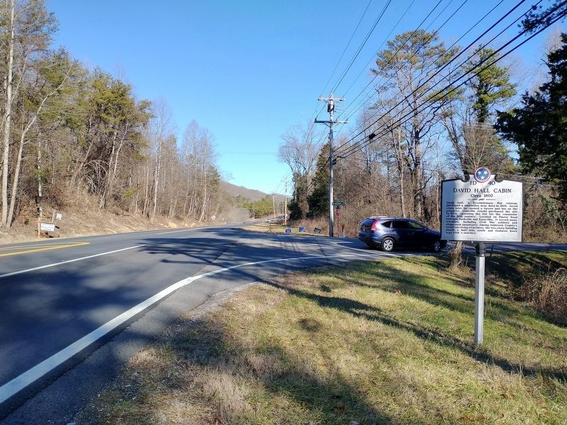
David Hall, a revolutionary War veteran, purchased a plantation near here in 1803. Seven years later he opened a tavern and inn on the property. Granville Arnold purchased the site in 1854, operating the inn for the remainder of the 19th century. . . . — — Map (db m165936) HM
Divided loyalties in Anderson County, as elsewhere in East Tennessee, often erupted in violence. It was commonplace for guerillas on both sides to raid farms and capture opposing sympathizers. In the county seat of Clinton, Confederates . . . — — Map (db m119021) HM
With the threat of war looming, Anderson County residents voted overwhelmingly against secession in 1861. When Confederate forces occupied East Tennessee and established a conscription center at nearby Clinton, Unionists slipped into Kentucky to . . . — — Map (db m112103) HM
On this knoll, members of the Federal party which attempted to destroy the Western & Atlantic R.R. in 1862, assembled before starting their foray. It started with seizure of the engine "General" and ended with recapture of the engine at the Georgia . . . — — Map (db m80317) HM
The Reserve Corps (Granger) moved south along this road, screened by the Army's Cavalry (D.S. Stanley). Taking Guy's Gap, against minor resistance, they pushed rapidly into Shelbyville, evacuated the same morning by the Corps of Maj. Gen. Leonidas . . . — — Map (db m26075) HM
In the cemetery north of the road are buried Confederate soldiers of the Army of Tennessee, who fell while opposing the advance of Rosecrans' Army of the Cumberland through Liberty Gap and Guy's Gap, in late June, 1863. Also buried here are soldiers . . . — — Map (db m25864) HM
(preface)
After the Battle of Stones River ended on January 2, 1863, Union Gen. William S. Rosecrans occupied Murfreesboro. Confederate Gen. Braxton Bragg withdrew south to the Highland Rim to protect the rail junction at Tullahoma, Bragg's . . . — — Map (db m85714) HM
Born in a house which stood here. Enlisted in the 1st Tenn. Volunteers for the Mexican War; on graduation from US Military Academy in 1853, commissioned in Dragoons. Resigning for the Confederacy and rapidly promoted to colonel, he was captured at . . . — — Map (db m207913) HM
In memory of the
"Shelbyville Rebels" Co. F.
41st Tenn. Reg't. C.S.A. and
all soldiers from Bedford
County who fought for the
Confederacy in the War
Between the States 1861-1865
Erected and affectionately dedicated
by the Agnes L. . . . — — Map (db m85555) WM
[Side A]
Shelbyville — “Little Boston”
Shelbyville, Tennessee, better known as “Little Boston,” was a hotbed of Unionist sentiment throughout the war. When William Rosecrans' Union army captured the town, they were welcomed as . . . — — Map (db m191662) HM
By
Sergeant Major Larry E. & Mrs. Sheila M. Williams, US Army / Retired
Commander Camp #72 (Manchester), Starnes DBE., TN Div., SCV
10 December 2011 — — Map (db m152097) WM
Hardee's Corps retired to the Wartrace-Fairfield defensive line, January, 1863. Here they remained until late June, when Rosecrans, moving the bulk of the Federal Army of the Cumberland around the right flank to Manchester, made Bragg withdraw from . . . — — Map (db m152093) HM
The Beechwood Plantation house, which formerly stood at this site, was an important Confederate headquarters during the Tullahoma Campaign. It was built for Col. Andrew Erwin, Jr. and family in 1826. The Erwins, who were southern sympathizers, . . . — — Map (db m25862) HM
In April 1862, Major James M. Shanklin with 197 men of the 42nd Indiana Infantry campedon the west bank of Wartrace Creek, near the end of Bridgeview Street, to secure the supply line of the Nashville & Chattanooga Railroad by guarding two bridges . . . — — Map (db m152103) HM
(side 1)
Anatomy of a Campaign
In late June of 1863, Union Major General William S. Rosecrans launched a massive offensive from his base in Murfreesboro in an attempt to drive Confederate General Braxton Bragg’s 43,000-man Army of . . . — — Map (db m152889) HM
During the Civil War, several engagements occurred along the strategically important Tennessee River within about five miles of here. In each one, cavalrymen engaged naval forces.
On April 26, 1863 near the mouth of the Duck River east of here, . . . — — Map (db m74512) HM
8½ miles east, at Johnsonville Landing, Forrest's Cavalry Corps, after blocking river approaches from both directions with captured Federal vessels and gunfire, destroyed the Federal base at Johnsonville. Losses were 4 gunboats, 14 steamboats, 17 . . . — — Map (db m237476) HM
U.D.C. Marker to eight Irish CSA soldiers
probably worked on railroad
1860-1861
Erected by
Captain Nathaniel A. Wesson
United Daughters of the Confederacy
1992 — — Map (db m109049) WM
Some of the lesser known battles and incidents of wars have afforded drama and have portrayed characteristics of the participants far beyond those of usual recorded history. Such was the Battle of Johnsonville, fought between Maj. Gen. N. B. . . . — — Map (db m146444) HM
In 1862 and 1863, Confederate cavalry raids along the Louisville & Nashville Railroad often shut down operations and slowed the flow of supplies into Nashville. The Union army built a supply depot at Johnsonville to help alleviate the disruptions. . . . — — Map (db m171324) HM
The logs for this cabin were taken from a barn owned by Mr. James Sykes of Eva. The barn was used by scouts for General Nathan Bedford Forrest during a reconnaissance of the Pilot Knob area on November 4, 1864. The lower story of the Syke's home . . . — — Map (db m171323) HM
Below the hill to your front and concealed by thick brush, Confederate troops under the command of Maj. Gen. Nathan Bedford Forrest constructed five artillery positions to deploy guns against the Union supply depot at Johnsonville. On November 3, . . . — — Map (db m146438) HM
By the fall of 1864, the Civil War was not going well for the Confederacy. The Union invasion of the Deep South continued to ravage both the military and civilian population of the war-torn region. In an attempt to halt the advance, Confederate Lt. . . . — — Map (db m146440) HM
(side 1)
Commemorating the capture
of Federal gunboats
by Forrest's cavalry in the
Johnsonville Expedition
November 4, 1864.
(side 2)
"Faith is the duty of the hour."
N.B. Forrest, Major-General
to . . . — — Map (db m146443) WM
Take Exit 133, State Route 191, and drive north to visit two state parks associated with the struggle to control the Tennessee River during the Civil War.
In 1861, the Confederates built Fort Donelson on the Cumberland River and Fort Henry . . . — — Map (db m96639) HM
Late in 1862, the Union army Gen. Ulysses S. Grant threatened Vicksburg, Mississippi. Confederate Gen. Braxton Bragg ordered Gen. Nathan Bedford Forrest to sever Grant's West Tennessee supply line, which extended from Columbus, Kentucky, via the . . . — — Map (db m118580) HM
On Aug. 29, 1862, the Army of Mississippi was enroute to Kentucky: Army Headquarters was near Dunlap; Col. Joseph Wheeler's Cavalry Brigade was moving against Maj. Gen. A McD. McCook's Federal Division at Altamont. Advance elements of Maj. Gen . . . — — Map (db m81360) HM
The Bledsoe County Courthouse in front of you stands on the site of the first courthouse, which was completed by 1821. During the Civil War, in August 1862, Confederate Gen. Braxton Bragg led his Army of Tennessee north from Chattanooga to invade . . . — — Map (db m177522) HM
Members of the Religious Society of Friends (Quakers) came to Blount County in the 1790s looking for a place to worship in peace. Hardworking and industrious, opposing war and slavery, they developed the land and founded the prosperous settlements . . . — — Map (db m81361) HM
During the antebellum period, Blount County supported abolitionism. In 1822, local Quakers and other residents formed an abolitionist society, and in the decades following, local clergymen preached against the evils of slavery. When the county . . . — — Map (db m69452) HM
Dr. Samuel Pride, first Worthy Master of the New Providence Masonic Lodge, built his house here. Maj. Gen. W. T. Sherman, enroute to the relief of Burnside at Knoxville, billeted himself here. From 1878 to 1900 it was the Friends’ Normal Institute. . . . — — Map (db m58509) HM
Maj. Gen. W. T. Sherman, U.S.A., arrived in Blount County with 25,000 men, Dec. 5, 1863, to relieve Gen. Ambrose Burnside besieged at Knoxville by Gen. James Longstreet. The 15th Corps camped around Maryville, the 11th around Louisville and the 4th . . . — — Map (db m58836) HM
Charleston, formerly Fort Cass during the “Trail of Tears” (Indian removal of 1838), was strategically important in the military struggle for East Tennessee. The East Tennessee and Georgia Railroad bridge here, the line’s only crossing . . . — — Map (db m69343) HM
John McPherson entered Cherokee territory as a miller and was an early settler in the Eureka Valley. In 1834 he was one of five founding members of Candies Creek Baptist Church. An active Unionist during the Civil War, he was imprisoned by the . . . — — Map (db m177951) HM
During the war, Henegar House’s occupants, as in many other Tennessee homes, were divided in their loyalties. Henry Benton Henegar, the owner, was a Unionist while his wife, Margaret Lea Henegar, was a secessionist. Whenever Confederates occupied . . . — — Map (db m69346) HM
After battles at Chattanooga in November 1863, and before the Atlanta Campaign the following May, southern Bradley County lay between Union and Confederate lines at Cleveland, Tennessee, and Dalton, Georgia. Both armies scouted the area. Soldiers . . . — — Map (db m115884) HM
When the Civil War began, Cleveland was a divided community with most residents being sympathetic to the Union. Confederate troops occupied the area in 1861 to control the East Tennessee and Georgia Railroad and to protect the vitally important . . . — — Map (db m69342) HM
South (front) face
CSA
1861
1865
To our known
and unknown
Confederate dead
East face
1861-1865
Erected by, the
Jefferson Davis Chapter
United Daughters
of the Confederacy,
1910.
West . . . — — Map (db m153676) WM
The Craigmiles House-Carmichael Annex was built before the Civil War and first served as the residence of Pleasant M. Craigmiles, his wife Caroline, and their children, Augusta, Walter, Fannie, Edward, and Frances Campbell. Sadly, only Augusta and . . . — — Map (db m184253) HM
First called City Cemetery, this is the resting place of both Confederate and Union soldiers. On November 4, 1862, a train wreck south of Cleveland killed 17 Confederate soldiers who are buried here in a mass grave. Nearby engagements in 1863 . . . — — Map (db m102186) HM
Masonic Lodge No. 134 and the town of Cleveland established the Masonic Female Institute in 1848 and opened the school in 1856. At the beginning of the war, student and diarist Myra Inman wrote of a disruption in the school's leadership: "Mr. . . . — — Map (db m153687) HM
After Union victories at Chattanooga in November 1863, the Union Army IV Corps's First Division, led by Gen. David S. Stanley, camped in this valley and made preparations for the Atlanta Campaign. By April 1864, more than 9,000 men were present, . . . — — Map (db m153744) HM
This monument is to perpetuate the memory of the Boys in Blue in the war of 1861-65 who have lived in Bradley County was dedicated by Oviatt Post No. 20 G. A. R. May 30 1914 — — Map (db m153743) WM
Tennessee’s mountain residents were bitterly divided about secession in 1861, although most were Unionist. In Huntsville (Exit 141), Scott County residents voted to secede and join Kentucky if Tennessee joined the Confederacy.
Confederate . . . — — Map (db m219059) HM
The Civil War in Campbell County was often personal. Few residents owned slaves, and a large majority – 1,094 to 60 – voted against secession in June 1861. Local men formed what became Co. A and Co. B, 1st Tennessee Infantry (US), at the . . . — — Map (db m119921) HM
Heth's Division, with the army's artillery and subsistence trains, passed into Kentucky through Walker's and Big Creek Gaps, while other combat elements of the Army of East Tennessee moved through Roger's Gap. The two columns reunited at . . . — — Map (db m121322) HM
The road in front of you winds through Big Creek Gap, one of the few natural openings through the Cumberland Mountains in the region. During the Civil War, this corridor was much narrower and steeper, and even lightly loaded wagons found travel . . . — — Map (db m74229) HM
(North side)
To honor the memory, the
patriotism, the deeds of valor
and sacrifices of Cannon County's
Confederate soldiers of the period
of 1861-1865
Erected by Cannon County Chap-
ter United Daughters of the
Confederacy . . . — — Map (db m177931) HM WM
Here Forrest, with his newly organized brigade of about 1400 cavalrymen, halted for a short rest before making his successful raid on Federal forces at Murfreesboro under Gen. T.L. Crittenden. He freed a number of hostages from this locality and . . . — — Map (db m76173) HM
Woodbury, located on the Murfreesboro-McMinnville Turnpike, experienced two significant Civil War actions in 1862–1863.
On July 12–13, 1862, when Confederate Col. Nathan Bedford Forrest marched through Cannon County to raid . . . — — Map (db m150449) HM
(preface)
Gen. Nathan Bedford Forrest led his cavalry brigade on a raid through West Tennessee, Dec 15, 1862-Jan 3, 1863, destroying railroads and severing Gen. Ulysses S. Grant’s supply line between Columbus, Kentucky, and Vicksburg, . . . — — Map (db m174179) HM
When the Civil War began, Carroll County residents were divided about equally between Union and Confederate sympathies and furnished a similar number of soldiers for each army. The well-to-do cotton growers residing in the prime land in the western . . . — — Map (db m179657) HM
Established in 1822, this cemetery contains the remains of soldiers from every major American war since the establishment of the state. Among those buried here are two from the War of 1812, three from the Mexican War, and thirty-eight from the Civil . . . — — Map (db m51407) HM
Although many West Tennessee residents favored secession, Unionism was strong in many areas, particularly in the counties near the Tennessee River. Two of the most notable Unionists lived on the south and north sides of Huntingdon.
Isaac R. . . . — — Map (db m179626) HM
Moving to McKenzie, Forrest's Brigade captured the 100 - man garrison. Here they spent Christmas Eve, while working parties completed destruction of 4 miles of trestles and bridge between the forks of the Obion River. Other parties completed . . . — — Map (db m52174) HM
Albert Gallatin Harris purchased this farm in 1829 and built the present house in 1857. After camping on the land during the Civil War, Union troops ransacked the farm, killing or stealing all the livestock. They did not burn the house because the . . . — — Map (db m74514) HM
(preface)
Gen. Nathan Bedford Forrest led his cavalry brigade on a raid through West Tennessee, Dec. 15, 1862-Jan. 3, 1863, destroying railroads and severing Gen. Ulysses S. Grant's supply line between Columbus, Kentucky, and Vicksburg, . . . — — Map (db m74532) HM
Forrest's Brigade, re-armed, and re-equipped with material and horses captured from the Federal storehouses which they had plundered, passed through here enroute to Lexington and their re-crossing of the Tennessee River at Clifton. — — Map (db m51406) HM
In Memory of Mary Patton who made the powder that fought the King’s M’T’N’ Battle placed by her great grand son. T.Y. Patton
Built in honor of all soldiers of Carter County in all the wars from the revolution down to this date, 1912, by . . . — — Map (db m135496) HM WM
At Valley Forge, Dan Ellis usually assembled for Federal regiments whom he guided over obscure mountain trails to Kentucky, while East Tennessee was under Confederate control. Born 1827 and a veteran of the Mexican War, he was subsequently Captain . . . — — Map (db m135595) HM
Although Tennessee voted to secede from the Union in June 1861, East Tennessee remained staunchly loyal. The residents of Carter County voted against secession, 1,343 to 86.
One of those residents, Admiral and General Samuel P. Carter (born . . . — — Map (db m135600) HM
Born in this house. After attending Washington College and Princeton, graduated from U.S. Naval Academy; serving in the Navy until May 1, 1862, he was appointed brigadier general, U.S. Volunteers. His most conspicuous service was a raid into East . . . — — Map (db m46749) HM
High grade magnetite iron ore was found at the base of Roan Mountain near Cranberry, NC after the War of 1812. A "bloomery", or iron smelter, was built at Cranberry in 1820 to process the ore and supply iron to the Confederacy during the Civil War. . . . — — Map (db m184266) HM
Pioneer settlers arrived in the area from No. & So. Carolina as early as 1808. Civil War soldiers camped here on their way to Clarksville & Nashville. The community was named when a post office opened in 1882. In 1883 the village had blacksmith . . . — — Map (db m151790) HM
In the year 1790, Benjamin Darrow began operating a cotton gin and grist mill along
Sycamore Creek, In 1835, on the site of the old Darrow Mill, Robert and Edward Cheatham
along with Samuel Watson erected a powder mill which operated until the . . . — — Map (db m151807) HM
In November 1863, Federal troops occupied Kingston Springs to serve as headquarters for the supervisors of the U.S. Military Railroad Construction Corps. They oversaw the construction of this section of the Nashville and Northwestern Railroad. When . . . — — Map (db m69365) HM
Prior to the Civil War, a rail line ran from Nashville to
Kingston Springs. After the federal seizure of Nashville
in 1862, work began to extend the line westward from
Kingston Springs to Johnsonville, providing another
supply line for the . . . — — Map (db m205515) HM
Between the Battle of Shiloh in April 1, 1862 until the end of the war, Confederate and Federal forces contested the control of key transportation lines near here. Union General Jeremiah S. Sullivan strove to drive Confederate cavalry under Gens. . . . — — Map (db m200462) HM
Attacking this place at dawn, the Confederate cavalry battalion of Maj. N.N. Cox killed one Federal soldier, captured three officers and 33 enlisted men of "B" Co., 49th Illinois Infantry, and dispersed the rest. They burned the railroad station and . . . — — Map (db m84787) HM
The three-year fight in present-day Chester County for control of the Mobile & Ohio Railroad often touched the lives of Henderson's residents. Henderson's Station, as it was called, served as a Confederate recruiting center for the 51st and 52nd . . . — — Map (db m155291) HM
At the time of the Civil War, Henderson was a stop on the Mobile and Ohio Railroad line. First called Dayton and later renamed Henderson Station, the village consisted of houses and stores in a line facing the tracks. After the fall of Fort Donelson . . . — — Map (db m148486) HM
The town of Henderson was begun on this street in 1860. First known as Dayton, the town's name was changed to Henderson Station during the Civil War. In 1860, Polk Bray opened the first store. Confederates led by A.B. Crook captured the railroad . . . — — Map (db m148495) HM
The Jacks Creek community was settled in the 1820s in Henderson (now Chester) County. It furnished men to the 13th Infantry, 18th Newsome's and 21st Wilson's Calvary units, C.S.A., and was the site of a skirmish 1 mi. N on Sept. 12, 1863, and an . . . — — Map (db m84789) HM
Cumberland Gap became the principal passage between the eastern and western theaters of operation in the Upper South during the war. Whichever side held the high ground here held the Gap.
In 1861, Confederate Gen. Felix K. Zollicoffer's men . . . — — Map (db m35761) HM
"If you come through this misery alive... I want you to do something for all those mountain people who have been shut out of the world all these years." These words of President Abraham Lincoln to General O. O. Howard in 1863 proved to be the . . . — — Map (db m35760) HM
Built about 1810, Greystone was the home of William Graham, Dr. James Fulkerson, Attorney James P. Kivett and his descendants. Site of Federal occupation during the Civil War. — — Map (db m151544) HM
During the Civil War, the residents of the eastern and Cumberland River sections of present-day Clay County (then part of Jackson and Overton Counties) were usually Confederate sympathizers, while those in the western section supported the Union. . . . — — Map (db m74297) HM
Capt. Jacob C. “Jake” Bennett, a native Kentuckian and noted Confederate partisan ranger, is buried in Donaldson Cemetery (four miles north of here). During the war, bushwhackers and guerrillas on both sides raided the sparsely populated . . . — — Map (db m112197) HM
In 1842, state senator Andrew Johnson, a resident of neighboring Greene County, purchased his first slave here in Parrottsville. Her name was Dolly, and she was fourteen. Her son claimed that she approached Johnson and asked him to buy her because . . . — — Map (db m92476) HM
During the Civil War, both Union and Confederate forces accused each other of committing atrocities against prisoners and civilians. The hanging of Peter Reece, a Unionist who lived near present day Harned Chapel United Methodist Church, illustrates . . . — — Map (db m87171) HM
Hoover's Gap, TN. June 24, 1863. The 18th Indiana Battery, commanded by Capt. Eli Lilly, dislodged one Confederate artillery piece and forced the Confederate batteries to change position. The battery, along with Wilder's Brigade, did considerable . . . — — Map (db m81374) HM
On June 24, 1863, Union forces under Rosecrans overpowered Confederate defenders on Hoover's Gap, commanded by Stewart, Bate, and Bushrod Johnson. This was the beginning of Bragg's withdrawal to Chattanooga. Unknown soldiers who fell in the battle . . . — — Map (db m26052) HM
Originally the site of a pioneer cemetery, many early residents are buried here. In 1866, returned Confederate soldiers, under the leadership of Maj. William Hume and David Lawrence, collected and reinterred here the bodies of soldiers who fell at . . . — — Map (db m24162) HM
(Front):General A.P. Stewart Stewart's Division 2nd Army Corps (Hardee) Army of Tennessee CSA Dedicated 24th Day of April 2010 By Benjamin F. Cheatham Camp 72 Sons of Confederate Veterans Manchester, Tennessee (Reverse):Battle of . . . — — Map (db m30698) HM
Forrest's Farewell Order to his Cavalry Corps ExtractGainesville, Ala., May 9, 1865 Civil war, such as you have passed through, naturally engenders feelings of animosity, hatred, and revenge. It is our duty to divest ourselves of all such feelings, . . . — — Map (db m30715) HM
Born in Washington, Feb. 16, 1840, where his father, Harvey Magee Watterson, was in Congress, he spent most of his boyhood in a house 100 ft. W. Subsequently Confederate soldier, journalist and political leader, he founded the Louisville . . . — — Map (db m81375) HM
From here, Maj. Gen. W.S. Rosecrans marched his reorganized army against Bragg's Army of Tennessee, in the Shelbyville-Wartrace-Tullahoma area. Fainting with his Reserve Corps and cavalry against Shelbyville, he drove through Hoover's Gap with his . . . — — Map (db m185615) HM
In Honor of the men of the Confederate 1st/3rd Kentucky
Calvalry (Consolidated) who first encountered the
onslaught of Wilder's Brigade, Thomas's Corps of the
Union Army, North of Hoover's Gap June 24, 1863 — — Map (db m166932) WM
Union Major General William S. Rosecrans' plan to reach Manchester and cut off a Confederate retreat to Chattanooga depended upon capturing Hoover's Gap. In the early afternoon of June 24, Colonel John T. Wilder and his brigade of 2000 mounted . . . — — Map (db m166843) HM
Spencer Repeating Rifle
The Civil War occurred during a period of technological revolution. In the 1850s, the US Army replaced its smoothbore weapons with the long-range rifle musket Then, just before the war, Christopher Spencer, a . . . — — Map (db m166844) HM
In late June of 1863, Union Major General William S. Rosecrans launched a massive offensive from his base in Murfreesboro in an attempt to drive Confederate General Braxton Bragg's 43,000-man Army of Tennessee from its entrenchments at Shelbyville . . . — — Map (db m180859) HM
During the nineteenth century, the Duck River was a valuable power source for factories and mills along its banks. With the outbreak of war in 1861, the Confederacy quickly established gunpowder mills to support the Southern war effort. The . . . — — Map (db m166935) HM
In late June of 1863, Union Major General William S. Rosecrans launched a massive offensive from his base in Murfreesboro in an attempt to drive Confederate General Braxton Bragg’s 43,000-man Army of Tennessee from its entrenchments at . . . — — Map (db m75354) HM
When Manchester was founded in the late 18th century, local lore has it that the town, named for Manchester, England, was destined to become an American version of this powerful industrial city. The Duck River falls, it was noted, would provide an . . . — — Map (db m75355) HM
(preface)
After the Battle of Stones River on January 2, 1863, Union Gen. William S. Rosecrans occupied Murfreesboro. Confederate Gen. Braxton Bragg withdrew south to the Highland Rim to protect the rail junction at Tullahoma, . . . — — Map (db m156117) HM
2639 entries matched your criteria. The first 100 are listed above. Next 100 ⊳