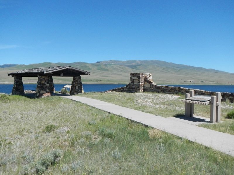
Few points along the route of the Lewis and Clark Expedition have the significance of this site, now beneath the waters of Clark Canyon Reservoir. Noted on their maps as "Fortunate Camp", the Lewis and Clark Expedition journeyed here hoping to . . . — — Map (db m124302) HM
By the time the Corps of Discovery passed through here, the "Valley of the Beaverhead" was already common ground for many Indian tribes. The Beaver's Head was a well-known landmark not only to the Shoshone but other Rocky Mountain tribes who passed . . . — — Map (db m193247) HM
Instruments for ascertaining, by celestial observations, the geography of the country through which you will pass, have been already provided. —President Thomas Jefferson
The data collected by Lewis and Clark is a striking indicator . . . — — Map (db m128183) HM
It was acquire many years ago in the mountains southwest of Dillon, MT. The tree could be as much as 500 years old. The Sheepeaters placed a mountain sheep skull in the crotch of a tree, and over a hundred years or more the tree grew around it. . . . — — Map (db m180689) HM
The Nez Perce camped near here on Horse Prairie Creek, Aug. 12 1877 following the Battle of the Big Hole Aug. 9-10. General Howard was summoned when beating drums arroused [sic] the citizens of Bannack. Women and children were quartered in the Meade . . . — — Map (db m49537) HM
In Commemoration of
Sacajawea
who guided Lewis and Clark through this
the land of her childhood and capture
On August 17th, 1805 she rejoined her tribe near this site. The services she rendered the expedition were invaluable. . . . — — Map (db m124293) HM
Pursued by the U.S. Army since June 1877, approximately 800 Nez Perce (nimi•pu•) men, women, and children traveled over the Bitterroot Mountains and camped here in the Big Hole Valley. Thinking there was no immediate pursuit by the Army, this . . . — — Map (db m123743) HM
From this vantage point you can visualize the general progress of the Battle of the Big Hole, but at a distance from the fear and chaos of its hand-to-hand combat. The landscape has changed little since the morning of August 9, 1877. This lush . . . — — Map (db m123741) HM
To the
everlasting
Memory of the
Brave Warriors of
Chief Joseph's Band
who fought on
these grounds
in the
Nez Perce War
of 1877
In Memory of
the Indians, Infants,
Children, Women
and Old Men
who . . . — — Map (db m123755) HM
(Three panels make up this informational marker:)
Natural Travel Corridor
Clark's 1806 Route
Captain Clark and his party found great quantities of camas just beginning to bloom when they passed here on Sunday July 6, 1806. . . . — — Map (db m123738) HM
In front of you on the morning of August 9, 1877, you would have seen soldiers and Montana volunteers pass by as they began to deploy for the coming attack on the Nez Perce encampment just through the trees.
Following the army's surprise attack, . . . — — Map (db m123745) HM
"In grateful recognition of the valor and sacrifice of the soldiers killed in action fought on these grounds, between the United States Forces under General George Crook and Sioux and Cheyenne Indians under Chief Crazy Horse. June 17, 1876. 3rd U.S. . . . — — Map (db m221578) HM WM
On August 10, 1983 a prairie fire swept over the battlefield, burning nearly 600 acres of dense, thick vegetation. In May and June of 1984 the National Park Service began an unprecedented systematic archeological survey of the Custer Battlefield. . . . — — Map (db m86810) HM
In memory of enlisted men 2nd and 7th U. S. Cavalry and 5th U. S, Infantry killed in action near Bear Paw, Montana September 30, 1877 < Left Side of Monument : > 7th U. S. Cavalry Troop A 1st Serg’t Geo. McDermott Serg’t Otto Derglew . . . — — Map (db m86873) HM
This monument was originally erected at Ft. Keogh in 1881 to honor U.S. Army casualties from the 1877 Nez Perce War. PLEASE NOTE: “Hostile Indians” is in historical context with a term used for Native American enemies of the United . . . — — Map (db m86865) HM
This position was held by Co. L commanded by Lt. James Calhoun. It may have been used to hold off Chief Gall and his Sioux warriors and thus protect Custer's advance. From here these soldiers could have attracted Capt. Benteen's column and the pack . . . — — Map (db m21643) HM
After separate skirmishing, Custer’s command reunites here. Company L, under Lt. James Calhoun, skirmishes with Gall, Crow King, Two Moons, and other warriors. From here these soldiers could have attracted Capt. Benteen’s column and the pack . . . — — Map (db m86838) HM
After the battle, Sioux and Cheyenne removed their dead and buried them in tipis, scaffolds, and adjacent hillsides in the Little Bighorn valley. Southern Cheyenne Chief “Ve’ho’enohnenehe” (Lame White Man) and Northern Cheyenne . . . — — Map (db m86860) HM
Plagued with the loss of the great buffalo herds, the confinement to reservations, disease, famine, and poverty, Chief Plenty Coups led the Crow people through a painful transition. Gifted with vision, the power of impressive speech, . . . — — Map (db m85999) HM
The white markers on the knolls and in the ravines to the west and southwest show were the troopers of Co, C under Capt. Tom Custer and Co. E under Lt. Smith were found. The Indian encampment lay beyond on the flat across the river. — — Map (db m21645) HM
From the Crow’s Nest, a vantage point 14 miles away in the Wolf Mountains, Custer’s Crow and Arikara scouts saw evidence of the massive Lakota, Cheyenne, and Arapaho encampment. Convinced that he was discovered, Custer abandoned plans for a . . . — — Map (db m86817) HM
After the brief encounter near the river, Custer’s two companies retreat up the ravine to your right known as Deep Coulee. The remainder of Custer’s command skirmishes with warriors on the high ridge ½ mile to your right. Seizing the . . . — — Map (db m86831) HM
Custer’s command deploys in the current national cemetery area and advances into the basin across the road to your left before withdrawing to Last Stand Hill. Toward the conclusion of the battle, soldiers from Company E moved toward the Deep . . . — — Map (db m86839) HM
Warriors ascend the large ravine behind you pursuing Custer’s troops. Soldiers retreat through the area to your front and right. Indians position themselves along the ridge to your left knows as Greasy Grass Ridge. Archeologists discovered numerous . . . — — Map (db m86834) HM
On June 25, 1876, approximately 7,000 Lakota, Cheyenne, and Arapaho, including 1,500 – 2,000 warriors, encamped below on the Greasy Grass River (Little Bighorn). Under the political and spiritual leadership of Tatanka-Iyotanka (Sitting Bull), . . . — — Map (db m86814) HM
An Indian memorial to honor Native American participation in the Battle of the Little Bighorn, June 25-26, 1876, and change the name of Custer Battlefield National Monument to Little Bighorn National Monument, was authorized by Congress in 1991 . . . — — Map (db m86804) HM
The Indian charge shatters the Calhoun defense and crashes through the soldier position at right, held by Capt. Myles Keogh’s Company I, Crazy Horse and White Bull cut down the retreating soldiers who flee northwest along this ridge in an effort to . . . — — Map (db m86811) HM
This knoll was contested by Indians and soldiers. Some evidence indicates soldiers of Company C occupied this position since bodies of Sergeants Finckle and Finley were found here. Indian testimony suggests that Southern Cheyenne war leader Lame . . . — — Map (db m86836) HM
This area was occupied by troops A, B, D, G, H, K, and M, 7th. U.S. Cavalry, and the pack train when they were besieged by the Sioux Indians June 25th and 26th 1876. — — Map (db m21636) HM
(Bottom of Marker):
In memory of
Officers and soldiers who fell near this place
fighting with the 7th United States Cavalry
against the Sioux Indians
on the 25th and 26th of June,
A.D. 1876
(The rest of the marker includes . . . — — Map (db m7022) HM
Arikara “I shall not see you (sun) go down behind the mountains tonight . . .I am going home today, not the way we came, but in spirit, home to my people.”- Bloody Knife, Arikara (June 25, 1876) “These Old Scouts, . . . — — Map (db m87723) HM
After leaving Cedar Coulee, Custer descends toward the Little Bighorn River in the ravine ahead known as Medicine Tail Coulee. Custer probably again divides his command: three companies likely ascend to the higher ridges beyond. Two companies . . . — — Map (db m86824) HM
As soldiers descend Medicine Tail Coulee, the Minniconjou and Cheyenne camps were on the western bank. Archeological evidence supports Indian testimony, that initial fighting took place on the flats near the river to your left and cutbank directly . . . — — Map (db m86827) HM
Following the battle, the Lakota and Cheyenne removed their dead and buried them in lodges, scaffolds, and the hillsides. Surviving members of the 7th Cavalry hastily buried the soldiers, Indian Scouts, and civilians on June 28, 1876. In 1877, . . . — — Map (db m86844) HM
Indian descendants of participants in the Battle of the Little Bighorn helped form the vision of the Indian Memorial. The “Peace Through Unity” theme was conceived by the late Enos Poor Bear, Sr. and Austin Two Moons. Together, they . . . — — Map (db m86806) HM
Under mounting pressure, Reno abandons the timber. His retreat disintegrates into a rout as pursuing warriors ride in amongst the troopers killing more than 30 soldiers. Indian casualties are few. Lakota and Cheyennes drive the cavalry across the . . . — — Map (db m86821) HM
After fording the Little Bighorn River one mile to your left, Reno’s battalion gallops down the valley below. Convinced he is vastly outnumbered, Reno dismounts, and forms a skirmish line across the valley floor, firing into the lodges. Warriors . . . — — Map (db m86819) HM
In an attempt to locate Custer, Company D under Captain Thomas Weir advances to this hilltop position without orders late on June 25. Weir may have witnessed the conclusion of the battle three miles ahead. He is later joined by Captain Benteen and . . . — — Map (db m86823) HM
This is the farthest point reached by Capt. Weir in his attempt to assist Custer. Minutes after arriving, his company was joined by Capt. Benteen's company and others. They remained about 45 minutes until mounting warrior pressure forced them back . . . — — Map (db m21640) HM
The hill in front of you was occupied by Lakota, and Cheyenne during the fight on Last Stand Hill. An unknown Sioux warrior wearing a warbonnet was killed here while firing his rifle at soldiers positioned behind a horse barricade on the crest of . . . — — Map (db m45593) HM
Where the Battle of Little Big Horn Began
June 25, 1876
(map of battlefield)
(showing Custer’s column, Reno’s column, Indian camp, Last Stand Hill)
Custer Battlefield Museum — — Map (db m98277) HM WM
The great plains of eastern Montana was home to thousands of
buffalo before Euro-American hunters nearly wiped them out in the
early 1800’s. The animals were central to the Indian lifeway. In the
dog days, hunters herded buffalo into corrals . . . — — Map (db m99063) HM
For the exhausted Nez Perce, this site, known to them as ćáynim?a•lika?spe (Place of Manure Fire), appeared to be a good place to rest before continuing to Canada. Then a large force of U.S. soldiers surprised them from the east. After . . . — — Map (db m142832) HM
Striking on the run, the U.S. Army planned to surprise and overwhelm the Nez Perce camp. Along this ridge Nez Perce warriors fought back fiercely and stopped the cavalry charge. The surprise attack was blunted, but the Nez Perce were pinned down, . . . — — Map (db m142866) HM
C'Aynnim 'Alikinwaaspa is the Nez Perce name for this site. It means "Place of the Manure Fire" because the Nez Perce used buffalo chips as fuel here.
On September 29, 1877, about 700 Nez Perce men, women and children camped in the basin . . . — — Map (db m142830) HM
With the fighting at a standoff, Hinmatóowyalahtq̓it (Chief Joseph) met with Colonel Miles near this site. Surrender was a survival strategy, to keep the Nez Perce people alive and together. One witness reported that Chief Joseph spoke . . . — — Map (db m142869) HM
These rolling hills and coulees are the site of the last battle of the 1877 Nez Perce War. For the Nez Perce this was the end of a 1,170-mile journey, after many successful skirmishes along the way. Canada was only 40 miles farther, its mountains . . . — — Map (db m142833) HM
About noon the families made camp. The scouts killed several buffalo. This place is ćáynim?a•lika?spe (Place of Manure Fire) .... Some warriors were on the buttes watching for enemies. We expected none. -- himi・n maqsmáqs . . . — — Map (db m142838) HM
This park links a series of widely separated sites of deep significance to the Nez Perce – historic villages, battlefields, and legend sites. The park experience involves a journey across both time and territory. Although firmly connected to . . . — — Map (db m142831) HM
This battle was fought September 30 to October 5, 1877, on Snake Creek, about 20 miles south of here near the Bears Paw Mountains, where after five days days' siege Chief Joseph, one of five remaining Nez Perce leaders, surrendered to Col. Nelson A. . . . — — Map (db m142800) HM
Fort Belknap Reservation was established in 1888 when Gros Ventres, Blackfeet, and River Crows ceded to the government 17,500,000 acres of their joint reservation that had covered all of northern Montana east of the Rocky Mountains. Home for the . . . — — Map (db m142915) HM
High points such as mountaintops and tabletop buttes are considered powerful and sacred areas by many Indian peoples. Snake Butte is one such location, often used as a place for the spiritual rite of vision questing. The individual vision quest is . . . — — Map (db m205818) HM
Jim Bridger arrived in Montana in 1822 as a member of a Rocky Mountain Fur Co. brigade. For years he had no more permanent home than a poker chip. He roamed the entire Rocky Mountain region and often came through this part of the country. A keen . . . — — Map (db m96630) HM
"The buffalo gone and freedom denied him, the Indian was visited by two equally hideous strangers, famine and tuberculosis. The could cope with neither. His pride broken he felt himself and outcast, a beggar in his own country. It was now that . . . — — Map (db m190094) HM WM
According to tradition, a band of Crow Indians left the main tribe and moved west into the foothills of the Beartooth Range many years ago. They painted their council tepee with red-clay and this old-time artistry resulted in the name Red Lodge. . . . — — Map (db m45247) HM
Medicine Rocks State Park was once a sea of sand dunes. About 61 million years ago during the Tertiary Era, a large freshwater river deposited fine-grained sands along its shores. From there, coastal winds blew the sand into dunes that eventually . . . — — Map (db m164323) HM
The Sioux aptly named Medicine Rocks Inyan-oka-la-ka, or "Rock with a Hole in It."
Evidence suggests the ancestors of modern-day American Indians lived and hunted in southeastern Montana beginning at the end of the last ice age, or about . . . — — Map (db m164326) HM
Barring fur trading posts, the first important white settlements in Montana were the mining camps in the western mountains.
Everything to the east belonged to the plains Indians and was buffalo range.
To protect the miners and settlers from . . . — — Map (db m101871) HM
"Come bring your lunch basket and you friends and have a good time," urged Montana newspapers in June 1897. The Fort Shaw Indian School's year-end exercises would begin at 1:00 p.m. with a band concert, followed by field games, recitations, and . . . — — Map (db m144021) HM
Fred C. Campbell became superintendent of the Fort Shaw Indian School in 1898. He was a progressive teacher and administrator skilled in public relations; and he quickly recognized the ability of the young women's basketball team. By 1902 he was . . . — — Map (db m143987) HM
The narrowleaf cottonwood, a tree "with a leaf like that of the wild cherry" was first described for modern science by Lewis on June 12, 1805. Other expedition first near Great Falls include documenting the cutthroat trout, thirteen-lined . . . — — Map (db m143875) HM
On July 3, 1984 this island was named in honor of Sacajawea, the Shoshoni Indian girl who accompanied the Lewis and Clark expedition from the Mandan villages to the Pacific Coast.
Sacajawea was born about 1788 in southwest Montana, At 12 years . . . — — Map (db m143877) HM
”…the men has to haul with all their Strength Wate & art, catching grass & knobes and Stones with their hands to give them more force in drawing on the Canoes & Loads, at every halt, those not employed in repairing the Course, are asleep . . . — — Map (db m126558) HM
Native American tribes followed the buffalo through this area and camped at Giant Springs. The temperature of the spring water stays a consistent 54 degrees all year long, making this a good site for winter camps.
Lewis and Clark Corps of . . . — — Map (db m127799) HM
When John Mullan built a wagon road across western Montana in 1860, he utilized a ford across the Sun River just a few yards west of here that had been used by the Indians for generations.
In 1862, the crossing was the site of a government . . . — — Map (db m101870) HM
Freight was unloaded at Cow Island when water dropped so low that steamboats could not travers the upper river to Fort Benton. For 130 miles the Cow Island Trail wound along the southern foothills of the Bear's Paw to the junction at Big Sandy then . . . — — Map (db m142562) HM
Gaze out over the lands around you and imagine them filled with 2,000 tidies and 15,000 Indians-it has happened at least twice. Here, enormous gatherings were called to negotiate treaties that transformed relations between Indian tribes and opened . . . — — Map (db m161905) HM
On September 21, 1877, Fort Benton commander Major Guido Ilges got word that the Nimíipuu (Nez Perce) had traveled across the Judith Basin headed for Canada. Thirteen members of Company F, Seventh Infantry Regiment and to civilians volunteers . . . — — Map (db m161479) HM
In September 1877 the Nez Perce traveled across the Judith Basin headed for Canada. In anticipation of trouble, Major Ilges (commandant at Fort Benton) organized a party of fifty volunteers, mostly Fort Benton's Irish Fenians. They loaded the . . . — — Map (db m142215) HM
You stand now on the ancestral homeland of nomadic native tribes whose territories overlapped in the Missouri River area-all of them drawn by the rich diversity of life sustained by the river itself. Blackfeet, Gros Ventre, Sioux and Assiniboine all . . . — — Map (db m161481) HM
In 1889 Evelyn Cameron (1886-1928) and husband, Ewen came from England and a privileged life to settle on various ranches near Terry, Montana. Evelyn documented life in eastern Montana both in her diaries and in her photographs. She . . . — — Map (db m163969) HM
This is the river that exuberant parties claim is a mile wide, an inch deep, and runs up hill. The statement is exaggerated. Captain Clark, of the Lewis and Clark Expedition, named it the Redstone in 1806 and afterwards found out that the Indians . . . — — Map (db m155578) HM
The modern day horse found its way to the Americas on Spanish ships around 1680, landing on Mexican shores. Some horses escaped the Conquistadors, and Native Americans quickly discovered the utility of the horse. The Plains Indians became experts at . . . — — Map (db m163882) HM
This ancient trail extended from the Yellowstone River past this point to the Wood Mountains in southwestern Saskatchewan. It was used for generations by the Sioux and Assiniboine Indians in pursuit of buffalo and for trade with the Canadian tribes . . . — — Map (db m202831) HM
"On our return we shal probably pass down the yellow stone river, which from Indian informations, waters one of the fairest portions of this continent." — Captain Meriwether Lewis, letter to President Thomas Jefferson, dated April . . . — — Map (db m202998) HM
Horses, Canoes and Bull Boats Clark and his party traveled by horse along the north side of the Yellowstone River until July 24, when nine members began a float in two lashed-together canoes built from cottonwoods they found along the river. . . . — — Map (db m202999) HM
A yachting party consisting of Capt. Wm. Clark, of the Lewis and Clark Expedition, six of his men, Sacajawea and her child flood by here August 1, 1806, navigating a craft made by lashing together two hollowed-out cottonwood logs. It was Clark's . . . — — Map (db m163815) HM
July 28, 1806 "Set out this morning at day light and proceeded on glideing down this Smooth Stream passing maney Isld...." July 29, 1806 "in the fore part of the day, I saw great numbers of Buffalow on the banks, … great . . . — — Map (db m203054) HM
In the 1870s, ranchers and prospectors looking for gold in the Judith Mountains clamored for military protection as they settled a region recently controlled by the Blackfeet. In response, the federal government constructed Fort Maginnis in 1880. . . . — — Map (db m143506) HM
In 1879, Metis—people of French and Chippewa-Cree descent—homesteaded in this area, near the army’s Camp Lewis. Many street names memorialize these settlers, who included Francis A. Janeaux and Paul Morase. But open range cattle . . . — — Map (db m143419) HM
Fort Maginnis, the last army post created in Montana, was built about 8 miles north of here in 1880. This country was great buffalo range before that time, but cattlemen were bringing in stock from the western valleys and the Texas longhorns were . . . — — Map (db m92697) HM
Lewistown’s first Catholic church was a small frame structure built in 1888. Visiting priests from distant St. Peter’s Mission, Great Falls, and Fort Benton celebrated mass for the French-Canadian, Indian, and settler congregations. The first . . . — — Map (db m143456) HM
Three panels make up this marker.
(panel 1:)
For thousands of years the fertile Wallowa Valley was home to many Nimiipuu, or Nez Perce people. A treaty in 1855 affirmed Nez Perce ownership of this homeland. Competition for . . . — — Map (db m143628) HM
The Flathead River enters the valley through Bad Rock Canyon. Old-timers aver that a Blackfeet war party from the plains surged over the divide years ago seething with ambition to corral a choice assortment of cayuses and maybe a scalp or two . . . — — Map (db m102214) HM
Marcus D. Baldwin came to Montana from Ohio in 1885, appointed by President Cleveland as superintendent to the Blackfoot, Blood, and Piegan bands of the Blackfeet tribe in northwestern Montana. Baldwin brought his wife, Sarah, and their two small . . . — — Map (db m160426) HM
Hudson Bay Company (HBC) agent Joseph Howse built a trading post just north of here in 1810, the first European settlement in the valley north of Flathead Lake. Described as “adventurous, tough, and intelligent,” Howse joined the . . . — — Map (db m127682) HM
Sacajawea, the Shoshone woman who guided portions of the Lewis and Clark Expedition led Captain Wm. Clark and his party of ten men over an old buffalo road through this pass on July 15, 1806. They were eastward bound and planned to explore the . . . — — Map (db m162423) HM
For centuries distant and diverse tribes visited the Gallatin Valley to hunt. They stampeded buffalo over cliffs during the "dog days" before the acquisition of horses and guns. They hunted animals for food, clothing and shelter. They also mined . . . — — Map (db m29075) HM
Conflicts along the Bozeman Trail between Lakota, Northern Cheyenne, and Arapaho Indians and settlers escalated with the establishment of forts along the route in 1866. After Indians killed John Bozeman, in the Yellowstone Valley in 1867, the . . . — — Map (db m29079) HM
An abundance of beaver encouraged Corps of Discovery members John Colter and John Potts to return to the headwaters. In 1808, Blackfeet Indians killed Potts in a confrontation and stripped Colter bare, giving him a chance to run for his life. In one . . . — — Map (db m29077) HM
One of Montana’s most amazing historical events occurred near here in 1809. In
September of that year, John Colter and John Potts, former Lewis and Clark Expedition
members, were trapping beaver on the Jefferson River near the headwaters when a . . . — — Map (db m98317) HM
The Headwaters Region was the setting for the legend of
Colter’s Run
1808
In the fall of 1808 John Colter and John Potts,
both former members of the Lewis and Clark
Expedition, were trapping on the Jefferson
River. Angered by previous . . . — — Map (db m98438) HM
The Headwater's Region was the setting for the legend of ... Colter's Run 1808
In the fall of 1808 John Colter and John Potts, both former members of the Lewis and Clark Expedition, were trapping up the Jefferson River. Angered . . . — — Map (db m192790) HM
In Patriotic Memory of
Sacajawea
an Indian woman whose heroic courage
steadfast devotion and splendid loyalty
in acting as guide across the Rocky Mountains
made it possible for the
Lewis and Clark Expedition
1804 - . . . — — Map (db m98495) HM
You are standing at the headwaters of the great Missouri River. The Jefferson and Madison Rivers converge with the Gallatin joining one mile downstream to become the Missouri River. Here, the famed explorers accomplished a major goal of their . . . — — Map (db m73542) HM
212 entries matched your criteria. The first 100 are listed above. Next 100 ⊳