Home of roving Indians until 1862. The exploring party of Nicollet, scientist, and Fremont,
‘Pathfinder of the West,’ visited Oakwood Lakes July 1838, leaving the first reliable record.
The region East of the Big Sioux was ceded by the Santee . . . — — Map (db m181268) HM
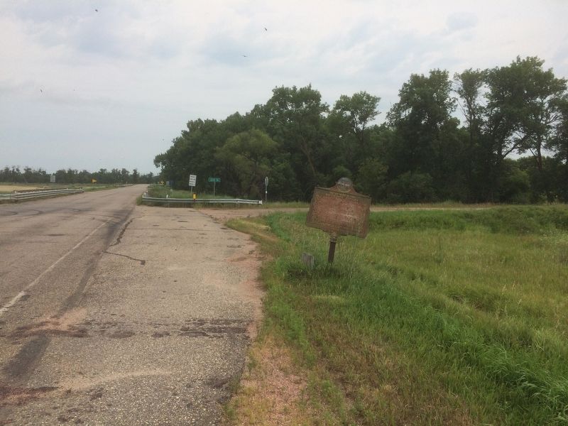
The Dakota Land Company of St. Paul, hoping to make this site the capital of a proposed
Dakota Territory, started a town here, naming it for Samuel Medary, Governor of Minnesota
Territory. Towns were also begun at Flandreau and Sioux Falls, the . . . — — Map (db m179957) HM
Legend of the Separation of the Lakes
See the narrow waterway between two peninsulas? How do you think it was formed?
A poem written by Professor A.B. Crane offers one explanation. He tells of an American Indian chief who pledged his . . . — — Map (db m179792) HM
The mounds found in Oakwood Lakes are typical of numerous such mounds in eastern South Dakota. Ten mounds have been located at Oakwood lakes and have been dated about A. D. 300 to A.D. 1400. Probably the remanents of late Woodland or Middle Missouri . . . — — Map (db m179695) HM
Breastworks
Probably built by two companies of the 2nd Infantry, under command of Capt. D. Davidson, in June-July, 1859. Parapets were then about 5 ft. high. A log house once stood in the center, but was razed long ago for firewood. Cannon . . . — — Map (db m179795) HM
Millennium ago, migrating bison herds grazed the tall grass. Ducks, geese and other birds nested in the sloughs, and fish were found in abundance in the lakes and streams in this area known as the Coteau des Prairies.
With all this . . . — — Map (db m179698) HM
C. Z. Sutton came to the Oakwood Village in 1872 and in 1878 built a home on this site. It was dug into the hill so that the back and much of the sides were dirt. The front was field rock with mortar made himself by burning local limestone. The roof . . . — — Map (db m179935) HM
Each leaf on a green ash has 5 to 9 leaflets growing on 8 to 12 inch stems. During fall and winter months, clusters of seeds remain on female ash trees. Note the seed's shape. Indians were inspired to use ash wood for canoe paddles because of the . . . — — Map (db m237244) HM
The Oakwood Lakes chain was formed more than 10,000 years ago when melting glaciers filled depressions scooped from the earth's surface. The eight lakes, fertile lands and native woods attracted prehistoric Indians. Burial mounds in the park are . . . — — Map (db m237234) HM
There are a number of large cottonwood trees along the west shore of the island. These shallow-rooted giants are exceptionally fast growing and require lots of water. It is one of the most common trees growing along the watercourses and lakeshores . . . — — Map (db m237247) HM
At the edge of the slough behind this post you can see the reddish stems of the dogwood. Notice the white, pea-sized berries. The inner bark of dogwood was used in a mixture with tobacco and called kinnikinnick. Indians favored this in their . . . — — Map (db m237241) HM
This cluster of shrubs is comprised of gooseberries. The plant is easily recognized by the sharp, half-inch spines on its stems. Songbirds seek out the ripe berries for food. Indians used the fruit, which ripens to a deep red in the fall, to flavor . . . — — Map (db m237239) HM
Here at the southeastern tip of Scout Island, exposure to wind and waves has washed soil away from the roots of trees and shrubs. The eroded soil settles to the bottom of the lake, eventually filling it in. The same thing that happens when dirt from . . . — — Map (db m237243) HM
You are about to enter
Brookings County
home of roving Indians until 1862. The exploring party of Nicollet, scientist, and Fremont, "Pathfinder of the West," visited Oakwood Lakes, July 1838, leaving the first reliable record.
The . . . — — Map (db m181265) HM
The region between Lake Poinsett and Oakwood Lakes was a summer hunting area for the Sioux for over one hundred years. The Sioux who frequented the area used various names for the different features in this area.
* Oakwood Lakes was . . . — — Map (db m238363) HM
Oakwood Lakes, called by the Sioux, Te-tonka-ha, meaning the place of the Great Summer Lodge, lie in a scenic state park 7 miles N and 3 W. First visitors of record were Nicollet & Fremont. July 8, 1838.
During the Indian Disturbances of . . . — — Map (db m179802) HM
Lake Hendricks State Park
This lake was named for Thomas A. Hendricks (1819-1885), Commissioner of the General Land Office, 1855-59, at which time the state boundary was surveyed and the lake named. Hendricks was a Member of Congress, 1851-55; . . . — — Map (db m184234) HM
Oakwood post, established in 1835 by Major Joseph R. Brown for the American Fur Company, was an early trading post in Brown County. French explorers called it “place of the scrub oaks,” a landmark used by Indians and Whites alike. Pierre Le . . . — — Map (db m187060) HM
"Standing at a crossroads, Dignity echoes the interaction of earth, sky, and people. She brings to light the beauty and promise of the indigenous peoples and cultures that still thrive on this land. My intent is to have the sculpture stand as an . . . — — Map (db m124343) HM
In the 1930's St. Joseph's Indian School opened the Divine Infant Home on this site. The Divine Infant Home provided care for young infants and preschoolers when no other care was available.
The former Divine Infant Home was also a part of the . . . — — Map (db m242610) HM
Fr. Henry Hogebach – Founder
Fr. Henry Hogebach, SCJ, founded St. Joseph's Indian School in 1927. He devoted his life to the care and education of Native American children. His vision, patience and perseverance remains alive in our ongoing . . . — — Map (db m242611) HM
Norm and Eunabel McKie of Rapid City, South Dakota, announced their gift of Dignity to the State of South Dakota in 2014, in honor of the 125th anniversary of South Dakota statehood.
The statue was erected in September 2016 at this site, where it . . . — — Map (db m183903) HM
In memory of the Dakota whose lives were taken at Fort Thompson in 1863, these were the innocent exiled from Minnesota, who suffered hardship and sickness at this camp.
The stone that stands here, reminds us of the land from which you came. . . . — — Map (db m185463) HM WM
A Crow Creek Sioux dancer at a powwow.
Courtesy of South Dakota Public Broadcasting
The Crow Creek Reservation began in a tragic story of hardship. The Uprising, or the U.S. – Dakota War, started in 1862 when starving Dakota . . . — — Map (db m242476) HM
Dancers at a Lower Brule Sioux powwow.
Courtesy of Central Dakota Times, Debi Ruiz
For thousands of years, ancestors of the Kul Wicasa Oyate, members of the Lakota band known as the Sicangu (burnt or scorched thigh), . . . — — Map (db m242478) HM
Indigenous peoples throughout the West have used medicine wheels of many forms. For thousands of years, Native peoples have used this wheel pattern for health and healing.
The Spirit of the Circle Monument honors and remembers . . . — — Map (db m242477) HM
[marker on south side of cabin] This cabin, built in 1876 of logs split & transported by Spaulding from the Black Hills, was the first home on the Redwater & what became Butte County. An experienced scout, familiar with the . . . — — Map (db m234772) HM
From this location you are able to view the “Beautiful Forks” of the Redwater River as it runs into the Belle Fourche River as named by French explorers as they passed through the area over 200 years ago. Of course, “Belle Fourche” (pronounced . . . — — Map (db m234799) HM
Lewis and Clark and the Legend of Stone Idol Creek
On their epic exploratory expedition Meriwether Lewis and William Clark stopped near here and noted two stones resembling human figures, and third like a dog. Capt. Clark writes on Oct. . . . — — Map (db m112085) HM
Lewis and Clark
The Lewis and Clark Expedition, officially the Corps of Discovery, was in what is now South Dakota from August 21 to October 14, 1804 and from August 21 to September 4, 1806.
While here they would make numerous . . . — — Map (db m187079) HM
This monument commemorates the Yankton Sioux Treaty of 1858.
As increasing numbers of settlers came upriver, the Yankton Sioux had to decide whether to join other Sioux tribes in armed resistance or to co-exist with the immigrants. They . . . — — Map (db m217461) HM
In memory of the Yankton Chiefs, who made the Treaty of 1858.
Struck by the Ree ·
Black Bear ·
Medicine Cow ·
White Swan ·
Pretty Boy ·
Feather in the Ear ·
Crazy Bull ·
Frank Deloria
Sioux
Delegates who signed the . . . — — Map (db m217464) HM
Making a hide tipi cover was a community project. The women would get together to make a cover, which was made by piecing together the hides of multiple animals, usually buffalo.
It required 18 tanned buffalo hides to make the average tipi. . . . — — Map (db m187547) HM
"You have noticed that everything an Indian does is in a circle, and that is because the power of the world always works in circles, and everything tries to be round. . . . The sky is round, and I have heard that the earth is round . . . — — Map (db m187544) HM
To the Native American tribes of the Great Plains, the buffalo was sacred. They depended on the buffalo for their survival and used nearly every part of the animal. They felt a strong sense of kinship with the animal that kept them warm, . . . — — Map (db m187548) HM
Living under a vast blanket of stars above the Great Plains, Native Americans had an interest in the stars. Stars are believed to be Woniya of Wakan Tanka, "the holy breath of the Great Spirit." Constellations in the night sky . . . — — Map (db m187545) HM
Few dwellings stir the imagination like the tipi. Used by nearly all Native American tribes of the Great Plains, this practical, moveable, one-room home was ideal for seminomadic tribes that followed buffalo herds across the prairie.
Inside . . . — — Map (db m187543) HM
Tipis were the exclusive responsibility of women among Great Plains tribes. They worked together to set them up and take them down, make hide covers, cut poles, and pack and transport the tipis and their contents.
After the arrival of the . . . — — Map (db m187546) HM
The Omaha and Ponca
The Omaha and Ponca tribes were once a single people closely related to the Osage, Kansa and Quapaw tribes of the lower Missouri and Mississippi River valleys. The ancestoral Omaha-Ponca people migrated from that region . . . — — Map (db m234981) HM
Basin
Many thousands of years ago a great continental ice sheet advancing from the northeast onto the northern plains blocked or reversed the flow of all rivers it came into contact with. The result of this titanic natural force was the . . . — — Map (db m234980) HM
Change came slowly to Spirit Mound after 1804. For 55 years the area remained the land of the Yankton Sioux, with fur traders conducting business from posts on the Missouri. The tallgrass prairie continued to thrive as it had for thousands of years . . . — — Map (db m194632) HM
Lewis and Clark
The Lewis and Clark Expedition, officially the Corps of Discovery, was in what is now South Dakota from August 21 to October 14, 1804 and from August 21 to September 4, 1806.
While here they would make numerous . . . — — Map (db m187536) HM
On the hot day of August 25, 1804, captains Lewis and Clark and several of their men walked from the river to explore Spirit Mound. They had heard that little people with deadly arrows inhabited the mound. Although they did not find little people, . . . — — Map (db m194633) HM
The confluence of the Missouri and Vermillion rivers provided an ideal location for camping, farming, and settling for generations. Yankton Sioux camped below the bluffs in the winter for protection from the harsh winds and moved to the bluffs in . . . — — Map (db m179288) HM
This trail leads to the summit of Spirit Mound, a sacred site for several Plains Indian tribes. Some tribal members make pilgrimages to Spirit Mound, say prayers on top, and leave offerings. As you approach and walk to the top, please do so . . . — — Map (db m39700) HM
Spirit Mound was a sacred place to area tribes long before the first settlers arrived here from the east. To the Yankton Sioux, Omaha, Otoes, and other tribes, this was the "mountain of little people."
Indians believed it was "bad medicine" . . . — — Map (db m222055) HM
During the Moon of the Harvest (August) in 1773 a band of Sioux were camped on the shore of this lake. We-Wa-Ke, fairest maiden in the camp had given her heart to a brave young warrior, Big Eagle, whose courage on the hunt and in battle far . . . — — Map (db m180984) HM
In the summer of 1823, two of the first battles between Indians and Whites in South Dakota took place as a result of the desire for revenge. The conflicts began when the Arikara (Sahnish), living along the Missouri River at the time, blamed . . . — — Map (db m113317) HM
Welcome to the Standing Rock National Native American Scenic Byway, an 86 mile route which follows a stretch of highway that climbs up and down the stunning Missouri River breaks and runs past buffalo herds and eagle's nests. History comes . . . — — Map (db m113315) HM
Sakakawea won her place in history as the indomitable guide of Lewis and Clark on their trip to the Pacific in 1805. She was a member of the Shoshoni tribe dwelling near the Big Horn mountains in Montana. In one of the frequent tribal conflicts she . . . — — Map (db m190173) HM
Sitting Bull was born on the Grand River a few miles west of Mobridge. His tragic end came at the very place he was born. He was shot when being arrested because of his alleged involvement with the Ghost Dance craze.
Sitting Bull was . . . — — Map (db m127088) HM
"This village is built upon an open prairie, and the gracefully undulating hills the rise in the distance behind it are everywhere covered with a verdant green turf, without a tree or a bush anywhere to be seen. This view was taken from the . . . — — Map (db m113316) HM
Although extensive trade networks were always part of the economies of the indigenous Tribes in North America, the trade in furs between Native peoples and European traders emerged as the major tribal industry on the Missouri River from the . . . — — Map (db m113318) HM
Between 1874-1876, thousands of citizens illegally entered the Black Hills in search of gold. Every gold panner, newspaper article, and frontier story told of great wealth and encouraged the onslaught of the region.
The military made vain efforts . . . — — Map (db m121400) HM
Cultural conflicts erupted across the western Great Plains during the 1860s. Expanding railroads and frontier posts located in traditional hunting grounds impacted the various tribes in the northern plains. Restrictions on westward settlement . . . — — Map (db m121397) HM
An economic crash in 1873 affected the entire nation. The government, pressured to boost the economy, needed to explore new land. Open land for settlement and rich resources would create markets and new jobs.
George A. Custer and his . . . — — Map (db m121398) HM
The Crazy Horse mountain carving will be the world’s largest sculpture, measuring 563 feet high by 641 feet long, carved in the round. The nine-story-high face of Crazy Horse was completed on June 3, 1998. Work began on the 22-story-high horse’s . . . — — Map (db m155650) HM
Spurred by rumors of gold, many prospector groups attempted to enter the Black Hills in the 1870s. Without regard to the Fort Laramie Treaty, they planned to enter the region and exploit the untapped wealth.
A group of 28 people headed west from . . . — — Map (db m121399) HM
Between 350 and 500 bison roam the grasslands of the national park — a token of the herds numbering 30 to 60 million that once inhabited the prairies of North America. The American bison, commonly called buffalo, became nearly extinct as settlers . . . — — Map (db m234632) HM
Few images evoke the mobile nature of the Plains Indians life like the tipi. Crafted from what the land would yield — a few young trees, bison hides, and wooden stakes for anchoring — the tipi provided a sturdy yet portable home for families that . . . — — Map (db m234631) HM
This tree, regarded as "medicine" by the Indians, a scrawny hackberry, growing out of a rock, near Bois Cache Creek, soon to be lost to rising waters of Oahe Lake, on April 12, 1863 was rescued in a joint enterprise of the S. D. Dept. of History and . . . — — Map (db m180131) HM
This sculpture depicts a bird atop a person and is meant to show a co-existence of man, animals, and societal or physical environment. Other visual forms that appear bring a message of reconciliation with nature.
Oscar Howe, the eminent Yanktonai . . . — — Map (db m124207) HM
Indians from the Lake Region now Northeastern South Dakota visited this area frequently in the early 1800's and white traders also traveled this way while buying furs. The government survey party of Horace J. Austin arrived June 21, 1879, and began . . . — — Map (db m197685) HM
Chief Bluedog was an active participant in the 1862 Dakota-United States War in Minnesota. After the Dakota were removed by an act of Congress in 1863 he led the Tiospaye first to Canada and then here to the Lake Traverse Reservation after the . . . — — Map (db m239968) HM
The prairie has been changing for millions of years. Grasses have grown, soil has built up, rocks have eroded, and hillsides have fallen. Rain has been followed by drought, until the rain has returned. Fire would turn the land black, but soon . . . — — Map (db m125352) HM
Following the 1862 Minnesota Indian Uprising where nearly 600 men, women, and children were killed, the United States Army at Fort Wadsworth recruited friendly Indians as scouts to restrict the hostile Indians from white settlements. A half-breed, . . . — — Map (db m179955) HM
Founded in 1881 and named for J.P. Webster who homesteaded the townsite. Railroad supply point for Fort Sisseton (Fort Wadsworth) frontier outpost established 20 miles north in 1864. Gateway to
Northeastern South Dakota Lake Region whose abundance . . . — — Map (db m179947) HM
Due east of these rest areas, the valley land looks much as it did before the pioneers came to this country. This area is part of the drainage of Hidewood Creek, located one-and one-half miles south of here. Hidewood's name comes from the prairie . . . — — Map (db m92068) HM
Due east of these rest areas, the valley land looks much as it did before the pioneers came to this country. This area is part of the drainage of Hidewood Creek, located one-and one-half miles south of here. Hidewood's name comes from the prairie . . . — — Map (db m100894) HM
Leader of the Fool Soldiers, Martin Charger established a permanent camp here midway between the Cheyenne and Moreau rivers on the west bank of the Missouri River. In October 1804 the Lewis and Clark Expedition encamped just to the west of this . . . — — Map (db m235419) HM
Found near Mobridge, the impression was tediously incised by some old Indian intent on building himself up as a medicine man. Once formed it was a symbol of great power and was venerated by the Indians who believed it the work of the "Wakan" or . . . — — Map (db m179940) HM
According to tradition, American Indians were stricken with an epidemic known as “fell disease” about the middle of the 16th century that threatened to obliterate the tribes. A messenger arrived from the Great West with news of a . . . — — Map (db m124081) HM
(side 1)
The site of Hot Springs was occupied before white men ever came to the area by tribal peoples for the “curative” benefits of the mineral springs. The constant 97-98 degree waters became the basis for the thriving . . . — — Map (db m124000) HM
In 1877 some Sisseton Christian Indians sponsored by the Presbyterian Mission, with Daniel Renville as native pastor, decided to take homesteads near Yellowbank Creek north of this point. That year they erected their church, the first in Grant . . . — — Map (db m197527) HM
You are entering
Roberts County
South Dakota
Long the home of Sisseton, Wahpeton & Cuthead Yanktonaise Sioux, it became part of Deuel & Cheyenne Counties in 1862; Deuel extending N to 46th parallel (4 miles N) in 1872. The Reservation . . . — — Map (db m197534) HM
In 1880, the 25th Infantry—one of four U.S. Army regiments of African Americans—were headquartered at Fort Randall. Members of the regimental headquarters staff, regimental band, and three companies remained here for nearly three years.
Native . . . — — Map (db m188321) HM
"The life my people want is a life of freedom.... Is it wrong for me to love my own? Is it wicked for me because my skin is red? Because I am Sioux? Because I was born where my father lived? Because I would die for my people and my . . . — — Map (db m188322) HM
In the mid-1800s, the United States had a growing appetite for land and natural resources. Wanting to expand across the continent, Congress passed the Donation Land Claim Act in 1850, offering free land to encourage settlement in the Oregon . . . — — Map (db m188301) HM
1/2 mile west this old trail went up the steep canyon.
This famous Old Spotted Tail Trail was used by both chiefs
Sitting Bull and Hump traveled this road to Rosebud and back.
Original wagon wheel ruts can still be seen after 100+ years. . . . — — Map (db m168897) HM
The Civilian Conservation Corps was a federal relief program during 1933-1942 that gave jobless men work renovating abused lands. The Army built 48
200-man camps in South Dakota and provided
food, clothing, medical care,
pay and programs . . . — — Map (db m202576) HM
U.S. Highway 85 Regina, Canada – El Paso, Texas 1588 miles through five states South Belle Fourche • 78 Deadwood • 103 North State Line • 80 Williston, N.D. • 219 Probably the first white men to traverse this area were Wilson Price Hunt and his . . . — — Map (db m231200) HM
Crow Buttes, located in Harding County, was the scene of a bizarre battle between the Crow and Sioux Indians in the summer of 1822. Sioux men ravaged a Crow camp, destroying it and raping the squaws. Warfare ensued, Crow warriors left their women . . . — — Map (db m231199) HM
Lewis and Clark's stay in this area has been described as a "tense three days." The days with the Teton Sioux were filled with long periods of friendly visiting and good company but were also punctuated by isolated moments of trouble and . . . — — Map (db m223796) HM
On the Bluff, a quarter of a mile North, ancient Indians, pre-dating the Aricara, built a fortress or strong point, involving an exterior perimeter of over 2,000 yards, enclosing about 50 acres, and with bastions, at intervals all along its . . . — — Map (db m220068) HM
People have made this area their home for over 10,000 years. In the Paleolithic period, hunters crossed the region hunting ice-age bison and mammoths. Over time, other animals were added to the menu, wild plants became an important food source, and . . . — — Map (db m225023) HM
The expedition passed Régis Loisel's abandoned trading post east of here on Sept. 22, 1804. Around the cedar fort, they saw Indian "lodges" and fallen cottonwoods, a sign that horses had been feeding on the bark. The next day, three Teton Sioux boys . . . — — Map (db m224669) HM
Welcome to Griffin Park! Griffin Park is located next to the Great Missouri, on which Meriwether Lewis and William Clark traveled during their Journey to the Pacific Ocean. Lewis and Clark's travels through this area have been considered as one of . . . — — Map (db m124870) HM
The Lewis and Clark Expedition, officially the Corps of Discovery, was in what is now South Dakota from August 21 to October 14, 1804 and from August 21 to September 4, 1806.
While here they would make numerous discoveries of animals, plants, . . . — — Map (db m124871) HM
This portion of the Missouri River Valley has sparked the interest of archaeologists since 1895. Prehistoric sites along the river were excavated, mapped, recorded, and preserved. By the 1930s, aerial photography became an important tool for finding . . . — — Map (db m225028) HM
The chapel before you did not always sit here above the dam. The Oahe Mission, which operated the Oahe Industrial School boarding school from 1884 to 1914, was built five miles north on Preoria Bottom. The chapel was used for both worship and as a . . . — — Map (db m170497) HM
Stephen Return Riggs became a Missionary to the Sioux in Minnesota in 1837. Thomas L. Riggs was born in 1847 and twenty-five years later was delegated to serve the Teton Sioux on the Missouri. His first Station, Hope, was west of the Missouri, . . . — — Map (db m178666) HM
Lewis and Clark and their men then spent September 21-29, 1804, in this area. Private John Colter camped and hunted on what is known today as Farm Island. Captain Clark dubbed La Framboise Island "Good Humored Island" as he and Captain Lewis were . . . — — Map (db m123914) HM
An Aricara lookout surprised by a Sioux War party and badly wounded, took flight to warn his kinsmen. He ran about one-half mile and keeled over dead. The Sioux, admiring his bravery, placed a rock for each drop of his blood and a cairn where he . . . — — Map (db m177386) HM
This huge structure and its lake, 200 miles long, will cover a multitude of Historic Sites. Oahe is a Dacotah (Sioux) Indian word meaning "Something to stand upon," a foundation, and so it was that in 1875 Thomas L. Riggs, Congregational . . . — — Map (db m112897) HM
Effigies are patterns on the land made by the careful placement of stones. There are over one hundred effigies in South Dakota. Created by American Indians, little is understood about the effigies. Archaeologists believe some mark significant . . . — — Map (db m112889) HM
Water is scarce in the Badlands, which get less than 16 inches of precipitation per year. The bowl-like Cliff Shelf where you stand provides more moisture than commonly found in this desolate land.
Drawn to this spot for more than 11,000 . . . — — Map (db m137125) HM
Mako sica - Lakota
Les mauvaises terres - French
The Badlands - English
When the Lakota looked on the land around you, they saw the Paha ska (white hills)-a place of bountiful hunting. Historically used for . . . — — Map (db m137121) HM
The area within about a 5 mile radius of this site was considered a neutral area by all Indians. French traders set up a trading post every fall near the big spring. There was no fighting; competing tribes camped side-by-side. However, it is fairly . . . — — Map (db m180747) HM
229 entries matched your criteria. The first 100 are listed above. Next 100 ⊳