On Abram’s Creek, near the site of the early Cherokee village, Chilhowee, William and Robert James established a water-powered cotton and woolen spinning and weaving factory. A charter for the business was issued in 1846 and the mill was evidently . . . — — Map (db m58501) HM
Established by James Houston in 1785, it stood about 300 yards east on Little Nine Mile Creek. From here, in 1786, John Sevier led 160 horsemen against the Cherokee towns. In 1788, the Kirk family was massacred about three miles south; shortly . . . — — Map (db m58500) HM
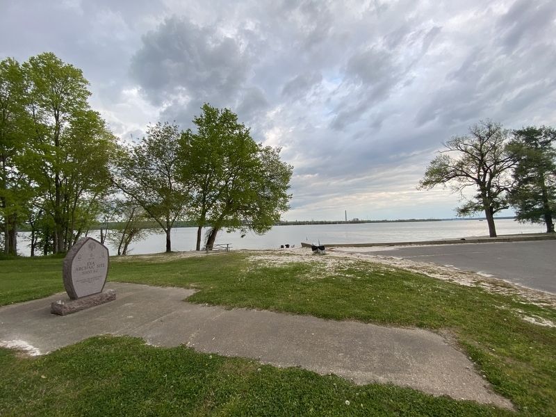
Site of the original settlement of Maryville. Here Captain John Craig in 1785 erected a fort on Pistol Creek to protect settlers from Indian raids. In 1793 as many as 280 men, women, and children lived within its walls for several months, surviving . . . — — Map (db m58839) HM
Montvale Springs and Chihowee Mountain, eight miles south of Maryville, were inhabited by Native Americans for thousands of years. In 1832 Dantel Foute constructed a road from Maryville and built Montvale Springs Hotel, one of Tennessee's first . . . — — Map (db m203538) HM
Near here was one of these three Cherokee villages, unoccupied when settlers arrived about 1791. A branch of the Great War and Trading Path forked here, one to North Carolina, the other to villages on the Little Tennessee. The Virginia trader, . . . — — Map (db m46477) HM
It affords me sincere pleasure to apprise the Congress of the entire removal of the Cherokee Nation of Indians to their new homes west of the Mississippi. The measures authorized by Congress at its last session, with a view to the . . . — — Map (db m177976) HM
I have often wished to enjoy your company once more but it is very uncertain whether I shall ever again have that pleasure. If we Cherokees are to be driven to the west by the cruel hand of oppression to seek a new home in the west, . . . — — Map (db m177983) HM
The full moon of May is already on the wane; and before another shall have passed way, every Cherokee man, woman and child in those states [North Carolina, Georgia, Alabama, and Tennessee] must be in motion to join their brethren in . . . — — Map (db m177955) HM
We are overwhelmed! Our hearts are sickened, our utterance is paralyzed, when we reflect on the condition in which we are placed, by the audacious practices of unprincipled men...
— Principal Chief John Ross to the . . . — — Map (db m177958) HM
I have all necessary preparations made, having upwards of 600,000 rations on hand, and boats and wagons sufficient to my command to carry [the Cherokee] off comfortably.
— General Nathaniel Smith to C.A. Harris, . . . — — Map (db m177965) HM
Our situation is truly a critical one. Our whole country is full of troops and fortifications and should it be determined by the Govmt, to remove the Cherokees by force under the fraudulent Treaty by the kind of Soldiers which are . . . — — Map (db m177967) HM
My troops already occupy many positions in the country that you are to abandon, and thousands and thousands are approaching from every quarter, to render resistance and escape alike hopeless. All those troops, regular and militia, are . . . — — Map (db m177970) HM
The Cherokees are nearly all prisoners. They have been dragged from their houses, and encamped at the forts and military posts, all over the nation … Our brother [Jesse] Bushyhead and his family, Rev. Stephen Foreman, native . . . — — Map (db m177972) HM
[A]s a very natural result of collecting and marching … men, women and children of all ages and conditions, changing suddenly, and very materially all their habits of life … We should feel little astonishment at finding a high grade . . . — — Map (db m177973) HM
On last Friday two Cherokee men came into our camps … for the purpose of ascertaining whether any thing could be done for their relief. … They said they left their families sick and one of them said he had lost one of his children … . . . — — Map (db m177975) HM
In truth, our cause is your own; it is the cause of liberty and of justice, it is based upon your own principles … Spare our people! Spare the wreck of our prosperity! Let not our deserted homes become the monuments of our . . . — — Map (db m177961) HM
In December 1835, a small faction of Cherokee, led by Major Ridge, John Ridge, Elias Boudinot, and others, acting on their own and without the consent of Principal Chief John Ross, signed the Treaty of New Echota, setting the conditions for the . . . — — Map (db m177914) HM
In December 1835, a small faction of Cherokee, led by Major Ridge, John Ridge, Elias Boudinot, and others, acting on their own and without the consent of Principal Chief John Ross, signed the Treaty of New Echota, setting the conditions for the . . . — — Map (db m177984) HM
Here stood the home of John Walker, Junior, known as “Chief Jack”. A grandson of Nancy Ward, he was prominent in the affairs of the Cherokee nation, belonging to the party advocating a voluntary treaty of removal of the Cherokees to the . . . — — Map (db m81366) HM
In 1873, Bennet Cooper (1797-1886) gave one-quarter of an acre of land for a family burying ground. His first wife, Lydia, was buried there along with several other family members. The cemetery is located on a ridge behind the Cooper Homeplace . . . — — Map (db m81367) HM
One mile west was this Cherokee council ground. Here was held the last council between the United States and the Cherokee nation, preceding the removal of the Indians to Indian Territory, now Oklahoma. John Howard Payne, author of “Home, . . . — — Map (db m49722) HM
From Canasoga, near Wetmore, to Chiaha, near South Pittsburg. De Soto's expedition of 1540 followed the Great War and Trading Path, which ran from northeast to southwest, passing near this spot. — — Map (db m178048) HM
Imagine, 800 years ago on this site a thriving Indian village. The people farmed, fished, and worshipped their ancestors. Carved and painted pillars, colorful mats and sculptured figures, decorated 3 temple mounds. Burials, pottery, weapons, tools, . . . — — Map (db m218640) HM
In the valley to the south, that part of the Cherokee nation which took part in the enforced overland migration to Indian Territory rested for about three weeks in 1839. About 15,000 persons of various ages took part in the march. Several who died . . . — — Map (db m76174) HM
Nearby Buffalo Creek is one of numerous place names in the Southern Appalachian mountains that serve as reminders that the buffalo, or American bison, was once plentiful in the region. In 1769 Daniel Boone narrowly escaped being trampled by a . . . — — Map (db m184052) HM
Sycamore Shoals, located just to the north of this spot, was a significant place in early American history. The site is named for a stretch of shallow rapids along the Watauga River and for the abundant sycamore trees along its banks. The shoals . . . — — Map (db m157870) HM
In this valley, March 17, 1775, the Transylvania Company, led by Richard Henderson, John Williams and Nathaniel Hart, bought from the Cherokee, led by Chief Oconostota, all the lands between the Kentucky and Cumberland Rivers. Over 20 million acres . . . — — Map (db m47196) HM
Understanding Early Inhabitants East Tennessee has been the site of continuous human occupation for thousands of years. Archaeology is an important tool for understanding the early inhabitants of Sabine Hill. Through the study of . . . — — Map (db m174639) HM
After the July 21, 1776 attack, the second fort was built on land owned by Sevier, and joining the historic shoals on the Watauga River he and his family played a major role in the Watauga Association and the early settlement of Tennessee. . . . — — Map (db m157866) HM
Here, March 19, 1775, at the Sycamore Shoals, the Watauga Association, Charles Robertson, Trustee, bought from the Cherokee, with Oconostota as chief, lands along the Watauga, Holston and Great Canaway (now New) Rivers. The consideration for the . . . — — Map (db m47180) HM
Across the river are the remains of an 800-year old town built by ancient Native American Indians. Almost surrounded by the river, it was also guarded by a high palisade wall. A large temple mound and several smaller mounds surrounded an open plaza. . . . — — Map (db m143825) HM
The 1791 Holston Treaty prohibited settlers from entering the Cherokee lands in the Powell Valley, but Tennesseans holding North Carolina land grants moved into the area. President Washington directed the pioneers to leave the valley. Captains . . . — — Map (db m142725) HM
Located .2 mi. east on the Big Pigeon River is a strategic crossing used by the Cherokees. In Aug. 1782, Gen. Charles McDowell of Burke Co., North Carolina, raised an army of five hundred mounted militia from Morgan District to cross the mountains, . . . — — Map (db m61779) HM
The Great War Path of the Cherokees forded this river just west of this spot. It was the main route linking the Watauga and Chickmauga settlements. — — Map (db m126464) HM
About 2 miles northeast, south of the mouth of Cosby’s Creek, William Whitson, Jr., established a fort on the east bank of Pigeon River in 1783. It was an important frontier outpost, since there was a ford there, and the west bank of the river was . . . — — Map (db m58404) HM
About 1/2 mi. S.W. are remains of stone fortification and moat of ancient and unknown origin. One theory is that it was built by a party of 12th Century Welch voyagers who entered the country via the Gulf of Mexico. Near here also was the capital of . . . — — Map (db m24967) HM
Around 2,000 years ago, Native Americans built a rock and earthen wall around a 50-acre hilltop plateau situated between the Duck and Little Duck Rivers. Here in 1966, archaeological investigations recovered artifactual and radiocarbon data . . . — — Map (db m166938) HM
Two blocks west is the grave of this renowned frontiersman and Goodlettsville’s first citizen. Coming first to the Cumberland Settlements in 1770, he returned in 1780 and built his fort one-half mile north on Mansker’s creek. He repeatedly fought . . . — — Map (db m2428) HM
Andrew Jackson built a cotton gin and press at The Hermitage in 1807, both of which stood in the field in front of you. It was a shrewd decision on Jackson's part, not only making his plantation more self-sufficient, but also generating additional . . . — — Map (db m85479) HM
Native warm season grasses grow well during the summer heat. These are bunch type grasses, and the bare ground between the grass clumps provides wildlife cover and nesting space. Habitat conditions are excellent for species such as bobwhite quail, . . . — — Map (db m85446) HM
Indigenous populations lived in the Cumberland Valley of
Middle Tennessee in large villages such as Mound Bottom in
present-day Cheatham County. They were the first farmers of
Tennessee and grew corn, beans, and squash for their own
sustenance . . . — — Map (db m205342) HM
Alice Thompson (1777-1828) married Revolutionary War veteran Edward Collinsworth (1759-1816) in Dec. 1795, after spending two years as a captive at the Muscogee (Creek) tribal town Kialegee, in present-day Alabama. Alice and Edward reared seven . . . — — Map (db m207153) HM
In recognition of
Colonel Richard Henderson
Born in Virginia 1735
Died in North Carolina 1785
—————
Founder and Promoter of the noted
"Transylvania Land Company"
Whose purchase from the Cherokee Indians covered the territory . . . — — Map (db m24373) HM
Jaques-Timothe De Montbrun, French Canadian fur trader and later lieutenant governor of the Illinois Country, visited in this area as early as 1769. On at least one occasion he took refuge in the cave 0.9 mile N. when attacked by Indians. He settled . . . — — Map (db m83845) HM
Native peoples have played a prominent role in the Cumberland River Valley's indigenous heritage. The names of significant tribes, prominent chiefs and warriors are recognized on the remembrance ring.
Shawnee • Delaware • Kaskinampo • . . . — — Map (db m188770) HM
Native peoples have lived in the Cumberland River Valley for thousands of years. Though no formal history of the region's earliest civilizations was recorded, the remains of their presence are visible today in the form of archaeological sites and . . . — — Map (db m188768) HM
The early peoples who enjoyed the bounty of these bottom lands by the Cumberland River were able not only to survive - they thrived in very sophisticated and populous settlements. Evidence also shows that they produced beautiful works of . . . — — Map (db m221460) HM
Humans settled along the Cumberland River at least 14,000 years ago, during the end of the last Ice Age. For thousands of years, they lived in small, multifamily groups, moving around seasonally as they hunted, fished, and foraged for native . . . — — Map (db m221457) HM
A double log house and a few log cabins, partially picketed, stood here about 1790. On May 9, 1793, 4 children on their way to the spring were attacked by Indians. Three were scalped and killed. One escaped. The home of Charles Bosley, wealthy . . . — — Map (db m53362) HM
A major treaty with the Chickasaw in 1818 opened West Tennessee to restless settlers, and land speculators took advantage of inherent opportunities. Local governments and other cultural institutions developed in burgeoning towns, as steamboats . . . — — Map (db m215301) HM
Tennessee became a leading agricultural state, Nashville was selected as the permanent capital, and the establishment of new schools and colleges reflected a growing refinement. Thousands of Cherokee were forcibly removed from their ancestral lands . . . — — Map (db m215445) HM
In 1836, President Andrew Jackson declared the Treaty of New Echota binding, thereby mandating Cherokee emigrate by 1838 or be removed. — — Map (db m215447) HM
Remains of an ancient Native American metropolis lie deep beneath the surface of modern day Nashville. Both here and directly to the east across the Cumberland River once stood a bustling city with thousands of inhabitants. Archaeologists have . . . — — Map (db m173821) HM
In 1760, the Cherokee seized Fort Loudoun and killed nearly two dozen inhabitants in equal retaliation for the execution of chiefs by the British. In return the next year, the British destroyed 15 Cherokee towns and burned 1,500 acres of crops. . . . — — Map (db m214772) HM
Contact between Native Americans and Europeans began in 1540-1541 with Hernando de Soto's search for gold and silver that extended into East Tennessee and to the Mississippi River. Juan Pardo led a similar expedition, 1566-1567. — — Map (db m214651) HM
The Mississippian culture disappeared
in Middle Tennessee about 1450, but remained alive in East Tennessee util the early 1600s. — — Map (db m214650) HM
For the first time since removal in 1838, Eastern & Western Cherokee Councils reunited on the sacred council grounds at Red Clay State Historic Area in 1984. — — Map (db m218837) HM
On July 15, 1673, James Needham and Gabriel Arthur, the first English-speaking men to cross the Appalachian Mountains into the future Tennessee, arrived at the Overhill Cherokee village of Chota. — — Map (db m214685) HM
The name French Lick Creek, the course of which is traced approximately
by the greenway leading east, recognizes the presence of the French traders
Charles Charleville and Timothy Demonbreun. They lived here in the 1700s
and traded European goods . . . — — Map (db m199679) HM
During the last major Ice Age — 12,000 to 25,000 years ago — Middle Tennessee was home to many animals that are extinct today, including the saber-tooth tiger, the mammoth, and the mastodon. In 1885, the tusk of a mastodon, an Ice Age ancestor of . . . — — Map (db m173819) HM
In 1771, after John Donelson's survey, the Wataugans were advised that they were in North Carolina, not Virginia, and were illegally residing on Indian land. — — Map (db m214956) HM
In 1791, John Hague built the third cotton textile mill in the U.S> near Nashville. It was abandoned after Indian Raids in 1793. — — Map (db m215143) HM
At this place, the Cherokee crossed the Cumberland River on the Nashville Toll Bridge during the forced march west from their homelands in the southern Appalachian Mountains. Nashvillians in the busy public square looked on as thousands of Cherokee . . . — — Map (db m147753) HM
Against the backdrop of the American
Revolution, settlement was begun in Middle Tennessee and continued in East Tennessee, often in a hostile atmosphere of attacks and reprisals by both pioneers and Indians. — — Map (db m214960) HM
For thousands of years, this lowland area north of the Tennessee State Capitol was one of the most important sources of mineral water in southeastern North America. Located on the southern border of the Great Eastern Salt Basin, an area that . . . — — Map (db m173818) HM
By A.D. 1250,
prehistoric habitation peaked during the Mississippian era with a complex society, large towns, far-ranging trade routes, elaborate pottery and personal items, and ceremonial mounds. — — Map (db m214648) HM
From the 1500s, diseases to which Native
Americans had no natural immunity were brought from Europe by explorers and settlers, resulting in depopulation. In 1738-1739, nearly half of the Cherokee died from smallpox. — — Map (db m214687) HM
Pioneer settlements were established in East Tennessee during the early 1770s on Cherokee lands leased near the Watauga River, north of the Nolichucky River. The settlements of Carter's Valley and North of the Holston River were also established . . . — — Map (db m214953) HM
On the west bank of the Cumberland River, beneath the nearby Jefferson Street Bridge, a large, flat-topped earthen mound once stood as the platform that supported significant ceremonial and domestic buildings associated with the Mississippian . . . — — Map (db m173824) HM
In 1835, the Cherokee owned prosperous farms, thousands of livestock, many sawmills, blacksmith shops, and cotton gins.
They also had numerous slaves. — — Map (db m215451) HM
Nearly 1000 years ago, the area around First Tennessee Park supported a thriving salt works site. Once the home of a large Mississippian metropolis, Native Americans procured salt from surrounding springs to help sustain their cultural community . . . — — Map (db m173822) HM
Sequoyah completed his syllabary, a written language, for the Cherokee Nation in 1821.
The Cherokee moved very rapidly to literacy, thereby giving their nation the power of "the talking leaves." — — Map (db m215285) HM
After 18 years of protests from farmers, Native Americans, and environmentalists concerned about the snail darter fish,
TVA completed Tellico Dam in 1980, thereby flooding Overhill Cherokee village sites such as the sacred town, Chota. — — Map (db m218820) HM
Modern interstate highways both trace and diverge from the trails of Native Americans, who often traveled paths established by animals.
Sources: "The Trail System of the Southeastern United States" from the Smithsonian's Ethnology . . . — — Map (db m213048) HM
Perennially gathered around the river valleys, for 12,000 years people have found Tennessee to be a desirable place to live.
Map of heaviest concentrations of prehistoric peoples and historic tribes based on data from the Tennessee . . . — — Map (db m213057) HM
The Jackson Purchase of 1818 from the Chickasaw encouraged settler migration into West Tennessee. The Chickasaw expected by treaty to continue residence, but were removed in 1830s. — — Map (db m215299) HM
The Treaty of Hard Labour, signed by the Cherokee and the British in 1768 to prevent pioneer settlement in Tennessee, failed to stop an inrush of Virginians and Carolinians toward Cherokee land. — — Map (db m214951) HM
Three major Native-American nations were living in future Tennessee when early French and English explorers and their African slaves arrived. Both cooperation and struggle were commonplace among these diverse peoples. — — Map (db m214686) HM
At Sycamore Shoals in 1775, Richard Henderson negotiated the Transylvania Purchase of more than 20 million acres in future Tennessee and Kentucky from some, but not all, of the Cherokee leaders. Much of this land was also claimed by Chickasaw, . . . — — Map (db m214958) HM
Signed by about 300, but later disavowed by the great majority of the Cherokee, the Treaty of New Echota in 1835 provided for their removal to the Trans-Mississippi West. — — Map (db m215454) HM
The Woodland Indian culture, characterized by settled communities, pottery production, and burial mounds, existed about 1000 B.C. A.D. 900 — — Map (db m214647) HM
Native American Roots
Long before the settlement of Nashville, Native Americans had strong ties to this land. Archaeological Investigations have returned varied and numerous prehistoric artifacts from the Middle Woodland Period (200BCE - . . . — — Map (db m206501) HM
The Bison Meadow is a 2 acre prairie planted in 1994 on a terminal
branch of the historic Natchez Trace which is today Hillsboro Road.
This "old indian trail” is where buffalo, bear, elk and other large
animals once roamed north to the big salt . . . — — Map (db m188896) HM
356 entries matched your criteria. The first 100 are listed above. Next 100 ⊳