A Friendly Encounter with People from an Ancient Village
For thousands of years, a Nimiipuu ("the people") village was located a few miles west of here, near the Álpáha (Alpowa) Creek - Snake River confluence. For a . . . — — Map (db m159257) HM
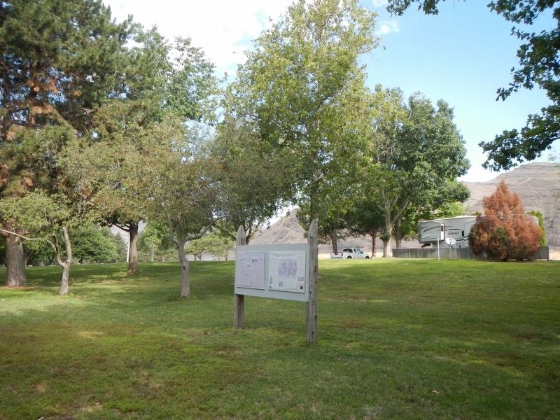
On October 10th, 1805, the Lewis & Clark Expedition camped across the river from this park. They called the great river flowing in from the south Lewis' River.
”The Country on either Side is an open plain leavel & Fertile …not a tree of . . . — — Map (db m129075) HM
Guided by two Nez Perce men, the Lewis and Clark Expedition entered present-day Washington on October 10, 1805. They beached their dugout canoes and camped at a site across the Snake River from here.
In this area, the explorers met, traded with, . . . — — Map (db m129083) HM
The Lewis and Clark Expedition reached the Clearwater — Snake river confluence on October 10, 1805. The explorers camped across the river from here, their first encampment in present-day Washington. That evening, William Clark wrote about the . . . — — Map (db m129064) HM
"Swifter than any horse could run"
In fall 1805, the Lewis and Clark Expedition raced against time, hoping to reach the Pacific Ocean before winter set in. Traveling faster than at any other time during the journey, the party . . . — — Map (db m159272) HM
The Nez Perce Indian Nation was comprised of hundreds of separate bands. Chief Timothy, along with Red Wolf, ruled the Alpowa Band whose camp was located where Alpowa Creek meets the Snake River.
Chief Timothy, a Nez Perce Indian Christian . . . — — Map (db m129085) HM
"I gave my hand to them all and made signs of my friendly disposition"
On October 19, 1805, William Clark and three men traveling ahead of the rest of the party arrived at a Umatilla village near here. Upon seeing Clark, the villagers . . . — — Map (db m158634) HM
This site on Ribbon Cliff called Broken Mountain by the Indians experienced a violent earthquake in December, 1872. The shock split the mountain, forming the cliff to the west and causing a huge rock slide which stopped the flow of the Columbia . . . — — Map (db m129261) HM
The Native Americans Prehistoric travelers established trails. The first travelers to cross the Cascade Range were the ancestors of today's American Indians. They followed animal trails and natural passageways which eventually became . . . — — Map (db m156201) HM
Bordered by the Strait of Juan de Fuca and the Pacific Ocean, pre-contact Makah held a vast area of inland and coastal territory. These richly forested lands and the seas which teemed with life offered early Makah a wealth of natural resources. The . . . — — Map (db m129586) HM
According to a seventeenth century account, Apostolos Valerianos discovered a waterway through the northwest corner of North America in 1592 — a Northwest Passage. He reputedly sailed for the Spanish under the name “Juan de Fuca.”
For a . . . — — Map (db m177413) HM
The Columbia River, located a few miles west of here, was one of the first highways in the West. American Indians used canoes as their principal transportation between camps and villages along the river, carrying fish, roots, berries, baskets and . . . — — Map (db m112963) HM
You are standing on the site of a once-bustling riverfront complex at Fort Vancouver. A boat building operation, blacksmith shop, and tannery filled the air with the sights, sounds, and smells of industry.
A busy place is this. The . . . — — Map (db m12292) HM
In Recognition of the People Who Have Inhabited this Region for Thousands of Years.
Ilchee Moon Girl
History says she was born along the Columbia River about 1800, daughter of Chinook Chief Concomley and, later, wife of Chief Casinos leader . . . — — Map (db m8422) HM
After marrying Amos Short in 1829, Esther (Clark) Short set out on the adventure of her life! Originally from Tioga County, Pennsylvania, Esther Short, who was ½ Algonquin Indian, her husband Amos and 10 children traveled west to Linton, Oregon . . . — — Map (db m64239) HM
In October 1832, the Japanese cargo ship Hojun Maru set sail from near Nagoya bound for Edo (present day Tokyo). Disabled in a storm off Enshu Nada, the Hojun Maru drifted for fourteen months before running aground on the coast near Cape Flattery, . . . — — Map (db m8423) HM
This Italianate-Revival style home was built in 1878 for General Oliver Otis Howard, Commanding General of the Department of the Columbia from 1874 until 1880.
This gracious home was considered ”the finest dwelling house north of the . . . — — Map (db m8572) HM
Ancient Passage Between the Rivers
On the advice of the Walla Walla people, the Lewis and Clark Expedition followed "a good road...plenty of Deer and Antilopes" that led travelers overland between there Columbia - Walla Walla and . . . — — Map (db m159023) HM
This land will always be home to the Cayuse, Umatilla and Walla Walla people. The land is used by and shared with relatives and neighbors such as the Palouse, Wanapum, Yakama, Wishxam, Wyam, Tenino and Nez Perce.
In 1805 and 1806, Lewis . . . — — Map (db m159022) HM
Palouse Indians To supplement a diet of salmon, families migrated from riverside “mat lodge” villages to the mountains for game, roots, and berries. “Appaloosa” horses played a paramount role in tribal life.
. . . — — Map (db m129473) HM
The Celilo Falls Trail, now known as The Nez Perce Trail passed through Dayton near this site. For centuries this was the path used by the Indians, trappers, missionaries and the new settlers. Most notable was the Lewis and Clark Corps of Discovery. . . . — — Map (db m158967) HM
The Lewis and Clark Expedition camped nearby on October 16 and 17, 1805 on its way to the Pacific Ocean. One of the members of the Expedition was a young Northern Shoshone, Sacagawea.
During the winter of 1804-05 at Fort Mandan, in . . . — — Map (db m38587) HM
Indians lived in this coulee many centuries ago. You are standing on an ancient Indian camp site. The Indian trail came down the steep hill behind you and crossed the coulee to the east. The famous Cariboo Cattle Trail crossed the coulee here going . . . — — Map (db m208186) HM
Ephrata was a summer Indian camp. Hundreds of Indians spent weeks gathering roots at the springs west of here. Ephrata was the gateway between Walla Walla & Okanogan. Indians, military expeditions, and wagons traveled here in 1880. The first . . . — — Map (db m129093) HM
Chief Moses and many Indians from miles around came to gather food, trade & race horses each summer at the great encampment 3/4 mile east of here on Rocky Ford Creek. During the Nez Perce War of 1877, Chief Joseph sent runners to Chief Moses camp . . . — — Map (db m208206) HM
Until recent times the Wanapum Indians inhabited the banks of the Columbia River from Beverly Gap to where it is joined by the Snake River near Pasco about 75 miles south.
The Wanapums were a very religious and peaceful people living on fish, . . . — — Map (db m92610) HM
Indians camped along Crab Creek in Stratford to gather roots and other food. The main Indian trail came past Stratford across the creek. The Indian trail branched here and one went past Pinto Dam. Lt. Symons came past here while laying out military . . . — — Map (db m129096) HM
In 1854, the U.S. Commissioner of Indian Affairs instructed Isaac I. Stevens, Governor of the Washington Territory, to enter into treaties with the coast Indian tribes. Following the initial council meetings here in Cosmopolis, treaty councils were . . . — — Map (db m129124) HM
We extend you a warm and friendly welcome to Coupeville in the heart of Ebey's Landing National Historical Reserve!
In 1792, Captain George Vancouver sailed the HMS Discovery into Puget Sound. His first mate, Joseph Whidbey then . . . — — Map (db m179345) HM
Humans have been part of this landscape for at least 10,000 years. By the time European explorers entered the Salish Sea in the late 1700s, the Lower Skagit people had [utilized] Whidbey Island for millenia, living in mobile and established . . . — — Map (db m179286) HM
On May 28, 1840 Father Francois Norbert Blanchet came to Ebey's Landing, from his Cowlitz Mission. The visit was in answer to a request by Chief Tslalakum to come and teach his people the new religion.
He was received with great joy by the . . . — — Map (db m179284) HM
Places to visit
1 Island County Museum
908 NW Alexander Street
The Island County Museum features local and regional history. Ice Age relics, woolly mammoth remains, a Native American collection that includes . . . — — Map (db m179321) HM
From the end of the Lake Ozette Road, 2 trails lead to the ocean beaches. One, the Indian Village Trail, leads to the site of an abandoned Ozette Indian village at Cape Alava. For over 2000 years, Cape Alava was home to the Makah Indians. . . . — — Map (db m179353) HM
The Skagit Indians maintained several villages on Penn Cove. The paramount Skagit chief lived at Snakelum Point, southeast across the cove. The village at Monroe’s Landing was called cokwol’a. Cokwol’a was a major village of the Skwdabs, a subgroup . . . — — Map (db m61074) HM
Sv. Nikolai Mission In September 1808 the Russian American Company (RAC) schooner Sv. Nikolai (Saint Nicholas) set sail from the Russian American Company's fort in Sitka, which was then in Russian territory (now part of the State . . . — — Map (db m129574) HM
Escape to the Hoh River Leads to Captivity At dawn following a harrowing, fearful night awaiting retribution, the Russian party reconnoiters, but finds only dense forest growing down to the high-tide surf line. Captain Bulygin decides to take . . . — — Map (db m129588) HM
The tribal name for the Hoh River is Chalak'At'sit (meaning "The Southern River"). The river itself is focal in Hoh tribal identity and folk-history and in traditional economic patterns. The Hoh people were created along the river. Mythic narratives . . . — — Map (db m129587) HM
Thousands of winters before the arrival of the White Drifting-House people, the Ho-qwats, the Quileute Indians and the ghosts of their ancestors lived and hunted near La Push, Washington. For as long as the ageless memory of legend recalls, the . . . — — Map (db m129589) HM
The čičməhán Trail is comprised of 16 sites that naturally divide into a 3-mile, a 6-mile, or a 12-mile loop. The 3-mile loop includes downtown historical sites; the 6 mile loop extends uptown; and the 12-mile loop (best for . . . — — Map (db m179367) HM
Early settlers to the Port Townsend area found a S'Klallam Indian community well established on the protected shores of Port Townsend Bay. This settlement, known as Kah Tai, meaning "to carry" or "pass through," was located on the portage route . . . — — Map (db m179612) HM
The S'Klallam people made their canoes from Western Red Cedar trees ranging from 300-800 years of age. Seats and brackets were made of Yew wood, and paddles carved from Yellow Cedar.
Canoes Came In All Sizes
A freight canoe of good . . . — — Map (db m179378) HM
Chief of the Clallam Indians
A Friend of the White People
From this rock
he gave warning of danger
and saved them
from massacre in 1856 — — Map (db m179770) HM
Many in Port Townsend have heard of Chief Chetzemoka (Cheech-Ma-Ham), chief of the S'Klallam. At Point No Point in 1855, he signed the treaty giving up all S'Klallam land for a reservation to be shared with another tribe. Such treaties, pushed . . . — — Map (db m179408) HM
"Blessed are the peacemakers:
for they shall be called
the children of God." Matthew 5:9
"If I am seen coming to you I will not be able to help you further. But each morning I will sit on top of the big rock on the east side of Kai Tai . . . — — Map (db m179771) HM
Chetzemoka's Big Heart, a story by Mary Ann Lambert (1879-1966, also the author of The 7 Brothers of the House of Ste-Tee-Thlum) of the Jamestown S'Klallam Tribe's Lambert/Reyes family, illustrates Chetzemoka's heart, and the power and respect . . . — — Map (db m179745) HM
In 1989, the Canoe Culture was revitalized with the inception of the Intertribal Canoe Journey. The S'Klallam/Klallam Tribes participate in the Intertribal Canoe Journeys in which Canoe Families from dozens of Tribes travel to one destination . . . — — Map (db m179387) HM
For centuries, the S'Kallam people traded with other Tribes within the continental U.S. and across the Strait in Canada. Direct trade was the Native method of food and materials redistribution across geographical bounds, and from great . . . — — Map (db m179381) HM
Here in the wind-buffeted rain shadow of the Olympic Mountains grow colorful relics of the last ice age. The tiny prairie before you is a remnant of once extensive grasslands that followed the retreat of continental ice over 10,000 years ago. . . . — — Map (db m179767) HM
The Jamestown S'Klallam Tribe, like the Northwest Maritime Center, is a 21st century organization with a tremendous appreciation of our seafaring history and respect for those who have preserved and shared their knowledge throughout the . . . — — Map (db m179410) HM
For over 8,000 years Native Americans camped at Point Hudson while migrating from summer camps to winter lodges.
The American explorer, Captain Charles Wilkes, named the area in honor of Commander William L. Hudson in 1841. . . . — — Map (db m179370) HM
Before the shoreline was filled to create the marina, Point Hudson was a popular clamming beach for S'Klallams and a landing point for tribes from locations across the Olympic Peninsula.
Change began as soon as settlers arrived, but grew . . . — — Map (db m179751) HM
It is believed that for thousands of years Point Hudson was used as a seasonal home by the Native American tribes, particularly Klallam and Chemakum. Presence of a freshwater lagoon, a wide variety of shellfish and other seafood easily obtained . . . — — Map (db m179746) HM
This site is the last remaining vestige of the natural prairie that spanned the qatáy Valley, between wetland areas. Relatively dry, upland areas of the valley provided camas bulbs (qʷɬúʔi in Klallam and Camassia quamash in Latin) . . . — — Map (db m179762) HM
After signing the 1855 Point No Point Treaty, it was clear that there had been some misunderstandings, and the federal government was failing to follow through on its funding promises. Some of the Tribes of Washington rose up against what they saw . . . — — Map (db m179769) HM
For thousands of years, the S'Klallam ("strong") people lived in villages along the north coast of the Olympic Peninsula, moving with the seasonal resources and living in harmony with nature. In addition to hunting in the mountains and . . . — — Map (db m179376) HM
Steven C. Brown, in his essay "Vessels of Life: Northwest Coast Dugouts," from The Canoe: A Living Tradition, by John Jennings published in 2002 by Firefly Books wrote: "The Coast Salish canoe incorporates features that make for a successful and . . . — — Map (db m179379) HM
Welcome
2019
Designed by: Dale Faulstich
Carved and painted by: Dale Faulstich,
Tyler Faulstich, Tim O'Connell, Andy Pitts
——————————
Representing from the top:
Supernatural Carpenter
Spirit of the . . . — — Map (db m179433) HM
Fin Fish included salmon, halibut, smelt and euchalon (a kind of smelt). Fish were taken with reef nets, dip nets, trawl nets, harpoons, gaff hooks, spears, basket traps, weirs, tidal pounds (rows of underwater stakes), hooks, and herring rakes . . . — — Map (db m179383) HM
Looking south, view Kilisut Harbor and Indian Island, now Naval Magazine Indian Island. Archeological evidence shows that Indian Island was an important location to the ancestors of the S’Klallam and Chimacum people for over 1,500 years. For . . . — — Map (db m179600) HM
The village of qatáy once sat near the bluff at what is now the corner of Monroe and Water Streets. It was the principal village of S'Klallam people at the time of the treaty signing, and home to their Chief, čičməhán . . . — — Map (db m179731) HM
Carkeek Park is an urban oasis. The salt water beach, the salmon bearing stream, wetlands, forest, picnic tables, play areas and miles of trails welcome visitors with new discoveries year round.
The land once occupied by early Salish peoples . . . — — Map (db m102488) HM
The site of the Indian camping place called Muck-Muck-Wum. In 1911 the headquarters of Washington’s first public port was established here by commissioners H.M. Chittenden, C.E. Remsberg and Robert Bridges. This tablet dedicated May 19, during . . . — — Map (db m48002) HM
[Right side of the monument]
Kitsap sights Vancouver’s vessel 1792 – First vessel on Puget Sound
[Left side of the monument]
Seattle
Chief of the Suquamish
A firm friend of the whites
For him the city of . . . — — Map (db m47938) HM
Late at night on June 15th of 1917 the world's first vehicle crossed the Fremont Bridge. Foot traffic was allowed across the bridge deck the next day and has continued in a steady stream since then, along with horse drawn conveyance, trolleys, . . . — — Map (db m112962) HM
Restored in 2012-2014 and unveiled and dedicated on June 6, 2014 at the "Birthplace of Seattle" Log House Museum of the Southwest Seattle Historical Society.
This is a replica of a totem pole carved by natives of the coastal island region . . . — — Map (db m181248) HM
Treaty signed here January 26, 1855 Transferring the land lying from the crest of the Olympic Mountains to Puget Sound (except prior treaty lands) from the Sklallam Sko-Ko-Mish To-An-Hooch Chemkum and all Indian sub tribes to the . . . — — Map (db m222604) HM
Trading as a Way of Life
Since time immemorial, American Indians have lived nearby, nest to the life-giving river. They have thrived on the abundant fisheries, the rich resources of the uplands, and an extensive trade network. Captain . . . — — Map (db m158325) HM
Centuries before North America was colonized. Indian societies flourished on Columbia River shores. Annual return of the salmon provided nutrient-rich food, a valued commodity for bater, and spiritual renewal.
Men fish and hunt while women gather . . . — — Map (db m158630) HM
"ill Suckcess in precureing horses"
The Lewis and Clark Expedition prepared to depart the river in this area while eastbound in April 1806. The explorers wanted to obtain horses and proceed overland to the Nez Perce villages. . . . — — Map (db m158360) HM
A Great Place to Live
Floods of lava and water formed the unique landscape of the Columbia River Gorge. Nearby, rock formations and sandy soils created a perfect site for a village. In the low land beyond this small plateau, . . . — — Map (db m158326) HM
American Indians have harvested salmon from the Columbia River for over 10,000 years. Celilo Falls, a sacred location, now lies beneath the waters of the Columbia, directly east of the railroad bridge you see below. The loss of this fishery at . . . — — Map (db m128967) HM
The Lewis and Clark Expedition reached Celilo Falls, its first major obstacle on the Columbia River, on October 22,1805. William Clark named this imposing stretch of the river “Great Falls of the Columbia.” For millenia, tribes . . . — — Map (db m128969) HM
Since time immemorial, the area surrounding Celilo Falls was the hub of a vast American Indian trade network that stretched from California to Alaska, and from the Missouri Plains to the Pacific Ocean. Native people established this trading center, . . . — — Map (db m128968) HM
It used to be that you could throw a stick near the headwaters of the Cowlitz River beyond Packwood and it would float past here, to the Columbia River, eventually ending in the Pacific Ocean. Native Americans and pioneers alike not only used the . . . — — Map (db m158980) HM
The community of Mossyrock sits on the eastern edge of the Klickitat Prairie. The prairie, named after the Klickitat Indians, was actually home to the Taidnapam, or Upper Cowlitz Indians. Both spoke a dialect of Sahaptin. Early settlers often . . . — — Map (db m158981) HM
Before Euro-Americans arrived, Native people crossed the mountains on rugged trails to visit relatives, trade with other tribes, and gather food for winter. Later, prospectors, sheepherders, settlers and early Forest Service rangers used the same . . . — — Map (db m71657) HM
Established in 1880 as Camp Spokane, this U. S. Army post insured relative peace between nearby Indian reservations and the increasing number of settlers to the south. The post was transferred to the Indian Bureau in 1899 and for the next 30 years . . . — — Map (db m196840) HM
Fort Spokane was the last Western frontier fort built in the Pacific Northwest. From 1880 to 1898 the fort helped to maintain order and enforce U.S. government reservation policies.
In 1900 the fort became an Indian Boarding School. Native . . . — — Map (db m196832) HM
This area was a U.S. Army fort from 1880-1898 and became an Indian boarding school from 1900-1907. Then the fort served as a hospital and offices before being abandoned in 1929.
Explore the area, take a hike, come to the visitor center, and learn . . . — — Map (db m196837) HM
Scotch Creek Basin, bordered by Schalow Mt. on the west and by Dunn Mt. and the Lime belt on the east, provided an ancient Indian trail to the Sinlahekin valley and north to Canada. Contorted sediments in the landmark Barnett Bluff are evidence . . . — — Map (db m223520) HM
This beautiful river valley forms a natural north-south passage, used for centuries by Indians. Later came Hudson’s Bay Company fur brigades, packing pelts from Canada to Fort Okanogan. Hardly had the dust settled from the last brigade (1846) when . . . — — Map (db m129000) HM
The first to settle in the area were the Methow Indians. Although they moved frequently in summer to take advantage of various foods (berries, deer and roots), they usually wintered less than one mile from the mouth of the Methow River.
The . . . — — Map (db m128998) HM
A Collision of Cultures
First they came by sea and then by land - the Euro-American presence swelled through the region. The newcomers brought strange illnesses, like smallpox and malaria, and unwittingly spread plagues of death to the . . . — — Map (db m177402) HM
Here the Columbia River, the mightiest river flowing into the Pacific Ocean from the American continents, ends its journey. Native people have lived along the banks of this river and fished its waters for thousands of years.
Euro-American . . . — — Map (db m177312) HM
Here was the home of the Chinook Indians and their great chief, Comcomly.
Capt. Robert Gray dropped anchor near here after his discovery of the Columbia River in 1792.
In the days of the fur trade this area was witness to many stirring . . . — — Map (db m125769) HM
The Chinook people remember the significance of Qiqayaqilxam and have handed this knowledge down through the generations. They continue to live along the lower Columbia River and cherish this place. Their old ways — from art and language to fishing . . . — — Map (db m177356) HM
After the U.S. government's failure to ratify the Tansy Point treaties signed by chiefs of five Chinookan tribes, the Chinook continued to hold tightly to their identity as a tribe and to their homeland. In 1855 on the Chehalis River, Washington . . . — — Map (db m177353) HM
The Chinook commanded the mouth of the Columbia and lands up the coast to Willapa Bay in the north and down the coast to Tillamook head in the south going back centuries. They lived at the heart of a vast trade network, and served as middlemen, who . . . — — Map (db m177358) HM
This place — where river meets ocean – is one of many stories. The Chinook people lived here at Qiqayaqilxam, or Middle Village, for countless generations. Qiqayaqilxam is one of several villages that stretched from Cape Disappointment to Pillar . . . — — Map (db m177411) HM
The Chinook people have lived along the Pacific Coast for countless generations — in fact, the Chinook say their ancestors were here at the end of the last ice age, when the waters and forests were very different. The people of this place would have . . . — — Map (db m177409) HM
In the past two centuries there have been many changes at Beard's Hollow. Historically, the Chinook Indians visited the tide pools near the water's edge to collect sea life for food and shells to use as tools and decorations.
When the Lewis and . . . — — Map (db m116578) HM
This area at the mouth of Donkey Creek was once the village site of the S'Homamish Indians. Gig Harbor was then known as Tua'wILkel or Twa-wal-kut.
As part of the Puget Salish people of the Pacific Northwest, the S'Homamish spoke a form of . . . — — Map (db m179871) HM
In 1867, Sam Jerisich, Peter Goldsmith, and John Farrague were fishing in Puget Sound when bad weather prompted them to seek shelter in Gig Harbor. They liked what they saw and decided to make it their home, becoming the first three white people . . . — — Map (db m179977) HM
For hundreds of years, South Hill has been at the crossroad of some of our nation's most fundamental changes. The South Hill Heritage Corridor traces four historic trade routes the stories of which, contributed to the rich history of our state. . . . — — Map (db m197184) HM
Margaret (Maggie) Davis was a
Puyallup Indian. Married at 16, she
raised 14 children in Old Tacoma. She
would strap her children to her back
and row across the bay to Vashon
to dig for clams. — — Map (db m157830) HM
For thousands of years, S'Puyalupubsh (Puyallup) Indian fisherman camped at this site to fish, dig clams, and preserve their catch. They also rested here to await the changing tide before traveling through the Tacoma Narrows. They called
this . . . — — Map (db m157749) HM
Indians Had Canoes Of Many Kinds On Skagit Waters
The old-time Indian canoe builders with their crude tools were master craftsmen turning out everything from these utilitarian shovel-nosed Skagit River canoes for poling up stream and . . . — — Map (db m178086) HM
Native people knew her. Their names for the mountain translated to "Fire Mountain" or "Smoker." They watched her erupt repeatedly, building most of the visible mountain over the last 2,800 years. Eruptions and heavy ash fall caused them to abandon . . . — — Map (db m158994) HM
142 entries matched your criteria. The first 100 are listed above. The final 42 ⊳