This prominent butte, perhaps the steepest hill in Wisconsin, was called La Roche-a-Cri by 17th and 18th century French voyageurs. Rising 300 feet above the surrounding plain, this landmark undoubtedly guided Indians and early pioneers. Indians of . . . — — Map (db m19822) HM
Native American canoes launched North America’s maritime legacy about 12,000 years ago, making them among the world’s oldest watercraft.
The origins of the birchbark canoe are told in the oral traditions of the Ojibwe people. The spirit . . . — — Map (db m57836) HM
Early Native American Inhabitants
People have been using and occupying sites in the Apostle Islands area for thousands of years. But it was probably not until after 800 A.D. that more extensive use of the islands took place in the form of . . . — — Map (db m165677) HM
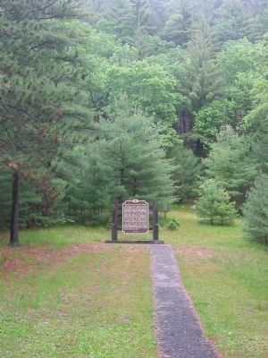
Established about 1836 as part of a Roman Catholic mission under the guidance of the dynamic Austrian priest, Frederick Baraga, later made a bishop.
The white man's style of house was adopted as a grave cover by the Christianized Ojibway . . . — — Map (db m144130) HM
The largest of the Apostle Islands was one of the earliest areas of Indian settlement, fur trade, missionary activity and commercial fishing in the interior of North America. It was discovered by French explorers in 1659. Trading posts were built . . . — — Map (db m234580) HM
A French-Canadian trader built a post on this site about 1792. From his wife Madeline daughter of the Chippewa chief White Crane the island takes its present name.
The official French fort La Pointe was built in 1718 about 500 feet west. Its . . . — — Map (db m144128) HM
Aaniin, visitors. Welcome to Mooningwaanikaaning, the homeland of the Ojibwe people. The Ojibwe name for Madeline Island means “home of the yellow-breasted flicker bird.” This island was the last-foretold stopping point on the Ojibwe migration . . . — — Map (db m234361) HM
The Mauvaise (Bad) River was so named by the French due to the difficulties of its navigation. The Indians called it Mushkeezeebi or Marsh River. In 1845 the Rev. L.H. Wheeler, Protestant missionary at La Pointe, planned an agricultural settlement . . . — — Map (db m63661) HM
VOICES IN THE MIST
When the mist turns a waltz along the shoreline, and swirls heavenward via convection, lend your ears to the bay. There are forms in the mist, and in the forms there are faces. The faces smile, and the hint of a melody plays . . . — — Map (db m201384) HM
You are standing at the “turning Point” for the Bayfield Waterfront Walk and across the water is a place of significance where “turning points” in history occurred. Madeline Island, or “Mooningwanekaaning Minis,” . . . — — Map (db m98243) HM
"This is the best combination of cultural heritage and land management that I can think of."
Bob Krumenaker, Superintendent
In October 2017, Apostle Islands National Lakeshore, in collaboration with the Red Cliff Band, Bad River Band . . . — — Map (db m201395) HM
Once upon a time, according to an old Indian legend, the sand beach on the east side of this bay was a favorite camping ground. One spring a few lodges of Chippewa from La Pointe encamped here. When their chief, Bi-aus-wah, returned from the hunt, . . . — — Map (db m194929) HM
To the east is Madeline Island, known to the Ojibway as Moning-wunakauning, “The Home of the Golden Breasted Woodpecker.” The French soldier Pierre le Sueur built his post there in 1693. In 1718 a fort was erected which remained France’s principal . . . — — Map (db m208926) HM
Near this site stood the first Episcopal Mission in Wisconsin
Founded in 1827 by the Reverend Richard Fish-Cadle
Later first director of Nashotah House — — Map (db m68040) HM
Built by the Indians for Father Claude Allouez in 1671, this is a replica of Wisconsin's first Catholic Church. The original was part of Mission St. Francis Xavior, about one mile south of this site. — — Map (db m68048) HM
The rapids at De Pere were well known to all early travelers along the Fox and Wisconsin rivers, which provided the best access to the Mississippi. Despite Indian domination, the waterway served explorers, fur traders and voyageurs, missionaries, . . . — — Map (db m11053) HM
The Fox River has served as a highway for the movement of people and goods for thousands of years. Archaeologists working along the Fox River in De Pere uncovered two-thousand-year-old pottery that demonstrates trade with communities in Illinois. . . . — — Map (db m189977) HM
On the river shore
Block 3 Astor directly west of this
marker stood about the year 1745 the
home and trading house of
Augustin de Langlade
and his distinguished son Charles,
the first permanent settlers of Wisconsin.
Charles . . . — — Map (db m39145) HM
to many people for thousands of years before the first Europeans arrived. The rich waters of the bay attracted a number of American Indian Tribes - all members of a large and complex trading network stretching throughout North America.
Green . . . — — Map (db m43813) HM
Welcome to the Oneida Veterans Memorial
Civil War
About the War: The civil war was fought in 1861-1865 between the United States (the "Union" or the "North") and several southern slave states that declared their secession and . . . — — Map (db m78976) WM
Many of the explorers who followed Columbus were more interested in finding an easy route to Asia than they were in exploring and settling this continent. In 1634 Jean Nicolet, emissary of Gov. Samuel de Champlain of New France, landed at Red Banks . . . — — Map (db m22457) HM
This statue, designed by Suamico native, Sydney Bedore, and dedicated on June 10, 1931 with Governor Phillip Lafollette among the speakers, represents a Fox Indian, Claude Allouez and Nicholas Perrot. Native Americans lived in Wisconsin for about . . . — — Map (db m39250) HM
This site is part of a 4800-acre tract patented to Eleazer Williams by the United States. In 1882 Williams led a delegation of New York Indians to the Fox River Valley, hoping to set up an Indian Empire in the West. A year later he married the . . . — — Map (db m57219) HM
James Powlis, whose Oneida name Tewakatelyλ·thale! means "I'm Worried", was born around 1750, probably in New York State. In 1777, after the disintegration of the Iroquois Confederacy's neutrality, Congress sought to offset the allegiance of . . . — — Map (db m11097) HM
The Site
The Delfosse-Allard site represents a campsite/village occupied intermittently from about 4000 B.C. to A.D. 1700. The site was first identified in 1906 and additional investigations took place in the late 1970s. The WIS 57 . . . — — Map (db m143343) HM
The Site
The Fabry Creek (Boss Tavern) site produced a range of artifacts related to three prehistoric occupations including:
•Paleoindian
•North Bay Middle Woodland
•Mero Complex Oneota
The site is part of a complex of archaeological . . . — — Map (db m143254) HM
While the WIS 57 corridor is rich in Euroamerican history, prior to the 19th Century, the Native American presence is the major historical record on the Door Peninsula. For perhaps 12,000 years, Indian peoples have lived on the Door Peninsula and . . . — — Map (db m143329) HM
The Site
The Heyrman I site represents a campsite and stone tool workshop occupied almost continuously from Paleoindian to Historic Euroamerican times.
The Heyrman I site was situated on a long, narrow, saddle-shaped sand ridge, running . . . — — Map (db m143544) HM
North Bay Middle Woodland on the Door Peninsula
North Bay Middle Woodland groups lived on the Door Peninsula from about A.D. 1 to A.D. 400. During the spring and summer months the people hunted and fished from camps on the Door Peninsula . . . — — Map (db m143291) HM
The Holdorf Site: A Chipped Stone Workshop
The Holdorf site was situated at the top of an upland knoll about three miles north of the Door/Kewaunee County border. The site was one of the most unusual investigated by WIS 57 archaeologists and . . . — — Map (db m143538) HM
Why Was This Project Undertaken?
WIS 57 is the primary route into and out of the Door Peninsula's popular resort country and by the early 1990s had become inadequate to safely carry current traffic loads.
A Wisconsin Department of . . . — — Map (db m143303) HM
Historic Preservation and the WIS 57 Project
The National Historic Preservation Act of 1966 (NHPA) requires federal agencies to take into account the effect their properties might have on historic properties such as buildings and . . . — — Map (db m143313) HM
Before the white man came to this area Indians of the Chippewa, Winnebago and other tribes roamed freely along the Mississippi River. Recorded history tells of an Indian tribal battle that took place on these river banks which was witnessed by some . . . — — Map (db m43206) HM
The Brothertown (Brotherton) are descendants of the Pequot and Mohegan (Algonquin-speaking) tribes in southern New England. They became a tribe in 1769 when seven Christian and English-speaking communities organized and moved to land in upstate New . . . — — Map (db m31792) HM
A Distinguished Wisconsin Indian
in authentic tribal costume of 1827.
Designed by Adolphe E. Seebach
Erected by Sculpture House, New York
Erected and Presented by Banta Company Foundation
1961 — — Map (db m164772) HM
Around A.D. 1100, there was a large Native American village on the north side of Stockbridge Harbor. The pottery recovered from archaeological excavations at this site indicates that the villagers came from two formerly distinct cultural groups. . . . — — Map (db m31799) HM
Among the fur traders who attained prominence in the Lake Superior region were Jean Baptiste Cadotte (Cadeau) and his sons, Jean Baptiste, Jr., and Michel.
Each married daughters of prominent Ojibway Indians; became influential as merchants, . . . — — Map (db m120429) HM
This Columbia Street site was the location of the ornate pioneer mansion built by Hiram Stores Allen. Called the founder of Chippewa Falls, Hiram built the first grist-mill, the first flour-mill, and the first hotel in Chippewa Falls. He operated . . . — — Map (db m38891) HM
This tablet was erected in 1931
by The Women's Club of
Cornell, Wisconsin
and serves a twofold purpose.
—
On the hillside below, unmarked and obliterated, are many Indian graves of days long past. At a later period this plot . . . — — Map (db m46047) HM
Jean Brunet is one of the most noteworthy pioneers of the Chippewa Valley. Born in France in 1791, Brunet immigrated to this country in 1818 and moved to Chippewa Falls in 1828. He built the first dams on the Chippewa River at Chippewa . . . — — Map (db m46018) HM
This memorial statue was envisioned to serve as a touchstone where the quiet tears of unresolved grief from mothers, fathers, brothers, sisters, relatives and friends could be shed in an honorific setting and be strengthened by the groundswell of . . . — — Map (db m29599) WM
In the autumn of 1828 a permanent fort was built on this site by the First Regiment of the United States Infantry under the command of Maj. David E. Twiggs, later a general in the Confederate Army. The fort was constructed primarily to control the . . . — — Map (db m2364) HM
The Indian Agency House was built in 1832 by the United States Government for John Harris Kinzie and his wife Juliette Magill Kinzie. John Kinzie was the Indian Agent to the Ho-Chunk (Winnebago) Indians. He had been assigned by the Government to . . . — — Map (db m230836) HM
On June 14, 1673 Jacques Marquette and Louis Jolliet started the portage (1.28 miles) from here to the Wisconsin River, which led to their discovery of the Upper Mississippi June 17, 1673 at Prairie du Chien. The expedition, in two birch bark . . . — — Map (db m2341) HM
1828 — 1845
Surrender of Red Bird
Noted Winnebago Chief
1827
Erected by Wau-Bun Chapter Daughters of the American Revolution 1924 — — Map (db m4609) HM
This home, constructed for Indian sub-agent John H. Kinzie, served as an embassy between the Federal Government and the Hoocak (Ho-Chunk, Winnebago) Nation during a turbulent period of cultural convergence and the initiation of the Hoocak Trail . . . — — Map (db m230837) HM
Before the introduction of the railroad, the Wisconsin River
provided one of the most practical means of transporting lumber
and farm products to distant markets. The old Village of Dekorra was
beautifully situated to take advantage of this . . . — — Map (db m165534) HM
(two panels, side-by-side)
Indians
Indian tribes have lived in this area of Wisconsin for centuries. Jean Nicolet, a French Government representative, was the first white man to have contact with the Indians in 1634. . . . — — Map (db m157082) HM
The mounds of this group are a fairly representative sample of those built by the people of the Effigy Mound Culture between A.D. 700-1000. It has been through excavation of other burial mounds quite similar to these that archeologists have learned . . . — — Map (db m7731) HM
For thousands of years, indigenous people have lived on this land. Wisconsin Dells is home to the Ho-Chunk, whose native land extends from Michigan to Illinois. For centuries, the Ho-Chunk people have gathered in the Dells to revitalize themselves . . . — — Map (db m157127) HM
In 1673, Louis Jolliet, Canadian fur-trader and explorer, and Father Jacques Marquette, French Jesuit Missionary, with five French Canadian boatmen, were the first white men to enter the upper Mississippi River.
Indians directed them to the . . . — — Map (db m43530) HM
In prehistoric times water from melting glaciers cut a wide valley between the bluffs of the Mississippi River to form a broad flood plain. On it French explorers, traders and missionaries found a large and well-established Fox Indian village. The . . . — — Map (db m43529) HM
This hilltop mansion commands a sweeping view of a landscape steeped in history. Descendants of pioneer fur trader Hercules Dousman built the house in 1870 atop a mound overlooking the Mississippi River, which drew European explores to this spot in . . . — — Map (db m23586) HM
The onset of the Black Hawk War in northwestern Illinois in April, 1832 triggered panic in southwestern Wisconsin's lead mining region, prompting erection of over a dozen stockades. On an open prairie knoll 3/4 mile south of this marker, area miners . . . — — Map (db m35412) HM
This memorial, carved by Harry R. Whitehorse from a storm-damaged hackberry tree, honors his Indian ancestors and is a tribute to the Effigy Mound Builders. Sculpture funded by City of Madison Committee for the Arts Dane County Cultural Affairs . . . — — Map (db m33497) HM
These mounds were constructed by a people of a hunting and gathering culture who met periodically at ceremonial grounds like this one to bury their dead. — — Map (db m33501) HM
This mound was constructed by people of a hunting and gathering culture who met periodically at ceremonial grounds like this one to bury their dead. — — Map (db m33532) HM
Madison changed with great speed in the 1830s: from Ho-Chunk home to war zone to capital city. Powerful forces were gathering against the Ho-Chunks. To gain more land, southwest Wisconsin lead miners pressured the U.S. government to remove the . . . — — Map (db m35314) HM
Even before Madison was founded, people met to exchange money and merchandise not far from this spot. Five hundred Ho-Chunk camped near the square in 1832 to swap furs for trader Oliver Armel’s goods. People began building businesses on Capitol . . . — — Map (db m33482) HM
This mound was constructed by a people of a hunting and gathering culture who met periodically at ceremonial grounds like this one to bury their dead. — — Map (db m33245) HM
Largest Indian Mound of its Type in Wisconsin Body 131 Feet Wingspread 624 Feet Marked by the Wisconsin Archeological Society July 30, 1910 — — Map (db m35130) HM
These mounds were constructed by a people of a hunting and gathering culture who met periodically at ceremonial grounds like this one to bury their dead. — — Map (db m33503) HM
At least 887 earthen Indian mounds once dotted the land around lakes Mendota, Monona, Wingra, Waubesa, and Kegonsa—so many that archaeologist Charles E. Brown once suggested Madison be renamed Mound City. Most southern Wisconsin mounds were . . . — — Map (db m35551) HM
More than a thousand mounds once dotted the shores of Madison's lakes, so many that archaeologist Charles Brown favored the name Mound City for Madison. In the early 1900s, Brown found 160 mounds in 17 groups around Lake Monona. Native people . . . — — Map (db m35431) HM
The Lewis Nine Springs E-Way
The original vision for the Nine Springs E-Way began in 1970 as a demonstration project funded by the National Endowment of the Arts. In 1971, Dane County adopted the "Environmental Loop Plan". After a series of . . . — — Map (db m195471) HM
On July 20th, during the Black Hawk War of 1832, Black Hawk led about 700 Sac, Fox and Kickapoo Indians past this point and through the “Third Lake Passage,” the juncture of the Yahara River and Lake Monona. By sunset, the military also . . . — — Map (db m167062) HM
On July 21, 1832, during the Black Hawk War, the U.S. Militia "passed through the narrows of the four lakes," Madison's Isthmus, in pursuit of Sac Indian leader Black Hawk and his band. Near this location, the Militia shot and scalped an old Sac . . . — — Map (db m31700) HM
To the native peoples who lived here, this water spirit represented the god of the underworld and has both spiritual and environmental significance. — — Map (db m33514) HM
Forest Hill is an intact example of the rural cemetery movement of the 19th century, in which cemeteries were located in a park-like setting that also served as a place for strolling, picnics, quiet recreation and contemplation. Many centuries . . . — — Map (db m89869) HM
One of the several groups of prehistoric burial, linear and effigy mounds formerly located on the crest of the Monona-Wingra ridge. Several of these were surveyed by Increase A. Lapham, in 1850. Village site was in the park below. Marked for the . . . — — Map (db m36955) HM
Indian Lake Park lies at the edge of the unglaciated or "driftless" area of southwestern Wisconsin. Here, features of both glaciated and unglaciated land are prominent. The steep slopes of exposed rock indicate that this valley was never completely . . . — — Map (db m36989) HM
On July 21, 1832, during the Black Hawk War, Sac Indian leader Black Hawk and his band left Pheasant Branch, west of Madison, retreating ahead of the military forces commanded by Colonels Ewing and Dodge. The band fled north following a route past . . . — — Map (db m31806) HM
Prehistoric woodland Indians built effigy mounds on the many glacial drumlins in this area, including those in Indian Mound Park. Later Winnebagoes lived along the shores of Lake Waubesa and the Yahara River. They ceded the land to the government in . . . — — Map (db m33761) HM
On the night of July 20th, during the Black Hawk War of 1832, Sac Indian leader Black Hawk and his followers camped near this location. Desperate for food and frightened by the approaching military, the Indians fled northwest towards the Wisconsin . . . — — Map (db m31753) HM
The Stamm House, built in 1847, was an early inn and provisions center for the travelers of the federal military road. The bygone scene saw stage-coaches, wagons of settlers and traders, and native Americans from nearby lakeside encampments. Later . . . — — Map (db m45340) HM
Monona’s Birthplace
Dissatisfied with the services being provided by the Township of Blooming Grove, five residents of the area – Ernie Ferchland, Ray Owen, Ed Rothman, Walter Simon and Justin Waterman – met in Ernie’s Trading Post to . . . — — Map (db m68388) HM
The Monona Mound is believed to have been built by the ancestors of the Ho-Chunk between AD 700 and 1100. The long tapering mound is often interpreted as an abstract turtle or water spirit. In 1988, due to the efforts of many local groups, this . . . — — Map (db m185576) HM
The largest of nineteen conical, oval and linear mounds once located in this vicinity, the Outlet Mound was constructed as a burial place by Woodland Indians about 2,000 years ago. It was saved from destruction by the Wisconsin Archaeological . . . — — Map (db m19958) HM
Escaping the ravages of the last glacier, this tranquil valley retains ancient geologic features. Located just southwest of the Johnstown moraine, it is one of Dane County's most scenic areas.
The 110 foot Donald Rock is a rare remnant of St. . . . — — Map (db m41932) HM
Attracted by abundant water, early Indian inhabitants erected effigy mounds in the area. George Spaulding was the first white settler in 1841. The Town of Windsor's first election was held in 1847 at Charles Lawrence's Prairie House Inn. A post . . . — — Map (db m35697) HM
Horicon Marsh, an area of 31,653 acres, was scoured out by the Wisconsin glacier, at least 10,000 years ago. Gradually the upper Rock River made deposits which slowed its current and spread its waters over the marshland. The Marsh became a haunt of . . . — — Map (db m23090) HM
Ah-choo! Menominee Indians made a tea of the hemlock's inner bark to treat colds. Today, hikers enjoy the dark evergreen for its beauty. Examine its short, flat needles. Do you see two white stripes underneath?
Hemlock is an indicator species, . . . — — Map (db m238468) HM
Northern white cedar trees cling to the rocky rim of 38-acre Horseshoe Island. A tangle of birch and balsam fir, with pale blossoms of climbing fumitory, grow on the island, too. Long ago, people lived on Horseshoe Island.
Indian people, . . . — — Map (db m74416) HM
In September when other forest trees begin to drop leaves, witch hazel magically springs to life. Bright yellow flowers bloom along bare branches and seed pods develop. When mature, the pods burst open and throw two shiny black seeds several feet. . . . — — Map (db m238467) HM
Early Presence
Jean Nicolet was among the first Europeans to arrive in
Wisconsin, landing on the eastern shore of Green Bay near Red Banks in 1634. He was followed by Claude Allouez in 1639 and Father Louis Hennepin in 1675.
For . . . — — Map (db m80287) HM
The Brule River flows in the former channel of a larger river which once flowed in the opposite direction and drained melting ice from glacial lake Duluth. The receding glacier created Lake Superior and also carved the valley now occupied by the . . . — — Map (db m58502) HM
In September 1860, Antoine Gordon arrived from Madeline Island and established a trading post at the junction of the St. Croix and Eau Claire rivers. This land had long been the summer home of the Chippewa Indians who used the Brule-St. Croix . . . — — Map (db m43698) HM
The Brule and St. Croix rivers provide the natural water highway between Lake Superior and the Upper Mississippi. Daniel Greysolon, Sieur du Lhut, in 1680 was the first white man to use this passage.
Traveling from Prairie du Chien in 1766, . . . — — Map (db m43476) HM