The first U.S. citizen known to have seen the site of present-day Alamosa, Lt. Zebulon M. Pike, was arrested nearby in 1807 for trespassing on Spanish soil. But the Spanish were trespassers themselves—the Utes occupied the land. The . . . — — Map (db m160914) HM
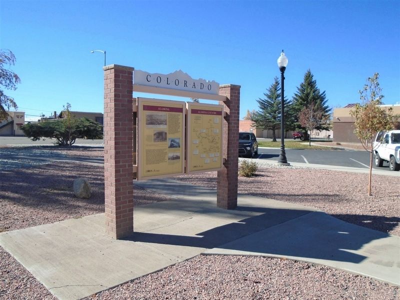
This monument is placed here to preserve the important history of the start of the whole San Luis Valley, by the Denver and Rio Grande Railroad's entrance to Alamosa.
The work train arrived in Alamosa in late 1877, and the first passenger train . . . — — Map (db m160877) HM
Colorado's first home railroad was begun in 1871. William J. Palmer, Civil War veteran and founder of the Denver and Rio Grande, felt that transportation was the key to success in this new, undeveloped land.
"Narrow gauge" railroad was a new . . . — — Map (db m160929) HM
Emblematic of the courage, fortitude, and vision of those stalwart pioneers and valiant railroad builders who foresaw a great future in the Southwest, this monument is installed to guide the way for posterity in this mighty empire.
High-Five Plains Towns
Watkins, Bennett, Strasburg, Byers, Peoria, Deer Trail, Agate, Godfrey, Cedar Point, Riverbend—most of these Colorado high plains towns were founded around the time when the Kansas Pacific Railroad arrived in . . . — — Map (db m70522) HM
The first railroad to reach present-day Littleton was the Denver & Rio Grande on October 28, 1871. The line was being built by William Jackson Palmer to connect Denver to the resort community he had just founded, Colorado Springs. Richard Little's . . . — — Map (db m177545) HM
The evolution of mass transit in Denver has resembled a cross-town commute — a long stop-and-go journey. It began in 1871, when the Denver Horse Railroad Company started running horse-drawn coaches over tracks laid in the middle of downtown’s dirt . . . — — Map (db m177560) HM
At various points in its history, the Rough and Ready Mill churned out flour, lumber, and livestock feed. But the end product was always the same: growth for Littleton. Built in 1867 by pioneers Richard Little, Joseph Bowles, and John Lilley, among . . . — — Map (db m177558) HM
Erected by Union Pacific Railroad in commemoration of Comanche Crossing Centennial
Marking point where rails were joined to form the first continuous land link by railroad across the U.S. — — Map (db m107232) HM
A continuous chain of rails, from the Atlantic to the Pacific had long been a vision of pioneer railroaders and frontier tamers. It became a reality at 3:00 pm on August 15, 1870 at a point 928 feet east of railroad milepost 602, near Comanche . . . — — Map (db m87596) HM
A continuous chain of rails from Atlantic to Pacific -- long a vision of pioneer railroaders and frontier-tamers -- became reality at 3:00 P.M. on August 15, 1870. At a point 3,812 ft. east of the depot in what now is Strasburg, Colorado. Near . . . — — Map (db m17596) HM
Pagosa Springs has a rich history, beginning with the Anasazi Indians. Later the Utes, Navajos and Apaches inhabited this beautiful corner of the Southwest. They also visited the great “Pagosah” hot springs which they believed had . . . — — Map (db m27527) HM
If you were here in 1908, you'd be singing, dancing or playing poker at the luxurious Crags Hotel. The Hotel's success was short lived. A fire destroyed the building in 1912.
Archaeologists who studied this site discovered significant . . . — — Map (db m185412) HM
Native peoples traveled through the Upper Arkansas Valley for centuries before European and American explorers.
Ute, Comanche and other tribes traveled on foot until the arrival of the Spanish and the introduction of the horse in the 1600’s. . . . — — Map (db m107827) HM
With the discovery of gold in California Gulch in 1860, getting to Oro City (now Leadville) meant an opportunity for fame and fortune.
It would, however, be twenty years before railroad service traversed the Upper Arkansas . . . — — Map (db m107833) HM
Named for the great western scout, guide, trapper, and Indian fighter. Located on famous trails – at the junction of the Smoky Hill stagecoach route and the Texas – Montana, Potter and Bacon, and Chisum cattle trails. On the old Kansas . . . — — Map (db m88444) HM
In many American small towns, the railroad depot was the portal to the rest of the world. More than any other public building, the depot touched the lives of all people in the town. Everything important to the existence of the town came and went . . . — — Map (db m77890) HM
Georgetown-Silver Plume
National Historic Landmark District
Hamill House
1867/1879
The Hamill House represents the height of prosperity achieved during Georgetown's mining era. The centerpiece of Historic Georgetown's properties, this . . . — — Map (db m69625) HM
Argentine Central Shay Locomotive No. 1 in Silver Plume, 1905. The Argentine Central Railway, incorporated in 1905 and built to service the Argentine Mining District in the Waldorf area, reached the summit of Mt. McClellan in 1906. The railroad . . . — — Map (db m13629) HM
This memorial is the
property of the State of Colorado
Cumbres Pass
Near Continental Divide between the
waters of the Rio Grande and the San Juan
”Cumbres” is Spanish for “Summits”
Altitude . . . — — Map (db m125500) HM
Times of Thriving, Times of Striving
Fertile soil and plenty of irrigation water
set the stage for farms that thrived for
forty years, beginning in 1919. The area
around Crowley was bursting with
orchards, vegetable farms, an . . . — — Map (db m119634) HM
Mining and Ranching
For a time, the Wet Mountain Valley appeared destined for mining glory. Silver strikes at Rosita (about fifteen miles southeast of here) in 1872, Querida (about twelve miles southeast) in 1877, and Silver Cliff (six . . . — — Map (db m120228) HM
Western Slope Agriculture
According to an 1888 U.S. Department of Agriculture report, western Colorado's thin soils, high altitude, and lack of rainfall rendered the region totally unfit for cultivation. The document’s author apparently . . . — — Map (db m120123) HM
North Fork Harvests Early pioneers recognized that the mild climate of the Hotchkiss/Paonia area, also known as the North Fork Valley, could support quality fruit production, and in 1882 the first orchards were planted. In 1902 the Denver & Rio . . . — — Map (db m186965) HM
"Visitors to Denver will certainly find a great improvement because they will… step aboard any one of the different lines right at the door of Union Station."
The Denver Post, May 26, 1918
(opening day of the Denver Tramway . . . — — Map (db m118591) HM
”Union Station belongs to all of us.”
Union Station neighbor, 2002
Rich or poor, famous or anonymous, everybody passed through Union Station from the time it opened in 1881. A trip to the station meant something new was . . . — — Map (db m118585) HM
Denver's Union Station was constructed to consolidate rail activity in the City and to replace the four separate stations serving the boom town. When completed in 1890 in an Italianate style of Colorado Rhyolite with sandstone trim, the station . . . — — Map (db m237358) HM
Denver's emergence as the metropolis of the Rockies is directly related to its role as the regional rail hub. When the transcontinental railroad chose Cheyenne and not Denver as its gateway to the west, Denverites rallied. Civic leaders such as . . . — — Map (db m237361) HM
1881: Union Depot, constructed in the High Victorian Eclectic style, opened on June 1 at a cost of $525,000
1883: On November 18, the railroads instituted a time zone system specifically to keep trans on time at Union Depot and across the . . . — — Map (db m237360) HM
"Without railroads, Denver would be too dead to bury."
Thomas Durant, Vice President
Union Pacific Railroad, 1867
A survivor of fire and floods, Union Station is at the head of our railroad history. Landlocked, Denver needed . . . — — Map (db m118570) HM
”This is our history – from the Transcontinental Railroad
to the Hoover Dam, to the dredging of our ports and
building of our most historic bridges – our American
ancestors prioritized growth and investment
in our . . . — — Map (db m118589) HM
Originally built as the stables for the Denver City Railway Company in 1883, this building was the birthplace of Denver's Public Transportation system. Horse drawn trolleys, soon replaced by one of America's most extensive cable car networks, . . . — — Map (db m97394) HM
Valedictorian of the first class, Denver high School, 1877. Graduated from United States Military Academy 1884 with record of 2070.4 out of possible 2075. War with Spain, Colonel 1st Colorado infantry U.S.V. His regiment led the advance in capture . . . — — Map (db m46108) HM
The St. Elmo Hotel, constructed in 1896, joined a pantheon of grand and small hotels clustered in lower downtown to serve railroad travelers. In 1870, the first Denver Pacific locomotive pulled into Denver, and prosperity followed close on its . . . — — Map (db m97391) HM
Denver's first settlement was along the confluence of the South Platte River and Cherry Creek. Arapahoe Indians named Cherry Creek for the wild chokecherries they harvested here in the fall. They respected the stream's power and warned the first . . . — — Map (db m96283) HM
The four corners of 17th and Champa Streets are occupied by the Boston Building (1890), the Colorado National Bank (1915), the Railway Exchange (Title) Building (1937), and the Ideal Cement (Colorado Federal) Building (1907). All were built of . . . — — Map (db m4659) HM
Before the coming of the rails, stagecoaches were a major form of passenger transportation to and from Denver.
In 1878, Helen Hunt Jackson wrote, The public coaches are here, as everywhere, uncomfortable, overloaded, intolerable. I know of no . . . — — Map (db m135476) HM
This tablet is the
Property of the State of Colorado
——
This plaque was presented to the City of Denver by the Colorado State Historical Society and the American Pioneer Trails Association on June 3, 1951, the day . . . — — Map (db m4679) HM
Down 17th Street, Longs Peak is visible over the roof of Union Station. Together, they symbolize two bases of Denver's economy. Since its founding in 1858, Denver has taken advantage of its location for freight and passenger transportation. . . . — — Map (db m135104) HM
By 1886, Denver’s transportation system was becoming more sophisticated with the use of an electric streetcar system.
However, by 1887 its use declined and this mode of transport was ultimately abandoned. The electricity was inadequate and . . . — — Map (db m135480) HM
The evolution of mass transit in Denver began in 1871 and by the mid-1880s the system (eventually called the Denver City Railway) boasted 45 coaches and a sixteen-mile network of rails. In 1886, the Denver Tramway Company inaugurated the nation's . . . — — Map (db m135546) HM
This property has been
placed on the
National Register
of Historic Places
By the United States
Department of the Interior
Secondary plaque
This property
has been designated as a
Historic . . . — — Map (db m105505) HM
The Historic Railroad Depot was the first passenger loading area and mail station in the central valley. The Depot was a source of pride and the center of the town. By 1919 the railroad departed Basalt.
From 1930 the building has been repurposed . . . — — Map (db m152905) HM
In 1883, investors created the Colorado Midland Railroad and built track from Colorado Springs to Buena Vista. In 1885 the CMR began tunneling under Hagerman pass, on to Aspen Junction and then to Aspen and Grand Junction. This was the first great . . . — — Map (db m152985) HM
The durable Colorado Midland Depot in Basalt has had a wide and varied career over its 127 years of existence and is still going strong today.
Constructed in 1886, the Railroad Depot was the first passenger loading area and mail station in the . . . — — Map (db m152903) HM
In the lower left corner of the large photo, you can see the edge of the roof of a house, which you are now facing. Constructed as a residence circa 1890, Frank Snell's home was destroyed in the fire of 1897 that devastated the western end of . . . — — Map (db m152902) HM
Basalt was formed in the late 1800s. Settlement of the West was influenced by many factors: miners looking for precious metals; ranchers providing meat, grains and vegetables; and the railroads, which served both. Railroads became the lifelines that . . . — — Map (db m152906) HM
The first Anglo explorers journeyed th[r]ough this area in the early-to-mid-1800s. The Homestead Act of 1862 opened the land to pioneers to select a 160-acre parcel to establish a dwelling and start their adventure in the west. First pioneers on . . . — — Map (db m158304) HM
The Denver & New Orleans Railroad was established in 1881. It was intended that the railroad would extend south from Denver, ultimately connecting with other railroads in Texas to establish a connection to New Orleans. Construction of the line . . . — — Map (db m45758) HM
Built before 1880, this building originally faced east towards the railroad tracks. It became the Elizabeth Hotel in 1882 and catered to tourists and railroad crew members. It changed to the Arlington hotel in the early 1900's to include a . . . — — Map (db m203888) HM
Lt. Zubulon M. Pike and his men, who traveled through this area in November and December 1806, were the first American explorers to view the Arkansas River Canyon now known as the Royal Gorge. A small party from the Maj. Stephen H. Long expedition . . . — — Map (db m34858) HM
Drive the Gold Belt Tour National Scenic Byway and follow the historic travel routes to the Cripple Creek Mining District, one of the world's wealthiest gold mining districts. Phantom Canyon Road follows the grade of the Florence and Cripple Creek . . . — — Map (db m153320) HM
[Left panel]
Florence
A historic Colorado oil town
Enjoy your visit
Caption:
[Center panel]
In 1859, Jesse Frazer fashioned a plow from a large cottonwood branch and planted his fields in the broad fertile . . . — — Map (db m153163) HM
Royal Gorge Railroad War
Racing to lay the first tracks into the Colorado Rockies in April 1878, the Denver & Rio Grande and its rival, the Atchison, Topeka & Santa Fe, reached the Royal Gorge in a dead heat. Competing construction crews . . . — — Map (db m152999) HM
A blinding snowstorm reduced Engineer Hartenberg's vision as he guided the D & RGW passenger train No. 1 through Glenwood Canyon. It was 11:30 the night of February 1, 1899, as the train passed Shoshone headed for Glenwood Springs. . . . — — Map (db m120545) HM
The Roaring Fork Valley's coal fields sparked a war of expansion between two railroads: the Denver and the Rio Grande Railroad and the Colorado Midland Railroad. In 1886 the Colorado Midland proposed building a line to Aspen.
Knowing that . . . — — Map (db m120532) HM
Glenwood Canyon inspired the finest hour in American rail travel. During World War II a railroad official rode through here in the cab of a diesel freight locomotive. The view from the panoramic windshield so impressed him that he began steps to rig . . . — — Map (db m120140) HM
The Robbery
On June 7, 1904, an outlaw named Harvey Logan attempted one of the west's last train robberies near here. Also known as Kid Curry, Logan was a member of Butch Cassidy's notorious "Hole in the Wall" gang.
When the westbound . . . — — Map (db m67922) HM
On this site stood the Colorado Central Railroad’s “Quartz Mill Depot”. The structure was constructed by William Loveland from the remnants of the New York Mill. To accomplish this, large doors were built into the building. The tracks, . . . — — Map (db m93084) HM
Gilpin County, Colorado
Black Hawk History
Gregory Street Crossing
The Colorado Southern Narrow Gauge Railroad (originally the Colorado Central Railroad) was vital to Black Hawk. During the late 1800’s aside from rugged wagon roads, it . . . — — Map (db m51886) HM
Built in 1882 by Baldwin Class C-16 2-8-0
Worked in Gunnison for 73 years (1882-1955)
Fire put out for the last time on July 1, 1955
The paint scheme on the engine was done in 1949
for the Chicago Railroad Fair. Later #268 appeared
in . . . — — Map (db m158567) HM
[Clockwise from top right]
Glenwood Canyon. In 1993 the Colorado Department of Transportation completed the final link of Interstate 70 through this remarkable canyon.
Glenwood's Natural Hot Springs have soothed and healed human ailments . . . — — Map (db m158790) HM
Before there was a reservoir here, three towns existed along the banks of the Gunnison River. The Denver & Rio Grande Railroad hauled both freight and passengers to the towns of Iola, Cebolla, and Sapinero. Sightseers came for the Rocky Mountain . . . — — Map (db m158858) HM
Before there was a reservoir here, three towns existed along the banks of the Gunnison River. The Denver & Rio Grande Railroad hauled both freight and passengers to the towns of Iola, Cebolla, and Sapinero. Sightseers came for the Rocky Mountain . . . — — Map (db m158865) HM
Thunder in the Black Canyon
The Black Canyon thwarted explorer John W. Gunnison, and years later railroad engineers declared it impassable. But General William Jackson Palmer, president of the Denver & Rio Grande Railway, believed his men . . . — — Map (db m158726) HM
Four bridges once stood southwest of the original town site of Sapinero. Cars and trucks used the high bridge to travel between Gunnison and Montrose. Anglers used the low bridge to access the river.
The Denver & Rio Grande Railroad needed two . . . — — Map (db m158933) HM
Here, in the shadow of the Spanish Peaks and the Wet Mountains, stands El Huerfano - "the orphan." This stark and lonely volcanic outcrop, named in the late 1700s by an unknown Spanish trader, had for centuries guided earlier Hispanos and . . . — — Map (db m97717) HM
The relative solitude of North Park was shattered by the clank
of picks and shovels and the shouts of workers as the railroad
came to the valley in 1911. Stretching from Laramie, Wyoming,
to Coalmont, Colorado, the "iron horse" greatly . . . — — Map (db m240726) HM
In 1860, Col. Thomas W. Know, a famous traveler and editor of the Western Mountaineer newspaper, believed the route up Clear Creek Canyon was a place he “never expected to see a mule go who had his senses, or a decent regard for his . . . — — Map (db m49901) HM
Dedicated to Charles E. Bradshaw Jr. who established the Durango & Silverton Narrow Gauge Railroad. Mr. Bradshaw saved the Silverton branch of the Denver & Rio Grande Western from abandonment in 1981 and preserved the Railroad as a National Historic . . . — — Map (db m71079) HM
has been designated a
Registered National
Historic Landmark
under the provisions of the
Historic Sites Act of August 21, 1935
This site possesses exceptional value
in commemorating or illustrating
the history of the United . . . — — Map (db m160243) HM
The Florida River Railroad Bridge No. 437 (distance in miles from Denver, Colorado), provided an important river crossing in the Denver and Rio Grande's (D&RG) route to Denver. The Union Bridge Company fabricated the Pratt through-truss bridge in . . . — — Map (db m177463) HM
Stony Pass
• From 1872 until 1882, when the railroad reached Silverton, Stony Pass was the vital link between the San Juan mining districts and supply towns to the east.
• A practical but tough route from Del Norte ran up the Rio Grande . . . — — Map (db m153409) HM
The sound of a train whistle was music to the ears of a miner spending the winter on Fremont Pass. Up until just before World War II, Colorado 91 was a dirt track that was closed six months a year, and the railroad was the mine’s only link with the . . . — — Map (db m122839) HM
Engine 638 was manufactured in 1906 and put into service with the Colorado & Southern R.R. for service at Trinidad for hauling coal, cattle, agricultural products and general merchandise.
Later the engine saw service in other areas of . . . — — Map (db m116849) HM
Panel 1
Arriba
In frontier Arriba (locally pronounced "AIR-uh-buh"), the only thing
more scarce than water was whiskey. Charles Creel, who founded
the town in 1888 to greet the advancing Chicago, Rock Island &
Pacific . . . — — Map (db m89381) HM
Welcome to Lincoln County, Home of Pioneer Hospitality!
With its cowboy and homesteader heritage, Lincoln County is infused with an old-time spirit of hospitality. The discovery of gold in the Colorado mountains brought large cattle . . . — — Map (db m107246) HM
This engine given to the City of Sterling by the Great Eastern Sugar Company in commemoration of the industry’s contribution to the growth and prosperity of this area. This engine was used for many years hauling sugar beets within the factory . . . — — Map (db m62208) HM
Reportedly, in October 1899 Butch Cassidy and several members of the Wild Bunch, also known as the Hole-in-the-wall Gang, travelled through Grand Valley.
From 1889 to 1904 this band of desperadoes thrilled local citizens and terrified many . . . — — Map (db m104504) HM
[center panel] Elkhead Creek drains an area to the north and east. It is 37 miles long and empties into the Yampa River a short distance to the south of this point. Elkhead Reservoir is a 25,500 acre-feet body of water, four miles north of . . . — — Map (db m166697) HM
Community Connections
Welcome to the Four Corners! As you explore this area and visit the National Parks, Monuments, and National Forest lands or drive on the San Juan Skyway, you will be traveling through a number of communities... . . . — — Map (db m160181) HM
Clockwise, from top left:
Six ancestral Puebloan villages dating to around A.D. 1200 can be visited at Hovenweep National Monument although only Square Tower Sites are easily reached. The other sites are more remote and are not . . . — — Map (db m153391) HM
Promoters called this the "Scenic Line of the World" to entice travelers to see western Colorado by rail. The Denver & Rio Grande guidebook Around the Circle invited readers to join the trip: "Unlike many of the Colorado canyons, . . . — — Map (db m158937) HM
The Denver & Rio Grande Railroad opened up vast new markets to sheep and cattle ranchers. Cimarron grew to become one of the busiest loading stops in Colorado.
Breeding stock wintered in valleys to the west. Trains or spring drives brought cattle . . . — — Map (db m158946) HM
The Gunnison River carved Black Canyon through a 50-mile block of rock called the Gunnison Uplift. Look up to the slopes above to see the edge of the uplift. The Cimarron River cut through its walls and into the canyon creating a geographic . . . — — Map (db m158945) HM
When you build a new railroad, what possible difference can 20½ inches between rails make? In the 1880s, the decisions to use a narrow gauge here in the mountains opened up trade across Colorado.
In 1863 Congress set the standard guage for . . . — — Map (db m158942) HM
Like a snarling dragon, the river kept an endless attack on the rail bed in the canyon. Slumping soils on the hills near Cerro Summit pushed tracks toward nearby creeks. Keeping the tracks east and west from Cimarron in good working shape was a . . . — — Map (db m158986) HM
Bull Whackers and Mule Skinners
Discovery of gold and silver in the 1870s in the San Juan Mountains south of Montrose created a demand for freighting services to haul equipment and supplies into the mines and carry out ore bound for . . . — — Map (db m120127) HM
This plaque commemorates the establishment of
the City of Montrose. First called Pomona, the
original 320 acre townsite was laid out in January
1882 by O.D. Loutsenhizer and Joseph Selig. They
were assisted by A. Pumphrey, John Baird, . . . — — Map (db m120006) HM
The San Juan Mountains have long posed a barrier to travel and, by extension, to economic development. Early miners had to transport ore via pack animals over rocky trails, a process so inefficient that it rendered many claims unworkable. Matters . . . — — Map (db m186903) HM
The eighteen-mile Silverton Railroad was truly a "little train that could." Incorporated by Otto Mears on July 5, 1887, this narrow gauge railroad connected the communities of Albany, Ironton, Guston, Red Mountain Town, Congress (Red Mountain . . . — — Map (db m179033) HM
Otto Mears was a Russian immigrant known as the "Pathfinder of the San Juans." He developed a network of toll roads and narrow gauge railroads that established the routes of most of this area's highways.
Mears' crowning achievement was the Rio . . . — — Map (db m199594) HM
Sam Hartsel:
Life in Hartsel has always called for character and adaptability.
Sam Hartsel came to South Park in 1860 to mine but realized that he could make a better living raising food for miners.
Starting with a 160-acre homestead in . . . — — Map (db m107890) HM
South Park has long served as a crossroads and a destination for people from other places.
American Indians who came to hunt, collect natural salts, and soak in hot springs established routes through the landscape as they traveled between their . . . — — Map (db m153262) HM
In 1886, James W. Price homesteaded here & in 1889 built the Grandview Hotel. In 1900 he & the Colo. & Southern Railway developed Shawnee & built Shawnee Lodge which burned in 1929. In 1900 Price built the Shawnee Mercantile Co. Store & moved the . . . — — Map (db m152982) HM
The log ruin that you see is all that remains of this once important stopover for teamsters and prospectors on their way to the high country. Janeway, known as "Mobley's
Camp” until 1877, was renamed for Mary Jane Francis, a local innkeeper . . . — — Map (db m152851) HM
Panel 1
Borderland
The 1819 Adams-Oñis Treaty fixed the boundary between the U.S. and Spain at the Arkansas River, formalizing a centuries-old convention - the Arkansas had always been a border. Neighboring Indian tribes . . . — — Map (db m168584) HM
The large complex in the background is the Mayflower Mill. It was built in 1929 to process ore from the Mayflower Mine as well as other mines in the Silverton area. It was constructed by the Shenandoah Dives Mining Company to extract gold, silver, . . . — — Map (db m177656) HM
129 entries matched your criteria. The first 100 are listed above. The final 29 ⊳