Early Plymouth colonists called Barrington "The Garden of the Colony" for its beautiful location on Narragansett Bay and the Providence River, its numerous streams and meadows, and its fertile soil.
- from Bicknell, A History . . . — — Map (db m223012) HM
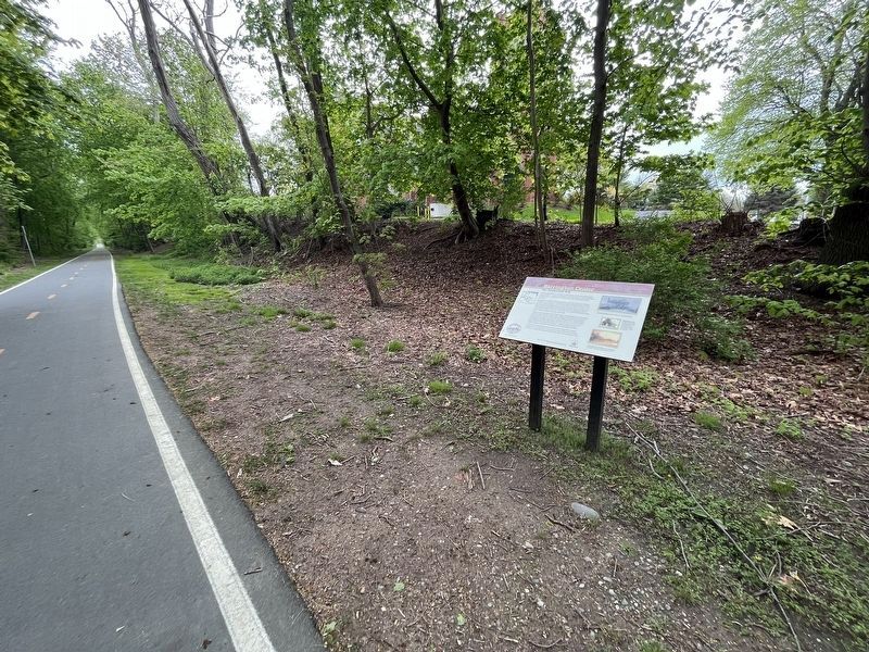
"When workers were building the Barrington Bridge in 1914, my grandmother, Maria Balia, who lived nearby would serve them drinks that she kept cold in her well. The workers used to go to her house every day and sit under the grape . . . — — Map (db m222998) HM
Osamequin Nature Preserve and Bird Sanctuary is named in honor of the Massasoit (Great Leader) Osamequin (or Ousamequin) of the Pokanoket Tribe. Osamequin, which means Yellow Feather, led his people in helping the settlers of the Plymouth Colony . . . — — Map (db m223753) HM
In January 1680, following King Philip’s War, Plymouth Colony sold the area “known by the name of Mount Hope Neck and Poppasquash Neck”, which was part of Sowams, the ancestral home of the Pokanoket Tribe. Following the sale, four wealthy Boston . . . — — Map (db m186127) HM
Organized and first church edifice built on Bristol Common 1683. Oldest Congregational church in Rhode Island. Second church building erected 1784. This building erected 1856. — — Map (db m222915) HM
Erected in memory of the stalwart founders and builders of Bristol those courageous men and women whose dauntless spirit and renowned achievements have become the everlasting heritage of this town — — Map (db m222923) HM
Finney's Distillery was discovered during demolition of the structure of the original Bank of Bristol (shown below, center). For nearly thirty-five years, two hundred gallons of rum were made each day. The rum was placed in barrels called . . . — — Map (db m222816) HM
In 1675, after King Philip's War, the lands known as Mount Hope were ceded to Plymouth Colony. Plymouth sold the area that became the Town of Bristol and its deep water harbor to four proprietors, who laid out streets relative to the waterfront. . . . — — Map (db m222772) HM
In Bristol's early years, the waterfront was an important means of transportation. In addition to ships engaged in the trans-Atlantic merchant trade, smaller boats ferried people and goods around both Narraganset Bay, and beyond to cities like . . . — — Map (db m222836) HM
In the 'Miery Swamp,' 100 feet W.S.W. from this spring, according to tradition, King Philip fell, August 12, 1676, O.S. This stone placed by the R.I. Historical Society. December, 1877. — — Map (db m86296) HM
In 1818 James DeWolf and his brother built the DeWolf Warehouse. The DeWolf family engaged in numerous sea-related enterprises that included the slave trade, rum distilleries, privateering, merchant marine, insurance, banking and Cuban sugar and . . . — — Map (db m222814) HM
Organized by members of the Church of England 1718. First church erected on this spot 1720. Burned by the British May 25, 1778. Second church erected 1786. removed to make way for a larger one 1833. Third church burned Dec. 5, 1858. Fourth church . . . — — Map (db m222933) HM
The War of Independence
Voice of the People
In response to the "Boston Tea Party" the citizens of Bristol in the Town Meeting of February 28, 1774 adopted an 11-point resolution in support which included these words: . . . — — Map (db m222856) HM WM
Rhode Island College, now Brown University, was founded on this site with the Rev. James Manning as its first President.
The First Commencement was held here in 1769, when the student enrollment was 29.
The College moved to its . . . — — Map (db m222989) HM
The Sowams Heritage Area includes Barrington, Bristol, East Providence, Providence, and Warren RI, and Rehoboth, Seekonk and Swansea, MA. Sowams means "Southern Area” and was the historic home of the Pokanokets (later described as Wampanoags) . . . — — Map (db m155910) HM
The town of Warren was first settled by people from the Pokanoket Tribe, later known as the Wampanoag. The Pokanoket controlled the land from Plymouth to the eastern shores of Narragansett Bay. In 1620, “Osamequin”, which translates as “Yellow . . . — — Map (db m223848) HM
In memory of Hugh Cole. Born London, England, 1627. Died Swansea, Mass, 1699. An honorable and useful citizen of Plymouth Colony. Many years a representative of Swansea, Mass. A sergeant in King Philip's War, 1675. An esteemed friend of King . . . — — Map (db m223850) HM
This tablet was erected
May 25, 1897
by the
Benevolent Baptist Society
Incorporated Aug. 29, 1785.
First Officers
Pres. Nathan Miller •
V.Pres. Ebenezer Cole •
Treas. Robert Carr •
Sec. Wm Turner Miller . . . — — Map (db m222986) HM
Indigenous people known today as the Pokanoket Tribe had made their home in the Town of Warren for thousands of years prior to the arrival of the first European settlers.
The town and the surrounding area was called Sowams, and the land . . . — — Map (db m222960) HM
Washington St. so called since 1835. In colonial days, known as Ferry Lane; later, as King St. On the corner opposite stood Burr’s Tavern, which in Revolutionary times played host to Washington; Jefferson, De Lafayette, De Castellux, Putnam and . . . — — Map (db m66344) HM
This American Liberty Elm was named after "The Liberty Tree: Our Country's first Symbol of Freedom." On the morning of August 14, 1765, the people of Boston awakened to discover two effigies suspended from an elm tree in protest of the hated Stamp . . . — — Map (db m152526) HM
Homestead OverviewIn 1770, this house was built by 27 year-old Quaker and iron-master, Nathanael Greene. The building is a well-preserved 18th Century structure of simple, yet refined design. The iron forge, which was located on the Pawtuxet . . . — — Map (db m83326) HM
Armory of the
Kentish Guards
has been placed on the
National Register
of Historic Places
in 1970
by the United States
Department of the Interior — — Map (db m223020) HM
1774-1974
Kentish Guards Drill Field
To those Kentish Guardsmen who in 1774 utilized this field to prepare themselves for the conflict that assured our independence. This tablet was dedicated on the 200th Anniversary of the Kentish Guards . . . — — Map (db m58261) HM
Conanicut Battery
A Revolutionary Fort
Built by Americans in 1776
Grounds cleared and tablet placed by the Daughters of the American Revolution of Rhode Island — — Map (db m56383) HM
Below this concrete cap sits the stone foundation Beavertail's 1749 lighthouse.
Initially built to provide safe passage into Newport's colonial harbor, it was designed and built by Peter Harrison, "America's first architect," who later designed . . . — — Map (db m56457) HM
Historically, the rocky cliffs behind and above the buildings of the Harbor Mine Complex were of military significance to Rhode Island's earliest colonists, who built earthen fortifications on its headland and installed cannon to protect nearby . . . — — Map (db m242649) HM
This Tablet erected by the Rhode Island Society of Colonial Wars in recognition of the exceptional services rendered by Col. Benjamin Church
His fearless leadership and effective command during King Philip's war 1675-1676 — — Map (db m52392) HM
This property has been
placed on the
National Register
of Historic Places
by the United States
Department of the Interior
Captain Phillips Hosue
Built cir 1730
Bought in 1806 by
Samuel Phillips, Mariner
Moved . . . — — Map (db m223237) HM
Christopher Ellery House
has been placed on the
National Register
of Historic Places
by the United States
Department of the Interior
c 1750 — — Map (db m223142) HM
Equality Park is a triangular shaped park bounded by Equality Park West, Equality Park Place and Broadway. It is one of three Broadway Parks, the other two being on the east side of Broadway. These two parks are both titled Congdon Park and . . . — — Map (db m223286) HM
On this old common the boats of H.M.S. Liberty were burned on July 19, 1769 by the citizens of Newport, who had previously fired upon and destroyed the sloop. This was the first overt act of violence to Great Britain in America. — — Map (db m223295) HM
This property has been placed on the National Register of Historic Places The James Nicoll House c. 1750 by the United States Department of the Interior — — Map (db m48687) HM
This piece of land was given to the town of Newport by Major Nathaniel Sheffield and Mr. Daniel Thurston as common land to be used as a mustering place for the militia. This marker dedicated by the Artillery Company of Newport on their 250th year . . . — — Map (db m48096) HM
Newport's location is a fisherman's dream. Easy access to Narragansett Bay and "out front" (the open Atlantic Ocean), puts hundreds of delicious species within reach of this well-protected harbor.
With origins dating back to the 17th . . . — — Map (db m223224) HM
Pelham Street runs along the southern edge of colonial Newport and is the location of houses built in the 18th and 19th centuries. It is named for the Pelham family of Newport which is related to the British Prime Minister Henry Pelham. In 1810, . . . — — Map (db m223154) HM
Queen Anne Square lies within the area of some of Newport's earliest settlement. Prominent at the head of the park lies Trinity Church, a Newport icon and one of Newport's oldest congregations. Formed in 1698 as an Anglican congregation of . . . — — Map (db m223215) HM
18th century, Newport was a major hub for the northern 'triangle slave trade'. Enslaved Africans, traded for rum, arrived and departed from Bowen's Wharf, in sailing ships and labored as dock workers, shipbuilders, sailors, caulkers, sailmakers, . . . — — Map (db m223202) HM
Charles Handy, Sr., owned land between Pelham and Bowery Streets that once belonged to Abraham Redwood. Handy died in 1793, leaving the estate to his sons Thomas, Levin, John, and William. About 1800 they sub-divided the land and laid out . . . — — Map (db m223179) HM
Because of its commitment to religious toleration, Newport had no established church during the colonial period. There was no Puritan meeting house on the town square as was the norm elsewhere in New England. Instead, the Colony House and the Brick . . . — — Map (db m48556) HM
To commemorate the repeal of the Stamp Act in March 1766, William Read deeded a small triangle of land at this site where grew the original Tree of Liberty, to William Ellery and others in trust. This tree was cut down by British occupation forces . . . — — Map (db m48095) HM
Touro Synagogue of Jeshuat Israel Congregation Founded 1658 Ths oldest synagogue building in the United States was designed by Peter Harrison. Ground was broken August 1, 1759. It was dedicated on December 2, 1763. Here, 1781-84 The Rhode Island . . . — — Map (db m48698) HM
Washington Square, originally called the Mall and later the Parade, is ringed by buildings constructed over two centuries. The Square reflects Newport’s transformation from a rudimentary outpost to one of the five major trading posts in colonial . . . — — Map (db m48545) HM
Erected to honor the memory and
perpetuate the spirit and ideals of
the founders of the first government
in the world to allow and to insure to
its citizens civil and religious liberty.
Established on this Site in the Year 1638
Portsmouth . . . — — Map (db m29736) HM
Due to land disputes and broken peace treaties between local natives and early English settlers, King Philip's War took place for 14 months during 1675 and 1676. Captain Michael Pierce's fight with the natives occured on this spot in March of 1676. . . . — — Map (db m45093) HM
Tradition holds that Ebenezer Jenks built the house in front of you in the mid-1700s. He was the grandson of Pawtucket's first settler, Joseph Jenks, Jr.
By the end of the 1700s, Sylvanus Brown, a mechanic owned the place. He welcomed Samuel . . . — — Map (db m151660) HM
Built in 1685, this is the oldest standing house in Pawtucket and is on the National Register of Historic Places. It is now operated by the Pawtucket Chapter of the Daughters of the American Revolution.
For tour Hours Contact the Park Office — — Map (db m45087) HM
Sylvanus Brown lived in this cottage from 1784 to 1824. Brown's proven pattern-making and carpentry skills earned him a place at Samuel Slater's side. Brown had also built water-powered mills and visited European mill sites. Between 1789 and . . . — — Map (db m118327) HM
There is no National Memorial to Roger Williams here [in Washington], unlike the monuments to other national heroes like Washington, Jefferson, and Lincoln. Our National Memorial is in Rhode Island, where he lived and left us a philosophical . . . — — Map (db m115205) HM
This intersection was the earliest center of colonial Providence. A grist mill stood just north, at the falls of Moshassuck River, and a tannery and taverns were nearby across the street. In 1676 the natives of many tribes united against the New . . . — — Map (db m56152) HM
Providence’s Downtown was not always located in its present location across the river.
The first town center was located along the Moshassock River and North Main Street near St. John’s Episcopal Church.
The second Downtown was located around . . . — — Map (db m107762) HM
This memorial recognizes Brown University’s connection to the trans-Atlantic slave trade and the work of Africans and African-Americans, enslaved and free, who helped build our university, Rhode island, and the nation.
In 2003 Brown . . . — — Map (db m107414) HM
Near this spot the men and women of Providence showed their resistance to the unfair taxation by burning British Taxed tea in the night March 2nd 1775 — — Map (db m56349) HM
Has been designated a Registered National Historic Landmark
Under the provisions of the Historic Sites Act of August 21, 1935
This site possesses exceptional value in commemorating and illustrating the history of the United States
US . . . — — Map (db m56155) HM
This edifice of which the older portion was begun in the year of Our Lord 1760 and first occupied in 1762 was used as Court and State House by the Colony and State of Rhode Island and Providence Plantations until the year 1900 — — Map (db m56158) HM
Providence has changed dramatically since its founding in 1636, from the early settlement enriched by farmland, to the town competing with Newport for trade, to the thriving capital it is today. This evolution can be evaluated through a case . . . — — Map (db m151732) HM
This memorial plaque is presented
by the
American Baptist Churches USA
to
First Baptist Church in America
Providence, Rhode Island
On the Occasion of its 375th Anniversary
1638 - 2013
Who from its founding by Roger . . . — — Map (db m122521) HM
Near this spot lived Gabriel Bernon a Huguenot Refugee
Born Larochelle France April 6, 1644
Died Providence February 1, 1736
Merchant Colonizer Churchman — — Map (db m56148) HM
The home of John Brown Reflecting the wealth and position gained from his lucrative career as a slave trader, privateer, China trade merchant and Patriot. — — Map (db m56014) HM
This hilltop has been an important and strategic location throughout the history of Providence. In early days there was a beacon to use for communication between settlements along Narragansett Bay. Later, at the beginning of the Revolutionary . . . — — Map (db m223296) HM
Roger Williams said there was no amount of money that could have purchased Providence.
In 1636, Williams and the Narragansett tribal leaders, or Sachems, Cononicus and Miantonomo, negotiated for the land that became Providence. Together, they . . . — — Map (db m115211) HM
169 entries matched your criteria. The first 100 are listed above. The final 69 ⊳