Surveyed in 1762 by Patrick Calhoun and named for Gov. Thomas Boone, this 20,500-acre township was one of four townships laid out west of Ninety-Six as a buffer between white and Cherokee lands. In 1763 Scots-Irish families began to settle in the . . . — — Map (db m10605) HM
Dedicated to
Jane Byrd Wilson
Sept. 19,1939 - March 17, 2000
She worked to preserve the valuable
heritage of the Boonesborough Township — — Map (db m12103) HM
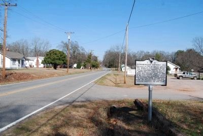
As early as 1765 the site 6 miles NW known to the Indians as Yellow Water, where the Keowee Path crossed the Cherokee line, was called DeWitt's Corner. In 1777 a treaty between S.C. and the Cherokee Indians was signed there. The present town was . . . — — Map (db m10602) HM
Savannah Town
Forerunner of modern towns and highways and known to the English as early as 1685, this Indian town stood at a major northwestern entrance into S.C. on the trading routes to the Creeks, Choctaws, Chickasaws, and Lower Cherokees. . . . — — Map (db m28101) HM
(obverse)
Indian Head
The Indian Head, a series of springs at the head of Goodland Swamp, long served as a landmark and watering place. Travelers along the Middle Road referenced it and it appears on colonial plats. In 1781 . . . — — Map (db m102914) HM
(Front)
A patriot and Christian
devoted to his country, his
family and his god.
He served his country well
as a member of Hart's Battery
and died loving the cause
for which he fought.
Dempsey Hammond Salley was
. . . — — Map (db m47645) HM
(Front text) Woodlands was the country home of William Gilmore Simms (1806-1870), the most prominent and prolific writer of the antebellum South, from 1836 to his death. A novelist, poet, historian, critic, and essayist best known for his . . . — — Map (db m32008) HM
This high bluff was called
Red Hill in the colonial
era. It overlooks Turkey
Creek, which flows into the
Great Salkehatchie River.
The Charleston-to-Augusta
road, along an old Indian
trail, crossed the creek
nearby. The waters of . . . — — Map (db m63305) HM
Originally Barnwell County was part of Granville County, later a part of Orangeburg District. Winton County was created by an act of the legislature on March 12, 1785. Justices William Robertson, John Parkinson, Thomas Knight, Richard Treadway, . . . — — Map (db m8749) HM
1520 - 1711
In 1520 the Spaniard, Francisco Gordillo, sailing from Hispaniola, stopped near Port Royal Sound long enough to call the place Santa Elena. Fourty-two years later, in 1562, Jean Ribaut and his French Huguenots named the . . . — — Map (db m5886) HM
During the Colonial period the Beaufort district grew and prospered. Rice was produced for export on the mainland, indigo in the sea islands, shipbuilding flourished. The Parish System developed as the political basis and Beaufort competed with . . . — — Map (db m5935) HM
Born in Dublin Ireland in 1671
Son of Jacobite, Alderman Matthew Barnwell
Immigrated to South Carolina in 1701
Protege of Governor Nathaniel Johnson
and Chief Justice Nicholas Trott
Deputy Surveyor in 1703
Clerk of the Council 1703 . . . — — Map (db m148755) HM
Arrived Port Royal (Beaufort) 1666 with
Robert Sanford's Expedition exploring
the area. He remained with Indians and
learned their language. Captured by
Spanish, he escaped; later returned
guiding the Port Royal Colony. On his
advice the . . . — — Map (db m144230) HM
On or near this site in the settlement known as Stuart Town stood the "Tight Watch House" erected in 1683-4. After the destruction of the town by the Spanish in 1686 it was replaced by a fort, approximately 100 feet square defended by "9 Great Guns" . . . — — Map (db m5939) HM
John Mark Verdier
1759-1826
Builder Of This House
1795-1800
General Lafayette Spoke To The People
Of Beaufort From This Portico
March 18, 1825 — — Map (db m19644) HM
This plantation was part of a 1717 Proprietary landgrant of 500 acres to Col. John Barnwell. Later owners included members of the Green, Ellis, and Pope families. Nearby tabby ruins are remains of fire places of slave cabins. Graves of blacks, who . . . — — Map (db m6625) HM
A prominent landmark for mariners
since the voyages of the early
Spanish explorers, this headland
was known to the English as
Hilton Head after the voyage
in 1663 of Captain William Hilton
which led to their first
permanent settlement in . . . — — Map (db m16231) HM
native of Ireland, soldier in the Revolution, planter
on this island, a founder of the Episcopal Church on Hilton Head, the ancestor of the Stoneys of South Carolina. Also of his grandson, John Safford Stoney, eldest son of John and Elizabeth . . . — — Map (db m119649) HM
A Chapel of St. Luke's Parish,
established May 23, 1767, built of
wood shortly after 1786 under the
direction of Captain John Stoney
and Isaac Fripp, was consecrated
in 1833. Members of the Barksdale,
Baynard, Chaplin, Davant, Fripp,
Kirk, . . . — — Map (db m119648) HM
Taming the Wilderness
1715 - 1750
In 1715, Alexander Parris aquired what would come to be known as Parris Island. By 1722, Parris gave almost half the island to his daughter Jane and her husband John Delabare. Both families established . . . — — Map (db m21410) HM
[Front]:
Born in South Carolina, Pinckney was educated in England and served in the First and Second Provincial Congresses. A commander in the Revolution, he later served in the SC General Assembly, signed the US Constitution, and was . . . — — Map (db m30536) HM
Church of Prince William's Parish
known as
Sheldon
Built Between 1745-1755
Burned By the British Army 1779
Rebuilt 1826
Burned By the Federal Army 1865 — — Map (db m106086) HM
Text from Front Side
Prince William's Parish Church
(Sheldon Church)
These ruins are of Prince William's Parish Church, built ca. 1751-1757 and partially burned during the American Revolution, with its interior and roof rebuilt . . . — — Map (db m106077) HM
William Bull
of Sheldon
Born 1683 Son of Stephen Bull,
the Immigrant
Member Colonial House of Commons
1706 - 1719
Colonel of Berkeley County Regiment
Tuscarora and Yemassee Wars.
Lord's Proprietors Deputy 1719.
Member and President . . . — — Map (db m106135)
The Parish of St. Thomas was established by Act of Assembly Nov. 30, 1706. The first church was erected in 1708 and destroyed by forest fire in 1815. The present ediface was erected in 1819. — — Map (db m23368) HM
Home of Henry Laurens, born in Charleston in 1724, died at Mepkin in 1792. President of the First and Second Councils of Safety, 1775-76. President First Provincial Congress of S.C. 1775. Vice President of S.C. 1776. President of Continental . . . — — Map (db m23174) HM
Chapel of Ease to St. John's (Biggin Church), built about 1725 on land bequeathed by James Child, founder at this place, of the Town of Childbury. Strawberry Ferry was established here by Act of Assembly in 1705. — — Map (db m234406) HM
This county was designated a court and land conveyance district in 1682, and an election district in 1683. It was named for two brothers, Lord John and Sir William Berkeley, both Lord Proprietors of Carolina. Over the years, functions of this early . . . — — Map (db m21958) HM
About 1765-1767 Thomas Sumter, future hero of the American Revolution, kept a country store near this spot where the stream of colonial traffic to the Up Country divided in the fork where the Nelson's Ferry Road branched off from the Road to . . . — — Map (db m22247) HM
Marker Front:
Boochawee Hall, created in 1683 by a 2,400-acre grant, was owned by two colonial governors, father and son. James Moore (d. 1706), a trader and planter, served on the Grand Council and later led “the Goose Creek . . . — — Map (db m29492) HM
(Front text)
Broom Hall Plantation, later called Bloom Hall and still later Bloomfield, was first granted to Edward Middleton in 1678. By 1710 this property passed to Benjamin Gibbes (d. 1722), who named it for Broom House, his ancestral . . . — — Map (db m28558) HM
Marker Front:
This plantation was once part of Boochawee Hall, owned by Governor James Moore (d. 1706). Moore left 615 acres to his daughter Rebecca, who married Thomas Barker (d. 1715) in 1709. Barker, who planted inland rice here, served . . . — — Map (db m29493) HM
Crowfield Plantation, on the headwaters of Goose Creek, was originally granted to John Berringer in 1701. John Gibbes (1696-1764), a member of the Royal Assembly, sold it in 1721 to Arthur Middleton (1681-1737), also a member of the Royal Assembly. . . . — — Map (db m28504) HM
Early Indian Trading Paths
One of the earliest major trading paths in the Carolina colony, dating from the first decade of English settlement 1670-1680, ran nearby. The colonists traded guns and ammunition, cloth, rum, and other goods for . . . — — Map (db m27351) HM
(front)
From the 18th century, the State Road from Charleston and the Road to Dorchester met near here. These paths connected Charleston to the S.C. interior. Travelers from Charleston would have crossed Goose Creek, two miles south, . . . — — Map (db m206675) HM
(Front text) Goose Creek
This area has been called Goose Creek since the late 17th century. For almost 200 years after the Lords Proprietors granted large tracts to English, French Huguenot, and other planters, their plantations . . . — — Map (db m27360) HM
The Parish of St. James was founded by Act of Assembly in 1706. The present edifice was begun in 1714, and completed in 1719. The Royal Arms of Great Britain can still be seen over the chancel, and here is preserved the Izard Hatchment, said to be . . . — — Map (db m39091) HM
[Front] Howe Hall Plantation, an inland rice plantation, was established here by Robert Howe, who came to S.C. in 1683. His first house here was later described as “tolerable.” Howe’s son Job (d. 1706) built a brick plantation . . . — — Map (db m29524) HM
(Front text) Howe Hall Plantation Howe Hall Plantation was established here by Robert Howe about 1683 and passed to his son Job Howe (d. 1706), Speaker of the Commons House of Assembly 1700-05. Later owned by such prominent lowcountry . . . — — Map (db m28079) HM
This inland rice plantation has its origins in a 1683 grant. In 1726 Nathaniel Moore and his wife sold a 900-acre parcel to Isaac Mazyck (d. 1736). Mazyck’s son Benjamin (d. 1800), a rice planter, cattleman, and merchant, consolidated several . . . — — Map (db m29490) HM
Built 1750-1790 at Otranto Plantation and used to process dye from indigo, an important S.C. crop from 1747 to 1796. Moved here 1979. — — Map (db m29485) HM
Originally known as "Yeshoe," this plantation was granted in 1679 to Arthur Middleton, great-granduncle of the signer of the Declaration of Independence. Called "Otranto" after 1771, when it was bought by Dr. Alexander Garden, noted physician and . . . — — Map (db m29484) HM
Marker Front:
Springfield Plantation, an inland rice plantation, was established here by Paul Mazyck (d. 1749), a planter and merchant who combined two large tracts on Foster Creek, a branch of Back River. His father Isaac, a French . . . — — Map (db m29489) HM
The Oaks, an inland rice plantation, was established here by Edward Middleton (d. 1685) on a 1678 grant from the Lords Proprietors. Middleton, a planter who came to S.C. from Barbados, received 1,630 acres on Yeaman’s Creek, later renamed Goose . . . — — Map (db m29497) HM
Marker Front:
In April 1715 Yamasee warriors killed government agents and traders who had come to meet with them at Pocotaligo, in present-day Beaufort County. Others killed colonists and raided plantations and farms at Port Royal, . . . — — Map (db m29505) HM
Home and burial place of Sir Nathanial Johnson, born in the County of Durham, England, in 1644. Knighted in 1680, was a member of Parliament, and Governor of Leeward Islands. He came to South Carolina in 1683 and settled at Silk Hope, from here he . . . — — Map (db m23548) HM
After receiving a proprietary landgrant of 370 acres in 1705. French settlers laid out the town of Jamestown, c. 2 mi. N. By 1706, a church had been built known as the parish church of St. James, Santee. Jamestown never prospered and a number of . . . — — Map (db m23149) HM
The Berkeley County Museum and Heritage Center opened its doors in 1992. Built to resemble the Lowcountry architecture of the Colonial period, the museum structure includes details such as flooring taken from a 150-year-old Darlington railroad . . . — — Map (db m206632) HM
Parish Church of St. John's Berkeley, founded by Act of Assembly November 30, 1706. Church erected in 1712. Burned by forest fire in 1775 and restored. Burned by Col. Coates of the British Army in 1781 and again restored. Burned again by forest fire . . . — — Map (db m23453) HM
After Eutaw Springs, the British retreated to their post at Fair Lawn Plantation. In November 1781, Brig. Gen. Francis Marion sent Col. Hezekiah Maham with 180 horsemen and Col. Isaac Shelby with 200 mountain riflemen to eliminate British foraging . . . — — Map (db m53885) HM
Fairlawn Plantation Fairlawn Barony, sometimes called “Fair-Lawn,” was granted to Peter Colleton, whose father John had been one of the original Lords Proprietors of the Carolina colony. John’s grandson John (1679-1754), known as . . . — — Map (db m53881) HM
First site of Monck's Corner, where the road to the Congarees branched off from this road. Founded by Thomas Monck in 1735. Relocated on the railroad about 1856.
Here about 3:30 A.M. April 13, 1780, Col. Wm. Washington's Light Dragoons were . . . — — Map (db m33664) HM
Fair Lawn Plantation was an enormous property granted to Sir Peter Colleton, oldest son of Sir John Colleton, one of the original eight Lords Proprietors of the Carolina colony. During the Revolutionary War, the British army first occupied the . . . — — Map (db m53883) HM
This land, part of Fairlawn Barony and known as Little Landing, was bought in 1767 by Sedgwick Lewis. His daughter Sarah married Keating Simons. They acquired the land in 1774 and are presumed to have built the present plantation house. Tradition . . . — — Map (db m29132) HM
Originally granted to Sir Peter Colleton in 1679. Acquired in 1712 by Thomas Broughton, who erected the present mansion, said to be modeled after Seaton Hall in England, in 1714. Thomas Broughton was speaker of the Commons House of Assembly from . . . — — Map (db m29130) HM
Here was located the provincial town of Moncks Corner, deriving its name from Thomas Monck, an Englishman, who in 1735 purchased Mitten Plantation, and upon whose land the town was settled. It became an important commercial center prior to the . . . — — Map (db m23312) HM
The Stony Landing House was built on land which was once part of the 12,000 acre Fairlawn Barony. Fairlawn was granted to Sir Peter Colleton, son of Lords Proprietor John Colleton, on September 7, 1678. John H. Dawson purchased 2,319 acres on . . . — — Map (db m23088) HM
The Colleton Family
The Colleton family was the only one of all the privince's original proprietors to cast their fortune in South Carolina by establishing a family seat and actual residence here. None of the seven other owners even . . . — — Map (db m206731) HM
Near this point was the SW corner of Wadboo Barony, a 12,000 acre tract about 4 miles square, granted in 1683 to James Colleton, son of an original Lord Proprietor, as part of the land due him as a landgrave of Carolina. Colleton's heirs were . . . — — Map (db m23066) HM
Wadboo was a Native American name given to the enormous landholding of James Colleton, a son of Sir John Colleton, who was one of the original eight Lords Proprietors of the Carolina colony. Called a barony according to the Proprietors’ plan . . . — — Map (db m53891) HM
[Front] Wassamassaw, with several variant spellings during the colonial era, is a Native American word thought to mean “connecting water.” It first referred to the large cypress swamp here, but eventually referred to the community that grew . . . — — Map (db m29135) HM
In 1686 Medway Plantation was granted by the Lords Proprietors to Jan Van Arrsen,seigneur de Weirnhoudt. In 1689 the property came into the possession of Landgrave Thomas Smith, Governor of South Carolina November 1693 to October 1694. He died in . . . — — Map (db m23473) HM
Thorogood Plantation. In 1682 the Lords Proprietors granted 3,000 acres here, on a branch of the Back River, to Joseph Thorogood (d. 1684). Though Thorogood only owned the plantation two years and his widow Jane sold it after his death, it was . . . — — Map (db m27401) HM
“The Village of Eadytown is the site of the last known Indian tribe in Upper St. John’s Parish. In early 1700 American Settlers, moving inland, settled here and eventually became a vital part of the Community. Fort Schinkin, located on the . . . — — Map (db m54974) HM
This county was designated a court and land conveyance district in 1682, and an election district in 1683. It was named for two brothers, Lord John and Sir William Berkeley, both Lord Proprietors of Carolina. Over the years, functions of this early . . . — — Map (db m30738) HM
Area 1238 square miles established by order of the Lord Proprietors, May 10, 1682. Named for John (Lord) Berkeley and Sir William Berkeley. The largest county in the state, and part of the middle coastal district.
This highway and markers were . . . — — Map (db m33448) HM
In 1737-38, the elder Rev. John U. Giessendanner
from Orangeburg began Lutheran work in this
area; this was continued by his nephew until 1749.
By the 1760s, St. Matthew's Lutheran Church near
here was in use. A later building erected at . . . — — Map (db m26240) HM
St. Matthew's Parish was established by the S.C. Colonial Assembly between 1765 and 1768. The first of four church buildings was erected in Amelia Township c. 1765. The parish church was incorporated by the S.C. General Assembly in 1788 as the . . . — — Map (db m237357) HM
This Stone marks the spot where the Wappetow Independent Congregational Church stood. This church was planted here in 1696 by a colony of 52 who came from New England and landed at Seewee Bay. — — Map (db m206024) HM
Notable for its fine Georgian
paneling, this was home and
office to Dr. David Ramsay,
the distinguished patriot,
Revolutionary Historian and
physician. Dr. Ramsay
introduced the Small Pox
vaccine to Charleston
and helped found the . . . — — Map (db m27447) HM
Drayton Hall
Seat of the Drayton family for
seven generations, this land
was acquired in 1738 by
John Drayton (c. 1759~1779)
as the center of his extensive
indigo and rice planting ventures.
One of the finest examples of
Georgian . . . — — Map (db m13859) HM
Fountainhead of the Drayton family, which
played so important a part in America's
Colonial, Revolutionary, and Independence
history. Its original plantation house, credited
by contemporary historians as having been
the earliest in the Carolina . . . — — Map (db m14853) HM
This Georgian-era dwelling was constructed as the parsonage for St. Michael's Church by master builders Martin Miller & John Fullerton, one of the earliest known partnerships of house builders in colonial Charleston. Reverend Robert Cooper, the . . . — — Map (db m242804) HM
Born at Magnolia Plantation in 1713, but
failing to inherit Magnolia, he purchased
an adjoining tract and built Drayton Hall in
1740, but later acquiring Magnolia from his
nephew. In a will hastily drawn the night he
died while fleeing the . . . — — Map (db m14515) HM
This residence was constructed by Col. William Rhett (1666-1722), a prominent Charleston merchant and colonial militia leader. In 1706 he led a small fleet of local ships that repulsed a combined French and Spanish invasion of the city. Rhett is . . . — — Map (db m31849) HM
Near this spot once stood the Liberty Tree where Colonial Independence was first advocated by Christopher Gadsden A.D. 1766 and where ten years later the Declaration of Independence was first heard and applauded by South Carolinians — — Map (db m31852) HM
(Front side)
This house, built ca. 1712, is believed to be one of the oldest houses in Charleston. It was built for William Rhett (1666-1723), a merchant, sea captain, militia officer, and speaker of the Commons House of Assembly famous . . . — — Map (db m31847) HM
This building, designed by
Gabriel Manigault
and built in 1801 for the
Charleston branch of
The First Bank of the United States,
Stands upon the site which was set
apart as a market place in 1672
and used for that purpose . . . — — Map (db m19539) HM
Colonel William Rhett, born in London in 1666,
arrived at Charles Towne in 1694.
In 1712 he built and lived at 54 Hasell Street,
thought to be Charleston's oldest dwelling.
A capable military man and sea Captain,
he was commissioned a . . . — — Map (db m47931) HM
On or near this spot “on the bay, near Vendue Range”
Elizabeth Timothy
in 1738, became the first woman newspaper publisher in America when she took control over publication of the South Carolina Gazette upon the death of . . . — — Map (db m30019) HM
Commemorating
Francis Salvador
1747-1776
First Jew in South Carolina to hold public office and to die for American Independence
He came to Charles Town from his native London in 1773 to develop extensive family landholdings in the . . . — — Map (db m27489) HM
George Washington was born in Virginia on February 22, 1732. As a boy, he excelled in field sports, and though
his formal education was limited, he exhibited skill in mathematics and surveying.
In the French and Indian War, though only 23, . . . — — Map (db m47791) HM
When the Powder Magazine was built in 1712, South Carolina was a proprietary colony owned by eight British aristocrats. Seven years later, the colonists peacefully overthrew the Lords Proprietor and South Carolina became a royal colony. The flags . . . — — Map (db m47962) HM
Early Barbadian supporter of the settlement of South Carolina Colonial Governor 1710-1712
Proprietor's Deputy Chief Justice of South Carolina
Member of 1st Assembly Colonel South Carolina Militia
Sent South Carolina Militia to aid North . . . — — Map (db m27505) HM
This property, a part of one of the
original town lots in the Grand Model
of Charles Towne was bought by
Paul Douxsaint, merchant, planter, and
French Huguenot immigrant, in 1725.
The Charleston single house of French
type . . . — — Map (db m27543) HM
First brick house erected in Charleston standing in 1709. Home of Nicholas Trott first Attorney General of the Province of Carolina 1698 to 1702 and Chief Justice 1713 to 1719. — — Map (db m47922) HM
The Old Exchange
Commissioned in 1767
by Act of
The General Assembly of
The British Colony of South Carolina
Completed in 1771
Deeded in 1917
by The United States Congress
to the South Carolina State Society
National Society . . . — — Map (db m241666) HM
The Old Powder Magazine
is the only public building remaining from the era of the Lords Proprietors, the eight English aristocrats who owned Carolina from 1670 to 1719.
Charles Town, as the capital and southernmost English settlement on the . . . — — Map (db m27556) HM
The Plan of Charles Town
Prepared by Edward Crisp about 1704, gives the
location of the several Bastions
A. Granville
B. Craven
C. Cartaret
D. Colleton
E. Ashley
F. Blake
G. The Half Moon
I. Johnson's Cover'd Half Moon
L. The . . . — — Map (db m19229) HM
The Plan of Charles Town
Prepared by Edward Crisp about 1704, gives the
location of the several Bastions
A. Granville
B. Craven
C. Cartaret
D. Colleton
E. Ashley
F. Blake
G. The Half Moon
I. Johnson's Cover'd Half Moon
L. The . . . — — Map (db m19228) HM
Located within the walled city of Colonial Charles Towne, Trott's Cottage is one of the few remaining pre-Revolutionary structures.
Judge Nicholas Trott (1663-1740) owned the property prior to 1709. Judge Trott, born in England, came to America . . . — — Map (db m27558) HM
In
Memory Of
Affra Harleston Coming
Who epitomizes the courage of the woman who
pioneered the settling of this state.
Coming by herself from England in 1670 as a
bonded servent and serving a two year
indenture . . . — — Map (db m55171) HM
Based on the English practice of housing the poor, the first act to establish a work house came locally in 1736. The first building, doubing as a public hospital, opened in 1738 at the southwest corner of Magazine and Mazyck (now Logan) streets. By . . . — — Map (db m206020) HM
Who made the first systematic weather observations with instruments in America January 1738-February 1753
In this building, which probably ante-dates the year 1715...Dr. Lining lived...made observations of the weather...and may have conducted . . . — — Map (db m27473) HM
403 entries matched your criteria. The first 100 are listed above. Next 100 ⊳