In October 1861, a group of prospectors in search of the mythical Blue Bucket Mine, made camp on a creek six miles southwest of here. That evening, Henry Griffin discovered gold in the gulch which bears his name. That started a stampede which . . . — — Map (db m108152) HM
Dedicated to the memory of the intrepid pioneers who blazed the way over the Old Oregon Trail with the first covered wagons in 1843 and won an empire for the United States.
Erected by the American Legion
July 4, 1925 — — Map (db m108048) HM
Of the 2170 miles of the Oregon Trail, approximately 300 miles of ruts remain. Swales created by thousands of wagon wheels and the trampling of draft animals are deep in some areas, shallow in other places. Much of the trail has disappeared due to . . . — — Map (db m108130) HM
Early Oregon Trail emigrants crested the south flank of Flagstaff Hill and, with the Blue Mountains looming to the west, saw a solitary tree in the valley below. Called l’arbre seul (the lone tree) by French-Canadian fur trappers, this large . . . — — Map (db m108122) HM
Beginning in 1843, thousands of Oregon Trail emigrants trekked through this region toward new lives in the West. This epic journey indelibly etched the landscape with wagon ruts, such as those near by. When Henry Griffin, a prospector from . . . — — Map (db m108128) HM
Wagons and cattle of the Great Migration, led by Marcus Whitman in 1843, descended Sept. 25 into Lone Pine valley.
After nearly a month of travel over the hot dry Snake river plains from Fort Hall near Pocatello, Idaho, the cool climate and lush . . . — — Map (db m108157) HM
A moveable community for four to six months along the trail… the wagon encampment typically grouped into a circle, forming a temporary corral. Around the circle, tents and bedrolls provided the shelter for exhausted pioneers. A few guards kept an . . . — — Map (db m199177) HM
This spot was famous in early days as Express Ranch an important relay station on the Umatilla-Boise Basin stage and freight route. It was also a favorite camping place for emigrants and teamsters. — — Map (db m108121) HM
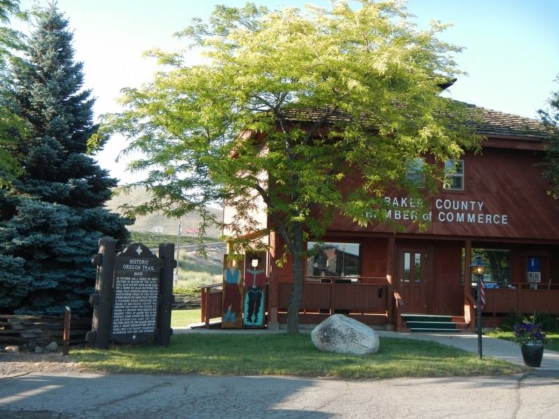
(Six panels dealing with the Baker Valley portion of the Oregon Trail are found beneath this kiosk) Permanent Settlers
In 1861, Henry Griffin, a prospector from California discovered gold eight miles southwest of the present . . . — — Map (db m111284) HM
The last camp on the weary journey across the Snake River plains. Here the Oregon Trail left the Snake River and wound overland to the Columbia. Here camped Wilson Price Hunt, December 23, 1811; Capt. Bonneville, January 10, 1834; Nathaniel J. . . . — — Map (db m107217) HM
(The Farewell Bend Oregon Trail kiosk houses seven panels which deal with the trials and tribulations on this arid portion of the Oregon Trail.)
"Pathway to the "Garden of the World"
Excitement filled the air May 22, . . . — — Map (db m107276) HM
From Alkali Springs, called by many pioneers Sulphur Springs, the emigrants traveled on to Birch Creek, which offered much needed water and grass for their livestock. First named "Riviere aux Bouleaux" by French-Canadian fur trappers, here travelers . . . — — Map (db m107212) HM
(Six panels dealing with the Burnt River portion of the Oregon Trail are found beneath this kiosk)
Dear Little Willie
Emigration on the Oregon Trail peaked in 1852 with 10,000 would-be Oregonians. Poor sanitation and . . . — — Map (db m108110) HM
(Seven panels dealing with topics related to the Applegate Trail are found at this kiosk.)
Applegate Trail
Southern Route to Oregon
In 1846, Jesse Applegate and fourteen others from near Dallas, Oregon, established a . . . — — Map (db m116846) HM
In 1973, Dr. Robert MacVicar, president of Oregon State University, and Gene Hansen, president of the Corvallis Chamber of Commerce, discusses the need to develop a stronger connection between the university and downtown, especially for . . . — — Map (db m117364) HM
In June 1846 Jesse Applegate, Levi Smith and 11 other men left their homes near Dallas Oregon to develop a southern route from Fort Hall (Idaho) to the Willamette Valley. Their route passed through the gap west of Pigeon Butte, then proceeded . . . — — Map (db m119068) HM
(Two interpretive displays are located here next to the South Benton Community Museum):
(First Display)
In 1846, Jesse Applegate and fourteen others from near Dallas, Oregon, established a trail south from the Willamette Valley and . . . — — Map (db m116837) HM
This mountain pass in named for Samuel K. Barlow who opened the first wagon route over the Cascades in 1846 to complete the Oregon Trail. The route was far from easy. Emigrant Isom Cranfill (cabinet maker, farmer, and itinerant preacher) made the . . . — — Map (db m112383) HM
Imagine feeding your hungry children and skinny ox teams whottleberries here. Helping you spouse repair your tired wagon for tomorrow's dreaded drop down Laurel Hill. Rain clouds gather around Mount Hood's peak. More storms coming. And they say the . . . — — Map (db m112373) HM
First Road built over Cascade Range in 1845-1846 by
Samuel K. Barlow (1792-1867)
an Oregon Pioneer from Kentucky
Wamic -- Miles 32
Dalles California Highway -- Miles 38
Maupin -- Miles 48 — — Map (db m112396) HM
Village of
Government Camp
formerly a camp on the old Barlow Road, the village was named in 1849 when US Cavalry troops were forced to abandon wagons and supplies here. — — Map (db m112337) HM
Village of
Government Camp
Formerly a camp on the old Barlow Road was named in the fall of 1849 when the first United States Mounted Rifles abandoned a large number of wagons here, while a detachment was traveling from The Dalles to . . . — — Map (db m112338) HM
Samuel Kimbrough Barlow
Oregon Pioneer from Kentucky
Built the first wagon road across
Cascade Mountains
passing this spot
1845 - 1846
The building of railways . . . — — Map (db m241048) HM
Here the Pioneers Ended Their
Journey West.
Abernethy Green is the Official
End of the Oregon Trail,
As Designated by the U.S. Congress
In 1978.
Placed in Honor
of the Pioneer Achievements of
Dan Fowler
Oregon . . . — — Map (db m114198) HM
Oregon City, Western Terminus of the Oregon Trail
(about 2200 miles from Independence, MO)
Here at Abernethy Green in the fall of 1845, members of the Barlow-Palmer-Rector Wagon Train entered Oregon City as best they could. Pioneering a . . . — — Map (db m114199) HM
"A few of us (went) to the Falls of Willamut where we found many people & considerable of business." Medorem Crawford, Journal, October 3, 1842
An emigrant of 1842, Medorem Crawford worked for nearly a decade hauling freight around . . . — — Map (db m114760) HM
"Past on twelve miles or more, took the (w)rong road and arrived at the Willammette bottoms about dark a little below the City." -- Samuel Dexter Francis, October 14, 1852
In September and October, and early November the meadows at the . . . — — Map (db m114136) HM
Letters in newspapers, emigrant guide-books, and word of mouth gave counsel on overland travel. Emigrants commonly used farm wagons - simple, well-made, and utilitarian. Many were home-made or commission-built by local wagon makers. Some had custom . . . — — Map (db m114761) HM
The pioneer road here detoured the Columbia River rapids and Mount Hood to the Willamette Valley. The road at first followed an old Indian trail. The later name was Barlow Road. Travel was difficult. Wagons were snubbed to trees by ropes on held . . . — — Map (db m112372) HM
Fire
On July 23, 1922 a fire destroyed more than twenty-five buildings on Front Street, including city hall.
Many of the businesses rebuilt a few blocks to the west, moving the heart of downtown Marshfield.
The fire was . . . — — Map (db m114151) HM
Travel by land was difficult until about 1915.
The road between Marshfield and North Bend was not completed until 1912. Most people continued to travel by small boats around Coos Bay for several more years.
Mosquito Fleet
. . . — — Map (db m114148) HM
In 1872, the Coos Bay Wagon Road was completed.
The road, which connected Coos Bay Roseburg, was 58 miles long. A stagecoach could make the trip in about 28 hours in good weather.
Another route to the interior was the stage . . . — — Map (db m114150) HM
Welcome to historic Fish Lake.
Now a quiet and peaceful place, it was once filled with the hustle and bustle of people working and traveling across the Cascades.
Nearby is the Fish Lake Remount Depot which has been in continuous use as a . . . — — Map (db m62025) HM
(Seven panels dealing with topics related to the Applegate Trail are found at this kiosk.)
Applegate Trail
Southern Route to Oregon
In 1846, Jesse Applegate and fourteen others from near Dallas, Oregon, established . . . — — Map (db m112862) HM
In 1846, Jesse Applegate and fourteen others from near Dallas, Oregon, established a trail south from the Willamette Valley and east to Fort Hall. This route offered emigrants an alternative to the perilous “last leg” of the Oregon Trail . . . — — Map (db m116842) HM
(Seven panels dealing with the Columbia Plateau and Columbia River portions of the Oregon Trail are found at this kiosk)
Pathway to the "Garden of the World"
Excitement filled the air May 22, 1843 as nearly one thousand Americans left . . . — — Map (db m111946) HM
The Cant family's touring car might have traveled this trail route frequently. Before highway improvements were made in the 1930s, the trail on which you are standing is a remnant of the historic fabric that makes up this spot, a clue to the way its . . . — — Map (db m158008) HM
Thousands of Oregon Trail emigrant passed this way toward new lives in a place Abigail Scot, emigrant of 1852, called the "Garden of the World" The Willamette Valley was nearly 2,000 miles from Missouri, and by the time emigrants reached this . . . — — Map (db m158539) HM
Harry DeWitt built this new automobile garage in 1920 when the demand for new cars and service was high in Hood River. During the Great Depression of the 1930s, the garage was divided and used as the Greyhound Bus Station, a service garage, and a . . . — — Map (db m112235) HM
Gale-force winds bedeviled explorers and emigrants alike in the Columbia River Gorge.
Journals from the 1800s depict travel as treacherous through this singular passage in the Cascade Range where 60 mile-per-hour gusts are common.
By . . . — — Map (db m113939) HM
"The valley opens and we pass some very pretty
locations. Timber in a great many varieties, some
entirely new to me." Virgil K. Pringle, Oct 11, 1846 — — Map (db m152440) HM
"Make 10 miles and camp at a considerable sized creek
[Ashland Creek], the best camp we have had for several
[days.] Road very good. High mountains around."
- Virgil K. Pringle, Oct 11, 1846 — — Map (db m152442) HM
Named for its hundreds of fresh water springs, lush glades and meadows, the Greensprings has for millenia been a seasonal gathering place for Native Americans and later provided refuge for travelers. In 1846, Levi Scott and the Applegate brothers, . . . — — Map (db m113544) HM
This toll road was constructed in 1858-1860 by the Thomas brothers. It was owned and operated by Lindsey Applegate, 1860-1869, and later by James Thornton and Jesse Dollarhide. It was replaced by the Pacific Highway in 1915. — — Map (db m112500) HM
This toll road was constructed in 1858-1860 by the Thomas brothers. It was owned and operated by Lindsey Applegate, 1860-1869, and later by James Thornton and Jesse Dollarhide. It was replaced by the Pacific Highway in 1915. — — Map (db m134508) HM
(Seven panels dealing with topics related to the Applegate Trail are found at this kiosk.)
The Applegate Trail
Southern Route to Oregon
In 1846, Jesse Applegate and fourteen others from near Dallas, Oregon, . . . — — Map (db m112656) HM
"Father and I rode down to Jacksonville about 10 miles
from Wagner's Fort. The country is very fine. The town is
wedged up into the mountain but the mines are all stopped
Business is very dull" - Welborn Beeson, Sep 4, 1853 — — Map (db m149048) HM
"The roads today were excellent and the face of nature
appeared full as interesting as yesterday Followed
down Rogue River [Bear Creek] about 12 mi[le]s & camp"
-Lester Hulin, Oct 15, 1847 — — Map (db m152444) HM
We continued our journey towards Jacksonville this morning,
designing to find a suitable place to graze our cattle until we
can find a shelter for our families...we then proceeded across
a prairie...where we encamped" - William Hoffman, Oct . . . — — Map (db m152446) HM
This single-story concrete structure was built in 1926 for the Medford Auto Company, and is one of many similar structures built on this portion of the Pacific Highway referred to as "auto row" from 1925 to 1930. This building was home to the Buick . . . — — Map (db m112838) HM
Applegate Trail emigrants required up to four days to travel from the Klamath River over the Cascades and Siskiyous to the Rouge River valley. The journey may have challenged those with healthy oxen, but it was a devastating trail for those whose . . . — — Map (db m88403) HM
In July 1846 Jesse Applegate, Levi Scott and thirteen others known as "The South Road Party" located this pioneer trail. It was used by the emigrants traveling from Fort Hall on the Oregon Trail to the Rogue River and Willamette Valleys between . . . — — Map (db m88005) HM
Southern Route to Oregon
In 1846, Jesse Applegate and fourteen others from near Dallas, Oregon, established a trail south from the Willamette Valley and east to Fort Hall. This route offered emigrants an alternative to the perilous . . . — — Map (db m88017) HM
"The valley is about 3 miles wide here. It is not the main Rogue
River Valley, but a branch of it called Bear Creek...The first
tomatoes and melon patch I found I helped myself to as many as
I could eat being very hungary" - Wellborn Beeson, . . . — — Map (db m152443) HM
This magnificent view is preserved and protected by the efforts of the Oregon Roadside Council, which initiated and secured the passage of the Oregon Scenic Areas Act in 1961. 3585 scenic miles of highways were surveyed and selected by the Council. . . . — — Map (db m113382) HM
The perilous last leg of the Oregon Trail down the Columbia River rapids took lives, including the sons of Jesse and Lindsay Applegate in 1843. The Applegate brothers and others vowed to look for an all-land route into Oregon from Fort Hall (in . . . — — Map (db m167270) HM
In 1846 the Crowley Family arrived in the valley with the first wagon train over the Applegate Trail.
Martha Leland Crowley, a daughter, succumbed to typhoid fever at the age of 16. She was buried here in a casket made of timber boards from some . . . — — Map (db m114481) HM
"Move one mile to camp (on Grave Creek), having none last night, and spent the day burying Mr. Cowley's daughter (Martha), who died yesterday evening, age about 14 years." - Virgil K. Pringle, Oct. 19, 1846 — — Map (db m112854) HM
The narrow gorge of Canyon Creek has long served as a travel corridor. Native Americans likely trekked this canyon for thousands of years. Alexander McLeod of the Hudson's Bay Company provided the first written account of the route in 1829, while . . . — — Map (db m112856) HM
Between 1846 and 1856 the Applegate Trail through Josephine County became a major travel corridor for settles, miners, freighters and those trekking between Oregon and California. Where the well-traveled route crossed the valley of Wolf Creek, a . . . — — Map (db m114479) HM
Generations of Oregon school children learned the lyrics of a song: "Hurry up oh pioneers, your faithful little band must never fail." Applegate Trail emigrants struggled to follow this advice, but the mountainous terrain of northern . . . — — Map (db m153823) HM
Jesse and Lindsay Applegate, members of the first wave of Oregon Trail emigrants, watched their ten-year old sons drown in the Columbia River when a boat overturned in the rapids near The Dalles in 1843. Once their families were settled, the . . . — — Map (db m114483) HM
In 1846, Jesse Applegate and fourteen others from near Dallas, Oregon, established a trail south from the Willamette Valley and east to Fort Hall. This route offered emigrants an alternative to the perilous "last leg" of the Oregon Trail down the . . . — — Map (db m114488) HM
The first emigrant train over the "Southern Route," including more than fifty wagons under the leadership of Captain Levi Scott and David Goff, left the Oregon Trail at Fall Creek or Raft River, on the Snake River, August 10, 1846. The Klamath River . . . — — Map (db m88002) HM
In 1846, Jesse Applegate and fourteen others from near Dallas, Oregon, established a trail south from the Willamette Valley and east to Fort Hall. This route offered emigrants an alternative to the perilous "last leg" of the Oregon Trail down the . . . — — Map (db m112867) HM
10 miles south of this monument, paths established along the south rim of the Klamath River Canyon by Shasta, Klamath, Pit and Modoc Indians were later followed by Hudson Bay trappers, the U.S. Army pack trains and in the early 1870's, supply . . . — — Map (db m147732) HM
You're standing on part of a wagon road built in the 1860s by the Oregon Central Military Road Company and the Willamette Valley and Cascade Mountain Wagon Road Company.
In the 1860s, the new state of Oregon needed better roads for commerce and . . . — — Map (db m157461) HM
In 1846, first crossed the Applegate Trail. The Southern Wagon Road and Topsy Road made original junction. An Indian Trail, at first; then the
Soldiers traversed these roads and in 1863, the Pony Express Trail was used to carry messages from Fort . . . — — Map (db m100225) HM
The Applegate Trail crossed the present boundary of Oregon approximately three miles southeast of here and went around the northern end of the lake which covered much of the basin, passing close to where you are now standing. The route was opened in . . . — — Map (db m112699) HM
Honorable Lindsay Applegate, son of a Revolutionary soldier with Colonial ancestry, born in Kentucky, September 18, 1808. Explorer, soldier, Trailblazer. Came to the Oregon country 1843. An Oregon Patriot, served in provisional, territorial and . . . — — Map (db m112625) HM
In 1846, Jesse Applegate and fourteen others from near Dallas, Oregon, established a trail south from the Willamette Valley and east to Fort Hall. This route offered emigrants an alternative to the perilous “last leg” of the Oregon . . . — — Map (db m112707) HM
Southern Route to Oregon
In 1846, Jesse Applegate and fourteen others from near Dallas, Oregon, established a trail south from the Willamette Valley and east to Fort Hall. This route offered emigrants an alternative to the perilous . . . — — Map (db m87946) HM
A party of 15 men, styled the South Road Expedition, as led by Capt. Levi Scott, Jesse Applegate, and David Goff, crossed the 42nd parallel on late July 4, 1846. It was blazing a road on which to lead Americans from harm, free of the impending war . . . — — Map (db m87945) HM
Having been among the early pioneers in this area, S.B. Chandler became one of the largest land owners in the vicinity during that era (1870 – 1930).
He ran large amounts of sheep and also some cattle.
At the peak of his land ownership . . . — — Map (db m113811) HM
Marker on Left:
In 1846, Jesse Applegate and fourteen others from near Dallas, Oregon, established a trail south from the Willamette Valley and east to Fort Hall. This route offered emigrants an alternative to the perilous . . . — — Map (db m147032) HM
This observation point has been provided to facilitate public enjoyment of the unusual and interesting combination of historical and geological features nearby. The development was planned and supervised by the Willamette National Forest and . . . — — Map (db m114229) HM
This is a portion of the McKenzie Salt Springs and Deschutes Wagon Road constructed during the period 1866-1872. The route across these lava fields was rough and torturous. However it was 1,000 feet lower in elevation than the older Scott Trail . . . — — Map (db m114227) HM
In 1862 Felix Scott led a crew of 50 men who blazed a trail across the Cascade Mountains following an old Indian trail which skirted lava flows.
Scott hoped to use the new route to take supplies to gold fields in Idaho.
His trail was . . . — — Map (db m114245) HM
In 1846 Levi Scott, together with Jesse and Lindsay Applegate, led an expedition that established the southern route to Oregon from Ft. Hall, Idaho. He was also elected to guide the first emigrants over the new route. Scott's significant role in the . . . — — Map (db m112910) HM
Slowed by rugged trail conditions, weather, and weary teams, emigrants in 1846 entered the southern Willamette Valley in dire circumstances. Transit of the mountains between the Rogue River and the Willamette watershed took a terrible toll - . . . — — Map (db m112911) HM
Roads and rights-of-way were serious public considerations on the Oregon frontier. Market roads, territorial roads and county roads were the lifelines of commerce and communication. River Road - the road upon which you are standing - was once a . . . — — Map (db m112909) HM
In 1846, Jesse Applegate and fourteen others from near Dallas, Oregon, established a trail south from the Willamette Valley and east to Fort Hall. This route offered emigrants an alternative to the perilous "last leg" of the Oregon Trail down the . . . — — Map (db m112908) HM
The trail to Oregon was never a single set of wagon ruts etched from Missouri to the Willamette Valley. Wagons often traveled abreast through valleys and plains sometimes widening the trail several miles. In the mountains they constantly attempted . . . — — Map (db m112912) HM
(The following two of four interpretive displays located in this park highlight the Applegate Trail):
(First Display)
In 1846, Jesse Applegate and fourteen others from near Dallas, Oregon, established a trail south from the Willamette . . . — — Map (db m116803) HM
165 entries matched your criteria. The first 100 are listed above. The final 65 ⊳