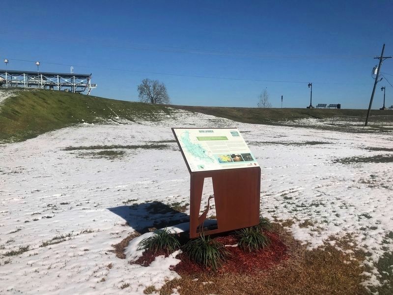
Once a course of the Mississippi River, Bayou Lafourche helped shape Louisiana's coastline by carrying fresh water, sediment and nutrients south to the Gulf of Mexico.Bayou LaFourche is a 106-mile waterway that stretches from Donaldsonville to . . . — — Map (db m111250) HM
This facility is dedicated to the memory of Walter Lemann, Sr. (1879-1952) a citizen of Donaldsonville whose untiring efforts to restore a flow of fresh water to Bayou Lafourche continued from its closure in 1903 until his death.
It was his . . . — — Map (db m86047) HM
The first major building designed by noted architect Henry Howard. Construction of this Greek Revival mansion was begun in 1846, using materials from the land. Steamboats carried trade to Madewood on Bayou Lafourche. — — Map (db m87862) HM
The community of Pierre Part in nearly surrounded by water and was inaccessible by land until the Mid-20th century, thus isolated from much of the world. Bayous lace this portion of south Louisiana. The highest land in the area is located along . . . — — Map (db m111809) HM
Bayou Des Glaises' French name likely refers to the kind of loamy, clay soil that settlers found along its banks.Bayous are typically found in flat, low-lying areas and can be slow-moving streams, rivers, marshes or wetlands. They are sometimes . . . — — Map (db m116249) HM
Big Bend is located along Louisiana State Highway 451, adjacent to Bayou des Glaises in a loop through northeastern Avoyelles Parish, between Hamburg and Moreauville. The community was settled in the 19th century by people of both French and . . . — — Map (db m105604) HM
Prior to 1913, floodwaters from the nearby Mississippi, Atchafalaya, and Red Rivers frequently forced the evacuation of people, livestock and property in the Big Bend area. The Avoyelles Parish Police Jury in 1915 authorized the . . . — — Map (db m105571) HM
Located on Red River 11 miles upstream from Marksville, Lock & Dam #1 is the first of five locks used to manage transportation from Shreveport to the Mississippi and Atchafalaya Rivers.The Red River is 1,360 miles long and originates in the . . . — — Map (db m116089) HM
Near this site on the main road from Opelousas to Avoyelles, Reuben Ray operated a ferry service across Bayou Boeuf. A surety bond granted by the State of Louisiana is dated 19 Sep 1816. In the early 19th Century before the advent of bridges and . . . — — Map (db m229930) HM
Louisiana's Atchafalaya Basin
Our Mission is to conserve, restore, and enhance the natural habitat and give all people the opportunity to enjoy the Atchafalaya experience.
The Atchafalaya Basin is, simply put, an asset to the southeastern . . . — — Map (db m97848) HM
Spring Bayou in located within the Spring Bayou Wildlife Management Area, which spans more than 12,000 acres in the low-lying , poorly drained Red River backwater system.Spring Bayou is located within Spring Bayou Wildlife Management Area, . . . — — Map (db m117592) HM
Also known as Norwood's Plantation, fought on May 18, 1864. Last battle of Banks' Red River Campaign. General Richard Taylor's Confederate army failed to prevent Union army crossing Atchafalaya River at Simmesport. — — Map (db m97437) HM
Nearest point of Federal advance on Shreveport during Civil War. About four miles to southwest near confluence of streams Confederates sank steamer New Falls City which blocked passage of Federal gunboats, April 10, 1864. — — Map (db m109795) HM
Cedar Bluff Ferry was one of the ferries on the Red River between Bossier and Caddo Parishes in the 19th and early 20th century. It operated until the early 1950s when a bridge was built to the north for Highway 2. It ran from Cedar Bluff in Bossier . . . — — Map (db m87160) HM
Just to the north of Herndon Middle Magnet School is one of the most historic regions in north Caddo Parish. During the early decades of the 19th century it was a crossroads of navigable bayous, a Caddo Indian Trail, an early road which settlers . . . — — Map (db m174348) HM
Near this site stood the trading post of James H. Cane and William S. Bennett. The first business building in what later became Shreveport. Built before 1852 at this place, then known as Cane & Bennett's Bluff, it was for many years the center of . . . — — Map (db m109745) HM
One block west near mouth of Cross Bayou at Red River the ironclad Missouri and ram Webb built. Missouri armored with railroad iron, In 1863 Webb fought U.S.S. Indianola near Vicksburg. Missouri was surrendered . . . — — Map (db m139539) HM
One of Shreveport's most historic waterways, Cross Bayou is spanned by the old KCS Railroad Bridge, one of only two surviving examples of the Waddell A-Truss bridge design in America. On the south bank of Cross Bayou was the Confederate Navy Yard . . . — — Map (db m139540) HM
Welcome to Greenwood Cemetery the second oldest cemetery in the city of Shreveport, opened in 1892.
The natural beauty of its seventy two acres is only the beginning of an amazing story at the edge of the frontier of American history. From the . . . — — Map (db m169142) HM
Jean Laffite was a French privateer, pirate and patriot. A hero with his band of baratarians at the Battle of New Orleans in 1815. Reputed to have had a warehouse on Contraband Bayou and to have conducted business with locals, Charles Salier and . . . — — Map (db m136230) HM
• At this site a natural river crossing was used by Native American who traversed the Ouachita River valley before the time of Christ
(Indian mounds upriver at Watson Brake date 3500 BC.)
• The Ouachita tribe of the Caddo nation was prominent in . . . — — Map (db m244308) HM
Columbia Louisiana - Established 1827. Only settlement between Monroe and Black River towns noted for its port and steamboat captains. Available List of captains on the Ouachita River before the Civil War Available List of captains on the . . . — — Map (db m120875) HM
Near this spot Confederate soldiers under the command of Col. W.H. Griffin captured the Union gunboats Wave and Granite City in the Battle of Calcasieu Pass, Cameron, Louisiana, on May 6, 1864. These gallant men died for their cause:Union . . . — — Map (db m160087) HM WM
Scottsville
In 1847, Benjamin Scott acquired a forty-acre tract of land located here on the east bank of Corney Bayou. It was the era of steamboat travel and this location, previously known as "Corni Bluff," was the northern-most point of . . . — — Map (db m180967) HM
The Three Rivers Confluence is where the Red River, Old River and the Atchafalaya River meet and combine the distributary outflow of the Mississippi River with the Atchafalaya Basin. This complex intersection is the origin of the Atchafalaya River . . . — — Map (db m116158) HM
The devastating Great Mississippi River Flood of 1927 did not spare the Town of Vidalia.Heavy rains and melting snow in the northern United States in late 1926 and the spring of 1927 swelled the river to the top of its banks. Its tributaries . . . — — Map (db m119734) HM
The Mississippi River's watershed measures 1.85 million square miles, or 41 percent of the U.S., from the crest of the Appalachian Mountains to the crest of the Rocky Mountains.One of the longest rivers in North America, the Mississippi flows . . . — — Map (db m119848) HM
After logjams in the Red and Atchafalaya Rivers were removed, the Mississippi threatened to change course by sending increasing mounts of water to the Atchafalaya via Old River.The connection between the Mississippi, Red and Atchafalaya rivers . . . — — Map (db m116156) HM
"Vidalia, a City on the Move!" is the slogan which has, in recent years, signified a progressive town surging ever forward. But, in 1938, it meant something entirely different to Vidalians as they literally moved their town from the banks of the . . . — — Map (db m10582) HM
In 1990, construction of the largest prefabricated power plant in the world, the Sidney A. Murray, Jr., Hydroelectric Station, was completed 40 miles south of Vidalia. It was the vision of Mayor Sidney A. Murray, Jr. to harness the power of the . . . — — Map (db m10583) HM
Front
The Village of Pleasant Hill was founded at this location just inside the DeSoto Parish in 1846. Pleasant Hill was a major road intersection with roads radiating to Mansfield, Natchitoches, Grand Ecore, Ft. Jessup, Many, Red River . . . — — Map (db m105673) HM
From this point Gen. Green's Texas Cavalry drove Gen. A.L. Lee's Federal Cavalry back toward Pleasant Hill until re-enforced. Then the Confederates withdrew, skirmishing all the way, to Ten Mile Bayou. — — Map (db m105352) HM
During his more than forty years of service with the Marine Corps, John A. Lejeune participated in campaigns in Panama, Cuba, Mexico, France and Germany. He led the famed 2nd Division, American Expeditionary Force, during World War I with valor and . . . — — Map (db m88608) HM WM
On December 07, 2018, the Honorable Sharon Weston Broome, Mayor-President of the
City-Parish of East Baton Rouge, in cooperation with the Louisiana Naval War Memorial
Commission and the Military Order of the Purple Heart -- Red Stick Chapter 177, . . . — — Map (db m134215) HM WM
Panel 1:
USCGC WHITE ALDER/WLM-541
7 December 1968
In memory and honor
of those shipmates who loyally served
the United States Coast Guard
on board the CGC WHITE ALDER.
They gave the ultimate sacrifice.
On December 7, . . . — — Map (db m126952) HM
Panel 1:
It is August first, 1945, Hunter's Point Naval Shipyard, San Francisco. The KIDD is just completing repairs following the April 11 Kamikaze hit that killed thirty-eight of her crew off Okinawa. It is before the days of television, . . . — — Map (db m85886) HM WM
In memory of the Officers and men of the USS Kidd who gave their lives in the action of 11 April 1945 off Okinawa.
Greishaber, George P., Lieut. (JG) USNR Berwick, Robert A., Ens (SC) USNR Bridgewater, Dorsey C., s 1/C USNR Smith, Addison . . . — — Map (db m137274) WM
Look over the water and across time. Do you hear the paddling of Native American dug-outs? Thunderous volleys from the Civil War gunboat pictured above? Perhaps Mark Twain piloting a paddle-wheeler or P.T. Barnum beckoning with his showboat's . . . — — Map (db m88295) HM
The idea to create lakes from the old Perkins Swamp originated in a Chamber of Commerce meeting in 1933, when thousands of men needed work and the relocation of the LSU campus had created momentum for growth of the city southward.The Baton . . . — — Map (db m111270) HM
Ship's Bell...from the Amos K. Gordon, the first all-steel towboat owned by Standard Oil Company of Louisiana. The bell is marked: CAST BY // THE CHAPLIN-FULTON MFG. CO. // PITSBURGH, PA. — — Map (db m133649) HM
About The AreaStretching from Milford Wampold Memorial
Park, affectionately known as "Baton Rouge
Beach,” to the City-Brooks Community Park golf
course, the LSU lakes-University Lake and City
Park Lake-lie on LSU's eastern edge . . . — — Map (db m120272) HM
The Mississippi River - One of the longest rivers in North America - is divided into three sections: Upper, Middle and Lower Mississippi. At certain points on the southernmost section, the river is one mile wide.The Mississippi River is one of . . . — — Map (db m111611) HM
Bayou Fountain was once connected to the Mississippi River when springtime flooding flowed over the natural levees just below downtown Baton Rouge, entering the swamps to the east of the river. Bayou is a word used frequently to describe . . . — — Map (db m111819) HM
Parent soil material along the Comite includes quartz and sand crystals, which differ significantly from the alluvial mud that characterizes the Mississippi River Basin.The Comite River begins in East and West Feliciana parishes and joins the . . . — — Map (db m111589) HM
Left side
The fall of New Orleans in April 1862, capped the beginning of an 18-month drive to control Vicksburg and the Mississippi River. The fight for this strategic location was arduous. Vicksburg, sitting high atop . . . — — Map (db m90404) HM
In early 1863 Federal General U.S. Grant dug a canal here connecting the Mississippi River and Lake Providence. This attempt to use bayous and rivers to bypass Vicksburg failed. — — Map (db m90201) HM
Marker middle
Winter Quarters
Winter Quarters, the country home of Haller and Julia Nutt, is the only plantation home along Lake Saint Joseph that survived the Vicksburg campaign. The Nutts were Union sympathizers who . . . — — Map (db m90405) HM
In early 1863, Union troops commanded by Gen. U.S. Grant dug a canal connecting the Mississippi River and Lake Providence. They camped in an area known as "Soldiers' Rest," which provided a temporary home. — — Map (db m89783) HM
At 6:00 PM on April 26, 1864, here, near the junction of Cane and Red Rivers the Confederates set up an artillery battery to intercept Federal gun boats. Two boats were captured. More than 200 people on board the vessels were killed or wounded. . . . — — Map (db m136284) HM
Avery Island is a 2,200 acre salt dome located in coastal Iberia Parish. The dome's elevation supports habitats not found in the surrounding marshes, swamps and parishes.Avery Island stands out from the surrounding wetlands, rising at its . . . — — Map (db m118435) HM
Petite Anse actually means "Little Cove"'' in Louisiana French.
This particular bayou runs along the west side of Avery
Island before flowing south into Vermilion Bay and the Gulf
of Mexico (through the Avery Canal). In the 19th . . . — — Map (db m118481) HM
This structure is known as the Ward Boathouse. Like Edward
Avery Mclhenny, Charles Willis Ward (1856-1920) ran a
plant nursery and was an avid conservationist. Around 1910,
McIlhenny and Ward met, and with McIlhenny's permission
Ward set up a . . . — — Map (db m118532) HM
Because movement here in the late 1800s was easier by water than by land, many daily activities occurred on or along Bayou Teche, including transportation, trade, and mail delivery.Bayou Teche is an ancient channel of the Mississippi River, . . . — — Map (db m116057) HM
A lone chimney rises above the surface of Lake Peigneur as a reminder of the unusual disaster that occurred here in 1980.
More than 140 years ago, Lake Peigneur was described as the most beautiful lake in the South. The present-day lake and . . . — — Map (db m118837) HM
The wreckage of Teche, a steamship, lies buried below the surface at this site. The steamer, built in 1860, was originally named Sam Sugg and then Tom Sugg. It was constructed for commercial use with a small side-wheeled . . . — — Map (db m115657) HM
First known as Lake Flamand for one of the early settlers, Jean Baptist Grevemberg; known as Lake Tasse by the French due to its cup shape; and known as Spanish Lake for early Spanish colonials who lived on its shores. — — Map (db m115654) HM
Throughout much of the nineteenth century, New Iberia was the area terminus for water-borne traffic on Bayou Teche from north and east. Barges, schooners and smaller craft plied the Teche until the coming of the steamboat. In the fall of 1830, the . . . — — Map (db m87096) HM
The Gulf Intracoastal Waterway was designed primarily for commercial traffic but is also used by recreational boaters. It allows vessels and goods to travel more than 1,300 miles through safer waters inland from the Gulf of Mexico.Completed in . . . — — Map (db m111259) HM
Le passage des Acadiens Pendant après la de'portation de 1755 depuis le Canada jusqu'aux Attakapas de Sud-ouest.
Passageway of Acadians after deportation of 1755 from Canada to the Southwest Attakapas. — — Map (db m87228) HM
Upon completion in 1909, The Plaquemine Lock was an engineering marvel thanks to the unique gravity of water flow system that operated the highest fresh water lock in the world.As a distributary of the Mississippi River and an inland route to . . . — — Map (db m111247) HM
Bayou Plaquemine was an important Mississippi River distributary that allowed for boat navigation throughout the Atchafalaya Basin. Travelers left the Mississippi via Bayou Plaquemine, moved west to the Atchafalaya, and then headed further inland . . . — — Map (db m111443) HM
Gary J. Hebert
1929-1994
Due to his vigilant and untiring efforts, this historic property still stands. Gary J. Hebert refused to back down despite a tremendous push for destruction of the lock to make way for a four-lane highway. After a two . . . — — Map (db m86843) HM
Here in Bayou Goula Bend on December 7, 1968 the Coast Guard Cutter White Alder sank after collision with the Formosan Freighter Helena. This light is dedicated to the crew of the White Alder. Seventeen Coast Guardsmen lost their lives in the . . . — — Map (db m126912) HM
Home of Pierre A.C.B. Derbigny, 6th Governor of La., 1828~1829, member 1st La. Legislature, La. Secretary of State, La. Supreme Court Judge, Battle of N.O. veteran. 1820 operated 1st steam ferry on Miss. River at N.O. Died 1829 from a carriage . . . — — Map (db m80975) HM
Ferry operated from 1898 to 1942 with two transfer boats. One, the Gouldsboro, named for railroad magnate Jay Gould, was built in 1863 as the Federal Monitor Chickasaw and saw action at the Battle of Mobile Bay. — — Map (db m129478) HM
In 1839, St. Mary's Market Steam Ferry Company developed 824 lots along Lafayette Avenue, naming the area Gretna and establishing commercial ferry service between the West Bank and New Orleans. — — Map (db m129780) HM
In 1736, Claude Dubreuil initiated a canal
at this site, from the Mississippi River
to Bayou Barataria. One hundred years
BEFORE the Harvey Canal, it was the
FIRST man-made waterway accessing
New Orleans to the Gulf of Mexico.
That canal . . . — — Map (db m205429) HM
Originally Destrehan Canal, dug before 1845, connecting Mississippi River to Bayou Barataria. "Submarine Railway" lifted boats over the levee until successful completion of locks in 1907. Became part of Gulf Intracoastal Waterway in 1924. — — Map (db m80971) HM
Lake Pontchartrain began forming about 5,000 years ago when North America glacier melts caused the Mississippi River to swell and shift to the east. The river deposited sediments into the Gulf of Mexico, creating a broad delta, which would later . . . — — Map (db m99364) HM
Known as the PBR was introduced in 1965
in Vietnam to patrol inland waterways,
this 31 foot fiberglass boat could reach
speeds of 32 mph. — — Map (db m236661) HM
In World War II, U.S. Navy Seamen were members of the most powerful fleet ever established to maintain control of the seas. These courageous fighting men participated in the most important U.S. victories at sea including those fought in the Pacific. . . . — — Map (db m94574) HM WM
A submarine built by Manitowoc Shipbuilding Co. of Manitowoc, Wisconsin. Funds for this boat were raised by the citizens of Caddo Parish Louisiana. Launched One August, 1943. On her second patrol under command of LCDR. James S. Clark, was sunk by . . . — — Map (db m133997) HM WM
This otherwise flat region, sloping, hill-like formations are visible and represent the Mississippi River escarpment (bluff-like shelf) that divides this area into floodplain and prairie. The Vermilion River flows at the base of this . . . — — Map (db m114785) HM
GUIDE ROPE FERRY: Simple Technology for Traversing Bayous South Louisiana features numerous rivers and bayous that flow from north to south, making east-west travel difficult in the pre-modern age. Ferries were essential for . . . — — Map (db m134963) HM
TRAPPER'S CABIN: Harvesting the Natural Bounty of the Wetlands This replica of a structure is based on an outbuilding used for storage from the 1700s, and illustrates st a basic dwelling in which trappers and moss pickers in . . . — — Map (db m134624) HM
The Vermilion is a tidal river formed from the bottom up by Vermilion Bay tides and other natural actions that slowly eroded inland from the marshes and cheniers and through the Louisiana prairie. The Vermilion River, also known as Bayou . . . — — Map (db m114505) HM
During early settlement and into the Antebellum Period, the Vermilion was an important secondary waterway for steamboats carrying agricultural products to New Orleans, the east coast and, eventually the world.The Vermilion River, also known as . . . — — Map (db m114649) HM
Larose, located at the crossroads of Bayou Lafourche and the Intercoastal Canal, called Canal Harang until the first Post Office was opened around 1890. Was named for Joseph Felicien Larose, a pharmacist who acted as an unofficial Postmaster. A . . . — — Map (db m85767) HM
Near hear was the prehistoric fork of Bayou Lafourche and Bayou Terrebonne. Acadians settled the area in 1785 and were joined by earlier French, German, Spanish and American settlers. The Village of Thibodauxville was started on the high banks of . . . — — Map (db m81073) HM
Surrounded by Lake Maurepas, the Amite River, Bayou Pierre, the Petite Amite, and Blind River. Lake named by Iberville in 1699 for Comte de Maurepas. Area settled by French, Spanish, and German immigrants. — — Map (db m87502) HM
Originally a Spanish settlement and early port on Amite River route from Mississippi River via Bayou Manchac. First called Scivicque's Ferry for Vincent Scivicque, native of Italy. Parish seat 1872-1881 — — Map (db m96055) HM
The Amite River Phase (4000-1500 B.C.) of the Archaic Period was a local variation of a pre-ceramic Indian culture in the area. Gravel lured Indians to the Amite River, which today remains important for this resource. — — Map (db m86004) HM
During the summer of 1862, the Federals’ first attempt to bypass Vicksburg by digging a canal across DeSoto Peninsula failed. By January, 1863, the Federals had reoccupied the Louisiana shore opposite Vicksburg. Gen. U.S. Grant ordered work on the . . . — — Map (db m84467) HM
This canal was the third attempt by the Union armies to route gunboats around Vicksburg. Excavation was begun in January 1863, by order of General Grant with two regiments and 1,200 Negro laborers. Two dredge boats were used in February but were . . . — — Map (db m84469) HM
The remains of the canal you see here today are the result of the second Union effort to bypass Vicksburg.
In January 1863, laborers and troops under the command of Maj. Gen. Ulysses S. Grant resumed work on the canal begun in June 1862. They . . . — — Map (db m84472) HM
In 1862, powerful Confederate guns along Vicksburg’s high bluffs kept the Mississippi River closed to Federal shipping. Union leaders decided the army should take the city by land to gain control of the river. But General Thomas Williams had a . . . — — Map (db m84468) HM
Known as Connecticut’s Irish Regiment, due to its predominant makeup of soldiers born in Ireland, the Ninth was mustered in at New Haven in September 1861. In December, the 845-man regiment arrived at Ship Island, Mississippi, and was among the . . . — — Map (db m84476) HM WM
Rather than attack Vicksburg directly, the Federals at first tried to engineer their way around the Confederate stronghold.
In June 1862, Union troops started digging a canal across the foot of DeSoto Point. The theory: the river would adopt . . . — — Map (db m84470) HM
At daybreak on June 7, 1863, Gen. H. E. McCulloch led his Texas Brigade against the Union force which guarded the Union supply depot at Milliken’s Bend. In the savage fighting which ensued, the Confederates drove the Federals from their camp. While . . . — — Map (db m34798) HM
Col. T.W. Bennett's task force, which had been sent to reconnoiter the route from Milliken's Bend to New Carthage, reached this point at 2:00 P.M. on March 31, 1863. If the Federals were to occupy Richmond, they would first have to cross Roundaway . . . — — Map (db m89050) HM
Louisiana's abundant rivers and
bayous provided essential paths
for travel and trade. Merchandise,
people, animals, communications,
and even diseases were carried on
the waters by dugouts, barges
and steamboats over the centuries.
The Red . . . — — Map (db m227880) HM
During the French and Spanish Colonial Period, 1714 - 1803, this bayou emptied into the Red River, now Cane River Lake. It was the rendezvous when the river trade from New Orleans met the pack animal trains from Old Mexico.
Because of the many . . . — — Map (db m106517) HM
During the Great Red River Flood of 1945, the Cane River rose and crested 16 feet above it's typical
mean pool elevation of 98.0 on April 10,1945. The brick coursing variation above denotes the level to
which the waters rose during the 1945 flood . . . — — Map (db m175417) HM
Once a primary channel of the mighty Red River, Cane River has defined the region for centuries. It has been home to various ethnic groups over the years, including the Native Americans, French, Spanish, Africans from various tribes, and Americans. . . . — — Map (db m106513) HM
Once connected by a mule-drawn streetcar, Algiers and Gretna are now linked by this path of history. Follow the markers along the "Right Bank of the Mississippi River" to historic downtown Gretna, as many have done since the 1800's. — — Map (db m160913) HM
199 entries matched your criteria. The first 100 are listed above. Next 100 ⊳