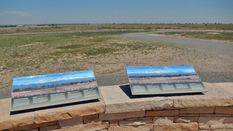
Rocky Mountain Arsenal National Wildlife Refuge
Located just eleven miles northeast of downtown Denver, the Refuge is the largest contiguous open space in the Denver metropolitan area. A major environmental restoration program will be . . . — — Map (db m119390) HM
According to Outdoor Life (April, 2004),
Old Mose was the most famous grizzly ever to
appear in their publication. This one bear
was responsible for a myriad of depredations.
Known for his distinctive footprint
(he was missing two . . . — — Map (db m160761) HM
This landscape is the result of dramatic climate changes that affected plants, animals, and humans. In ancient times, large shallow lakes existed on today's valley floor, and American Indians of the Clovis culture pursued great herds of large . . . — — Map (db m160699) HM
The Cimarron Cutoff and Granada Road were branches of the Santa Fe Trail from Missouri to Santa Fe. The Aubrey and Penrose were other trails. From 1866-97 thousands of Texas cattle were driven to Montana on the XIT and National Cattle trails. — — Map (db m120040) HM
The Arkansas River Valley is a historical frontier in both the American and European sense. Americans view the frontier as unsettled or a sparsely settled area lands on the edge of "civilization." To Europeans, frontiers are boundaries or borders . . . — — Map (db m120698) HM
Crowley Communities
If the dry summers of the late 1920s spelled trouble for Crowley County, the Dust Bowl of the 1930s spelled disaster. Many farmers simply packed up and left, and their acreage reverted to grasslands and became cattle . . . — — Map (db m120745) HM
Hardscrabble's rugged cliffs are perfect bighorn sheep habitat — wild, rocky, and open. Against the steep canyon walls, their brown coats blend into the vegetation and rocks. Scan the hillsides closely for their white rump patches or listen . . . — — Map (db m153186)
Originally built as the stables for the Denver City Railway Company in 1883, this building was the birthplace of Denver's Public Transportation system. Horse drawn trolleys, soon replaced by one of America's most extensive cable car networks, . . . — — Map (db m97394) HM
The first man to rob the Denver Mint was “Small Bad Jim” – James Clark. The gold bars were so heavy that he began dropping them only one mile away in what is now Cheesman Park. Six days later, the desperado was captured 25 miles south of Colorado . . . — — Map (db m100808) HM
"A dog fight on Champa Street is of more interest to Denverites than a war in Europe."
Frederick Bonfils
(1860-1933)
Founder of The Denver Post
and prominent philanthropist — — Map (db m135447) HM
As goes sagebrush, so goes the Gunnison sage grouse. These highly adapted birds rely on this shrubby vegetation for food, camoflage, and nesting material. Sagebrush rangeland also provides the setting for the species' highly unusual . . . — — Map (db m160150) HM
As you drive up Pikes Peak, you’ll feel it get colder. You’ll also notice that the plants change. See if you can pick out four different life zones on the way to and from the summit.
A life zone is a plant and animal community that exists at . . . — — Map (db m45929) HM
Alpine and subalpine tundra is the low-growing vegetation found in the “land above the trees.” At this high elevation, the climate is harsh with searing winds, intense sunlight and frigid temperatures that limit the growing season. In . . . — — Map (db m45927) HM
The foothills of Colorado’s eastern slope form the dramatic meeting place of the Great Plains and the Rocky Mountains. In this transition area between the prairie and the mountains, grasslands intermix with scrublands of mountain mahogany and scrub . . . — — Map (db m45925)
When artists and photographers portray Colorado’s mountainous beauty, they usually capture the classic views of evergreen forests, stands of quaking aspens, and meadows of brilliant wildflowers. The montane area above 8,000 feet contains just such . . . — — Map (db m45926) HM
Watch and listen to see how many different birds you can discover on Pikes Peak. From the foothills to the summit, there are about 225 species. This variety is due to the number of habitats on the mountain. Can you match the birds to the habitat? . . . — — Map (db m45920) HM
The abundant seeds of piñon and juniper trees draw wildlife to this ecosystem like a magnet. Chipmunks, foxes, piñon mice and squirrels munch the blue or copper-colored juniper berries. The berries last through the winter. They provide food for . . . — — Map (db m45982) HM
1775-1835 American Indian Area
Discover the history and culture of the American Indians who lived in the Central Front Range of the Rocky Mountains. Visitors will have an opportunity to see an elk or buffalo hide tepee, a wide variety of . . . — — Map (db m135562) HM
The Central Garden Trail is a moderate, one-mile round-trip loop. It is paved and wheelchair accessible. This trail will take you between the towering Gateway Rocks into the heart of Garden of the Gods Park. Along the way you will have the . . . — — Map (db m72936) HM
J.W. Abert, a military explorer-naturalist of the American Southwest, is credited with discovering the squirrel named in his honor. The genus name Sciurus refers to tree-dwelling squirrels. It means "shade-tail" because of the way these animals . . . — — Map (db m158347) HM
In the early days of New Castle, horses were at the center of all activity. The building before you was where that activity happened. C.H. Noren & Son, who rented horses and rigs for hauling, operated the livery business. Later Levi Strauss and A . . . — — Map (db m120105) HM
The Kawuneeche Valley is prime moose habitat. Wetlands along the Colorado River support aquatic plants, willows, and Aspen that moose eat. Moose frequented here, then were hunted out of the area by the early 1900s. In the late 1970s, the Colorado . . . — — Map (db m164288) HM
Dinosaur bones were deposited here on the inside of a meander by a
fast-flowing stream. This deposit known as a “point bar” grew by the addition
of sand, causing growth of the point bar towards the outer bank and
downstream. Larger, . . . — — Map (db m125104) HM
The downward bulges in the rock layers are most likely
dinosaur tracks viewed in cross section. When dinosaurs walked in soft sand
they sank in, pushing down and distorting the layers beneath their feet.
The tracks later filled in with more . . . — — Map (db m125156) HM
Windy Saddle Park is named for the nearly constant wind currents that can be felt blowing through the foothills. Winds traveling across the plains are forced upward when they hit the Rocky Mountains, and as the air rises, it has enough force to lift . . . — — Map (db m46157) HM
First noted by Matt Mossbrucker and later described by Dr. Martin Lockley,
this theropod (a carnivorous dinosaur) track was part of the top layer of sandstone at
the Bone Site, 50 yards to the north. During road construction in 1937, this . . . — — Map (db m125150) HM
Based on Late Cretaceous fossil evidence found along this trail, this area was a delta with lakes, streams and a mosaic of swamps, scrubby forests, palm tree thickets and small open areas. Impressions of logs, leaves and palm fronds suggest a . . . — — Map (db m111418) HM
Birds are descendants of theropod (meat-eating) dinosaurs and their tracks look similar:
three long narrow toes with claw marks. However, bird tracks are generally smaller than most
theropod tracks.
This print is wider than long and the . . . — — Map (db m114062) HM
Triceratops: 30 feet long, 6-12 ton Herbivore
Several tracks of Triceratops or a closely related horned dinosaur were discovered in this area. Among
horned dinosaurs, Triceratops is the most likely track maker because many of its bones have . . . — — Map (db m114058) HM
Designated a Colorado Natural Area in 2002, the Dakota Hogback/Dinosaur Ridge Natural Area in Jefferson County is a crown jewel of statewide, national and international importance. The Dakota Hogback/Dinosaur Ridge Natural Area exemplifies all the . . . — — Map (db m80464) HM
Grasslands are some of the most biologicaly productive but endangered ecosystems on
Earth, and are the major ecosystem in the
Great Plains. The prairie is integral in shaping this cultural landscape. It supports the interaction and survival of . . . — — Map (db m185037) HM
Sand Creek Massacre
National Historic Site
Sand Creek Massacre National Historic Site memorializes the massacre of nearly two hundred Cheyenne and Arapaho Indians.
Near dawn on November 29, 1864, detachments of the 1st . . . — — Map (db m107179) HM
Plains Indian Life
By the nineteenth century, Colorado’s southeastern plains country was home to many native peoples, including Comanches, Kiowas, Plains Apaches, Arapahos, and Cheyennes. Although vastly different in language and . . . — — Map (db m107178) HM
Trails & Passes
• The Colorado Rocky Mountains, appearing as a formidable barrier, have trails over almost all 260 passes.
• A trail is a corridor between two places: usually a network of paths that meet at certain key points, such as river . . . — — Map (db m153407) HM
Elk descend to this meadow and other lowlands when
higher elevations are blanketed by snow in fall, winter,
and spring. Preferring forests by day, elk are most often
seen grazing here at dawn or dusk.
By 1900, elk were hunted out of this area. . . . — — Map (db m164275) HM
Today the Purgatoire River rolls through a rugged, arid landscape in a deeply carved
canyon—but imagine a lush conifer forest and verdant ferns right where you're standing!
Learning from the Layers
The layers of rock at the . . . — — Map (db m181056) HM
From the air, you can see
the tracks of two sauropod
dinosaurs walking side by side
along the ancient lakeshore. The
discovery that some types of
dinosaurs lived in large herds like
modern animals happened because
of parallel tracks . . . — — Map (db m181013) HM
Panel 1
The Ludlow Massacre
By April 1914, the striking coal miners encamped at Ludlow (ten miles northwest of here) had nothing to lose but their lives. Poor, powerless, largely immigrant, they had held out for . . . — — Map (db m97716) HM
The Denver & Rio Grande Railroad opened up vast new markets to sheep and cattle ranchers. Cimarron grew to become one of the busiest loading stops in Colorado.
Breeding stock wintered in valleys to the west. Trains or spring drives brought cattle . . . — — Map (db m158946) HM
They called themselves "Nuche," meaning "the people." The Ute Indian people lived in a land of diversity - from dry desert-scrub to verdant river valleys, from dense forests to high mountain meadows. To survive, they had to know where to find plants . . . — — Map (db m186957) HM
Take a few moments on this spot to explore the South Platte River and the riparian woodland that runs beside it. You'll discover that this ribbon of life is a great place for wildlife watching.Where the South Platte flows through prairie, farm, and . . . — — Map (db m47316) HM
The land surrounding the Arkansas River teemed with wildlife. Most numerous were the bison or buffalo. They were the dominant species of the high plains, the emblem of the prairie. The fortunes of Bent's Fort and the neighboring tribes were tied to . . . — — Map (db m192001) HM
When the Bents first traveled to this area they may have encountered elk, bighorn sheep, pronghorn, deer, grizzly bears, wolves, beaver, river otters, and the huge herds of bison that once lived here. Bison especially, provided the region's native . . . — — Map (db m180856) HM
Dubbed Bayou Salado by early European explorers, South Park is one of four high-altitude mountain parks in Colorado.
The view from Wilkerson Pass looks down to a great flat plain, perhaps the best-known mountain park in the state.
The name, . . . — — Map (db m153273)
The Independence Pass corridor is home to irreplaceable natural habitat, much of which is protected by federally-designated Wilderness Areas. Wilderness is off-limits to motorized recreation and mountain bikes but provides important low-impact . . . — — Map (db m152924)
The Buffalo Symbol
The buffalo symbol, displayed in the walkways of this plaza, has been developed to symbolize the great importance that this animal had in Plains Indian cultures. For peoples such as the Arapahos and Cheyennes, who moved . . . — — Map (db m188267) HM
Panel 1
A Highway for the Ages
Though less famous than the trails that brought American pioneers westward, the north-south route along the foot of the Rockies covers far greater distances in space and in time. This . . . — — Map (db m97734) HM
Panel 1
Pueblo
El Pueblo
El Pueblo never achieved great commercial success, but one could make a living there. Built in 1842 by traders George Simpson, Matthew Kinkead, Robert Fisher, Jim Beckwourth, and several others, . . . — — Map (db m89335) HM
”My people roamed all over this country… over these mountain passes. They gathered to hunt buffalo and went back to the lower country when winter was approaching.” ~Eddie Box Senior Southern Ute Tribe At the dawn of history, . . . — — Map (db m163893) HM
They called themselves the Nuche, a Ute word that means “the people.” For generations they lived in “the shining mountains” of Colorado, southern Wyoming, northern New Mexico, and western Utah. The Ute comprised . . . — — Map (db m163896) HM
As you travel the Silver Thread Scenic Byway, through the heart of the San Juan
Mountains, watch for wildlife. Elk, moose, mule deer, and bighorn sheep can be found along streams or rivers or in open meadows. Look near a forest edge or on a . . . — — Map (db m153324) HM
”Back to their springs, like the rain shall fill them full of refreshment.” —Longfellow The most fragrant of the springs is the Sulphur Spring, with it odiferous sulphur gas, regarded by the native Indian tribes as . . . — — Map (db m155854) HM
From the eastern prairie to the Rocky Mountains and the western plateau country beyond, Colorado enjoys a rich abundance of wildlife. Protecting this heritage has been a challenge, and Colorado's success is due to the efforts and cooperation of . . . — — Map (db m47323) HM
For thousands of years, these grasslands have supported tens of millions of buffalo, from the giant species of ancient times to the smaller version of today. As North America's largest land animal, buffalo dominated life on the Great Plains. In . . . — — Map (db m47319) HM
The semi-arid plains are home to hundreds of wildlife species. but even species specialty adapted for life on the prairie need water to survive. The South Platte River and nearby State Wildlife Areas provide excellent habitat for a variety of wild . . . — — Map (db m47373) HM
Standing here 34 million years ago you would probably recognize a number of plants and insects. But the year-round mild climate in the Rockies would be a surprise, as would the mammals of the time. The warm temperate forest was diverse, with . . . — — Map (db m158429) HM
As outcrops of shale weather, they separate into paper-thin sheets, exposing fossils on their surfaces. Within these delicate pages, a chapter of Earth's history unfolds.
Size played a key role in determining what was preserved at Florissant. The . . . — — Map (db m158439) HM
Open stands of ponderosa pine, Douglas fir, and quaking aspen now dominate the slopes of the Florissant valley. The ecosystem has changed since the days of the dense redwood forests. There are more open grasslands and the cold temperate forest is . . . — — Map (db m158433) HM
The Abert's squirrel inhabits this forest. It eats ponderosa pine cones and the inner bark of the twigs. It's just one of many animals that depend on the ponderosa forest for food, nesting, and cover. The fossil record also shows animals and plant . . . — — Map (db m158510) HM
The bears that live on Pikes Peak are Black Bears and have been seen in shades of cinnamon to dark brown. They stand approximately 3 feet tall at the shoulder and eat mostly berries, nuts and leaves. Before winter hits, bears eat almost constantly . . . — — Map (db m45772) HM
You can help the Peak’s wild animals by not feeding them. “Can one chip hurt?” you may wonder. Yes it can, when multiplied by 2,000 visitors per summer day. Then when the summer’s over, the animals are without their junk food fix.
Even . . . — — Map (db m45844) HM
When snow falls and cold winds blow, elk lose their antlers. Elk drop and re-grow antlers each year while bighorn sheep wear their horns for life. The antler cycle begins when the previous season’s antlers, now useless, break off. Soon skull bumps . . . — — Map (db m45774) HM
The porcupine defends itself with between 15,000 and 30,000 needle-sharp quills. Each quill has barbs that flair out from the shaft that resist being pulled out, but also work themselves in. When challenged, the porcupine simply puts its head . . . — — Map (db m45773) HM
Last Days of the Buffalo
For thousands of years, the grasslands supported staggering numbers of bison, from the giant species of 10,000 years ago to the smaller animals of today. As North America's largest land animal, the buffalo dominated . . . — — Map (db m199982) HM
After his 1820 expedition west, Stephen H. Long reported that the region was "a Great American Desert...uninhabitable by those depending on agriculture for their subsistence." The transformation of this area into one of the nation's premier . . . — — Map (db m222162) HM
On these widespread plains blown clean by the wind and rains large herds of buffalo roamed and gained in number. Then the warriors of Indian tribes hunted them for food and skins. Later white men came to trap beaver in the prairie channels and the . . . — — Map (db m119615) HM