Perhaps our best known group of birds, waterfowl species such as ducks, geese and swans have webbed feet and water repellent feathers that allow them to float and swim easily. Often striking in plumage, waterfowl are found in a variety of watery . . . — — Map (db m102937) HM
Sand Lake National Wildlife refuge, a 2,498 acre refuge, was established in 1935 to protect critical nesting and migrating habitat for our nation's waterfowl. The James River, which flows through the refuge, was dammed by the Civilian Conservation . . . — — Map (db m102938) HM
This 108-foot tower was built by the Civilian Conservation corps in 1936. The Sand Lake CCC camp ran from 1925 through 1939 and housed several hundred men. They built many of the dikes, fences, and facilities you see on the Refuge today. The . . . — — Map (db m103080) HM
"Over increasingly large areas of the United States, spring now comes unheralded by the return of the birds, and the early mornings are now strangely silent, where once they were filled with the beautiful bird song." Silent Spring, . . . — — Map (db m102940) HM
WEST
Looking to the west, the giant Canada goose pens and display pool are below you. In the spring and summer, you'll see the giant Canada geese raising their goslings in the area. Just beyond the goose area is the tree-lined Refuge . . . — — Map (db m103079) HM
A Wetland of International Importance (Marker 1)
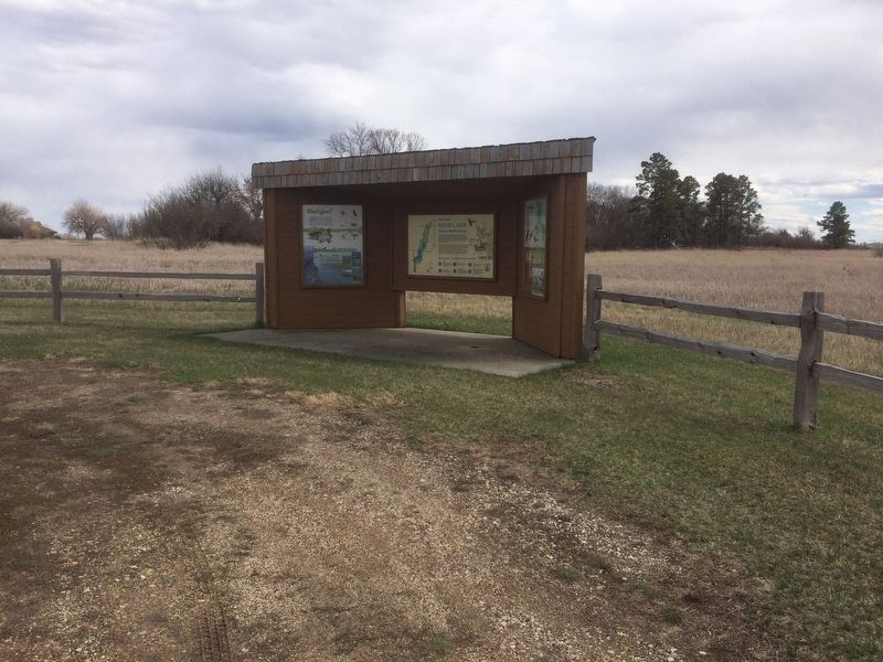
Wetlands are one of the most important ecosystems on the planet. They improve our quality of life by providing us with clean water, food, flood control, and many forms of recreation. . . . — — Map (db m100980) HM
Most of the native plants you see here are direct descendants of those found by Lewis and Clark when they arrived in the fall of 1804. As they traveled, the captains always noted stands of timber because they needed wood for kindling and because . . . — — Map (db m242479) HM
Our National Symbol
In 1782, over 200 years ago, the United States adopted the bald eagle as our national symbol. This majestic, white-headed bird, soaring freely throughout our continent, was a common sight to our ancestors.
Today, the . . . — — Map (db m234977) HM
Basin
Many thousands of years ago a great continental ice sheet advancing from the northeast onto the northern plains blocked or reversed the flow of all rivers it came into contact with. The result of this titanic natural force was the . . . — — Map (db m234980) HM
Change came slowly to Spirit Mound after 1804. For 55 years the area remained the land of the Yankton Sioux, with fur traders conducting business from posts on the Missouri. The tallgrass prairie continued to thrive as it had for thousands of years . . . — — Map (db m194632) HM
After heavy precipitation in the spring of 1984 averaged between 250 to 300 percent of normal, river levels were higher than normal and the ground was heavily saturated. Record (at the time) rainfall in June caused widespread flooding on the James, . . . — — Map (db m177315) HM
Lat 42° 46' 23.0" N
Long 96° 55' 51.0" W
From here the Water Trail follows five miles of the Vermillion River to its confluence with the Missouri River near River Mile 772, then continues down the Missouri nine miles to . . . — — Map (db m221312) HM
When William Clark climbed this "conical hill" in 1804, he concluded, correctly, that it was a natural form, not a human-created mound. Its central core is a bedrock of Niobrara chalk that the continental ice sheet did not erode away. The . . . — — Map (db m222056) HM
Found throughout the mountain west and perched high atop mountains, these manned towers
provide an excellent vantage point for spotting smoke columns and fires.
In Custer State Park fire detection
is a vital tool. The park's fire tower, Mount . . . — — Map (db m204234) HM
Breaking the Records
On August 24, 2000, a carelessly dropped match started what would become the largest fire in the recorded history of South Dakota. By the time the inferno finished its race through the forest, it had consumed 83,508 . . . — — Map (db m37093) HM
The Jasper Fire started on August 24, 2000. It burned over 83,000 acres. This includes the entire surface above known parts of Jewel Cave. Will such a large, intense wildfire affect this unique national treasure? Now is our chance to find out. . . . — — Map (db m37095) HM
Did you notice that this forest burned? Some areas show no signs of fire. Blackened tree skeletons tell of crown fire in other areas. This is a typical burn mosaic of a western wildfire. How did the visitor center and nearby trees survive? Fire . . . — — Map (db m37096) HM
He laid the foundation of the National Park Service, defining and establishing the policies under which its areas shall be developed and conserved unimpaired for future generations. There will never come an end to the good that he has done. — — Map (db m234600) HM
Wind Cave National Park harbors a fragment of an endangered ecosystem, a remnant of the native grasslands that once stretched from Indiana to the Rocky Mountains, from southern Canada to the Gulf of Mexico. In fewer than 100 years, the Great Plains . . . — — Map (db m234694) HM
Left Panel:
National Forests ~ An American Legacy
In 1891, Congress passed legislation to establish Forest Reserves (now called National Forests) to restore eastern lands damaged by deforestation and disastrous floods; and to . . . — — Map (db m184800) HM
The prairie has been changing for millions of years. Grasses have grown, soil has built up, rocks have eroded, and hillsides have fallen. Rain has been followed by drought, until the rain has returned. Fire would turn the land black, but soon . . . — — Map (db m125352) HM
Waubay National Wildlife Refuge is in the Prairie Pothole Region-a region of the northern Great Plains where shallow wetlands, or potholes, are scattered about the prairie. About 10,000 years ago, glaciers scoured the landscape and gouged out . . . — — Map (db m125281) HM
From hunting club to Refuge
What was once a hunting camp is now a refuge for waterfowl and other migratory birds. Waubay National Wildlife Refuge (NWR) was established in 1935 by President Franklin D. Roosevelt in response to record low . . . — — Map (db m125355) HM
Saving ducks by saving stamps
To help restore waterfowl populations that had been wiped out by hunting and drought, Congress passed the migratory Bird Hunting Stamp Act in 1934. Under the Act, hunters purchase an annual Federal Duck . . . — — Map (db m125353) HM
The White Draw fire started June 29, 2012 near Highway 18 by a vehicle fire. Due to very dry conditions and strong winds the fire spread quickly.
Most wildland fires are fought "indirectly" from the flank, rear, or overhead. Very important . . . — — Map (db m184799) HM
In the early 1970's, a major fire burned into Long Beach, CA, destroying hundreds of homes. In response Congress created the Modular Airborne Fire Fighting Systems (MAFFS), a joint effort between the US Department of Agriculture's (USDA) Forest . . . — — Map (db m184797) HM
You are Standing in the Middle of a Community Meeting!
This area is the meeting place of three distinct plant communities ~ the ponderosa pine woodland, the mixed grass prairie, and the Cascade warm springs ecosystem. Their boundaries . . . — — Map (db m184457) HM
The Castles
Administered by the Forest Service
United States Department of Agriculture
has been designated a
Registered Natural Landmark
This site possesses exceptional value as an . . . — — Map (db m154916) HM
This trail features seven types of animals that once lived in the area now known as Badlands National Park. Each of these lineages met a different fate as the climate changed. Some moved, some adapted to the changes, and some are now extinct. . . . — — Map (db m114175) HM
Rock layers in Badlands National Park contain fossils that show a dramatic cooling and drying of global climate over millions of years. The oldest rock layers contain marine fossils, roughly 70 million years old, from when this area was . . . — — Map (db m113124) HM
Oredonts were common throughout the Badlands, but became extinct. Their fossil remains provide evidence of their lives and habitat. Fossils can develop over time when animal or plant remains are quickly covered in sediment and replaced by . . . — — Map (db m113122) HM
These rocks were deposited millions of years ago when rivers and wind spread silt, sand, and ash across the landscape. About 500,000 years ago, ancient rivers began eroding this area, leading to the present day landscape. Modern rivers, rain, . . . — — Map (db m113126) HM
Prehistoric alligators lived in swampy conditions, as they do today.
Physically, alligators have changed mostly in size over the last several million years. Modern alligators are larger, growing up to 14 feet long. Ancient alligators grew . . . — — Map (db m113092) HM
The discovery of this specimen led to the golden age of paleontology in North America. After acquiring this fossil from fur traders, Dr. Hiram Prout wrote about it in 1846. His description captured the attention of scientists. At that time, . . . — — Map (db m113176) HM
Ammonite fossils found in the park are evidence that this area was under water 75 million years ago. Some ammonites could grow to more that three feet across and served as a food source for giant mosasaurs and other predators.
The Western . . . — — Map (db m113115) HM
Your fossil discovery begins a scientific process. Every detail is important, even the area around the find. A fossil and its surroundings reveal what types of plants and animals existed and how they lived, died, and changed.
The . . . — — Map (db m113123) HM
Fossils can reveal how animals lived and died, and what their environment was like. Evidence from one of the park's nimravid fossils offers crime-scene clues. The size and location of the holes in the forehead of this fossil match the knife-like . . . — — Map (db m113121) HM
Horses have adapted in North America over millions of years. As woodlands changed to grasslands, the dog-sized, primitive horses gradually evolved into the lineage that led to the modern-day horse.
Mesohippus was the first three-toed . . . — — Map (db m113091) HM
Mining and Logging Go Hand in Hand Homestake Mining Company contributed significantly to the need for long-term forest management practices that would ensure the perpetual availability of Black Hills timber. Fred and Moses Manuel in 1876 . . . — — Map (db m184914) HM
Northern red horse suckers and dace were the only species of fish present in Spearfish Creek during an early 1875 exploration of the Black Hills. Trout are not indigenous to the Black Hills but were introduced from Colorado in the late 1800s.
. . . — — Map (db m124103) HM
Deep into the distant years of prehistory, prairie grasses and flowers covered the rolling hills of this region where bison and elk roamed. Woodland animals and birds made their homes along the forested rivers and streams; eagles and hawks . . . — — Map (db m210635) HM
If you could step back in time to the year 1700 A.D., one of the most striking changes you'd see would be the immense herds of bison that lived in this area. Between 30 and 60 million bison roamed North America until the mid 1800s. Where did . . . — — Map (db m211280) HM
Brrrrrr! It would have been a chilly day 14,000 years ago. South Dakota was nearing the end of the last Ice Age and most of Lincoln County was covered by the eastern edge of a glacier, a massive sheet of ice that bulldozed across the landscape. . . . — — Map (db m244198) HM
Disappearing Waterfowl Habits
The prairies of the Great Plain once stretched from horizon to horizon-a rolling, grass-covered landscape filled, spring through fall with millions of birds. Starting in the 19th century, this habitat began . . . — — Map (db m120528) HM
When the last Glaciers receded from the Northern Great Plains 10,000 years ago, they left behind shallow depressions called "potholes." Some of these prairie potholes hold water temporarily, while others hold water year-round. These wetlands . . . — — Map (db m120531) HM
Temperate Grasslands
A temperate grassland known as prairie once rolled across one-fifth of North America from Texas to Canada, the Rockies to Illinois and provided habitat for a multitude of distinct plants and animals. The Samuel . . . — — Map (db m126905) HM
Peter Byg was born near the tiny village of Halk, South Jutland, Denmark. After emigrating to America, in time he settled on a claim located 2½ miles southwest of this spot. He built a sod dugout house where he lived with his wife, Anna Raven, and . . . — — Map (db m187016) HM
Doug Horsted died of cancer on January 18, 2000 at the age of 36. An avid sportsman, hunter, and fisherman, he took every opportunity to enjoy the outdoors with family and friends. He especially enjoyed pheasant, waterfowl, and deer hunting on the . . . — — Map (db m205267) HM
Beginning in 1873, for four consecutive summers great swarms of grasshoppers riding prevailing winds reached the Midwestern states and territories where they landed and destroyed farmers' field crops. Although several huge clouds of grasshoppers . . . — — Map (db m208637) HM
After emigrating from County Donegal, Ireland, Robert and Lillie Foster settled in a sod house about three miles northwest of this marker in late 1872. Six of their nine children shared the small, primitive home. Within months, two of the children . . . — — Map (db m187458) HM
(side 1)
The changing of global sea levels over millions of years was a major factor in determining the ancient geography of Minnehaha County. Through much of geologic time, salty warm-water seas covered the interior of the United . . . — — Map (db m124175) HM
This is the location of the historical Big Sioux River channel. This area, like many along the Big Sioux River's banks were very susceptible to seasonal flooding - predominantly caused by snowmelt runoff and by rainfall.
To improve the City's . . . — — Map (db m212171) HM
A highland existed along the east side of South Dakota long before the Ice Age began two million years ago. Successive periods of glaciation deposited sediment across the highland and increased its elevation.
The last glaciation began 35,000 . . . — — Map (db m187261) HM
The late-Wisconsin Glacier was no ordinary sheet of ice! The glacier was one mile thick and it stretched from eastern Ohio to the Missouri River. It caused North America's most recent Ice Age, about 14,000 years ago.
As the glacier pushed . . . — — Map (db m112817) HM
South Dakota Mahogany Granite - Sculptor Darold E. Bailey - 1999
Herds of Buffalo Roamed the Falls Area in the 1800's
The First Sculpture at Falls Park
Sioux Falls Sponsors
Denny and Char Oviati
Freda Horsmann Dawley
David . . . — — Map (db m112687) HM
On this day, river stages on the Big Sioux River reached 17.8 feet, 3.6 feet higher than the previous record of 14.2 feet in June 1957. The winter's record snowfall in Eastern South Dakota began melting and pouring into the Big Sioux River. The . . . — — Map (db m208336) HM
This young Ponderosa Pine forest was thinned by the Civilian Conservation Corps in 1935 to improve the growth of the remaining trees[.] The first commercial harvest was made in 1959 when the area was thinned again for posts and poles. From now on a . . . — — Map (db m37116) HM
Norbeck Wildlife Preserve
Created by Act of Congress, 1949
Peter Norbeck 1870 – 1936
Well driller, Statesman, first native Governor of South Dakota, U.S. Senator, founder of Custer State Park, sponsor of Mount Rushmore . . . — — Map (db m4395) HM
Be prepared for change
Thunderstorms, blizzards, and inclement weather can strike quickly and with little warning on the Great Plains. Thunderstorms & Wind uring the summer, the sun
heats the ground and causes
powerful convection . . . — — Map (db m174698) HM
The second rude cross erected on that miraculous day in May, 1876, when Father Pierre Boucher led his pilgrimage of Catholics & Protestants on an eleven mile trek seeking Divine Intervention in the grasshopper plague, was where you see the large . . . — — Map (db m190124) HM
The Missouri flows free for 59 miles below Gavins Point Dam and for 39 miles below Fort Randall Dam. These sections of the national recreational river provide glimpses of the once undammed, unchannelized river that played a major role in America's . . . — — Map (db m189403) HM