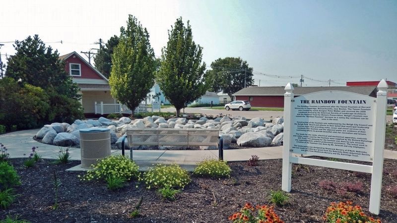
The Rainbow Fountain is patterned after the Tanner Fountain at Harvard University in Cambridge, Massachusetts, near Boston. The Tanner Fountain was created by noted designer Peter Walker and received the 2008 Landmark Award by the American Society . . . — — Map (db m237199) HM
This gazebo is dedicated to the
memory of the
Good Samaritan Air Crew.
On December 20, 1985, they gave
their lives attempting to save others.
Nancy Brandon
Joan Brown
Craig Budden — — Map (db m58938) HM
From 1934 to 1939, Companies 2741 and 2732 of the Civilian Conservation Corps occupied a camp near this site. Barracks housed about 200 men, ages 18 to 25, who built soil conservation dams and planted shelterbelts on nearby farms. The camp moved to . . . — — Map (db m181771) HM
This marker, dedicated on the 100th anniversary of Hartington High School, June 25, 1988, is in honor of two graduates who became governors of Nebraska. Dwight Burney, born in 1892, graduated from Hartington High School in 1910. Burney attended . . . — — Map (db m181317) HM
The National Grange of the Patrons of Husbandry was organized in Washington, D.C. in 1867. During the 1870's, it was the major voice of the American farmer and its social, educational, and fraternal activities brightened farm life. "Granger Laws", . . . — — Map (db m77761) HM
This tablet is dedicated by Capt. Christopher Robinson Chapter D. A. R. of Crawford, Nebraska, in grateful recognition of the many services rendered by Moses P. Kinkaid as Congressman, 1903-1923 which include Congressional Grant of this . . . — — Map (db m235899) HM
The Missouri River is the longest river in the United States. It stretches 2,341 miles from its headwaters at Three Forks, Montana, to where it meets the Mississippi River at St. Louis, Missouri. Its watershed covers one-sixth of the United . . . — — Map (db m72062) HM
A river forever changed by the power of humans flows beneath this bridge.
For more than a century, man has worked to tame the natural cycles of the Missouri River and exploit its power. There are benefits. Dams hold back floodwaters that once . . . — — Map (db m72066) HM
As pioneers settled in small towns and villages across Nebraska, the shout of “Fire” summoned fear and panic in every person who heard it. If they were lucky, bucket brigades could save part of a burning building and its surrounding . . . — — Map (db m58037) HM
The Midwest Regional Office, located in Omaha since 1937, assists NPS sites across the heartland of the United States. Inside this building, more than 200 people – from architects to wildland fire managers – work to sustain the . . . — — Map (db m57970) HM
In loving memory of The Right Reverend
Robert Harper Clarkson
(1826 - 1884)
Bishop of Nebraska and Dakota Territories
First Episcopal Bishop of the State of Nebraska
Founder of Trinity Cathedral
Founder and Sponsor of Nebraska's . . . — — Map (db m35188) HM
Land for Hanscom Park was donated in 1872 by Andrew J. Hanscom and James Megeath. Improvements including flower beds, lakes, cascades and fountains greatly changed the site’s rugged character. In time, the park was referred to as “one of . . . — — Map (db m57998) HM
Hanscom Park, Omaha’s oldest remaining park, was designed by landscape architect H.W.S. Cleveland in 1889. Early improvements were described in the 1898 Park Commissioner’s Report: “Two lakes, a cascade, extensive flower beds, two and . . . — — Map (db m57979) HM
Originally a filtration plant constructed in 1912, this building was remodeled and enlarged to become the Post Exchange Building in 1923. All incoming or outgoing calls, whether emergency or routine, would pass through the Post switchboard housed . . . — — Map (db m58118) HM
During World War I, citizen participation in relief and aid societies was exceptional across America. Omaha’s Red Cross chapter led all cities in the country in per capita membership.
In addition to the Red Cross providing a canteen at Fort . . . — — Map (db m58149) HM
In 1880, nearly a dozen years after Fort Omaha was established, indoor hot and cold water bathing facilities were installed – three shower rooms for enlisted men and one for officers. By the end of the 19th century a new attitude towards the . . . — — Map (db m58120) HM
In 1903, George Fisher and Harry Lawrie designed Fire Substation No. 1 in the then-popular Chateauesque style. The gabled third floor gave the building the look of a French chateau. On April 9, 1917, firefighters were sunning themselves out front . . . — — Map (db m35244) HM
Boys Town was founded as a home and school for homeless, abandoned, neglected or otherwise underprivileged boys, regardless of color or creed, by Father Edward J. Flanagan (1886-1948) on December 10, 1917. The first Father Flanagan's Boy's Home at . . . — — Map (db m53109) HM
Founder of Boys Town
Omaha, Nebraska, U.S.A.
"The work will continue, you see,
whether I am there or not,
because it is God's work, not mine."
Msgr. Edward J. Flanagan
Mol an oige
agus tiocfaidh si
Ni neart go cur le cheile . . . — — Map (db m58482) HM
In memory of
Rt. Rev. Monsignor
Edward J. Flanagan
Founder of Boys Town and
Recipient of Variety Clubs
First Humanitarian Award
His dictum:
"There is no such thing as a bad boy" — — Map (db m58481) HM
Since times unrecorded, springs from the Ogallala Formation relieved travelers through the Republican Valley. In 1930 Benkelman citizens improved a nearby spring to benefit motorists on NE 3 (later US 34). The 1935 Republican River flood destroyed . . . — — Map (db m180993) HM
The Ohiowa Auditorium, completed in 1940 and preserved in near original condition, is one of several Nebraska buildings constructed by the Works Progress Administration during the Great Depression. The WPA, a federal government relief program, . . . — — Map (db m82530) HM
The fenceless plains were vast and open when early homesteaders first came here. But the very nature of homesteading - the possibility of an individual owning 160 acres - meant that somebody had to legally divide and define limits for the land. . . . — — Map (db m47577) HM
There’s a good chance you do – Homesteading reached three of every five states. Is yours among them?
The Homestead Act of 1862 offered people 160 acres of free land – if they were willing to live on it, farm it, and build a home. . . . — — Map (db m47512) HM
Dedicated to the Citizens of Beatrice
for all their efforts put forth in the
Beatrice Centennial Celebrations of 2007
Beatrice, Nebraska Territory
Founded on this site July 4, 1857
Time Capsule to be opened on July 4, 2057
200 . . . — — Map (db m47616) HM
The Homestead Act of 1862 was one of the most significant and enduring events in the westward expansion of the United States. By granting 160 acres of free land to claimants, it allowed nearly any man or woman the chance to live the American dream. . . . — — Map (db m47619) HM
Here, in the middle of this restored prairie, you can imagine what homesteaders experienced when they first came to their land - listen to the birds and insects, smell cottonwood in the air, feel the richness of the soil, see the variety nature has . . . — — Map (db m47580) HM
Originally dedicated 1934
Rededicated 2000
Symbolism of the Mural
Just as our own Nebraska natives left their homes to fight wars on foreign soil, the use of Endicott brick represents native earth that brings all of us back to our . . . — — Map (db m48234) HM
On September 29, 1875, Richard McClimans filed a timber claim on this site under the provisions of the Timber Culture Act of 1873. The original act, sponsored by Senator Phineas W. Hitchcock of Nebraska, enabled homesteaders to acquire up to a . . . — — Map (db m181986) HM
The first Grand Island airport, a grass field, was located approximately 1½ miles south of the present terminal building on land owned by H. O. “Doc” Woodward. It was used by the Grand Island Aero Company, organized in 1919 by former World War I . . . — — Map (db m181602) HM
First known as the Nebraska Soldiers and Sailors Home, the Grand Island Veterans Home was opened in 1887. The first home was a four-story Victorian building situated on 640 acres. The building soon became inadequate to house the veterans. Between . . . — — Map (db m181697) HM
In 1879 Hall County purchased 160 acres at this location where the county’s paupers could live and work in exchange for shelter, clothing, food, and medical care. In March 1881 part of the Poor Farm property was set aside as a cemetery for those who . . . — — Map (db m181695) HM
Old Dodge School served as one of two branch camps in Hall County housing German prisoners of war. On July 9, 1944, Leo B. Stuhr, president of the county Non-Stock Labor Association, announced plans to use the school for this purpose. About one . . . — — Map (db m53254) HM
Mayor 14 years
Expanded the water supply system.
Purchased the power and light plant.
Established the city library.
In 1936, on this site, a fire destroyed the Fleming Lumber and Coal Company and Carpenter Scarbourgh's Tools.
We . . . — — Map (db m76947) HM
This building was constructed in 1936 by the Indian Emergency Conservation Work (IECW) force. Like the Civilian Conservation Corps, the IECW was part of the country's New Deal program aimed at providing economic relief during the Great Depression. . . . — — Map (db m192597) HM
This fountain was donated by the National Humane Alliance in 1908 after formation of Lincoln’s Humane Society in January, 1907.
It is one of at least 70 similar fountains placed in communities throughout the United States.
The fountain includes . . . — — Map (db m101878) HM
The previous building on the site was constructed in 1885
as the Tremont House, a hotel providing sixty-two rooms.
The establishment was a favorite of visiting theatrical
companies for its location near the Depot and its rates,
starting at . . . — — Map (db m212137) HM
This giant plow was used to dig drainage ditches along the Nemaha River in eastern Nebraska, the Platte River here in Lincoln County, the Medicine Creek south of here in Frontier County, near Big Springs, Nebraska, and in Colorado and Wyoming. . . . — — Map (db m191851) HM
This shield is from the North Platte, NE. Union Pacific Depot 3-20-1918 to 11-1-1973 Home of WWII Canteen 12-25-1941 to 4-1-1946 — — Map (db m191939) HM
This park developed on ground once known as the “clay pit.” John F. Flynn came to Norfolk in April 1880 to start a brick factory at this site. Flynn, Dr. Ferdinand Verges, August Pilger, and Herman Gerecke formed the Norfolk Brick and Tile Company, . . . — — Map (db m181896) HM
[side 1] Built in 1906 and remodeled in 1923, this was the home of cattleman Heber Hord until his death in 1949. Hord was the only son of Thomas Benton (T.B.) Hord, who founded a livestock feeding company based in Central City. T.B. Hord . . . — — Map (db m181600) HM
The property upon which this visitor center sits was donated by Gordon and Patty Howard
In Memory of Roszel F. (Frank) Durnal and Mary B. Durnal and their descendants, who gave Chimney Rock to the Nebraska State Historical Society in 1939 . . . — — Map (db m169810) HM
Old Oregon Trail, 1750 feet south, 1850-1869.
The Old Pony Express Route 6 mi south, 1860-1861.
The First Transcontinental Telegraph Line
passed 6 miles south, 1861-1870.
Old Deadwood Trail, 4 mi. west, 1874-1886.
Old Mormon Road, 1 mi. . . . — — Map (db m182056) HM
During the 1930s, President Franklin D. Roosevelt's New Deal created government programs to counter the effects of the Great Depression. Hundreds of post offices were built and the U.S. Treasury commissioned art for many of them. Twelve Nebraska . . . — — Map (db m78462) HM
This one-of-a-kind museum was built by the Nebraska City Volunteer Fire Department. Opened in 2008, it displays the history and equipment used by those early Nebraska City firefighters. The Nebraska City Volunteer Fire Department is the oldest . . . — — Map (db m194899) HM
This fire alarm bell was used in Nebraska City from 1895 until 1964. It was purchased by the City of Nebraska City on November 18, 1875, from the E. W. Van Duzen Co., Buckeye Bell Foundry, Cincinnati, Ohio for $115.16 to replace a previous bell. . . . — — Map (db m66942) HM
St. John's Catholic Church, one of the oldest wood church buildings in Nebraska was built in 1877. The church originally had no steeple and was a simple square-type structure. The Steeple was later added along with the stained glass windows in the . . . — — Map (db m194900) HM
The first flour mill in Pierce County was constructed here about 1880 by Stephen F. Gilman. Power for its operation came from a dam on the north fork of the Elkhorn River. Flour from the mill was marketed widely under the “Golden Crescent” . . . — — Map (db m206800) HM
Due to the generosity of Mrs. Albert Gehner, Mr. Theodore Friedhof, and many other benefactors, this site has become a focal point of agricultural activity in Platte County.
The donation of this land, formerly known as the Browner Farm, and a . . . — — Map (db m122883) HM
In October 1934 Camp Platte was established near here by the Civilian Conservation Corps (CCC). The CCC was one of President Franklin D. Roosevelt’s New Deal programs designed to promote economic recovery during the Great Depression. Its goal was . . . — — Map (db m206955) HM
Harold Kramer
Kramer achieved national recognition for his state and national public power leadership as general manager of the Loup River Public Power District. Kramer first became active in Nebraska’s public power systems in 1932 when he . . . — — Map (db m58746) HM
The Columbus Powerhouse is one of Nebraska’s largest hydroelectric generating plants and the pulse of the Loup River Public Power District hydroelectric system. The system was financed in 1933 by a $7.3 million New Deal Public Works Administration . . . — — Map (db m182100) HM
Humboldt was platted in 1868 and the first business on the city square was established in 1869. Town founder O.J. Tinker deeded two acres for a public square in 1871 and Humboldt was incorporated in 1873. The bandstand in the center of the City . . . — — Map (db m177300) HM
Scouting was introduced to Papillion in 1913 with the formation of Boy Scout Troop 1. In 1921, the village granted permission to the troop's scoutmaster, Rev B. Johanssen to build a log cabin as the troop headquarters. The limestone foundation was . . . — — Map (db m223477) HM
This landmark is dedicated to Mr. Pascual Huerta and the men who helped build this stone building during the 1930’s. Mr. Huerta and his German Sheperd walked daily from near Stegall, Nebraska to Scottsbluff, gathering stones along the way. Mr. . . . — — Map (db m238879) HM
has been placed on the National Register of Historic Places by the United States Department of the Interior December 7, 2007 Dedicated in honor and memory of Steve and Ernestine Eurek Building renovation architect Ray . . . — — Map (db m181167) HM
The Chester Municipal Auditorium was a 1938 WPA project intended for social and recreational uses. It was built at a cost of $29,340 with much of the labor done by hand. — — Map (db m79893) HM
The Civilian Conservation Corps (CCC) was authorized by Congress in 1933 to provide employment and vocational training to young men during the Great Depression. The CCC worked on forestry and soil conservation projects across the nation. Company . . . — — Map (db m79890) HM
Tell me it ain't so, Joe. This reporter's smile crumpled to the floor as I scanned the Guinness website to find the world's largest porch swing listing. It doesn't exist. The only category I could fin[d] that even came close was the world's . . . — — Map (db m79888) HM
This hospital is named in honor of the first Native American woman physician. Dr. Picotte (1865-1915) was the daughter of Mary Gale and Iron Eye, also known as Joseph La Flesche, the last traditionally recognized chief of the Omaha tribe. She was . . . — — Map (db m206824) HM
In 1898 E. C. Bishop, a teacher in nearby Bradshaw, organized student clubs. Through these clubs he planned his school lessons so that they related to the students’ activities on the farm and in the home. The first projects Bishop assigned dealt . . . — — Map (db m181319) HM