There have been defences on this point since 1539, when Henry Ill built a blockhouse known as 'Little Dennis' to protect the estuary from enemy warships.
The blockhouse was equipped with heavy guns. You can see three gun openings at ground level . . . — — Map (db m124044) HM
George Fox 1624 – 1691 was imprisoned in this castle in 1656, for eight months. With other Quakers he suffered under unspeakable conditions in Dooms-Dale
“There was never under any imprisonment that I was in but it was for the . . . — — Map (db m124010) HM
Moote Hall
c.13th century
The castle, a symbol of law and order
was used as a centre of justice.
This building was used by the assizes
(travelling courts) and also for
administrative purposes. — — Map (db m124128) HM
This was the main entrance into the castle from the town until the late 12th century.
Originally, there was a deep ditch around the castle crossed by a fortified bridge. This was destroyed when nearby Eagle House was built in the 18th century. . . . — — Map (db m124009) HM
Shell Keep
c.12th century
This circular stone wall had a wall walk on the top designed principally for use as a fighting platform. The High Tower was built inside this wall in the13th century and the gap spanned with a platform. (Note the joist . . . — — Map (db m124180) HM
In the Middle Ages this gatehouse led out to the Earl's private deer park. The entrance passage continued out across the castle ditch, over a fortified bridge to where the Guildhall now stands.
Four square holes for the timber decking can be . . . — — Map (db m124176) HM
Throughout the Middle Ages the courtyard was packed full of buildings providing accommodation for the Lord and his followers.
There were also service buildings: a survey carried out in 1337 lists a chapel, stable, gaol, hall and various . . . — — Map (db m124126) HM
The development of the Castle
The first castle was built in the years immediately after the Norman Conquest — a military outpost in hostile country.
The original timber defences were gradually replaced in stone and by the 12th century . . . — — Map (db m124178) HM
The Earl's Chamber
You are standing in the lobby which led into the Earl's chamber in front of you.
Behind you another door led out onto the flat roof which, in the 13th century, covered the space between the high tower and surrounding walls. . . . — — Map (db m124203) HM
The Gate
There was a strongly defended gate here in the 13th century. The slot for the portcullis and the deep socket for the stout timber beams which secured the door can be seen in the wall behind you.
To your right, steps within the . . . — — Map (db m124206) HM
The Keep
In the 13th century, the building high on the mound in front of you provided a lordly reception suite where the Earl could entertain on special occasions.
The approach was deliberately formal and designed to impress. Anyone wishing . . . — — Map (db m124179) HM
The Landscape
From the top of this high tower it is easy to see why the Normans built their castle here at Launceston. Not only does the castle dominate the surrounding countryside but it also controlled the main road into Cornwall at the . . . — — Map (db m124205) HM
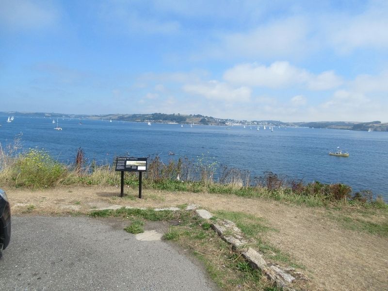
A Changing coastline
Arvor ow chanjya
Looking north-east, this spectacular view tells a story about the complex geology and changing shape of this north Cornwall coast.
The slates and siltstones that make up this coastline were . . . — — Map (db m124105) HM
Great Hall
A complicated ruin
Magor gomplek
The ruins in front of you are the remains of a series of successive halls and service buildings that once stood at the centre of the castle.
The original Great Hall was built in about 1230 and was . . . — — Map (db m124064) HM
Garden
A romantic retreat
Argel romansek
This walled garden was probably built in the 1230s and may have been part of a romantic literary landscape.
Gardening was taken up enthusiastically by English royalty in the 13th century. This . . . — — Map (db m124104) HM
Excavations and discoveries
Kowansow ha diskudhansow
This small hut was built for the site custodian shortly after excavations on the headland were completed in the 1930s.
These excavations, led by CA Ralegh Radford between 1933 and . . . — — Map (db m124107) HM
Florence’s shelter
Skovva Florence
Built in about 1900, this shelter provided welcome protection from the wind and rain for the ‘keeper of the keys’, Florence Nightingale Richards (b.1856).
Like her mother and grandmother before her, she . . . — — Map (db m124063) HM
Great Hall
Prince Dafydd's tale
Hwedhel Pennsevik Dafydd
It is a windy day in October 1242. Servants and tradesmen are busy bringing deliveries of food and barrels of wine, preparing for a feast.
You are standing in the island courtyard of . . . — — Map (db m124062) HM
The Haven
An Harber
The beach and headland at Tintagel appear to be wild and remote today, a haven for coastal plants and animals. But in the 19th century this area saw intensive use for mining, slate quarrying and fishing.
Beyond . . . — — Map (db m124110) HM
Dark Age Buildings
The northern ruins
An magoryow kledh
When this area was cleared by Ralegh Radford's workmen in the 1930s, they found the walls of several simple buildings. We do not know the date of these structures but they probably . . . — — Map (db m124068) HM
Chapel
The Priest's tale
Hwedhel an Pronter
In the driving rain, the weary priest makes his way to the chapel, as he has done every day for years. Today, in November 1361, he resolves that he won't spend another winter on this lonely, . . . — — Map (db m124071) HM
Gatehouse Courtyard
The Sheriff's tale
Hwedhel an Mer
It is an autumn day in 1306. Thomas de la Hyde, sheriff and steward of Cornwall, is visiting the castle to check on the progress and costs of building repairs.
Arriving on horseback, . . . — — Map (db m124060) HM
Dark Age Buildings
The Trader's tale
Hwedhel an Gwikor
A wooden sailing ship, laden with goods from the Mediterranean, is being unloaded down at the deep harbour. There are shouts in unfamiliar languages as large jars are brought up the steep . . . — — Map (db m124065) HM
Tintagel village
Tre War Venydh
The village of Tintagel, once known as Trevena, has been enormously influenced by the presence of the castle since it was built in the 1230s.
The medieval village of Trevena was enhanced by Earl Richard who . . . — — Map (db m124066) HM
Tunnel
Kowfordh
This tunnel is puzzling. Marks on the inside show that it was cut with metal tools, perhaps enlarging a natural cave.
It could have been a food store for the castle or perhaps a mysterious garden feature. — — Map (db m124069) HM
Upper courtyard
Garth gwartha
Soon after this part of the castle was built, the sea-cliff to your right collapsed, taking part of the medieval wall with it. The new wall built to replace it included two latrines that projected over the . . . — — Map (db m124061) HM
Well
Puth
This well is 5.5m deep. It was probably built at the same time as the castle, in the 13th century.
It is fed from natural springs, which emerge across the island. These springs would have provided fresh water for both the Dark Age . . . — — Map (db m124070) HM
Tintagel Castle has long been connected with the mythical King Arthur and its history is entwined with legend. But what really happened here?
In the 5th and 6th centuries AD there was a large, high-status settlement on the headland. It was . . . — — Map (db m124109) HM
A large Norman castle, built in the late 11th century, once dominated the town of Christchurch. This mound, or motte, originally had a timber tower which was replaced in stone in about 1300. The other castle buildings, including the fine Norman . . . — — Map (db m221645) HM
The construction of a castle and monastery transformed the fortified settlement of Twynham.
Twynham (the place between rivers') was part of a series of strategic defended places established by the Saxon King Alfred. In about 1100, the town was . . . — — Map (db m223370) HM
The Roman Walls
This is the only surviving section of Dorchester's Roman walls.
The Roman town of Dorchester, called Durnovaria, was a provincial capital with a garrison of soldiers. The town was protected on three sides by walls and ditches, . . . — — Map (db m123627) HM
Anchor
This iron anchor was caught in the net of a Newhaven trawler that was fishing about two miles offshore in October 1932.
It is probably about 300 years old. — — Map (db m129662) HM
Brack Mount
Brack Mount is the oldest part of Lewes Castle. William de Warenne built a motte and bailey castle here in the late 11th century.
He started with a mound overlooking the River Ouse and made it higher, using chalk blocks. When the . . . — — Map (db m129688) HM
Fireplace
From the Great Hall
Excavations suggest that the hall was rebuilt in the 13th century, up against the wall of the Shell Keep.
This large fireplace would have helped to heat the room. The fireplace is backed with re-used tiles . . . — — Map (db m129690) HM
A new, larger prison was needed in Lewes in the mid-19th century and opened in 1853. The Prison is now old but still houses over 500 prisoners.
Mick Jagger, of the pop group The Rolling Stones was one of its most famous residents. In 1967 he . . . — — Map (db m129708) HM
Lewes Racecourse was open by 1712. The first grandstand was built in the 1770s. Lewes races were very fashionable. In 1806 two horses, Pancho and Pavilion, raced for a prize of over £2000. The Prince Regent and 3000 people watched the race. The . . . — — Map (db m129714) HM
There was an Iron Age hillfort on Mount Caburn about 1000 years before Lewes Castle was built. The hillfort dominated the valley of the River Ouse from the east. Lewes Castle was built to control the valley from the west. — — Map (db m129711) HM
In the 1550s, during the reign of the Catholic Queen, Mary, 17 Protestants were burned to death in Lewes. They died in front of the Star Inn, now the Town Hall, in the High Street. This Obelisk was built in 1889 as a memorial to the martyrs. It . . . — — Map (db m129712) HM
Southover was one of the earliest suburbs of Lewes. The Priory was built here on low land between the River Ouse and the Winterbourne stream. King Henry VIII ordered the Priory to be destroyed in 1537-8. Some of the Caen Stone from the Priory . . . — — Map (db m129710) HM
St Michael’s Church is one of the oldest in Lewes. It was built just inside the West Gate of the town. The oldest surviving part of the church is the round tower, which may have been built in the 12th century. There are only three round church . . . — — Map (db m129709) HM
Stocks
Minor criminals used to be punished by being put in the stocks. They sat on the bench with their legs held straight in front of them by the wooden beam, which was locked in place. Sitting in this position soon became very uncomfortable. . . . — — Map (db m129664) HM
The Battle of Lewes, 1264
A violent clash between the barons and the King
Standing here on 14th May 1264 you would have witnessed one of the most important battles between rebel barons and King Henry III.
The King had a reputation for . . . — — Map (db m129689) HM
The Curtain Wall and Castle Moat
The Curtain Wall stretched out to either side of the Norman Gatehouse. To one side it went across to the second motte and up to the Shell Keep.
On the other side the wall and dry moat went along the line of . . . — — Map (db m129665) HM
The Norman Gatehouse and the Barbican
The Norman Gatehouse
The Norman Gatehouse was probably square, but only one wall is left. From the Gatehouse, part of the Curtain Wall, which enclosed the Castle, went up to the top of the motte.
The . . . — — Map (db m129687) HM
The Shell Keep and Angled Towers
The second motte towers 20 metres above the High Street. It was built around 1100 and topped with a shell keep. This was basically a wall around the top of the motte. The most secure and important buildings, where . . . — — Map (db m129666) HM
The Weald is an area surrounded by chalk hills called the North and South Downs. Lewes is on the South Downs. In the distance you can see the sandstone ridge of the High weald.
Closer to Lewes is the Low Weald. For many years the Weald was . . . — — Map (db m129713) HM
What Happened Where?
The de Warenne family lived inside the safest part of the Castle, the Shell Keep. Most of the Castle's occupants lived and worked in the Bailey.
This was a large, roughly oval area between the two mottes and inside the . . . — — Map (db m129694) HM
The Great Fire of London of 1666 burned this far but was stopped by the City Wall, saving areas further north and northwest from destruction. Later on, parts of the City Wall were demolished whilst others were incorporated into new buildings, now . . . — — Map (db m118138) HM
Conservation repairs have been carried out to this Bastion, which forms part of the remains of the City Wall. The site is a Scheduled Monument and part of ‘The Barbican’ Grade II Registered Historic Park & Garden. The work was necessary to protect . . . — — Map (db m118132) HM
Conservation repairs have been carried out to this Bastion, which forms part of the remains of the City Wall. The work was necessary in order to protect the Scheduled Monument from decay.
Moss and plant growth together with their root systems . . . — — Map (db m115959) HM
The garden contains remains of London Wall, the Roman and medieval defences of London including the west wall of the original Roman fort. When the defences went out of use, buildings encroached on the wall. Following WW2 bomb damage, 18th and 19th . . . — — Map (db m118140) HM
When German bombing raids in 1940 destroyed the area, the City Wall was revealed once again. For more than 20 years, the area remained undeveloped allowing archaeologists to identify the site of the Roman fort for the first time. A new road, . . . — — Map (db m118135) HM
Over 1000 Roman soldiers worked for the provincial governor in London. They were housed in a stone fort built in AD110. Some ninety years later, Roman construction workers began to build the first City Wall, using more than one million blocks of . . . — — Map (db m118137) HM
The Roman City Wall set the shape of the City of London for the next 1600 years although throughout those centuries, workers continued to maintain it, using various building techniques. The parish churches religious houses and the street pattern . . . — — Map (db m118136) HM
The London Wall Walk follows the line of the City Wall from the Tower of London to the Museum of London. The Walk is 1 3/4 miles (2.8km) long and is marked by twenty-one panels which can be followed in either direction. The City Wall was built by . . . — — Map (db m115970) HM
The London Wall Walk follows the line of the City Wall from the Tower of London to the Museum of London. The Walk is 1¾ miles (2.8km) long and is marked by twenty-one panels which can be followed in either direction. The City Wall was built by the . . . — — Map (db m118133) HM
The London Wall Walk follows the line of the City Wall from the Tower of London to the Museum of London. The Walk is 1¾ miles (2.8km) long and is marked by twenty-one panels which can be followed in either direction. The City Wall was built by the . . . — — Map (db m118131) HM
The London Wall Walk follows the line of the City Wall from the Tower of London to the Museum of London. The Walk is 1¾ miles (2.8km) long and is marked by twenty-one panels which can be followed in either direction. The City Wall was built by the . . . — — Map (db m117213) HM
Welcome to The Salters' Garden.
The Salters' Company is one of the Great Twelve Livery Companies of the City of London and was first licensed in 1394.
The Company built their seventh Hall here in 1976 following the destruction of the previous . . . — — Map (db m120029) HM
The Jewel Tower was built for King Edward III in 1365-66 by Henry Yevele, the 'deviser of the King's works of masonry'. It formed part of the king's palace and was designed as a private treasury.
The walls are mainly built of Kentish . . . — — Map (db m111722) HM
Gun 28/10
The Gibraltar Gun is one of the largest and heaviest objects in the Royal Artillery's collection – a 38 foot long coastal defence artillery piece weighing 40 tonnes.
The 9.2 inch calibre gun is a rare surviving example . . . — — Map (db m118555) HM
Winchester Palace
These ruins are all that remain of the palace of the powerful Bishops of Winchester, one of the largest and most important buildings in medieval London. Founded in the 12th century by Bishop Henry de Blois, brother of King . . . — — Map (db m118656) HM
Over 400 years, 112 people were executed on Tower Hill watched by crowds of eager spectators. The last execution was in 1747, when many spectators were injured in the crush to watch the beheading of the Scottish rebel Lord Lovat.
The . . . — — Map (db m117328) HM
The 13th-century palace was built along the shore of the River Thames. Henry III and, later, his son Edward I would have been able to look out of their windows and see a fine river view. Between 1275 and 1285 Edward built the outer-curtain wall, . . . — — Map (db m117422) HM
This massive fortress gun is believed to have been captured by British forces from the forts guarding Canton during the Second China War (1856-61). It was brought to Britain as a trophy by HMS Nankin. It was formerly displayed at Upnor Castle, . . . — — Map (db m117424) HM
Cast by the founder Mohammed ibn Hamza for the Sultan Sulaiman ibn Salim Khan, this gun was intended for a Turkish expedition to India to expel the Portuguese colonists. Captured at Aden in 1839 by Captain H Smith of HMS Volage and displayed at . . . — — Map (db m117423) HM
These bronze muzzle-loading guns form part of the Waterloo Battery, a set of eight guns captured and brought to the Tower by the Duke of Wellington after the battle of Waterloo in 1815. They fired a solid iron cannonball propelled by the . . . — — Map (db m117667)
The Coldharbour Gate foundations and this ruined wall are all that survive of the formidable late-1230s defences built by Henry III to protect his royal palace. Coldharbour was later used as a prison, though it wasn't escape-proof. Alice . . . — — Map (db m117670) HM
Collapse at the Tower of London!
Between 1238-40 Henry III expanded the castle beyond the Roman city boundary, ringing it with a new wall and whitewashing the Norman tower. He also built a magnificent western entrance which unfortunately collapsed . . . — — Map (db m128431) HM
By 1281 Edward I had swept aside his father Henry III's moat and entrance and replaced them with new, more sophisticated versions. He ringed Henry III's outer wall with another, making the Tower a concentric castle.
Begun in 1275, the moat . . . — — Map (db m117324) HM
By 1281 Edward I had completed the Tower's formidable new land entrance. Two huge stone gate towers and a semi-circular barbican (now demolished) were linked by causeways defended with drawbridges.
These massive fortifications, bristling . . . — — Map (db m117330) HM
Historic Royal Palaces
This Plaque Commemorates the Reopening of
Tower Hill
As a Place for Public Enjoyment by
Her Majesty The Queen
9 July 2004
The Project Was Supported By
The Heritage Lottery Fund
The Pool of London Partnership . . . — — Map (db m117326) HM
In 1389 Geoffrey Chaucer, poet and Royal Clerk of the Works, ordered the construction of this part of the Tower Wharf. 64 years later gun foundries and workshops were added. In 1803 a factory was built here to make hand-guns for the war against . . . — — Map (db m117752) HM
This is one of the most impressive surviving section of London's former city wall.
The lower part, with its characteristic tile bonding courses, was built by the Romans around 200 AD. Its purpose may have been as much to control passage of . . . — — Map (db m85846) HM
The sentry is part of a military guard stationed here to provide protection for the Crown Jewels. The military guard comes from an operational unit of the Armed Forces that is currently employed on ceremonial duties.
On duty today The . . . — — Map (db m117662) HM
Cannon have been fired in celebration from Tower Wharf for centuries. Henry VIII marked the coronation of his second wife, Anne Boleyn, with a cannon salute. On your right is the battery where modern guns are fired today to commemorate royal . . . — — Map (db m117358) HM
The Tower was often used as a refuge by kings in trouble and Henry III was no exception. He retreated here in 1238 and, horrified by the castle's out-of-date defences, ordered a mighty fortified gateway built.
The gateway was north of . . . — — Map (db m117323) HM
Conflict between a commercial need for tall buildings and the public desire to protect the Tower's views began in the 1860s. The multi-storey ‘Mazawattee’ tea warehouse was built on the edge of Tower Hill, controversially blocking the view
of the . . . — — Map (db m117329) HM
The curfew bell has rung from this tower for centuries; the current bell dates from 1651. The tower, and the wall next to it, were built during the reign of Richard I (1189-99) and once stood on the edge of the river. It is thought that Sir Thomas . . . — — Map (db m117420) HM
This area is a gateway that links the tower to the Thames waterfront on the wharf. It was a private entrance where important people and goods were brought into the Tower. Coins and bullion would also have been brought through here and into the . . . — — Map (db m117361) HM
On 20 February 1547, the 9 year old son of Henry VIII rode out from the Tower in a grand procession. Cheering crowds lined the route to Westminster Abbey where he was crowned Edward VI.
Young Edward VI was following a tradition which lasted . . . — — Map (db m117331) HM
Beneath your feet lie the ancient remains of Edward IV's bulwark. In 1480 he paid to construct this huge addition to the castle's defences which was designed to defend against artillery power.
In the 15th century, two rival dynasties fought . . . — — Map (db m117327) HM
In the 13th century, the Medieval Palace consisted of much more than the two towers you have just visited. The empty area in front of the White Tower is known as the Inmost Ward. Henry III had the White Tower whitened for the first time in 1241, . . . — — Map (db m117421) HM
The Norman Tower of London
Begun in 1075-9, William the Conqueror's stone tower was so impressive that the castle is still called the Tower today. He built the fortress on the river in the south east of the ancient Roman city to control Londoners . . . — — Map (db m128430) HM
Important visitors would have entered the castle here, at one of its three riverside entrances. Kings, queens and high ranking state visitors would have stepped off their boats and climbed the Queen's Stairs in their finery on to the wharf. . . . — — Map (db m117357) HM
Since the reign of King John (1199-1216) monarchs had kept exotic beasts at the Tower. However, by 1831-2 it had become impractical to keep the menagerie here and it was moved to Regent's Park to establish London Zoo.
The animals were gifts . . . — — Map (db m117332) HM
By the 18th century the view of the castle was very different. Towers were heightened with brick, and gun platforms were added, bristling with cannon. Rooftops of houses, storehouses and workshops peeped over the outer walls.
The Tower was . . . — — Map (db m117325) HM
The Tower in flames
In the early hours of 31 October 1841, the Grand Storehouse caught fire and burned to the ground. Crowds watched the flames destroy the huge 17th-century building and artists painted the spectacle.
The fire began in a gun . . . — — Map (db m128432) HM
William the Conqueror began the Tower of London close to the riverside, to stop invaders coming up the Thames. The foreshore was originally an open beach, but as London developed, wharves and warehouses were built to serve its growing trading . . . — — Map (db m117356) HM
This wharf was built in the 13th and 14th centuries to allow ships to dock next to the fortress. Where you are standing now would have been busy and bustling with people loading and unloading ships with weapons and military supplies. From the . . . — — Map (db m117359) HM
On 15 June 1845, the Duke of Wellington, hero of the Battle of Waterloo and Constable of the Tower, laid the foundation stone of these barracks, named after his greatest victory. Built to house up to 1,000 soldiers, the barracks were designed by . . . — — Map (db m117659) HM
The Roman invaders under Emperor Claudius founded London and later built a wall around the city. This is the site of one of the turrets, a small tower that marked a change in the direction of the wall. The Romans later replaced the turret with a . . . — — Map (db m117656) HM
240 entries matched your criteria. The first 100 are listed above. Next 100 ⊳