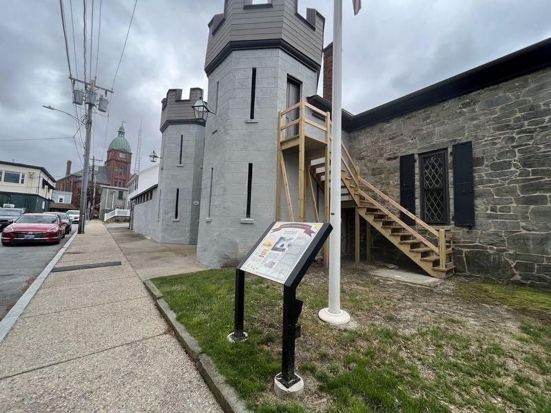
The Warren Artillery Company
~ incorporated May 17, 1842~ supported Governor King during the "Dorr Rebellion." In recognition, the state and town each gave the company $500 toward the total cost of $3,000 to build an "armory and public . . . — — Map (db m222980) HM
Conanicut Battery
A Revolutionary Fort
Built by Americans in 1776
Grounds cleared and tablet placed by the Daughters of the American Revolution of Rhode Island — — Map (db m56383) HM
Situated atop 50-70 foot high cliffs with clear views of the horizon and Block Island to the south. Fort Wetherill held an important strategic position within an extended harbor defense system of Narragansett Bay during World Wars I and II.
The . . . — — Map (db m189619) HM
Historically, the rocky cliffs behind and above the buildings of the Harbor Mine Complex were of military significance to Rhode Island's earliest colonists, who built earthen fortifications on its headland and installed cannon to protect nearby . . . — — Map (db m242649) HM
Built 1777 by the English for the defence of Newport The gift of ---------- W. W. Sherman J. N. Brown H. Brown F. S. Barker S. P. Barker — — Map (db m48062) HM
Imagine this twenty acre fort filled to capacity: 2,400 soldiers here to defend Newport with 468 cannon sited along the most probable attack routes. Though designed to house an imposing force, Fort Adams was normally garrisoned with several . . . — — Map (db m48125) HM
The Bay Islands Park, managed by the Rhode Island Department of Environmental Management, consists of nine sites that extend from Patience Island in the upper bay to Beavertail and Brenton Point overlooking Rhode Island Sound. Each of the nine . . . — — Map (db m48451) HM
“Fort Adams . . . often was dubbed the country club of the army, especially by those officers and enlisted men who were assigned to it after duty in foreign areas. And its peacetime background was dotted with stories of high society and . . . — — Map (db m48233) HM
U.S. army officer, Joseph G. Totten superintended the construction of Fort Adams beginning in 1825. He oversaw all details of construction until 1838, when he was appointed as the first Chief Engineer of the newly created Army Corps of Engineers. [ . . . — — Map (db m48181) HM
The late 19th century saw revolutionary changes in both weapons and strategies of defense. Steam powered ships with high velocity naval guns could now bring the walls down and rendered forts obsolete. To remedy the risk, Fort Adams expanded outside . . . — — Map (db m48230) HM
Think about how difficult a land attack against Fort Adams would be. First, you would have to capture the Redoubt, located a quarter mile to the south. You would then have to charge up the sloping glacis to the Southern front. Finally, you would . . . — — Map (db m48138) HM
During the 19th century, Newport was the only deep water harbor between New York and Boston which could serve as a base for a large fleet of warships. Fort Adams was located at a crucial point where it could prevent the entry of enemy warships into . . . — — Map (db m48129) HM
During the 19th century, Newport was the only deep water harbor between New York and Boston which could serve as a base for a large fleet of warships. Fort Adams was located at a crucial point where it could prevent the entry of enemy warships into . . . — — Map (db m48235) HM
Equality Park is a triangular shaped park bounded by Equality Park West, Equality Park Place and Broadway. It is one of three Broadway Parks, the other two being on the east side of Broadway. These two parks are both titled Congdon Park and . . . — — Map (db m223286) HM
Statesman ~ Legislator Teacher ~ Patriot 1st Chairman – Fort Adams Foundation May 18, 1972 A dynamic force for the preservation of Fort Adams with a determination as unyielding as this granite block. — — Map (db m48444) HM
History you can Touch Explore the casemates where the big guns once roared. Discover how 8 soldiers worked together to load and fire each cannon. Step into the quarters where the soldiers and their families lived. Ascend to the scenic . . . — — Map (db m48249) HM
History you can Touch Explore the casemates where the big guns once roared. Discover how 8 soldiers worked together to load and fire each cannon. Step into the quarters where the soldiers and their families lived. Ascend to the scenic . . . — — Map (db m48276) HM
History you can Touch Explore the casemates where the big guns once roared. Discover how 8 soldiers worked together to load and fire each cannon. Step into the quarters where the soldiers and their families lived. Ascend to the scenic . . . — — Map (db m48284) HM
To honor the members of the Fort Adams Foundation May 4, 1976 Governor Philip W. Noel Lt. Governor J. Joseph Garrahy Director Dennis J. Murphy, Jr. George E. Howarth, 1st Commandant Sen. Erich A. O’D. Taylor, President Sen. Robert J. McKenna Rep. . . . — — Map (db m48971) HM
Picture this space in action as gun crews drilled in live fire exercises – the booming noise of cannon, the thick smoke, the smell of burnt powder, and the shouting of commands. This casemate, a chamber with openings for cannons, could house . . . — — Map (db m48333) HM
I did not have far or long to look, because, being the junior officer of the garrison I could displace no other, and besides, there was but one casemate available for me to choose from . . . A good sweeping and a little glazing of broken . . . — — Map (db m48130) HM
While Fort Adams was in active service from 1842 to 1950, the United States flag flew proudly over the ramparts. When the last U.S. Army unit departed our flag was hauled down, and there was no longer a flagpole within the Fort proper. During 2001 . . . — — Map (db m48246) HM
During the late 19th century the Southwest battery was the advanced position for directing fire against the enemy’s warships. It was here that the giant Rodman cannons hurled their massive 15’ projectiles, each weighing over 300 pounds, to a range . . . — — Map (db m48143) HM
Problem . . . Insufficient workforce to build a Fortress. The solution would come from Ireland. Five hundred families came to not only escape famine and economic hardship, but here they obtained the freedoms they so longed for in their homeland. . . . — — Map (db m48703) HM
The Fast Passage provides easy entry to Narragansett Bay. So in wartime, an enemy fleet could have sailed right into Newport, with cannons blazing! To answer this potential threat, Fort Adams focused its firepower here on the west wall. Top tier . . . — — Map (db m48133) HM
This model of Fort Adams provides an overview of the Fort’s design, including the main structure and the outworks for land defense. The drawings of the Fort show details of its construction and reveal the complexity of its design along with the . . . — — Map (db m66374) HM
These fortifications erected by the British 1777 were occupied by the Americans 1778, becoming the island base of the Continental Army under General Sullivan in the Battle of Rhode Island. They are now consecrated to the immortal memory of those . . . — — Map (db m48069) HM
The earthen mounds on this site are the original fortifications that defended Tiverton against British forces that occupied Aquidneck Island. With hand tools & human toil colonists dug the breastworks then pulled artillery pieces up the hill to the . . . — — Map (db m48078) HM
This hilltop has been an important and strategic location throughout the history of Providence. In early days there was a beacon to use for communication between settlements along Narragansett Bay. Later, at the beginning of the Revolutionary . . . — — Map (db m223296) HM
South of this spot is located Fort Ninigret marked by the State of Rhode Island as a memorial of the Narragansett and Niantic Indians. The unwavering friends and allies of our fathers. — — Map (db m31988) HM