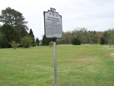
The first high school for blacks in Accomack County was dedicated on this site in 1932. It was named in honor of Mary Nottingham Smith (1892-1951), a black educator who dedicated her life to educating all young people. In 1956, the school was . . . — — Map (db m7822) HM
The Hopeton Passenger Station was donated to the Town of Parksley in 1988 by Nancy Shields for use as a museum. It has been relocated on the foundation of the 1906 Parksley Station and restored through the efforts of the Friends of the Eastern . . . — — Map (db m165088) HM
Factory Road was originally named New Road. It is said to have been built by Henry Frazier, a Black man, by hand, around the time of the Civil War. In 1919, George Lawson of Crisfield, MD in association with the Kegan, Grace & W. Shirt Makers Guild . . . — — Map (db m106988) HM
For almost 250 years the people of Tangier have wrested a living and a lifestyle from the waters that surround them. Most of their days have been occupied with family, work, church, and the other normal pursuits in which we all engage. But they have . . . — — Map (db m97723) HM
For almost 250 years the people of Tangier have wrested a living and a lifestyle from the waters that surround them. Most of their days have been occupied with family, work, church, and the other normal pursuits in which we all engage. But they . . . — — Map (db m106961) HM
On 3 Sept. 1963, nine years after the U.S. Supreme Court declared racial segregation of public schools unconstitutional, 26 African-American students desegregated Albemarle High, Stone-Robinson Elementary, and Greenwood School. With the . . . — — Map (db m170122) HM
Such relationships ranged from acknowledged affairs that...were familial in every sense but a legally recognized one to brutal acts of rape and sexual assault where slave owners showed the inhumanity for which slavery was notorious. . . . — — Map (db m231159) HM
Wood charcoal fueled the forges in the nailery on Mulberry Row and heated the stoves in the kitchen. Charcoal was stored under lock and key in wooden sheds that once stood here. Built about 1794, these "coal sheds" likely resembled temporary . . . — — Map (db m100442) HM
Despite the horrors of slavery, African Americans forged enduring family and community connections, and cultural and spiritual practices. The Contemplative Site is a space to reflect upon their lives and legacies.
Thomas Jefferson held at . . . — — Map (db m231012) HM
Mulberry Row’s buildings have all but disappeared—only the remains of four survive. Before re-creating lost buildings and roads, we look at information from many sources. How do we know about this important place and the history of its people, . . . — — Map (db m80863) HM
Isaac Granger Jefferson worked the forge in the original building on this site, which housed a "storehouse for iron" in 1796, a short-lived tinsmithing operation, a small nail-making shop, and also served as quarters for enslaved people. The use . . . — — Map (db m231059) HM
Born in slavery at Monticello on July 4, 1826, the day of Thomas Jefferson's death, Henry Martin worked at the University in various capacities from about 1847 until his retirement in 1910. In late 1868 or early 1869, he was employed as head . . . — — Map (db m75526) HM
The Eagle. Peacemaker. Tecumseh. Bremo. Wellington. Diomede. These were the six carriage and saddle horses, plus one mule, stabled here in 1821. As many as 30 riding and carriage horses, workhorses, and mules were stabled at various locations on . . . — — Map (db m100157) HM
Master carpenter James Dinsmore oversaw construction of this Ice House to Jefferson's design in 1802. Enslaved and hired workers filled it each year between November and February with ice cut from the nearby Rivanna River, shallow ponds, or snow . . . — — Map (db m68174) HM
Jefferson's elaborate design for Monticello could not have been achieved without the superior craftsmanship of hired free and enslaved woodworkers working closely together. Joiners, the most skilled, produced Monticello's classically inspired . . . — — Map (db m230977) HM
... architecture is my delight, and putting up, and pulling down, one of my favourite amusements.
Thomas Jefferson quoted by Margaret Bayard Smith, 1809
Thomas Jefferson shaped American architecture with his neoclassical designs . . . — — Map (db m231048) HM
Every article is made on his farm; his negroes are cabinet makers, carpenters, masons, bricklayers, smith, etc. Duc de La Rochefoucauld Liancourt, 1796
You are standing on Mulberry Row, a road once lined with more . . . — — Map (db m68171) HM
Jefferson attempted to create an efficient plantation based on new approaches to agriculture and manufacturing. To realize his goals, dozens of enslaved and free workers lived and worked here on Mulberry Row. Jefferson added a series of dwellings . . . — — Map (db m100132) HM
Jefferson set up a nail-making operation in 1794 to provide income until he could “put my farms into a course of yielding profit.” He calculated the nailers’ daily output, the waste of nailrod, and profits. In its first years, the . . . — — Map (db m80862) HM
What you see here is a reconstruction of the North Terrace wing. The original wing, built 1801-05, housed Jefferson's carriages and the horses and carriages of visitors; most of Jefferson's horses were stabled at the east end of Mulberry Row. Horses . . . — — Map (db m100469) HM
Though enslaved, Sally Hemings helped shape her life and the lives of her children, who got an almost 50-year head start on emancipation, escaping the system that had engulfed their ancestors and millions of others. Whatever we may feel about . . . — — Map (db m231286) HM
Over 200 years ago, four log dwellings stood here. The first, constructed in the 1770s and destroyed by fire ca. 1790. was the "Negro quarter," a large 17 x 34 foot structure intended for multiple enslaved individuals or families. Three identical, . . . — — Map (db m100176) HM
In the long, three-celled wooden structure that stood here between ca. 1790 and 1809, Jefferson combined two of what he considered "indispensable" elements of a Virginia plantation, the "smoke house" and "dairy." His unusual design placed "two . . . — — Map (db m100440) HM
Panel 1 Jefferson introduced mechanized cloth production to his plantation when trade embargoes and looming war cut off the supply of imported British cloth. In 1811, he hired William McLure, a free white artisan and "a very ingenious man," . . . — — Map (db m68175) HM
Thomas Jefferson's garden was a massive, edible laboratory. He tested new plants to record which fruit and vegetable varieties thrived. Like his neighbors, Jefferson designed a robust vegetable garden to provide food for his household. . . . — — Map (db m231112) HM
This chimney and foundation are all that remain of the “joiner’s shop”, one of the first structures on Mulberry Row. From about 1775, free and enslaved workmen produced some of the finest woodwork in Virginia. Sawyers and carpenters felled oak, . . . — — Map (db m80860) HM
On 3 Sept. 1963, nine years after the U.S. Supreme Court declared racial segregation of public schools unconstitutional, 26 African-American students formerly enrolled at all-black schools desegregated Albemarle High School, Stone-Robinson . . . — — Map (db m170167) HM
This is a spring that was used by the Carr family when they lived here in 1870. The spring provided a source of clean drinking water and was also used as a storage location to keep perishable foods cool — — Map (db m170175) HM
Legacy of Hugh Carr
The Ivy Creek Natural Area was once the home of Hugh Carr, born into slavery around 1840 in Albemarle County. The end of the Civil War in 1865 was for Hugh the start of a new life founded in freedom.
In 1870, Hugh . . . — — Map (db m170172) HM
A network of more than six miles of walking trails leaves large areas of natural habitat undisturbed. The 1.5 mile Central Red Trail leads back to the parking lot and barn. All other trails stem from the Red Trail.
A 0.75-mile paved trail . . . — — Map (db m170174) HM
1975: Red Flags
For years, Elizabeth (Babs) Conant had canoed the relatively new South Fork Rivanna Reservoir and enjoyed its abundant wildlife. Then one autumn day in 1975, she rounded a bend and saw something ominous. Survey stakes . . . — — Map (db m170170) HM
These garden walls,
included by Thomas Jefferson in his original designs for the academical village, were built by enslaved laborers.
The walls were reconstructed and enclosed gardens planted by
The Garden Club of Virginia
1952 . . . — — Map (db m230924) HM
The St. John School, built here in 1922–1923, served African-American students during the segregation era. Julius Rosenwald, president of Sears Roebuck and Co., collaborated with Booker T. Washington in a school-building campaign begining in . . . — — Map (db m102560) HM
On 3 Sept. 1963, nine years after the U.S. Supreme Court
declared racial segregation of public schools unconstitutional,
26 African-American students formerly enrolled at all-black
schools desegregated Albemarle High School, . . . — — Map (db m234288) HM
Ben Brown and other newly freed slaves, who
founded the community after the Civil
War, first named the settlement Egypt and then Bethel.
About 1881, the community became known as Proffit when the Virginia Midland Railway placed
a stop here, . . . — — Map (db m16946) HM
Free State, a community of free African Americans, stood here. Its nucleus was a 224-acre tract that Amy Farrow, a free black woman, purchased in 1788. Her son Zachariah Bowles lived here and married Critta Hemings of Monticello, an older sister of . . . — — Map (db m170663) HM
This land was once part of more than 1,100 acres acquired by the Terrett family by the mid-19th century. Within Fairfax County until annexed by the City of Alexandria in 1952, the area was primarily agricultural fieldsd and woodlands here before . . . — — Map (db m214230) HM
[Plaque on the left side of the entrance:]
From the establishment of Alexandria in 1749 to the present time, African Americans have been a vibrant part of this city's history. The City of Alexandria would not exist in its present form were . . . — — Map (db m131547) HM
Archaeologists excavated four ship hull remnants along the Alexandria Waterfront — one from the Hotel Indigo Site (44AX229) and three from the Robinson Landing Site (44AX235). Over 200 years ago, Alexandrians repurposed these old merchant ships . . . — — Map (db m216126) HM
Three roads formed this Fairfax County intersection by the early 19th century. Braddock Road, Middle Turnpike (later called Leesburg Pike/King Street/Route 7) and Quaker Lane were the wagon routes for trade between the port town of Alexandria and . . . — — Map (db m150816) HM
Alexandria's Changing Shoreline
In 1749 the town of Alexandria was laid out on 10 to 15 foot bluffs around a crescent of shallow water. The back edge of John Carlyle's property, where you are standing now, was about 15 feet above the Potomac . . . — — Map (db m129171) HM
During the Civil War, thousands of formerly enslaved individuals came to Union-controlled Alexandria to seek refuge and freedom. As a result, several new African American neighborhoods developed during and after the Civil War, including four in . . . — — Map (db m239750) HM
The African American Heritage Trail along the waterfront consists of two interconnecting routes. Both begin at Waterfront Park. Together, these trails illuminate the history of the African American community in Alexandria over a span of several . . . — — Map (db m239718) HM
The launch of urban renewal in 1965 led to a boom of archaeological discoveries in Alexandria's Old and Historic District. As buildings were razed exposing artifact-laden layers of history, community outcry demanded that the City address and halt . . . — — Map (db m115770) HM
Alexandrians created waterfront land by banking out the shoreline using timber cribbing and old ships including three discovered on this site.
For over two centuries this land embodied Alexandria's working waterfront with an evolving mix of . . . — — Map (db m204474) HM
Alexandria was established by Virginia's colonial assembly in 1749, over four decades the U.S. Congress authorized creation of a national capital on the banks of the Potomac River. Once the final site for the Federal city was selected by President . . . — — Map (db m141166) HM
The Alexandria Library's Kate Waller Barrett Branch (2 blocks north, 1 block east) and the Alexandria Black History Museum (6 blocks north) have an unusual shared history. The library building was constructed in 1938 and named for Dr. Kate Waller . . . — — Map (db m115715) HM
Just two blocks north of this location along Fayette Street (named for the Marquis de Lafayette who visited Alexandria in 1824), near the southwest corner of Queen Street, stood the Old Powder House, dating from 1791-1809. On the same spot, the . . . — — Map (db m115713) HM
At this intersection, a jail opened in 1827 when Alexandria was a part of Washington, D.C. In the 19th century, it housed criminals, debtors, and Civil War military prisoners. Before Emancipation, the jail was among the locations where enslaved . . . — — Map (db m243181) HM
As Virginia's population grew, so did its reliance on fish from the Potomac River as a dietary staple. In 1813, the city authorities passed a law designating the county wharf at the foot of Oronoco Street as the official place for landing fish. . . . — — Map (db m239715) HM
The Alexandria waterfront has changed dramatically since the City's founding in 1749. The Potomac River once flowed along the high banks about two blocks west of here near Water (now Lee) Street. Two hundred and fifty years ago, the area where . . . — — Map (db m182672) HM
The building at 1315 Duke Street, two blocks south of here, was originally built around 1812 as a residence for General Robert Young, commander of Alexandria's militia, who died in 1824. This three-story brick building then became the . . . — — Map (db m115706) HM
Published in 1894, The Life and George Henry Together with a Brief History of the Colored People in America captures the personal experiences of the author in his own words. George Henry described himself as the enslaved captain of the . . . — — Map (db m239721) HM
In 1804, Francois-Dominique Toussaint L'Ouverture, a formerly enslaved Haitian Black military leader, led the only successful uprising of enslaved people in the Western Hemisphere. As a result of the rebellion, the Caribbean island of Haiti . . . — — Map (db m239747) HM
Discover the spirit of Alexandria that has been making history for well over two centuries
Founded in 1749, Alexandria was the center of commercial and political activity for early patriots such as George Washington as the seeds of the . . . — — Map (db m115776) HM
Alexandria's Market Square was established only a few years after the town was founded in 1749. The site selected was centrally located in a prime block of the colonial settlement, immediately adjacent to the City Hall. At the time, Cameron and . . . — — Map (db m115757) HM
Living history
Discover the spirit of Alexandria that has been making history for centuries.
Alexandria has had a role in our nation's history since its founding in 1749. George Washington called Alexandria home in his . . . — — Map (db m236052) HM
Alexandria, D.C.
In 1791, Alexandrians applauded their inclusion in the District of Columbia, believing that the town would benefit economically as part of the Federal district. These positive feelings toward inclusion in the District . . . — — Map (db m239716) HM
An extensive amount of man-made land hides the original topographical feature that characterized the southernmost tip of Alexandria's crescent-shaped bay. This area was known from at least the 1760s as Point Lumley. As it does today, the town . . . — — Map (db m239746) HM
On January 1, 1808, the earliest date allowed by Article I, Section 9 of the United States Constitution, the Act Prohibiting Importation of Slaves went into effect and stated, "It shall not be lawful to import or bring into the United . . . — — Map (db m188750) HM
The West End in the 19th century centered on Duke Street and Diagonal Road. Large undeveloped, the area was devoted to stockyards, agricultural shipment, and "a" notorious business: the slave trade. The house at 1707 Duke Street (left) was part . . . — — Map (db m151028) HM
Close to midnight on Tuesday, August 8, 1899, Benjamin Thomas, a 16-year-old Black Alexandrian, was lynched from a lamppost on this corner.
Earlier, white rioters attacked the City Jail on N. St. Asaph Street, where they seized and dragged . . . — — Map (db m188809) HM
From 1898 to 1911, a 181-foot-long side wheel steamboat based out of Washington, D.C., called the River Queen would sometimes dock at the wharf at the foot of Prince Street in Alexandria. Build in 1864, it had first gained fame as the site . . . — — Map (db m239733) HM
Welcome to Old Town Alexandria! Experience historical charm with contemporary flair from the river to the rails
Plan
Alexandria Visitors Center at Ramsay House
Knowledgeable staff help you create a perfect plan for your visit. . . . — — Map (db m115143) HM
Archaeological Evidence of a Working Seaport
The archaeologists tasked with researching this property on the 200 block of South Union Street used a host of sources such as historic photographs, lithographs, deeds, court cases, newspapers, . . . — — Map (db m195635) HM
The Wilkes Street Tunnel was part of the eastern division of the Orange & Alexandria Railroad, founded in 1848 to promote trade with western Virginia. The Orange & Alexandria inaugurated its track in Alexandria on May 7, 1851 with a run from the . . . — — Map (db m143378) HM
Now a city park, Windmill Hill got its name from the windmill built here on Miller's Cliff by inventor John R. Remington in 1843. With soothing winds and a grand view of the busy port, the hill was the scene of fashionable promenades and numerous . . . — — Map (db m143377) HM
In honor of all from the City of Alexandria who served and died during World War I
Robert Adams •
George Anderton •
Stanley Bernard •
Herbert Bernhard •
William Bradley •
Bernard Brock •
William Brown •
Christopher Cloxom • . . . — — Map (db m129195) WM
A small group of Christian believers established Zion Baptist Church in 1864 on the corner of Wolfe and South Union Streets, northeast of the Wilkes Street Tunnel. At the end of the Civil War, Zion Baptist was one of five African American Baptist . . . — — Map (db m239753) HM
This area, called "Cross Canal," was a neighborhood of black residents who settled across from the canal shortly after the Civil War. The canal, located just north of this marker, extended from the Potomac River to Washington Street, thence north to . . . — — Map (db m129476) HM
During the Civil War, thousands of African Americans fled to the Union-controlled city, either moving into government-run freedmen camps; settling into historically black neighborhoods such as the Bottoms, or seeking out affordable housing on the . . . — — Map (db m237644) HM
Populated almost exclusively by Black residents, the racially segregated neighborhood of The Berg evolved by necessity to have its own set of dwellings, amenities, and social institutions. Houses like the "five frame shanties" that stood on this . . . — — Map (db m204836) HM
Neighborhoods function as support networks and knit people together. For Alexandria's Black residents in the late-19th and early-20th centuries, establishing neighborly bonds was essential for survival within a racist, segregated society.
In . . . — — Map (db m204833) HM
During the Civil War, an influx of self-emancipated slaves (often referred to as "contrabands") arrived in Alexandria. For several decades thereafter, this population, along with other free Black migrants, changed the racial character of both the . . . — — Map (db m204837) HM
Located on both sides of Montgomery Street between North Fairfax and North Lee Streets, the Old Dominion Glass Company opened its doors in 1901 to produce high quality soda, beer, and medicine bottles. Along with the Belle Pre Bottle Company, the . . . — — Map (db m237636) HM
This is the original entrance to the Robert H. Robinson Library, built in 1940 as the segregated facility for Alexandria's African American residents. — — Map (db m188812) HM
On August 21, 1939, five young African-American men, William Evans, Edward Gaddis, Morris Murray, Clarence Strange and Otto Tucker entered the Barrett Library, then a whites-only segregated, public facility. When they requested library cards and . . . — — Map (db m195649) HM
On 21 August 1939, five young African American men applied for library cards at the new Alexandria Library to protest its whites-only policy. After being denied, William Evans, Edward Gaddis, Morris Murray, Clarence Strange, and Otto L. Tucker each . . . — — Map (db m82774) HM
This modest, wood-frame building has played an important role in the segregated history of Alexandria. During World War II, the federal government encouraged women to join the war effort by providing safe and affordable day care. In Alexandria, . . . — — Map (db m129190) HM
Earl Lloyd, a Naismith Memorial Basketball Hall of Famer, grew up on this block, attended the segregated Parker-Gray High School, and graduated from West Virginia State College. On 31 Oct. 1950, as a member of the Washington Capitols, he became the . . . — — Map (db m195657) HM
Funded by the U.S. Public Housing Administration and built by the Alexandria Housing and Redevelopment Authority (ARHA) between 1954 and 1959, the James Bland Homes was Alexandria's fourth public housing project, and it more than doubled the . . . — — Map (db m72374) HM
The 1990 enlargement of this church is dedicated to God's glory and to the memory of the Afro-American Christians, many of them emancipated slaves, who became the congregation of Meade Church by Action of the vestry of Christ Church in 1873, two . . . — — Map (db m129187) HM
Parker-Gray School opened on Wythe Street in 1920 to serve African American students in grades 1-8. Until upper-level classes were added in 1932, African Americans had to travel to the District of Columbia to attend high school. Civil rights . . . — — Map (db m98083) HM
In 1941, the United States Housing Authority (USHA), under the Federal Works Agency, began to plan for the construction of permanent housing for Black defense workers in the Uptown neighborhood. Then known as the Lanham Act Alexandria Defense . . . — — Map (db m182231) HM
Panel 1:
In the summer of 1939, Attorney Samuel W. Tucker organized six youths — William Evans, Otto Tucker, Edward Caddis, Morris Murray, Clarence Strange, and Robert Strange — for a “sit-in” at the segregated . . . — — Map (db m141636) HM
Under the guidance of the Most Reverend Denis J. O'Connell, Bishop of Richmond, Saint Joseph's Church was built by Father Joseph J. Kelly, of the Society of Saint Joseph (the Josephites) with the assistance of many benefactors, among them being the . . . — — Map (db m129200) HM
About 100 years before Ramsey Homes was built, prominent Alexandrian Henry Daingerfield purchased this parcel of land. In 1849, prominent Alexandrian Henry Daingerfield purchased a parcel of land upon which the Ramsey Homes would eventually be . . . — — Map (db m188811) HM
Enforced racial segregation in Alexandria meant separate, poorly funded schools for the City's African American students. Here, in the African American neighborhood then known as Uptown, a new school was built in 1920 at 901 Wythe Street for . . . — — Map (db m182228) HM
The racially integrated working-class neighborhood known as the Hump, named for the high ground at its northern boundary, once spanned three blocks, centering on the 800 block of Montgomery Street. The Hump was first settled in the decade . . . — — Map (db m72500) HM
African Americans in Alexandria suffered, along with other of their race, when a segregated system prevented them from enjoying recreation facilities in their hometown.
From 1926 to 1951, the city had a municipal pool for white residents . . . — — Map (db m80843) HM
Parker-Gray High School served Alexandria's African American students—first on Wythe Street and later on Madison Street—during the City's years of enforced school segregation. With little support from the City, the school's faculty and coaches . . . — — Map (db m195656) HM
Alexandria, occupied by Union troops in 1861, attracted many African Americans escaping slavery. In Jan. 1864, a group of formerly enslaved people organized Third Freedmen's Baptist Church (later Third Baptist Church). The congregation moved to this . . . — — Map (db m140583) HM
This city block became part of the Alexandria town grid in 1798. Near the rural outskirts of the developing town, the block remained vacant throughout the nineteenth century. Colross, a country estate, was established in the vicinity, and outside . . . — — Map (db m70671) HM
The Alexandria War Memorial in front of Alexandria Union Station was dedicated on November 11, 1940, before a crowd of 3,000 people. A nearby flag pole was also dedicated in the ceremony. Numerous dignitaries attended, including the City's mayor, . . . — — Map (db m216133) HM
Charles A. Watson, an African-American, purchased this land in 1870. In 1905, three years after the passing of the "Jim Crow" Laws in Virginia, his wife Laura and sons Frank and Attorney Thomas M. Watson dedicated and subdivided the land to . . . — — Map (db m211888) HM
Known as the "Queen of Lynhaven", Ruby Tucker lived not far from this park on Lynhaven Drive for most of her adult life. She was an ardent advocate for her neighborhood and the City of Alexandria.
Ruby Tucker was a caring mother, grandmother . . . — — Map (db m184533) HM
In September 1900, Alexandria County opened the original Mount Vernon School on this property to educate children up to the 8th grade. In spite of continual expansion, crowding was always a problem. By 1932, it was necessary to rent the bank . . . — — Map (db m115682) HM
1617 entries matched your criteria. The first 100 are listed above. Next 100 ⊳