Coal Creek valley was the scene of an armed rebellion against the state by free miners seeking an end to the common practice of leasing convicts to coal companies. On Oct. 31, 1891 the convict laborers at Briceville were freed by armed miners. The . . . — — Map (db m102292) HM
Built in 1888 by Welsh coal miners, the church and its cemetery are listed on the National Register of Historic Places. Miners who fought the Tennessee National Guard over the use of convict labor during the Coal Creek War and the church was a . . . — — Map (db m102331) HM
The Cross Mountain Mine opened in 1888 approximately one mile up Slatestone Road to the west. By 1911, it had two power plants to generate electricity, providing incandescent light for the main entries. Coal was cut by electric chain machines and . . . — — Map (db m102329) HM
Powell Harmon wrote a farewell letter before suffocating in the Fraterville Mine in 1902 that said, "My boys, never work in the coal mines.: His eldest son, Briceville student Condy Harmon, knew that honoring such a request would subject his family . . . — — Map (db m102425) HM
Thirty-one of the 84 miners who perished in the December 9, 1911 explosion of the Cross Mountain Mine are buried in concentric circles around a monument beside Circle Cemetery Road. The arrangement of headstones may be rooted in the Welsh ancestry . . . — — Map (db m102427) HM
In the last half of the 1800s, the Welsh in America published books in their native language at a time when it was illegal to do so in Great Britain. Coal Creek miners Rees R. Thomas and his son David R. Thomas donated a rare collection of those . . . — — Map (db m102333) HM
Electric power in the Tennessee Valley is one product of the Multiple Resource Development Program of TVA. It is produced economically and sold at low rates so it can be widely used as a “tool” of economic growth. Vital defense . . . — — Map (db m165943) HM
In 1895, Sam Hendrickson (pictured) started Clinton's pearling industry. Clinton's citizens used braille boats (pictured) with braille hooks (pictured) to drag the bottom of the Clinch River for mussel shells (pictured). Young's Island (pictured) . . . — — Map (db m112097) HM
David Hall, a revolutionary War veteran, purchased a plantation near here in 1803. Seven years later he opened a tavern and inn on the property. Granville Arnold purchased the site in 1854, operating the inn for the remainder of the 19th century. . . . — — Map (db m165936) HM
Formerly known as Depot Street, a business district developed near the depot after the first train passed through Clinton in 1869. Market Street boomed in the 1880's, welcoming travelers and citizens alike with its variety of stores, taverns, . . . — — Map (db m214920) HM
In the weeks following Market Street's "big fire" of 1908, new brick buildings were built at a rapid pace. This building, built by R. Rutherford, and its "twin" on the corner, built by C.J. Sawyer, were completed and occupied before the end of 1908. . . . — — Map (db m214921) HM
Silas Taylor and his son George opened Taylor & Son general store in 1890, offering merchandise such as plows, barrels, harnesses, men's and women's clothing, and hats. The millinery department was on the second floor and all hats were designed and . . . — — Map (db m214919) HM
From about 1895 to 1936 Tennessee was one of the nation's six leading states in marketing pearls. Clinton was listed as one of three Tennessee towns known as centers of the pearling industry. New York dealers came regularly to Clinton during the . . . — — Map (db m112098) HM
The Tennessee River has its headwaters in the mountains of Tennessee, Virginia, North Carolina, and Georgia. The main stream forms at Knoxville, where the Holston and the French Broad Rivers join.
The Valley, 41,000 square miles in area, . . . — — Map (db m166056) HM
Union Bank - 1901
The Union Bank of Clinton was chartered in 1894. The bank building, constructed on this site in 1901, survived both the 1905 and 1908 Market Street fires, even acting as a block that prevented the fire from burning . . . — — Map (db m214969) HM
The Fraterville Mine exploded on May 19, 1902, killing all 216 miners. Poignant farewell messages were found on the bodies of Jacob Vowell, Powell Harmon, John Hendren, Harry Beach, Scott Chapman, James Brooks, R.S. Brooks, George Hutson, Frank . . . — — Map (db m102428) HM
Itinerant miners worked in the Fraterville Mine alongside miners with long-term contracts and strong local ties. Bodies of the itinerant miners were not claimed after the 1902 explosion and were buried adjacent to the railroad spur that led to the . . . — — Map (db m102429) HM
Sergeant major Eldad Cicero Camp, a Civil War Union veteran, U.S. District Attorney, and businessman, never used convicts in his mines. Instead, he established contracts with experienced miners. Fraterville, the name of Major Camp's first mine and . . . — — Map (db m231050) HM
The American Institute of Certified Planners has designated The Tennessee Valley Authority as a National Planning Landmark
Founded in 1933 and encompassing a multi-state region of more than 40,000 square miles, T.V.A. was the first large-scale . . . — — Map (db m101833) HM
The Tennessee River has its headwaters in the mountains of Tennessee, Virginia, North Carolina and Georgia. The main stream forms at Knoxville, where the Holston and the French Broad Rivers join.
The valley, 41,000 square miles in area, receives . . . — — Map (db m101834) HM
Although many residents still felt Oak Ridge was a wartime town, they were now encouraged to view their city as possibly becoming a permanent community. This transition was kicked off January 1 when the Manhattan Engineering District handed off . . . — — Map (db m112281) HM
Union Carbide agreed to manage X-10 as well as the Y-12 plant with their new defense mission, and the K-25 uranium enrichment plant. Carbide named Nelson Rucker as X-10 executive director who with Alvin Weinberg instilling a sense of stability as . . . — — Map (db m112282) HM
On January 20 “The Oak Ridger” published its first edition. It told the city’s stories for decades, like a favorite talk about colorful, hard-driving General Leslie Groves, Manhattan Engineering District commandant. When he had needed . . . — — Map (db m112283) HM
Starting with farmland in November 1942, 110,000 construction workers in two-and-a-half years built two huge uranium-235 production plants, Y-12 and K-25, at a cost of $759 million; X-10 and S-50, at a cost of $23 million; and the town for those who . . . — — Map (db m112348) HM
The Guest House provided accommodations for visitors to the Clinton Engineering Works (Oak Ridge) during the time of the Manhattan Project, which led to the development of the atomic bomb. The Guest House hosted such dignitaries as physicists J. . . . — — Map (db m114613) HM
Convicts cut trees from Militia Hill and surrounding hillsides in 1892 so soldiers could spot attacking miners. Many of those trees were American chestnuts. Convicts and soldiers could not know that a fungus carried by Chinese chestnuts, brought to . . . — — Map (db m102280) HM
Soldiers of the Tennessee National Guard became easy targets for miners positioned on higher ground after trees were cut from Fort Anderson. Convicts then dug these breastworks to provide cover from attacking miners.
War correspondents from . . . — — Map (db m102279) HM
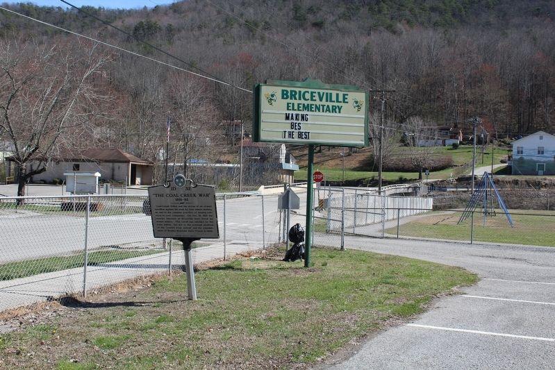
Welsh miners from the Knoxville Iron and Coal Company began mining coal at the foot of this hill in 1867, but were replaced by convict laborers during a strike in 1877. After convicts were brought to a mine in Briceville in July 1891, miners and . . . — — Map (db m101896) HM
After the Civil War, southern states leased convicts to private industry to cope with a growing number of convicts and dwindling state budgets. The system degenerated to where primarily young African-Americans were being arrested and forced to work . . . — — Map (db m101897) HM
Soldiers responded to attack by firing cannons from here into the Miners Nest encampment on Walden Ridge, located south of the Wye Gap. Soldiers also shot cans filled with mud through the Wye Gap into the town of Coal Creek to signal that the town . . . — — Map (db m102281) HM
The Tennessee National Guard built Fort Anderson on Militia Hill in 1892 to restore order during the Coal Creek War. The fort is located off Vowell Mountain Road, and listed on the National Register of Historic Places.
According to the Tennessee . . . — — Map (db m101893) HM
In 1877, convicts replaced striking Welsh miners in the Knoxville Iron and Coal Company Mine, located in the hollow to the south. Prison records show that 131 convict miners died there from 1877 to 1893, while others were caught igniting methane gas . . . — — Map (db m101892) HM
Fort Anderson was built here on Militia Hill in January 1892 as a base for the Tennessee National Guard to protect convict laborers and restore order. Hostilities escalated with as many as 2500 miners from Tennessee and Kentucky participating in the . . . — — Map (db m102277) HM
The Tennessee Coal Mining Company in Briceville dismissed convict labor in February 1892 and sold stock in the company to miners. Subsequent attempts to convince Gov. Buchanan to remove troops from the watershed failed, so miners attacked at this . . . — — Map (db m102284) HM
The arrival of General Carnes with the bulk of the state militia overwhelmed the miners by the late summer of 1892. Although they lost the final battle, Coal Creek miners won the war when newly-elected Gov. Peter Turney fulfilled a campaign promise . . . — — Map (db m102282) HM
Agricultural land in the region was owned and being farmed by 1880. Younger sons of farmers sought opportunities in mining, learning new job skills from experienced Welsh miners. Mining also offered opportunities for African-Americans who comprised . . . — — Map (db m101895) HM
Mildred Jolly Lashlee was the first woman elected to the Tennessee Senate for a full “regular” term. Elected in November 1944, she represented the 26th Senatorial District. Before her election she was appointed to complete the term of . . . — — Map (db m109048) HM
Gospel music publisher and hymnodist Robert Emmett (R.E.) Winsett composed many sacred songs, “Jesus Is Coming Soon” being the most well known, but his reputation rests more upon his publishing endeavor. The R. E. Winsett Publishing Company produced . . . — — Map (db m153659) HM
In 1916, the Babcock Lumber & Land Company acquired 350 acres along Pistol Creek where saw and planing mills were constructed to process lumber the Company was timbering in Monroe County. At the time, Babcock was the nation's leading producer of . . . — — Map (db m195377) HM
The V. J. Hultquist family home was constructed in 1925. The same year, the Aluminum Company of America (ALCOA) constructed a home for the family of E. M. Chandler, who supervised the Sheet Mill from 1924 to 1946. He also managed the North Plant . . . — — Map (db m195372) HM
Initial Plant & Town Site Construction In 1913, the Aluminum Company of America (ALCOA) began construction of a reduction plant for the production of aluminum. A townsite, including the Bassel community, was also constructed for Company workers . . . — — Map (db m195405) HM
The Nicely's Grocery Store building, built in 1939, stands as a proud reminder of the neighborhood grocery store where customers could purchase groceries on a credit account, and the store made home deliveries. When the building was new, the Masonic . . . — — Map (db m195376) HM
The city of Friendsville hereby recognizes the Friendsville community for contributing their talents to the stone profession.
Tennessee pink marble is a historic reminder of days past when the railroad ran through
Friendsville. This block of . . . — — Map (db m150767) HM
On Abram’s Creek, near the site of the early Cherokee village, Chilhowee, William and Robert James established a water-powered cotton and woolen spinning and weaving factory. A charter for the business was issued in 1846 and the mill was evidently . . . — — Map (db m58501) HM
For more than 200 years the Black Sulfur Spring has been a landmark location in Blount County. The spring and 215 acres was bought from David Delzell in 1834 to become one of three primary mineral springs for Daniel Foute's 6,500 acre Montvale . . . — — Map (db m164837) HM
William B. Scott, Sr., a free Black, migrated to East Tennessee in 1847 after increased racial tension in North Carolina. He made harnesses and saddles in Blount County’s Quaker community of Friendsville until the Civil War. In Knoxville, during . . . — — Map (db m107600) HM
Nicholas Bartlett built a mill 300 ft. downstream about 1785. When Blount County was created in 1795, its mill-pond was a turning point from the Stock Creek boundary to run toward Bay's Mountain. The mill was used as a fort in the Indian troubles . . . — — Map (db m109333) HM
This is the former site of the Little River Lumber Company mill complex. Founded in 1901 by Col. W.B. Townsend for whom this community is named, the company was one of the largest commercial lumber operations in the Smokies. From 1901 to 1939, the . . . — — Map (db m36995) HM
Our situation is truly a critical one. Our whole country is full of troops and fortifications and should it be determined by the Govmt, to remove the Cherokees by force under the fraudulent Treaty by the kind of Soldiers which are . . . — — Map (db m177967) HM
Built in 1911
by
Will H. and John B. Fillauer
Restored in 1988
by
Bank of Cleveland
Board of Directors
Henry M. Barkley • Wm. K. Fillauer • John G. Haile • Fritz Harris • G. Robert Taylor • R. Scott Taylor • E. C. Thomas . . . — — Map (db m184268) HM
The Hardwick-Jarnagin House stands as the cornerstone of the Cleveland Bradley County Public Library's main complex. Joseph H. Hardwick purchased the property in 1881, and the home was completed in 1883. The original home, furnished in the latest . . . — — Map (db m184263) HM
1.5 miles to the southeast on Cove Creek. Joel E. Stone built a dam, grist mill and a saw mill, which he and his family operated until 1934 when Norris Lake was raised. The mill served the surrounding area as a community center and whistle-stop for . . . — — Map (db m74243) HM
On Short Mountain, 7.1 mi., Henry Hoover & John Beeson established a millstone and grindstone factory in 1806. An inscription on a bluff of the mountain, and discarded fragments of stone mark the spot. — — Map (db m60423) HM
The East Fork Stone's River originates approximately 7 miles to the east, at a spring on
Short Mountain. Stone's River is named after
Uriah Stone, a member of a party of longhunters
who explored a section of the river in 1767.
Beginning in the . . . — — Map (db m150447) HM
This site was a portion of the property that was home for Hotel Olive built in 1889 and later burned in 1930. E.H. & Lida Mai Edwards built the service station on the property in 1935 that remained a functioning service station for the downtown area . . . — — Map (db m179644) HM
Barnes Boring was officially established as a corporation on February 26, 1900 with J. M. Barnes and J. R. Boring as principal stockholders. The two gentlemen died just months from each other nearly 30 years after beginning their partnership. — — Map (db m192800) HM
In the 1920s, German and Dutch investors established two factories for the production of rayon in Elizabethton: American Bemberg Corporation and North American Rayon Corporation. The East Tennessee and Western North Carolina Railroad (ET&WNC), . . . — — Map (db m135498) HM
Established in 1892 by Harry Burgie, Burgie Drug, a revered establishment which was visited frequently by Elizabethton residents, served the community as a pharmacy and convenience store. — — Map (db m192801) HM
John Carter
- 1781
Chairman of Watauga Association and of the five commissioners who established that first written compact for civil government by American-born freemen. Chairman of Committee of Safety. In Revolution, colonel of militia . . . — — Map (db m157908) HM
100 yards upstream at a falls stood an old powder mill, where Mary McKeehan Patton made powder for the soldiers who went to King's Mountain, Oct. 7, 1780. Michael Hyder, Sr., signer of the Halifax Petition in 1776 lived here and is buried on the . . . — — Map (db m157864) HM
This plaque is dedicated to Samuel Tipton, founder of Elizabethton. Born in 1752, Samuel Tipton was the eldest son of Col. John and Mary Butler Tipton. A Revolutionary War soldier, he owned the land on which Elizabethton is now located. His Green . . . — — Map (db m157907) HM
1/2 mile E. of Valley Forge on Doe River are the ruins of an iron furnace built in 1820 by William B. Carter of Elizabethton. It was purchased in 1824 by James, John, and Joseph O'Brien and William Gott. They owned 9000 acres of land and operated . . . — — Map (db m219553) HM
Railroads were a major force in developing southern Appalachia, bringing jobs, commerce, industry, and transportation to local communities. However, the mountainous terrain presented unique challenges to their construction. The East Tennessee and . . . — — Map (db m184200) HM
In 1902, the Cranberry Furnace Company opened this quarry to provide lime for the Johnson City iron foundry. The quarry featured a crusher and a 924' railroad siding to load the crushed lime on to the ET&WNC train for transportation to Johnson . . . — — Map (db m184199) HM
6.5 miles northwest, at the mouth of Brush Creek, is a mill built by Jeremiah Dungan in 1779, and continuously operated since then. East of it was a stone fort erected by pioneers of the Watauga Settlement.
Dungan and other pioneers are buried . . . — — Map (db m45997) HM
High grade magnetite iron ore was found at the base of Roan Mountain near Cranberry, NC after the War of 1812. A "bloomery", or iron smelter, was built at Cranberry in 1820 to process the ore and supply iron to the Confederacy during the Civil War. . . . — — Map (db m184266) HM
Visiting this area over 100 years ago, you would have found these mountains to be logged and pastured. During the later half of the 1800's a new industry found its way to East Tennessee and Western North Carolina.
An iron ore mine was operated . . . — — Map (db m177171) HM
Pioneer settlers arrived in the area from No. & So. Carolina as early as 1808. Civil War soldiers camped here on their way to Clarksville & Nashville. The community was named when a post office opened in 1882. In 1883 the village had blacksmith . . . — — Map (db m151790) HM
In the year 1790, Benjamin Darrow began operating a cotton gin and grist mill along
Sycamore Creek, In 1835, on the site of the old Darrow Mill, Robert and Edward Cheatham
along with Samuel Watson erected a powder mill which operated until the . . . — — Map (db m151807) HM
The son of C. Hyde and Vina (Hale) Stump, Thomas Jefferson Stump was born in Cheatham County on February 18, 1870 and was educated in Cheatham and Dickson Counties. On October 27, 1895, he married Henrietta Dozier. They had two sons. Stump engaged . . . — — Map (db m151786) HM
4.1 mi. northwest, at The Narrows, Montgomery Bell, pioneer industrialist, ironmaster, philanthropist and turfman, built a forge in 1818. Power was obtained by tunneling water through the hill at the top of the Narrows to a point below it where the . . . — — Map (db m143827) HM
The town of Henderson was begun on this street in 1860. First known as Dayton, the town's name was changed to Henderson Station during the Civil War. In 1860, Polk Bray opened the first store. Confederates led by A.B. Crook captured the railroad . . . — — Map (db m148495) HM
Russell Berkau Shops & Ford Dealership
Pinnacle Wagon Mfg. Co. (c. 1920)
Dr. Stone House On Right (c. 1890)
Russell Berkau Family
Paul, Kluck, Phil, Addie, Russell
247 Colwyn Ave (Mid 1930's)
Insets: Joanna, Addie (early 1920's)
. . . — — Map (db m190764) HM
Built before Civil War and used as a public toll crossing until 1905 when wooden floored bridge was built. Wm. Marcum was early operator from 1895 - 1905. — — Map (db m171108) HM
Dale Hollow Dam 1942-1943
Congress authorized the construction of Dale Hollow Dam in 1938 to reduce flood damages in the Cumberland, Ohio, and Mississippi River Valleys. Designed by the U. S. Army Corp of Engineers and built by private . . . — — Map (db m235590) HM
During the nineteenth century, the Duck River was a valuable power source for factories and mills along its banks. With the outbreak of war in 1861, the Confederacy quickly established gunpowder mills to support the Southern war effort. The . . . — — Map (db m166935) HM
When Manchester was founded in the late 18th century, local lore has it that the town, named for Manchester, England, was destined to become an American version of this powerful industrial city. The Duck River falls, it was noted, would provide an . . . — — Map (db m75355) HM
Now the city s regional Fine Arts Center, sisters Jennie and Affa Baillet and their parents lived and worked here beginning in the 1870's. Jennie was an artist [illegible] and the family operated a millinery store downtown. They watched much . . . — — Map (db m172400) HM
Jane (Jennie) Baillet
1834 - 1918
Emma Adell Baillet
1838 - 1926
Affa Ann Baillet
1850 - 1934
This house was the home of Jane, Emma, and Affa Baillet whose family purchased the property . . . — — Map (db m81379) HM
Here stood the Verandah Hotel, one of several buildings, taken over as a hospital for troops during the Civil War. Opposite it was Tullahoma's first depot built by the Nashville and Chattanooga Railroad in 1852. Ammunition stored in the brick . . . — — Map (db m172365) HM
Had high end apartments.
law office.
Beauty parlor and
Maude Frazier's Famous
Black & White
Coffee shop
Highland Federal
since 1961 — — Map (db m150290) HM
Of Native Crab Orchard
Stone and Art Deco Design.
Closed in 1978.
Restored in 2001 for a
Community Auditorium
Placed on the National
Register of Historic Places
in 1994. — — Map (db m150289) HM
This engine was brought to Cumberland County from Indianna by Samuel Cline about 1872. It powered a sawmill and grist mill at what was then Northville.
Donated to Cumberland County by Mason Hatfield in 1956. — — Map (db m69300) HM
Charles Edward Snodgrass commenced his law practice in Crossville in 1888, probably in this very building. He represented the 4th Congressional District of Tennessee in the U.S. House of Representatives in the 56th & 57th Congresses. He was Judge of . . . — — Map (db m182681) HM
The Mill Creek Valley Turnpike Company was incorporated by the Tenn. Gen. Assembly on Jan. 21, 1846. Starting near the four mile mark of Nolensville Pike, the road went through Mill Creek valley, "crossing main Mill creek at or near Rains' mills, . . . — — Map (db m220577) HM
In 1872 the Belle Meade railroad station was an active part of General Harding's Thoroughbred industry. The Railroad line running through the Belle Meade farm had numerous names and owners. In 1867, the State of Tennessee took over the line . . . — — Map (db m158705) HM
The Newsom family came to Tennessee from Virginia in the late 1700s.
The area known as Newsom's Station was settled and developed by
the family of William Bryant Newson sometime between 1796 and
1800. The original mill, built by William . . . — — Map (db m198971) HM
This 5 acres on the corner of Old Hickory Boulevard and Franklin Road was bought by A. H. Noble in 1929. A registered pharmacist, he operated a drug store here for nearly 20 years when the pharmacy was converted to a restaurant by Albert's son Glenn . . . — — Map (db m113948) HM
Germantown was home to many 19th-cen. European immigrants who brought their trade skills to Nashville, including brewing. By 1865 Germantown was home to 4 breweries: North Nashville Brewery (C. Kreig); Rock City Brewery (F. Kuhn); Cumberland Brewery . . . — — Map (db m163414) HM
For the Jackson family, the enslaved were property and the foundation of their wealth. The monetary value of the enslaved far exceeded the combined worth of the Hermitage land, mansion and other improvements.
Andrew Jackson himself had no . . . — — Map (db m52412) HM
Rarely do facts alone uncover the past. Scholarship, judgment, and analysis all have roles in interpreting evidence, and hints, of long-ago lives. So it is with these stones marking the location of a building that Hermitage archaeologists have named . . . — — Map (db m52410) HM
In June 1904 near this spot, "The Morning Star" moored for repairs. Seventh-day Adventist visionary Ellen White, mother of boat owner Edson White, saw the nearby Ferguson Farm for sale and told educators Edward A. Sutherland and Percy T. Magan to . . . — — Map (db m162447) HM
Madison College was founded in 1904 as Nashville Agricultural Normal Institute by Seventh-day Adventists on a farm of 412 acres. A sanitarium and campus industries were integral to the plan of work and study for students training for careers in . . . — — Map (db m147701) HM
In 1943, with a $1000 loan from a friend, Douglas G. Odom, Sr., his wife Louise, and their children - Doug Jr., Richard, Judy, and June - started a four-hog a day sausage business. Before selling the company in 2012, the three generation . . . — — Map (db m147698) HM
The Belle Meade Distillery once stood 3 miles east of Belle Meade Farm on the Harding Pike (where St. Thomas Hospital stands today). The location was known as Bosley Springs, the waters from which feed the Richland Creek that runs in front of . . . — — Map (db m158321) HM
Arthur Redmond, a European brewer who immigrated to Nashville in 1815, established a brewery and bakery on Chicken Pike, now Elm Hill Pike. Situated along the east side of Mill Creek near Foster's and Buchanan's mills, he brewed porter and ale and . . . — — Map (db m151769) HM
In 1786, the State of N.C. granted Gen. James Robertson several large tracts of land in this area. Robertson's Bend was renamed after the Cockrill family who established several farms and a mill here before the Civil War. The Romanesque-style third . . . — — Map (db m147820) HM
922 entries matched your criteria. The first 100 are listed above. Next 100 ⊳