On School Street, on the right when traveling east.
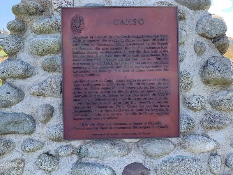
Important as a centre for the North Atlantic fisheries from
the 16th century, the islands in Canso Harbour offered a
safe haven for fishermen. First frequented by the French
and Basques, the area became the site of an extensive . . . — — Map (db m138598) HM
On Marine Drive (Nova Scotia Route 16), on the left when traveling east.
To the Glory of God and in loving memory of those who made the supreme sacrifice in the World War
Canso
Louis Dort, Vernon Earle,
Roy Greencorn, Lee Martin Hart,
Arthur S. Horton, James B. Keating,
Percy J. Lumsden, James Arthur Manuel, . . . — — Map (db m140441) WM
Only a century ago the spars of many schooners filled this harbour. Vessels from Lunenburg and the "Boston States" entered to take on bait, ice and water before sailing to the banks offshore.
Canso shipyards constructed smaller coastal . . . — — Map (db m140521) HM
On July 13, 2006
a Canadian Forces helicopter
from 413 Transport
and Rescue Squadron
carrying seven crew members
who were exercising rescue
techniques with local
Canadian Coast Guard
auxiliary members
crashed in Canso Harbour. . . . — — Map (db m139669) HM
During the seventeenth century French fishermen came from Cape Breton, across Chedabucto Bay, to fish for cod in thirty foot shallops. Later, the New England colonists came in their schooners. They fished the Banks and dried their fish . . . — — Map (db m140536) HM
On
May 23, 1881, the steamer Faraday landed a transatlantic telegraph cable at Dover Bay. The cable allowed the news of Europe to flash underneath the ocean for 2,531 nautical miles.
The European news arrived in Canso and Hazel Hill . . . — — Map (db m140501) HM
This is a place where seafaring people found shelter from the
harshness of the Northwest Atlantic. It is the most easterly point of mainland Nova Scotia, remote
and exposed upon Chedabucto peninsula, yet close to the fishing banks so . . . — — Map (db m140505) HM
Fishermen sailed to this coast before the earliest explorers. In the early 1600s French and Basque fishermen dropped handlines in the waters.
By 1725 New Englanders were pulling in cod worth 150,000 pounds (New England currency) . . . — — Map (db m140554) HM
On Marine Drive (Nova Scotia Route 316), on the right when traveling west.
During this three year period approximately 180
officers and men operated, serviced, or otherwise
gave support to a radar unit on this site. — — Map (db m139278) HM
On Marine Drive (Nova Scotia Route 316), on the right when traveling west.
Welcome to #5 Radar Unit. RCAF Queensport / Cole Harbour.
Bienvenue à Ja Sieme unité de radar deP'ARC, située à Queensport / Cole Harbour.
This base, along with ten others situated along the rocky shores of Nova Scotia,
Was tasked with . . . — — Map (db m139288) HM
On Church Street (Nova Scotia Route 16) at Queen Street, on the left when traveling north on Church Street.
The Court House was constructed in 1842-43. It was the third court house built in Guysborough, the original administrative centre of Sydney County from 1785-1827. Sydney County included present-day Guysborough and Antigonish Counties.
Built in . . . — — Map (db m139264) HM
On Pleasant Street (Nova Scotia Route 16), on the right when traveling north.
Born at Port Shoreham, N.S., educated at Guysborough Academy and at McGill, Tory served as professor at McGill (1893-1905), Principal of McGill College, Vancouver (1906-7), first President of the University of Alberta (1908-28), and . . . — — Map (db m138221) HM
On Marine Drive (Nova Scotia Route 16), on the left when traveling east.
The Voyage of Prince Henry Sinclair to the New World in 1398
On June 2, 1398 Henry Sinclair allegedly set foot in North America on the sandbar of Guysborough Harbour. His fleet consisted of 12 ships with between 200-300 men on board, a . . . — — Map (db m139656)
On Marine Drive (Nova Scotia Route 316) at Ballfield Loop, on the right when traveling west on Marine Drive.
The first settlers of Port Royal must have been aware of the extraordinary fertility of the immense salt marshes that surrounded them The height of the wild grasses alone would have been a clear sign of very productive soil. Until the . . . — — Map (db m141244) HM
On Marine Drive (Nova Scotia Route 316) at Ballfield Loop, on the right when traveling west on Marine Drive.
Many of the Acadians who escaped, or survived the Great Upheaval of 1755 to 1763, either died of exposure, or were captured and imprisoned as "Prisoners of War". Makeshift detention centers were often old trading posts such as Fort Edward . . . — — Map (db m141399) HM
On Marine Drive (Nova Scotia Route 316) at Ballfield Loop, on the right when traveling west on Marine Drive.
This monument is the creation of Raymond Delorey of Larrys River and the idea was conceived by members of "la Société des Acadiens de la Région de Tor Baie” under the direction of its Executive, President, Jude Avery, Vice President, . . . — — Map (db m141175) HM
On Marine Drive (Nova Scotia Route 316) at Ballfield Loop, on the right when traveling west on Marine Drive.
In 1603, Henry IV, King of France, granted Pierre Dugas, Sieur de Monts, the right to colonize lands in North America between the 40th and 60th degree north latitude. Along with the right to colonize that extensive region, his company was . . . — — Map (db m141181) HM
On Marine Drive (Nova Scotia Route 316) at Ballfield Loop, on the right when traveling west on Marine Drive.
Grand Pré (large meadow) settlement began in 1682 when a few families from Port Royal moved there. It is situated near the shores of Minas Basin, an inlet that empties into the Bay of Fundy. By 1707, the population had grown to 580 . . . — — Map (db m141256) HM
On Marine Drive (Nova Scotia Route 316) at Ballfield Loop, on the right when traveling west on Marine Drive.
Welcome to our Commemorative Park!
This development is a direct result of a cultural awakening following local festivities in 2004, in conjunction with the World Congress of Acadians, which was celebrated throughout Nova Scotia. Our people . . . — — Map (db m141146) HM
On Marine Drive (Nova Scotia Route 316) at Ballfield Loop, on the right when traveling west on Marine Drive.
French cartographer and geographer, Samuel de Champlain met Basque fisherman and fishery entrepreneur, Captain Savalette, on the north shores of Tor Bay in 1607. According to authenticated records, Champlain and a group of explorers, . . . — — Map (db m141209) HM
On Marine Drive (Nova Scotia Route 316) at Ballfield Loop, on the right when traveling west on Marine Drive.
Arriving in 1604, the French settlers built a fort on a small island named Ile Ste Croix at the mouth of the Ste. Croix River, which separates present day New Brunswick and Maine. After a disastrous winter, where 35 of the 79 men died of . . . — — Map (db m141190) HM
On Marine Drive (Nova Scotia Route 316) at Ballfield Loop, on the right when traveling west on Marine Drive.
After many visits to this eastern coastline region of mainland Nova Scotia between the years 1763 and 1797, a determined group of Acadian families from Chezzetcook, who were once again searching for peace and freedom, decided that the . . . — — Map (db m141401) HM
On Marine Drive (Nova Scotia Route 316) at Ballfield Loop on Marine Drive.
With the founding of Halifax in 1749 as a British naval base, the Acadians became the target of concern and possible displacement. Demands on them to accept and sign an "oath of allegiance” to the British crown were made several . . . — — Map (db m141258) HM
On Marine Drive (Nova Scotia Route 316) at Ballfield Loop, on the right when traveling west on Marine Drive.
The Deportation began in 1755 and ended with the signing of the Treaty of Paris in 1763. This Treaty not only ended what was perhaps the greatest human atrocity committed in British North America but it also gave Acadians the right to . . . — — Map (db m141389) HM
On Marine Drive (Nova Scotia Route 316) at Ballfield Loop, on the right when traveling west on Marine Drive.
Over the next eight years, or until the signing of the Treaty of Paris in 1763, the Great Upheaval continued in what has become known as the first act of "ethnic cleansing” in North America. In an ill-conceived and desperate plan . . . — — Map (db m141274) HM
On Tor Bay Branch Road, on the right when traveling south.
To commemorate the landing at Tor Bay (Port Faraday) on September 15, 1875, of the first direct commercial cable to successfully transmit messages from England
to the mainland of North America — — Map (db m138590) HM
On Marine Drive (Nova Scotia Route 316) at Port Felix Loop, on the left when traveling west on Marine Drive.
Every summer for more than 40 years,
beginning in 1565, this Basque fisherman
from Saint-Jean-de-Euz sailed to Eskikewa'kik,
a district of Mi’kma’ki within the traditional
territory of the Mi'kmaq. Here, his crew
caught codfish, which . . . — — Map (db m138605) HM
On Marine Street (Nova Scotia Route 316) at Port Felix Loop, on the left when traveling west on Marine Street.
Welcome to Place Savalette This park has been developed to mark and explain the site of the historic 1607 meeting between Basque fisherman/entrepreneur, Captain Savalette and explorer/cartographer Samuel de Champlain
on the shores . . . — — Map (db m139825) HM
On Marine Drive (Nova Scotia Route 16), on the left when traveling east.
Early European Settlers
The first European settlers of Queensport -- then known as Crow Harbour – bore family names of Digdon, Lamb, Lindsay, Sherlock, and Smith. The latter two families established a large fishing enterprise in the . . . — — Map (db m140674) HM
On Marine Drive (Nova Scotia Route 16), on the left when traveling east.
A Community linked to the Sea
Queensport was a fishing village community long before the first European settlers arrived here in the 1700s. Each spring and summer, the aboriginal Mi’kmaq would gather to harvest fish, one of the most . . . — — Map (db m141232) HM
Near Whitehead Road, on the right when traveling south.
Folklore of Whitehead
In April of about 1880, a brig sailed into Whitehead Harbour, claiming to be headed to Greenland whaling. Strangely, it had no name, and no one was allowed aboard or ashore. They stayed in harbor about a week. . . . — — Map (db m140380) HM
Near Whitehead Road, on the right when traveling south.
Village of Port Felix/Molasses Harbour
Early Acadians called Port Felix Molasses Harbour because of a keg of molasses washing up on shore. Many Acadian settlers arrived about 1797 after
the fall of Louisbourg. Following the American . . . — — Map (db m140390) HM
On Whitehead Road, on the left when traveling south.
The Whitehead Canal is located between Whitehead Harbour and Witch Cove. Prior to its construction, fishermen had to haul their
boats over a narrow beach between Whitehead and Molasses Harbour (now Port Felix) at a spot known as "The Haulover". . . . — — Map (db m139515) HM
On Whitehead Road, on the left when traveling south.
Early names of the community were Martingot and Tete Blanche.
Lovell's 1871 Directory of Nova Scotia said "Whitehaven is a fishing settlement intended to be the terminus of the inter-colonial railway. The harbour is one of the finest on the . . . — — Map (db m140352) HM
On Whitehead Road, on the left when traveling south.
Many yards in Whitehead boast a lilac bush which originated from the lilac bushes in Yankee Cove
Kayak/boating enthusiasts love the scenic voyage through "The Runs” via Yankee Cove & The Basin.
1760 – Seasonal fishermen began . . . — — Map (db m140377) HM