On Connaught Drive (Alternate Provincial Highway 16A) 0.4 kilometers north of Hazel Avenue, on the right when traveling north.
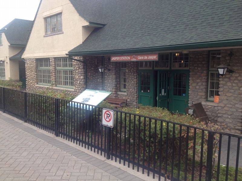
Strolling down the aisle, a conductor announces your destination. With steely squeals and a pish-sh-sh-sh of pent up steam, the locomotive glides to a halt. Descending the coach's stairs you step through the mist and arrive at Jasper Station. . . . — — Map (db m108634) HM
On Yellowhead Highway (Provincial Highway 16) 1 kilometer north of Hazel Avenue (Provincial Highway 93A), on the right when traveling north.
[English] Built by William Henry of the North West Company in 1811 to support David Thompson's exploration of the Athabasca Pass, Henry House stood at the head of navigation on the Athabasca River. When the pass became the principal . . . — — Map (db m202599) HM
On Connaught Drive (Provincial Highway 16A) just north of Miette Avenue, on the right when traveling south.
[English] This building is one of the finest and most influential examples of rustic architecture in Canada’s national parks. Designed by A.M. Calderon and completed in 1914, it introduced a building tradition based on the use of local . . . — — Map (db m197059) HM
On Yellowhead Highway (Provincial Highway 16) 4.2 kilometers north of Maligne Lake Road, on the right when traveling north.
[English] In 1862, the Overlanders, numbering about 250, left their homes in Canada for the Cariboo gold fields. They journeyed via Fort Garry and Edmonton, and thence, guided by Indians to the mountains and westward by the . . . — — Map (db m203692) HM