Austin in Travis County, Texas — The American South (West South Central)
Merrilltown Cemetery
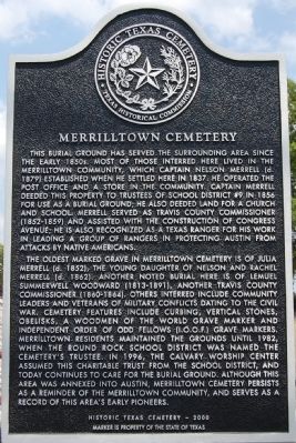
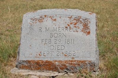
This burial ground has served the surrounding area since the early 1850s. Most of those interred here lived in the Merrilltown community, which Captain Nelson Merrell (d. 1879) established when he settled here in 1837. He operated the post office and a store in the community. Captain Merrell deeded this property to trustees of School District #9 in 1856 for use as a burial ground; he also deeded land for a church and school. Merrell served as Travis County Commissioner (1852-1859) and assisted with the construction of Congress Avenue; he is also recognized as a Texas Ranger for his work in leading a group of Rangers in protecting Austin from attacks by Native Americans.
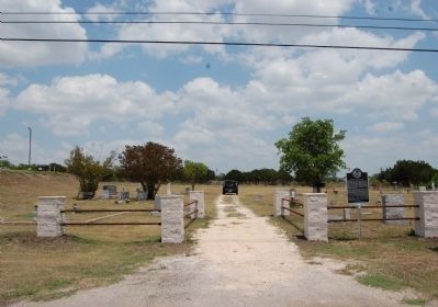
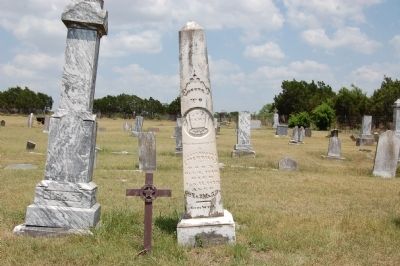
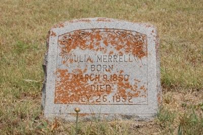
The oldest marked grave in Merrilltown Cemetery is of Julia Merrell (d. 1852), the young daughter of Nelson and Rachel Merrell (d. 1862). Another noted burial here is of Lemuel Summerwell Woodward (1813-1891), another Travis County Commissioner (1860-1864). Others interred include community leaders and veterans of military conflicts dating to the Civil War. Cemetery features include curbing, vertical stones, obelisks, a Woodmen of the World grave marker and Independent Order of Odd Fellows (I.O.O.F.) grave markers. Merrilltown residents maintained the grounds until 1982, when the Round Rock School District was named the cemetery’s trustee. In 1996, the Calvary Worship Center assumed this charitable trust from the school district, and today continues to care for the burial ground. Although this area was annexed into Austin, Merrilltown Cemetery persists as a reminder of the Merrilltown community, and serves as a record of this area’s pioneers.
Historic Texas Cemetery - 2000
Erected 2000 by Texas Historical Commission. (Marker Number 16037.)
Topics. This historical marker is listed in this topic list: Cemeteries & Burial Sites. A significant historical year for this entry is 1837.
Location. 30° 27.236′ N, 97° 41.705′ W. Marker is in Austin, Texas, in Travis County. Marker is on Farm to Market 1325 north of Merrilltown Drive, on the right when traveling north. Touch for map. Marker is at or near this postal address: 14901 Farm to Market 1325, Austin TX 78728, United States of America. Touch for directions.
Other nearby markers. At least 8 other markers are within 4 miles of this marker, measured as the crow flies. The Gault Homestead (approx. 1.2 miles away); Bratton Cemetery (approx. 1.9 miles away); St. Stephen’s Missionary Baptist Church (approx. 2.7 miles away); Waters Park (approx. 2.8 miles away); Sam Bass' Death Site (approx. 3.9 miles away); Otto Reinke Building (approx. 3.9 miles away); Old Broom Factory Building
(approx. 3.9 miles away); St. Mary Missionary Baptist Church (approx. 3.9 miles away). Touch for a list and map of all markers in Austin.
Related marker. Click here for another marker that is related to this marker. See marker for Gault Homestead. John M. Gault is buried here at Merriltown Cemetery.
Also see . . .
1. Merrilltown, TX. Handbook of Texas Online (Submitted on February 27, 2015.)
2. Captain Nelson Merrell. Link to Find A Grave entry for Captain Nelson Merrell (Submitted on February 27, 2015, by Richard Denney of Austin, Texas.)
Photographed By Richard Denney
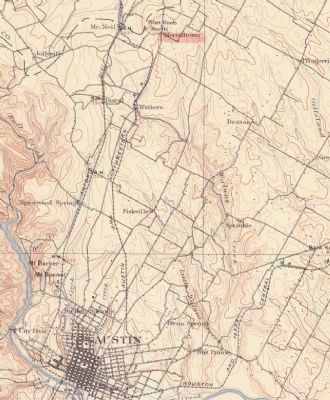
6. USGS Map with Merrilltown, TX
Part of a USGS map showing relation of Merrilltown, TX, to Austin. From Geologic Atlas Of The United States, Austin Folio, Texas: USGS Geologic Folio, 1902 (surveyed 1895). Notice "Pilot Knob (North)" just east of Merrilltown used for reference by travelers in the 1800s (there are other "Pilot Knobs" in Travis and adjacent counties, hence the "North" designation).
Credits. This page was last revised on February 1, 2023. It was originally submitted on May 30, 2011, by Keith Peterson of Cedar Park, Texas. This page has been viewed 1,495 times since then and 116 times this year. Last updated on February 27, 2015, by Richard Denney of Austin, Texas. Photos: 1, 2, 3, 4, 5. submitted on May 30, 2011, by Keith Peterson of Cedar Park, Texas. 6. submitted on February 28, 2015, by Richard Denney of Austin, Texas. • Bill Pfingsten was the editor who published this page.
