Near Columbia in Brown County, South Dakota — The American Midwest (Upper Plains)
The View from the Top
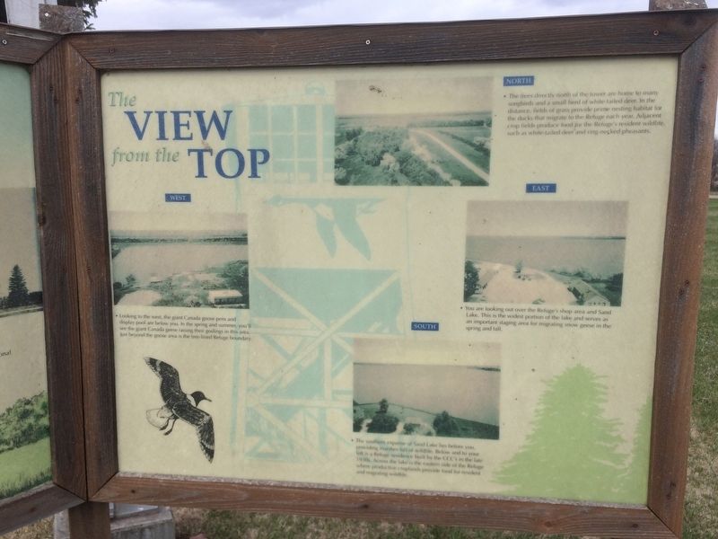
Looking to the west, the giant Canada goose pens and display pool are below you. In the spring and summer, you'll see the giant Canada geese raising their goslings in the area. Just beyond the goose area is the tree-lined Refuge boundary
You are looking out over the Refuge's shop area and Sand Lake. This is the widest portion of the lake and serves as an important staging area for migrating snow geese in the spring and fall.
The trees directly north of the tower are home to many songbirds and a small herd of white-tailed deer. In the distance fields of grass provide prime nesting habitat for the ducks that migrate to the Refuge each year. Adjacent crop fields produce food for the Refuge's resident wildlife, such as white-tailed deer and ring-necked pheasants.
The southern expanse of Sand Lake lies before you, providing marshes full of wildlife. Below and to your left is a Refuge residence built by the CCC's in the late 1930s. Across the lake is the eastern side of the Refuge where productive croplands provide food for resident and migrating wildlife.
Topics. This historical marker is listed in these topic lists: Animals • Environment • Waterways & Vessels.
Location. 45° 43.377′ N, 98° 18.292′ W. Marker is near Columbia, South Dakota, in Brown County. Marker is on Sand Lake Dr, ¼ mile County Highway 16. Touch for map. Marker is in this post office area: Columbia SD 57433, United States of America. Touch for directions.
Other nearby markers. At least 8 other markers are within 5 miles of this marker, measured as the crow flies. Sand Lake's Observation Tower (here, next to this marker); Waterfowl (approx. ¼ mile away); Sand Lake National Wildlife Refuge (approx. ¼ mile away); Songbirds (approx. ¼ mile away); Father Alexandra Ravoux (approx. 0.9 miles away); a different marker also named Sand Lake National Wildlife Refuge (approx. 3.6 miles away); Civilian Conservation Corps Camp (approx. 3.6 miles away); Columbia Marsh (approx. 4½ miles away). Touch for a list and map of all markers in Columbia.
Related marker. Click here for another marker that is related to this marker.
Credits. This page was last revised on May 1, 2017. It was originally submitted on April 28, 2017, by Ruth VanSteenwyk of Aberdeen, South Dakota. This page has been viewed 164 times since then and 11 times this year. Photos: 1, 2, 3, 4. submitted on April 28, 2017, by Ruth VanSteenwyk of Aberdeen, South Dakota. • Bill Pfingsten was the editor who published this page.


