Suffolk, Virginia — The American South (Mid-Atlantic)
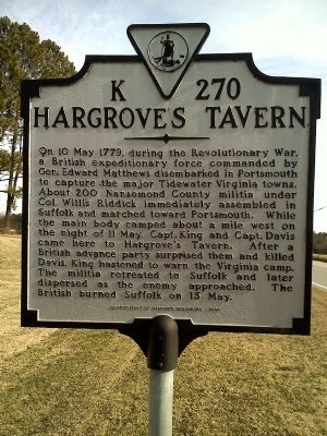
Hargrove's Tavern
Erected 1998 by Department of Historic Resources. (Marker Number K-270.)
Topics and series. This historical marker is listed in these topic lists: Patriots & Patriotism • War, US Revolutionary. In addition, it is included in the Virginia Department of Historic Resources (DHR) series list. A significant historical date for this entry is May 10, 1779.
Location. 36° 49.438′ N, 76° 29.779′ W. Marker is in Suffolk, Virginia. Marker is on Nansemond Parkway (Virginia Route 337), on the right when traveling west. Touch for map. Marker is at or near this postal address: 4400 Nansemond Parkway, Suffolk VA 23435, United States of America. Touch for directions.
Other nearby markers. At least 8 other markers are within 2 miles of this marker, measured as the crow flies. Glebe Church (a few steps from this marker); Bennett's Home (within shouting distance of this marker); a different marker also named Glebe Church (about 300 feet away, measured in a direct line); Sleepy Hole Ferry (approx. ¼ mile away); Yeates School (approx. ¼ mile away); Florence Graded School (approx. ¼ mile away); James Bowser, Revolutionary Soldier (approx. half a mile away); James Bowser Plantation (approx. 1.7 miles away). Touch for a list and map of all markers in Suffolk.
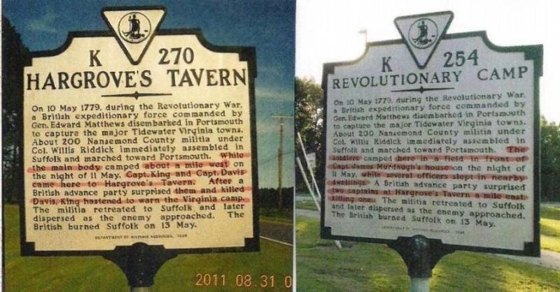
More about this marker. The inscription for Hargrove’s Tavern (K-270) is almost identical to the one for Revolutionary Camp (K-254). Both markers give an account of the same four days in May 1779 with slight variances in details. See the illustration below, “A Comparative of K-270 and K-254.”
Related marker. Click here for another marker that is related to this marker.
Credits. This page was last revised on February 1, 2023. It was originally submitted on January 14, 2011, by James Thomson of Chesapeake, United States. This page has been viewed 1,957 times since then and 96 times this year. Last updated on November 19, 2017, by Cynthia L. Clark of Suffolk, Virginia. Photos: 1, 2. submitted on January 14, 2011, by James Thomson of Chesapeake, United States. 3. submitted on November 19, 2017, by Cynthia L. Clark of Suffolk, Virginia. • Bill Pfingsten was the editor who published this page.


