2 entries match your criteria.
Related Historical Markers
By Cosmos Mariner, July 10, 2015
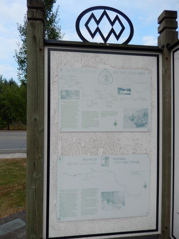
Route of Lewis Clark National Historic Trail Marker (tall view; showing related marker above)
SHOWN IN SOURCE-SPECIFIED ORDER
| 1 ► Oregon, Columbia County, Scappoose — Route of Lewis and Clark National Historic Trail — |
| Lewis & Clark and the Corps of Discovery In 1803, the United States purchased the Louisiana Territory from France, expanding this country from the Mississippi River west to the Rocky Mountains and from the Gulf of Mexico north to . . . — — Map (db m113159) HM | |||
| 2 ► Oregon, Columbia County, Scappoose — Lewis and Clark on the Columbia — |
| Lewis & Clark on the Columbia River The Lewis and Clark Expedition made the first documented descent of the Columbia from the mouth of the Snake River to the Pacific. This voyage strengthened the claim of the young United States to . . . — — Map (db m113157) HM | |||