7 entries match your criteria.
Related Historical Markers
Take a Virtual Tour by Markers of the Crown Point Historic Site.
By Bill Coughlin, July 11, 2008
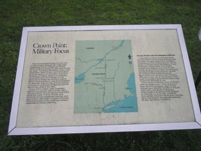
Crown Point: Military Focus Marker
SHOWN IN SOURCE-SPECIFIED ORDER
| | The most practical mode of travel and communication through the wilderness separating French Canada and British North America during the 18th century was by water. The Sorel (Richelieu) River, Lake Champlain, Wood Creek, and the Hudson River . . . — — Map (db m11434) HM |
| | In 1730, the French erected a small wooden fort at Point a la Chevelure, now Chimney Point, Vermont, thereby taking control of territory claimed by Great Britain under the terms of the Treaty of Utrecht (1713). The following year, construction of . . . — — Map (db m11435) HM |
| | Fort St. Frédéric consisted of an outer, bastioned limestone wall enclosing the Citadel, a four-story, eight-sided tower with walls twelve feet thick at the base. Cannon were mounted on each floor of the Citadel, and entry was gained by a . . . — — Map (db m11415) HM |
| | Following the French retreat from Crown Point in 1759, General Amherst embarked upon an ambitious plan to secure the area for Britain. An elaborate system of fortifications was begun on the Point; at times as many as 3,000 soldiers and artisans . . . — — Map (db m11437) HM |
| | “The fort is of wood, built in a most masterly manner. It has five Bastions, mounts 105 guns, and has casements for 4,000 Men, and to hold provisions de Guerre et de Bouche for four months. Within the Fort are good Stone Barracks for . . . — — Map (db m11442) HM |
| | These barracks were constructed in the fashionable Georgian style of the day, uncommon in the northern interior of New York in the mid-18th century. The soldiers’ barracks is composed of four dwelling units of four rooms. Each doorway opens into a . . . — — Map (db m11443) HM |
| | This tablet is erected by the Society of Colonial Wars in the State of New York AD 1912 to commemorate the capture of Fort St. Frédéric and the erection of this fortress AD 1759 by the British and Provincial Army commanded by General Sir Jeffrey . . . — — Map (db m9336) HM |
Apr. 19, 2024