Pawtucket in Providence County, Rhode Island — The American Northeast (New England)
Water Works
Blackstone River Valley National Historical Park, Slater Mill Historic Site
— National Park Service, U.S. Department of the Interior —
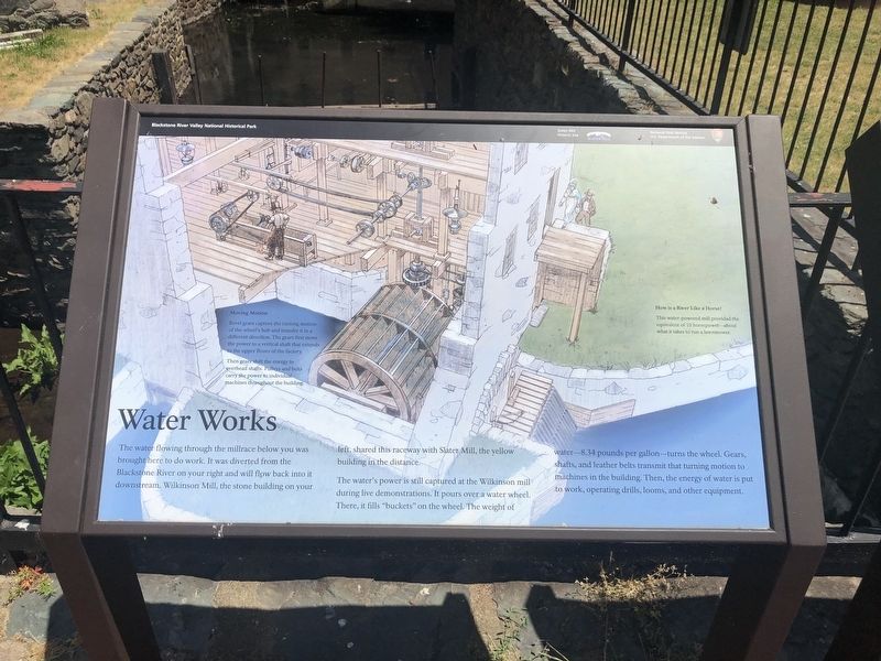
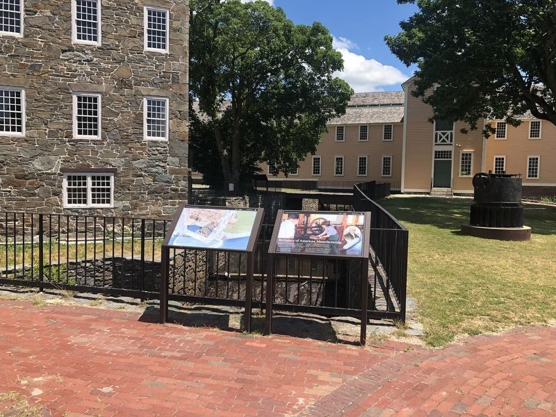
The water flowing through the millrace below you was brought here to do work. It was diverted from the Blackstone River on your right and will flow back into it downstream. Wilkinson Mill, the stone building on your left, shared this raceway with Slater Mill, the yellow building in the distance.
The water's power is still captured at the Wilkinson Mill during live demonstrations. It pours over a water wheel. There, it fills "buckets" on the wheel. The weight of water—8.34 pounds per gallon—turns the wheel. Gears, shafts, and leather belts transmit that turning motion to machines in the building. Then, the energy of water is put to work, operating drills, looms, and other equipment.
Moving Motion
Bevel gears capture the turning motion of the wheel's hub and transfer it in a different direction. The gears first move the power to a vertical shaft that extends to the upper floors of the factory.
Then gears shift the energy to overhead shafts. Pulleys and belts carry the power to individual machines throughout the building.
How is a River Like a Horse?
This water-powered mill provided the equivalent of 10 horsepower—about what it takes to run a lawnmower.
Erected by National Park Service, U.S. Department of the Interior.
Topics. This historical marker is listed in these topic lists: Industry & Commerce • Waterways & Vessels.
Location. 41° 52.641′ N, 71° 22.978′ W. Marker is in Pawtucket, Rhode Island, in Providence County. Marker can be reached from Roosevelt Avenue, 0.1 miles north of Main Street (Rhode Island Route 15), on the right when traveling north. Touch for map. Marker is at or near this postal address: 67 Roosevelt Ave, Pawtucket RI 02860, United States of America. Touch for directions.
Other nearby markers. At least 8 other markers are within walking distance of this marker. Birthplace of American Manufacturing (here, next to this marker); A Family Business (within shouting distance of this marker); Wilkinson Mill (within shouting distance of this marker); Harnessing the Power of the Blackstone River (within shouting distance of this marker); a different marker also named The Wilkinson Mill (within shouting distance of this marker); Milling Machines (within shouting distance of this marker); The Old Slater Mill (within shouting distance of this marker); First Successful Cotton Mill in America (within shouting distance of this marker). Touch for a list and map of all markers in Pawtucket.
Related marker. Click here for another marker that is related to this marker. This marker has replaced the linked marker.
Credits. This page was last revised on June 21, 2020. It was originally submitted on June 21, 2020, by Devry Becker Jones of Washington, District of Columbia. This page has been viewed 111 times since then and 12 times this year. Photos: 1, 2. submitted on June 21, 2020, by Devry Becker Jones of Washington, District of Columbia.

